Mt Flume, Mt Liberty, Mt Lincoln, Mt Lafayette, Mt Garfield. 2020-07-15 (Wednesday.)
Galehead, South Twin, North Twin, Zealand Mountains. 2020-07-16 (Thursday.)
Mt Guyot, West Bond Mountain, Mt Bond, Bondcliff. 2020-07-17 (Friday.)
Via Lincoln Woods Trail, Osseo Trail, Franconia Ridge Trail, Garfield Ridge Trail, Frost Trail, Twinway, North Twin Spur, Zealand Spur, Bondcliff Trail, West Bond Spur.
37.4 miles round-trip. Note: this does not include the quarter mile spur trails to the Garfield and Guyot campsites. Collectively, that’s another mile.
Over 11,000 feet of cumulative elevation gain. Several sections include rocky ascents or descents at rates at or near 1,000 feet of elevation change per mile.
Temperatures ranged from the low 70s during the day to 50s at night. Winds were negligible in the trees and most summits, with 10-15 knot winds at the summits of all three Bonds. Sun and clouds to start, finishing with a rainy morning on day three that dried out (but remained cloudy) by lunchtime.
Trailhead: 0730. Garfield campsite: 1950. Back on trail Thursday: 0715. Guyot campsite: 1930. Back on trail Friday: 0830. Car: 1515.
Three days in the woods? Count me in! (Wait… what’s that about hard miles?)
I got back to my car exhausted, my feet muddy, soaking wet, and aching… hell, my whole body ached. Unlike last year, I didn’t really feel jubilant, nor did I feel particularly melancholy. It just was. Tired, a bit hungry, ready to go home, and staring at two hours between me and there. Oh yeah, and I had to punch in at work in just a few more hours after that. Oh goody.
But wait. Doing the whole “start at the end” thing is fancy and cinematic and all. Hire an a-lister to play me, please and thank-you. Except what got me to that point?
It was an audacious plan.
There was some shuffling of schedules.
Rather fortuitously, a colleague needed a shift-swap at work. That, and another swap with someone else got me a chunk of time mid-week — three days where I could go hide in the woods and maybe find some quietude. I’d been wanting to knock out a Pemi Loop again, ever since last year’s. With COVID having basically shut the huts down, there wouldn’t be the delicious baked goods, and even the chance of some coffee was probably not going to happen.
At the same time, if everything that I’d been working toward had gone according to my master plan, I’d be on the Appalachian Trail right now. But obviously, all that got overcome by events in grand style. Here, at least, I’d be able to do a chunk of it — almost 15 miles, actually. And with that, I’d also be able to test out some gear that I’d been planning on using. So the lack of the hut croo’s baking wasn’t going to stop me. I knew the trails well, I had the gear, I had the motivation, and now, I had the time. I was off to the races.
Somehow, I actually got out of bed at an unreasonable hour.
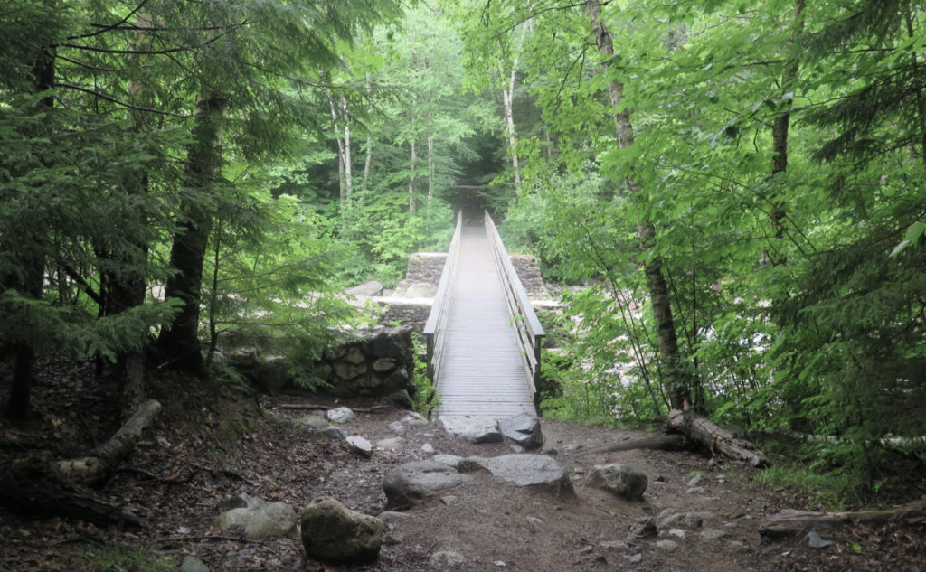
I got out of the house bright and early, and actually hit the trailhead “on time” for once. It felt like an auspicious start, and as I crossed the bridge and turned onto the Lincoln Brook trail, things went well — I arrived at the Osseo trail junction feeling like no time had passed. Before long, I was at the ladders, and then the familiar rugged cliff-walk near the top of Flume. I could probably do that section a thousand times, and it would still take my breath away.
Thinking it would be dumb to run out of water on the ridge, I turned downhill and stopped at Liberty Springs tentsite. Emmy, the caretaker, and I shared some thoughts on the loop. “You’re a plooper!” she exclaimed, explaining the obvious contraction. Amused, I asked her about the huts.
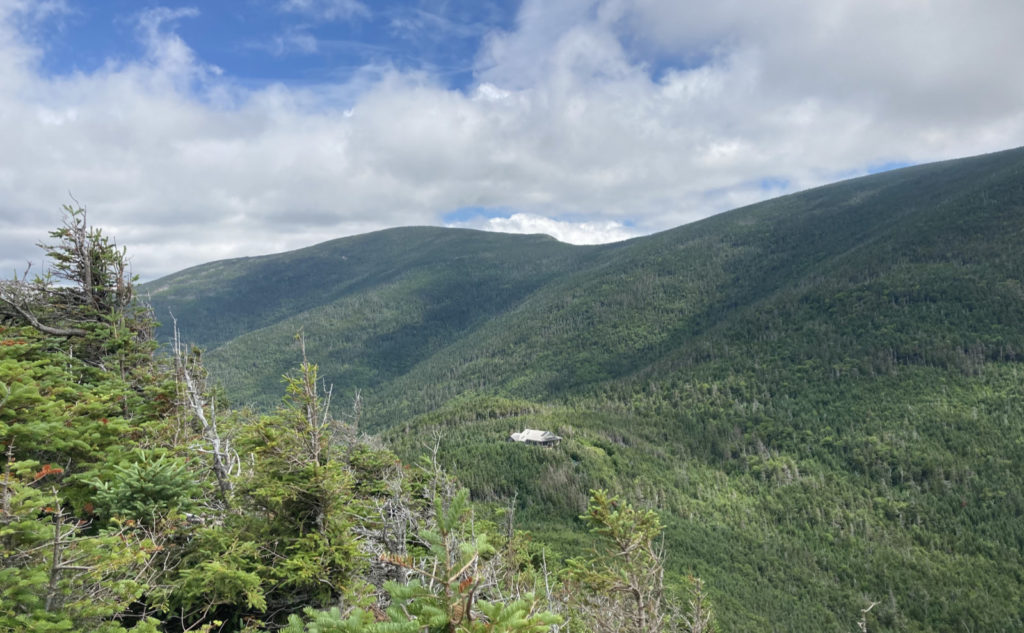
Right now, they’re minimally staffed, and basically, one should proceed into those areas as if the huts were closed outright. If they are open (basically, the caretakers aren’t out fetching supplies, or doing some other tasks) then yes, drinking water is available, bathrooms too, and there’s an odd chance that one might be able to get light snacks. But the subtext was “don’t count on it, treat it as gravy.” That said, while I didn’t check in at Greenleaf, I know for sure that at Galehead, an outdoor tap has been installed on the side of the hut, where one can get drinking water. It’s around the corner, on the right as you look at the front entryway. Pressing onward and upward…
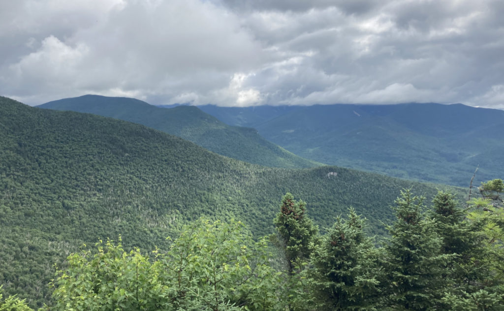
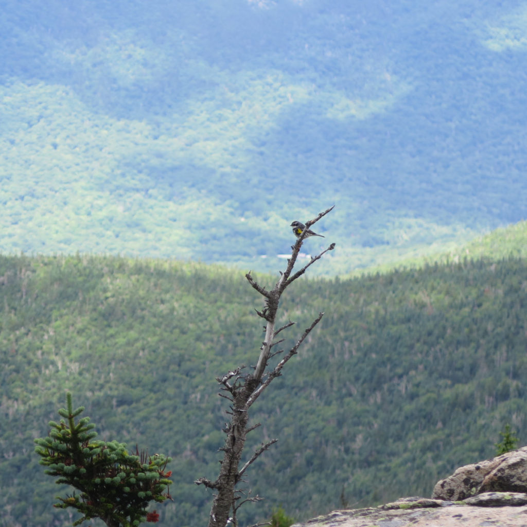
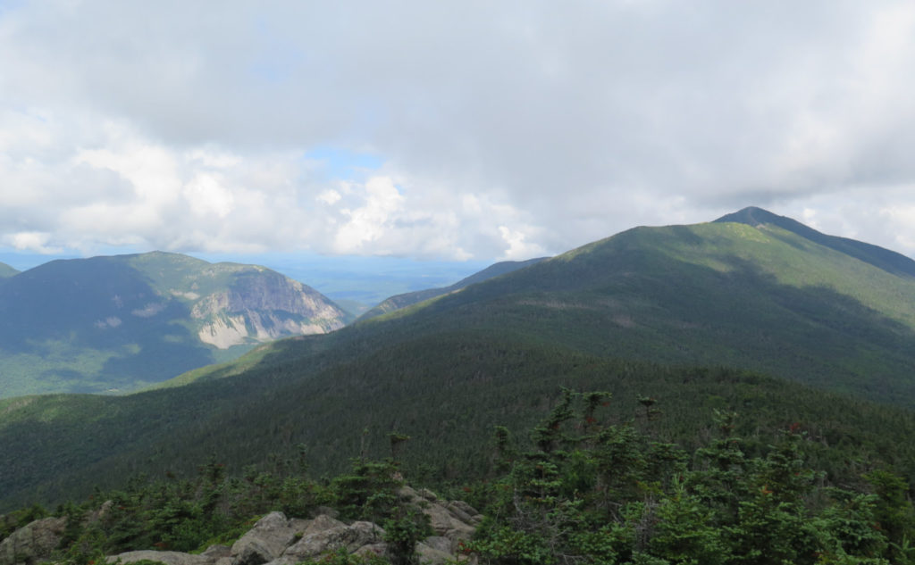
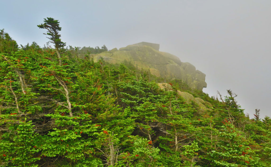
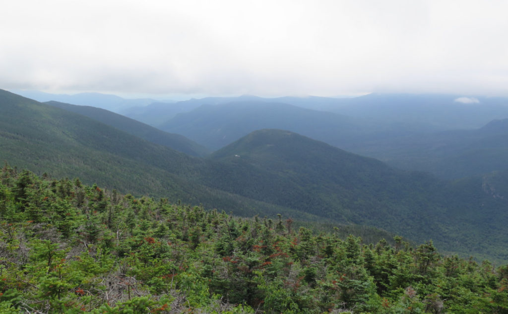
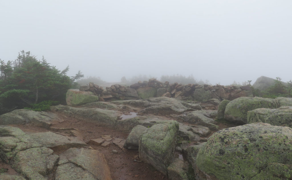
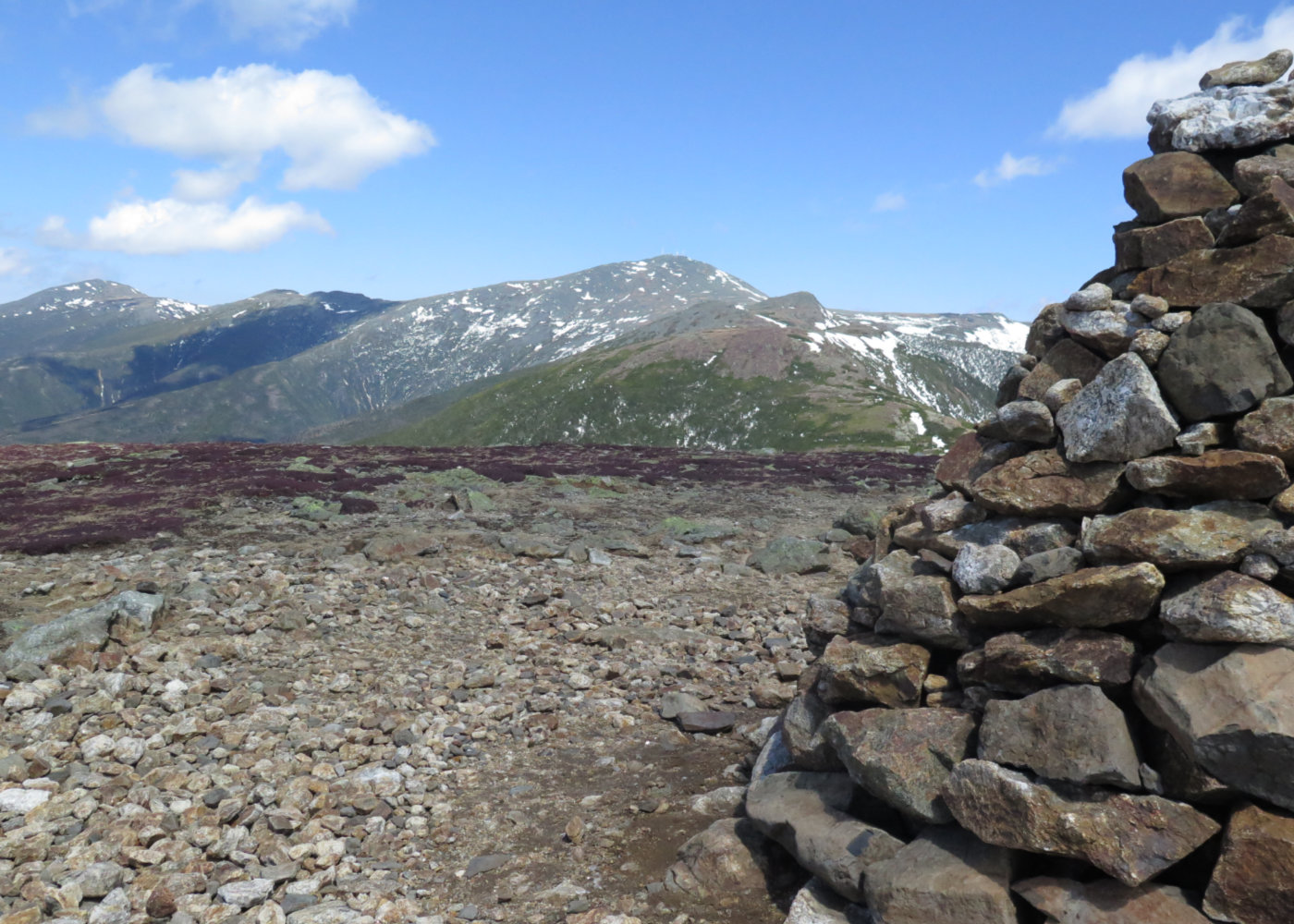
The clouds were insistent on getting in the way as I crossed over Franconia Ridge. Sometimes, I’d have a glorious view that took in Cannon and Garfield. I saw Owl’s Head — a mountain that I’m glad is underrated by many, because I find a lot of peace and solitude there. And I got a look out over Carrigain, and even Washington. But over and over, I’d have a quick shot at a view, then clouds would blow in and limit visibility to a few hundred yards at best. You can pick the day, you can pick the weather, but you can’t pick both. I pressed on, nonetheless, because just being in the mountains is its own reward. And hey, sometimes the clouds created interesting sights. Rock formations off the sides came into and out of view, looking more than a bit ethereal.
The old foundation of the summit house signaled that I was on Lafayette. I took a summit selfie, where I point my camera at my feet straddling the USGS summit medallion. It was past four in the afternoon, and I was on schedule, for sure, to make it to Garfield campsite well before nightfall. It’d be nice to stop and rest, get some dinner, and then enjoy the sounds of the critters in the woods as they sing me to sleep.
One ridge down…
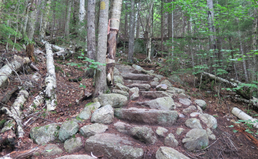
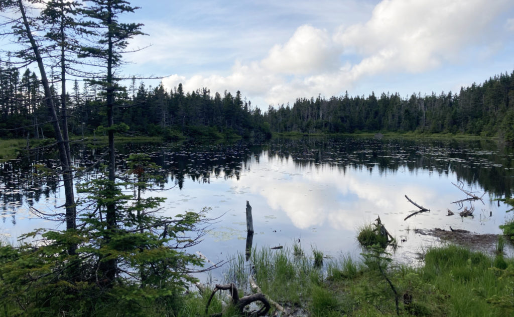
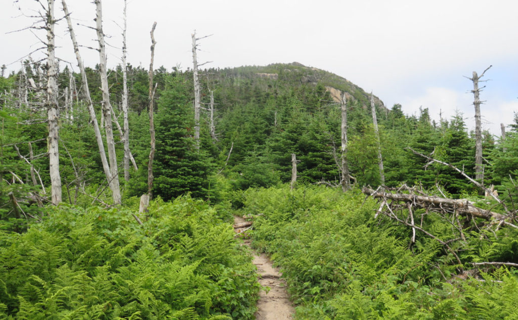
But of course, there was actually getting to, and past Garfield. Somehow, I’d forgotten about this from last year. Yeah, about that part of the trail. Descending the Lafayette portion of the Garfield Ridge trail, things got rough, and consequently slower. It was a lot of picking my way down a very rocky path. I had a lot of time to think about the weight of my pack as I plodded along. At the pond, I stopped by the shore to enjoy the view, and yes, it was totally worth that little detour. Carrying on, I crept up the steep route, ascending gigantic, blocky stone steps at times, up the magnificent cone that I’ve admired from afar so often. I was buoyed by the thought that it’s a hard trail up a very handsome mountain.
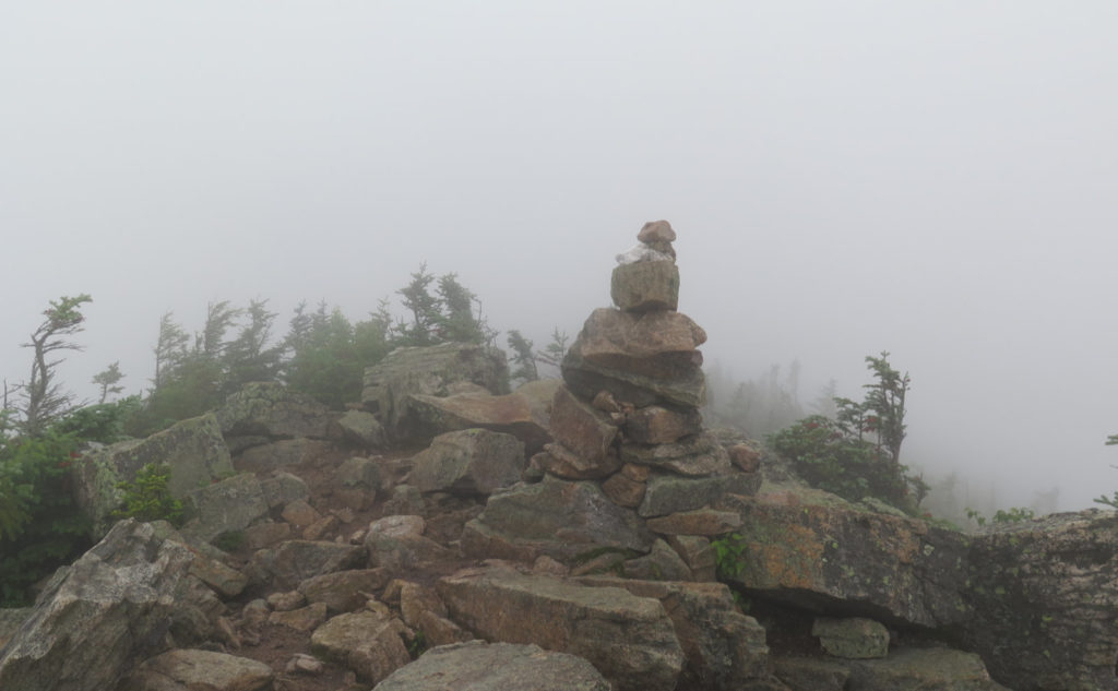
And then, the old foundation of the fire tower. Which, for the life of me, I’m still imagining how they got all that concrete up there. Never mind, because the views weren’t perfect, but I could see around. There were a lot of clouds, but just high enough and far enough away that at least the valley below was mostly apparent. Not perfect, but I’ll take what I can get.
Onward and downward, I made my way the short distance to the campsite. Checking in with the caretaker, I got a spot on a tent pad next to Half Baked, an AT hiker going NOBO. Nice guy, and we chatted for a spell about the AT while I got my tent set up and some food in me. Night fell and I didn’t even notice much after my head hit my pillow. Was it exhaustion, or just a return to natural rhythms?
Being back on the trail before most people got to the trailhead: priceless.
Waking just about with the sun, I realized that even though I woke up a couple times in the night, I fell back asleep almost as quickly. Now, here I was, feeling probably more rested than I’ve felt in months — easily since my last Pemi Loop. How rested? Well, as it turned out, I brought four packets of instant coffee, and its remarkable that they made it back home, unopened. Wow. I made some cold oatmeal while packing stuff up, and Half Baked and I exchanged a few more thoughts before parting ways. His trail legs were solid after months on the trail, while mine were still waking up. Oh well.
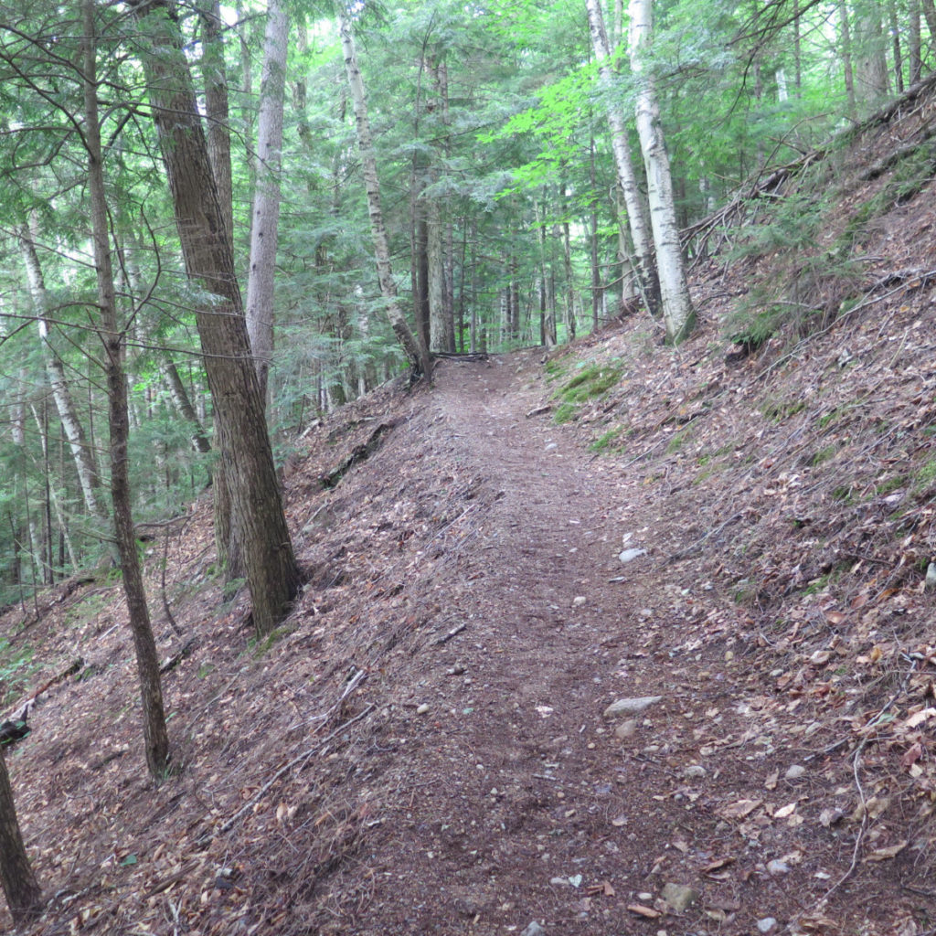
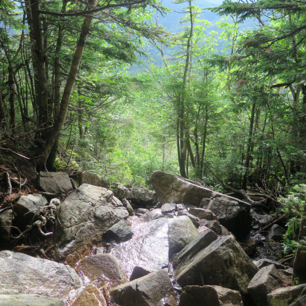
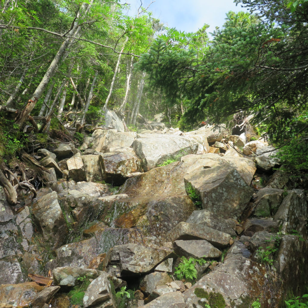
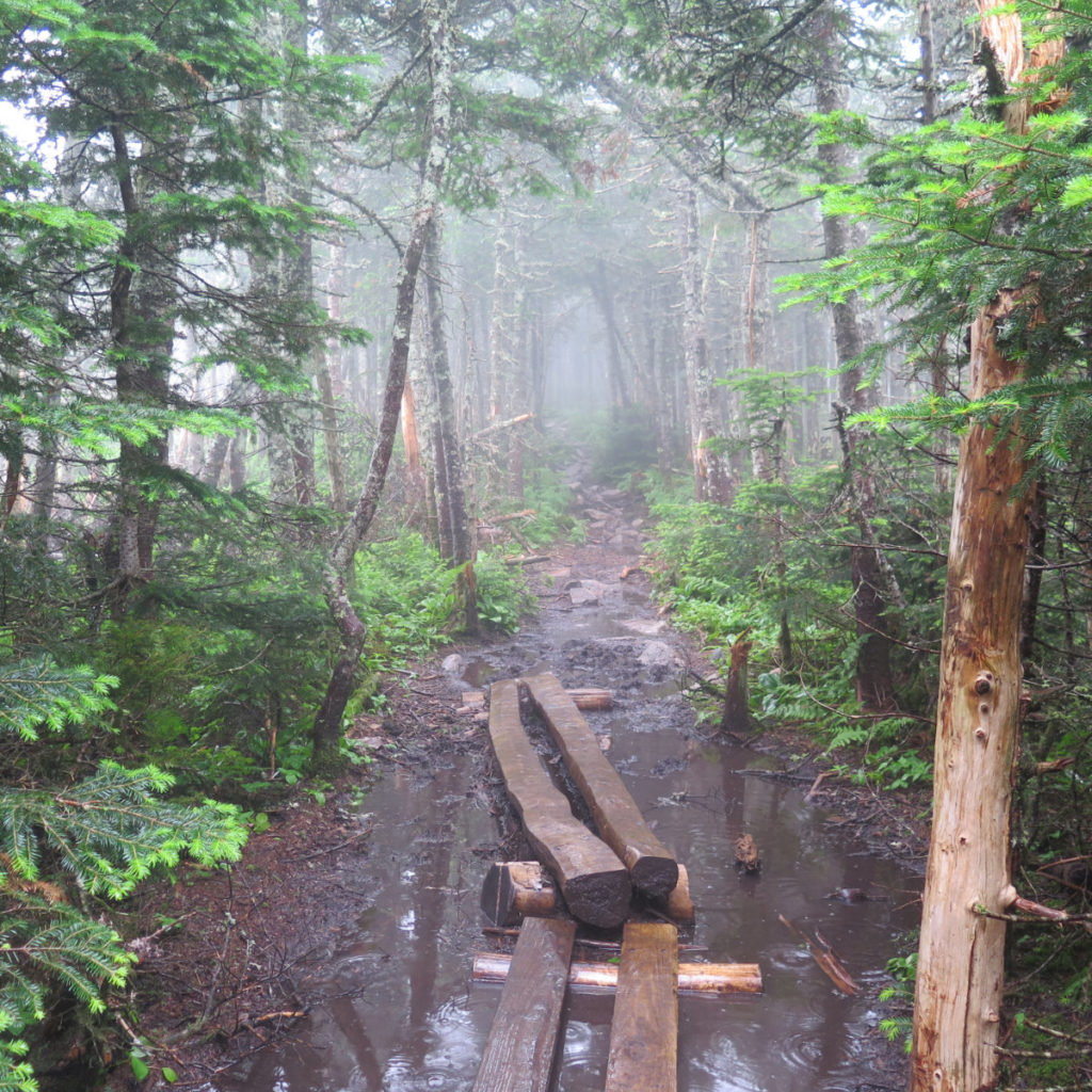
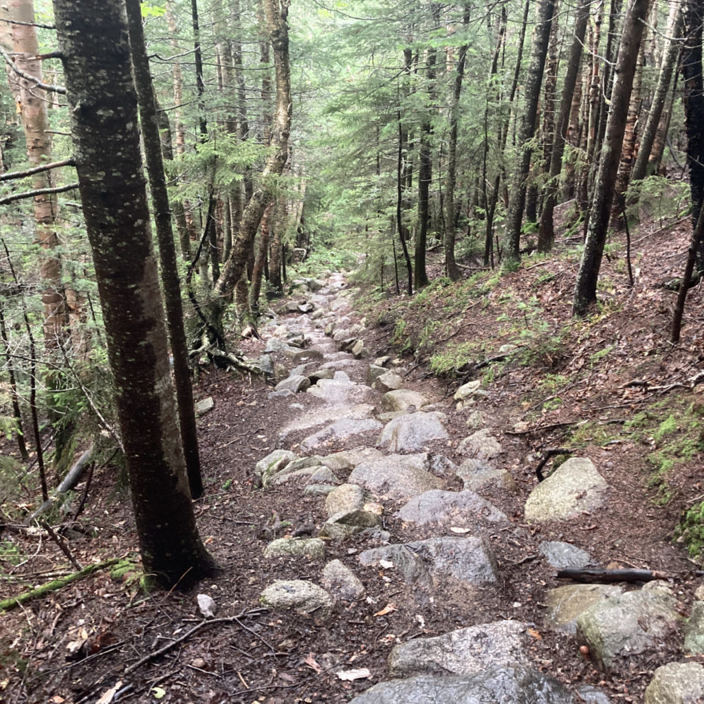
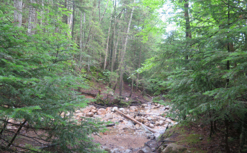
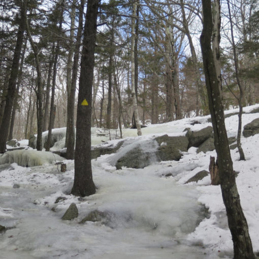
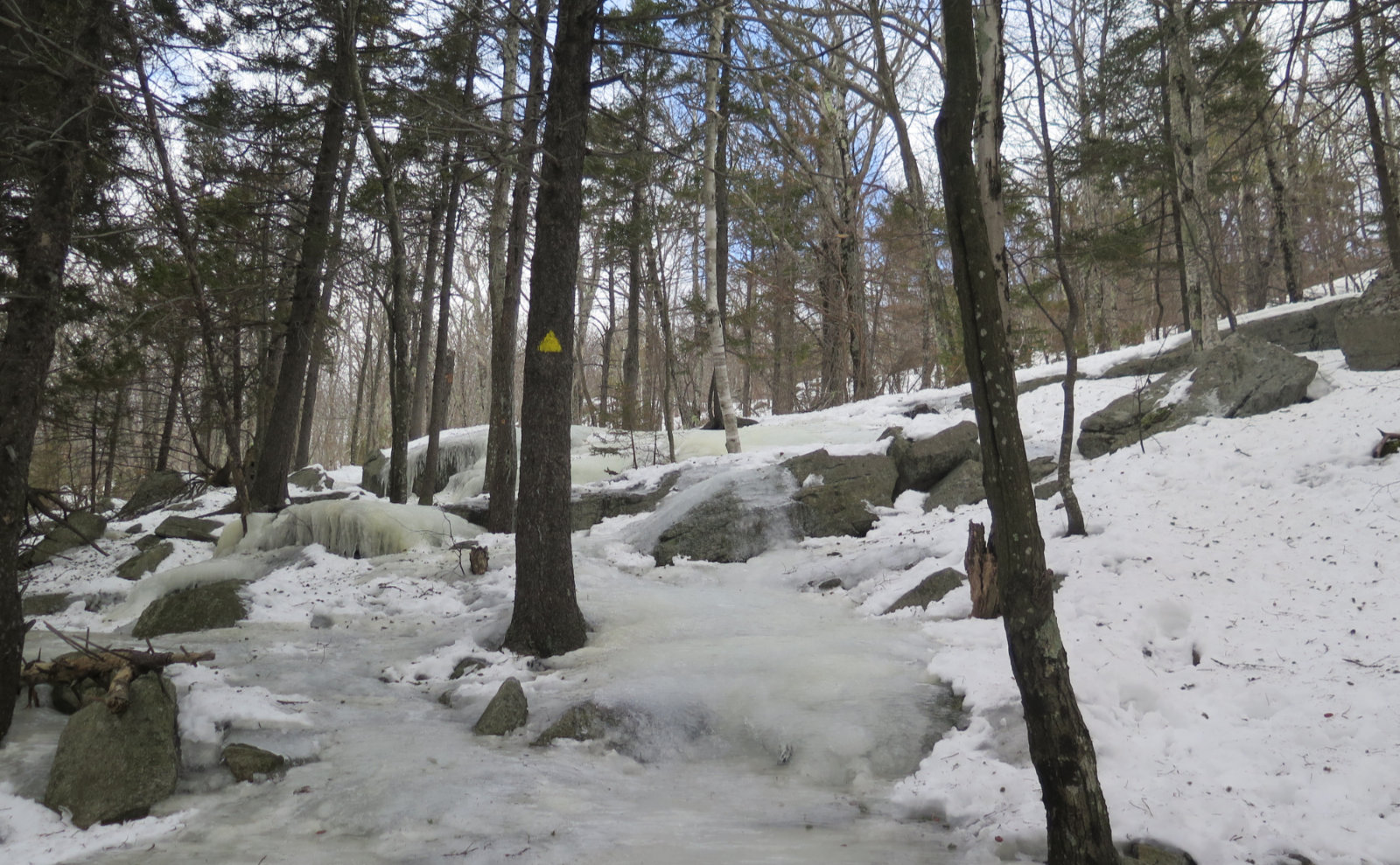
After more lumpy and bumpy trail, I got to Galehead. But it’s worth noting that in that opening bit after the campsite, I felt a lot of why AT hikers regard the Granite State as the hardest miles, even if they’re some of the most scenic. Note in the photos, yes, that’s the trail, heading straight down a very steep, very rocky stream. It was slow heading up Garfield, and it was at least as slow going back down. I’m thinking there was some protective shield in my head, because that part of the trip seems to have been utterly blocked from my memory from when I was last here. Yikes.
But there I was, at Galehead. The sun had come out, and people were on the lawn, on the porch, and just hanging around. Some came up from 13 Falls, some from Guyot, which by all accounts, was packed to the gills Wednesday night. I saw Half Baked with a couple other thru-hikers, waved hi, and headed up Frost Trail to the summit.
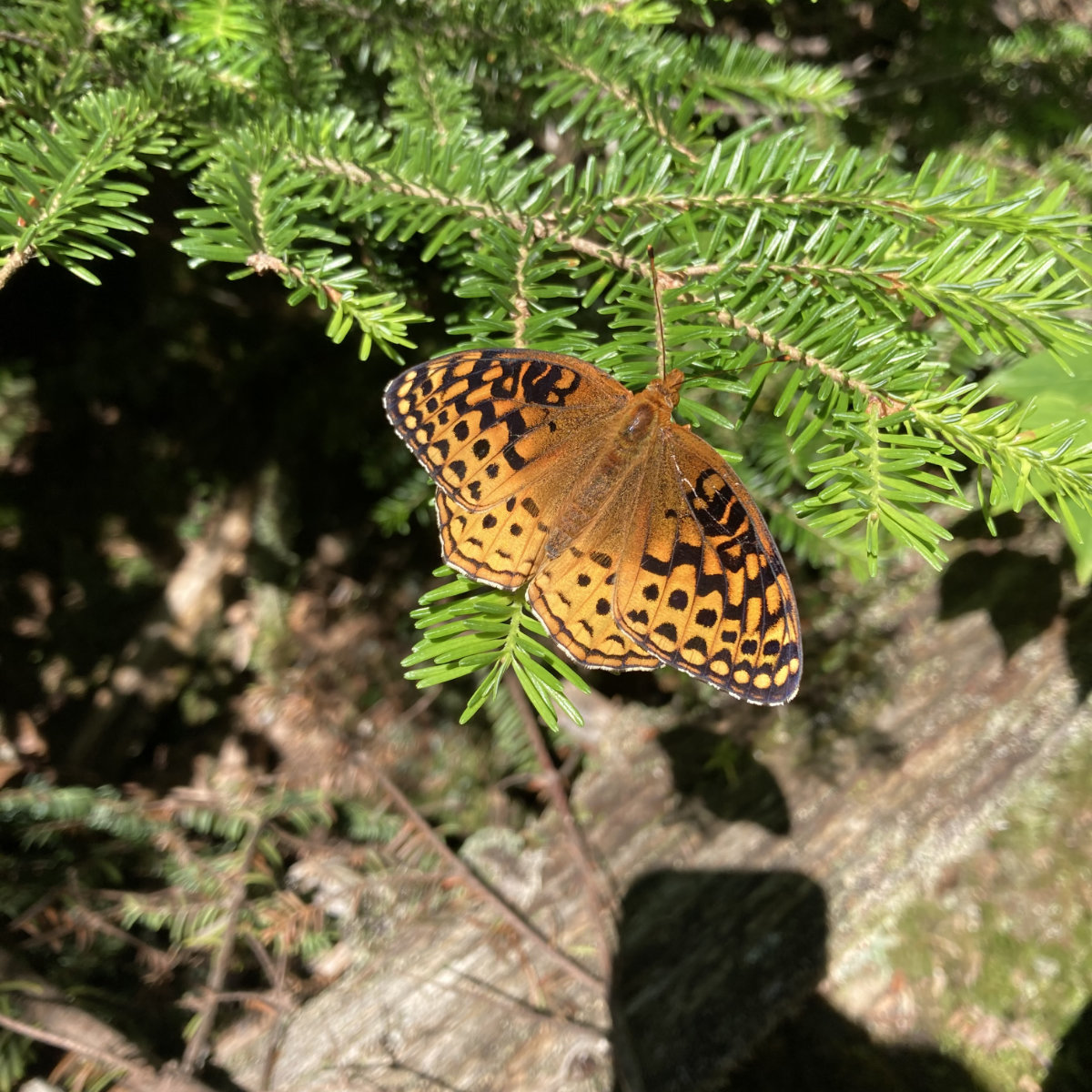
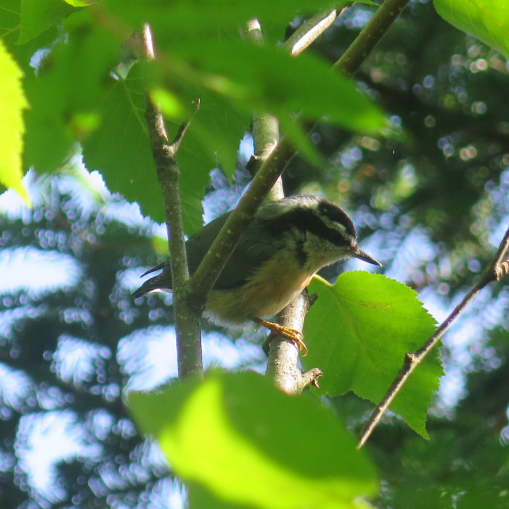
…And almost promptly, a great spangled fritillary landed on my hiking pole as I stopped to chat with a couple hikers. I’d recently read about them while trying to identify some butterflies. The name caught my eye only because it’s a B-side of a Cocteau Twins EP. But the butterfly itself caught my eye because in real life, it’s way more stunning than the photos could ever suggest. Not even mid-morning, and my day was already made. What next?
Time to elevate your game!
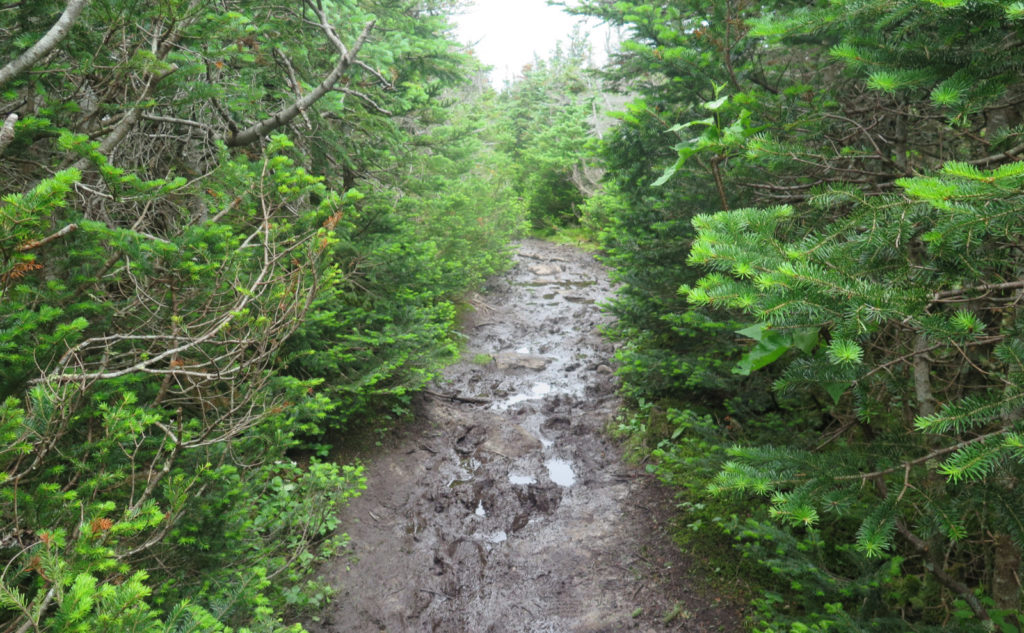
Galehead’s summit in the bag, I turned to the beast of an ascent that’s the trail to South Twin. By the AMC book, in 0.8 of a mile, there’s 1,150 feet of elevation gain. And there’s no way you’re not going to notice. Thankfully, it was early still, and my legs, though still feeling yesterday’s mileage, were somewhat fresh. But it’s still a hard ascent. At the summit, things were cloudy again, and so without much ado, I turned left, and headed into… mud. Oh, North Twin Spur, how much I’ve missed your mud puddles that span the width of the trail, and stretch endlessly into the horizon. Or so it always seems. The recent rains certainly didn’t help things.
At the overlook, though, another attenuated view, except I did get a clean shot at the Hut, even if I couldn’t see much else. It was becoming apparent that the ceiling was going to hover around 4-5 thousand feet, and I wasn’t going to get amazing views this trip. OK, so that’s how it’ll be. Keep looking around, and interesting stuff will pop out. I mean, there was that butterfly by the hut, right?
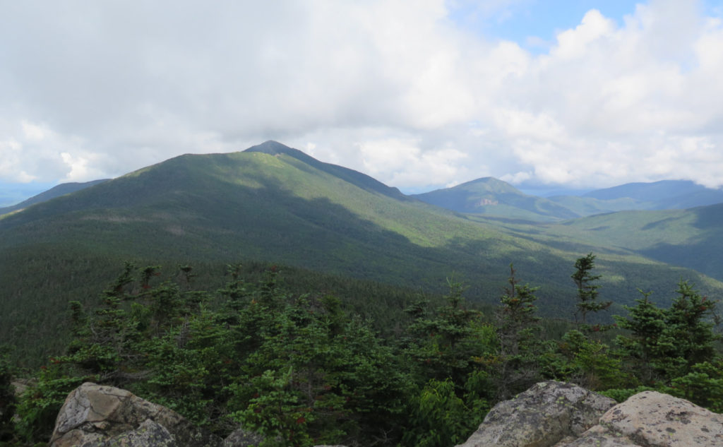
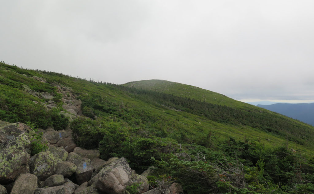
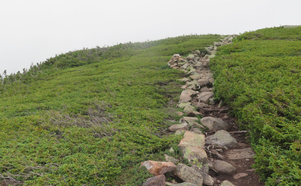
All the talk about how Guyot had been basically stuffed to capacity got me a tad worried about finding a place to spend the night, so I decided to cross Guyot, grab a spot at the campsite, and drop off my tent and sleeping bag. Not the least, I was really feeling the weight in my pack, and a lighter load would make a big difference. And so I walked across one of my favorite summits. The clouds were high enough that I could view its hump as I approached, and appreciate the green against the random rocks that stick through. Maybe I’m weird, but I think it’s one of the prettier summits. And, of course, totally underrated itself. Unlike Owl’s Head, it’s not even on the list.
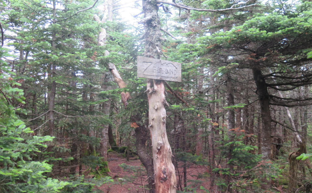
Without the weight of my tent or sleeping bag, I made quicker time to Zealand. It felt good to have more of a spring in my step, and despite the Twinway being very rough for the most part, I made good time. At Zealand, I turned onto the spur, and another familiar landmark was in view. Now, I was at 9 peaks for the trip.
Back at camp, the familiar hiss of my stove had my dinner made in short order. I was well and truly beat at this point, and my legs were quite sore. Next time, I’m going to pack more salty stuff, because I think I was losing more electrolyte than anticipated. Night fell, and again, I was out like a light before I knew it. No kidding, I don’t recall hearing any forest critters before the sun came up again.
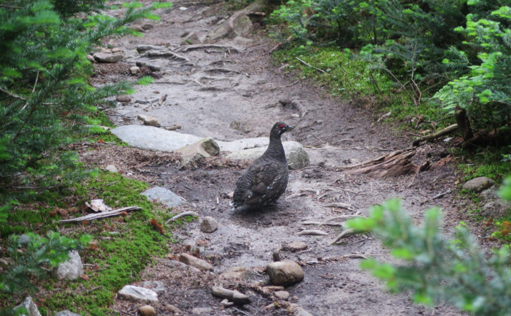
Not like there wasn’t anything to hear out there.
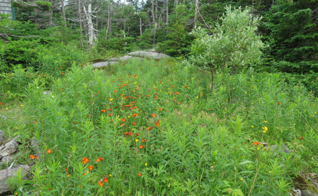
Well, you don’t always hear critters in the forest. Sometimes, there’s an insistent beating on the roof of your tent that says only one thing. Rain. It started in the wee hours, and kept on until after I got past Bond, with dribs and drabs going until after Bondcliff. I broke camp, but before leaving, I had breakfast, sheltering under the new and improved Guyot shelter. A family from Ithaca was there, and their daughter and I talked about using maps, and how her older brother is… well, you know, I’m sure. The sibling rivalry that’s high on the mind of kids everywhere. But her mom and dad were both scientists at Cornell, which was really cool — not the least, but hey, Carl Sagan’s school, right? She mentioned a few things about plant biology that were very fascinating, and I got smarter in those few minutes. Yet another day that was made well before lunchtime.
It was a wet climb up West Bond, but actually not that bad. Most of the mud was easily sidestepped, and then I was at the summit. Funnily enough, I’d been concentrating on the footing on the way up the Bondcliff trail, to the point where I stopped and thought “hey, I should see where the spur is on the map… oh hey, that’s the sign, right there.” To think that I almost went past it, and would have had to backtrack.
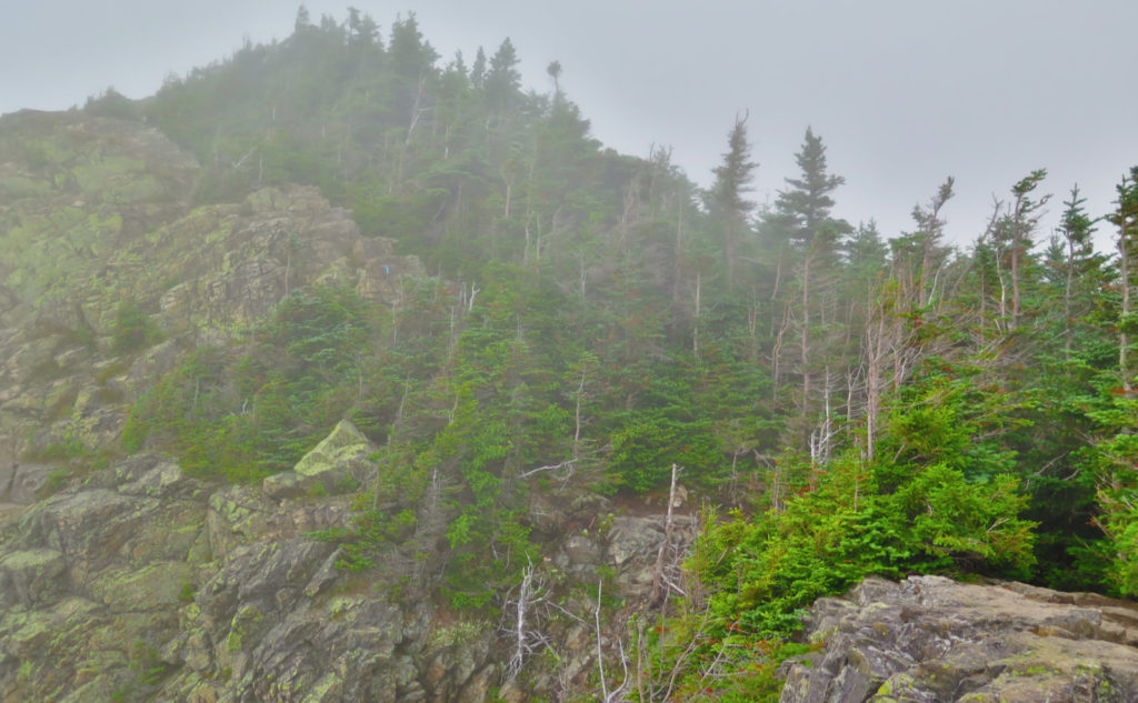
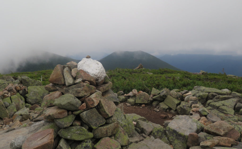
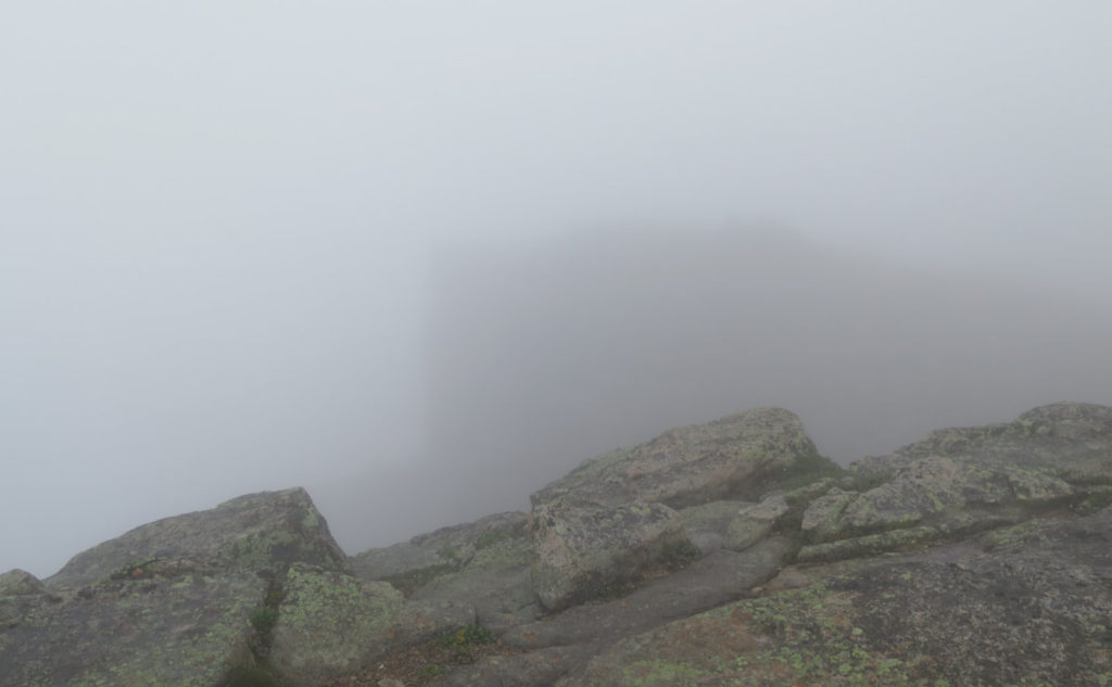
Mt Bond was a slightly different matter. The rain picked up as I approached the summit, to the point where it was outright pelting me with drops that were visibly large. It was unpleasant to look up, and I spent the briefest time on top before heading back down the trail, into the relative safety of the trees.
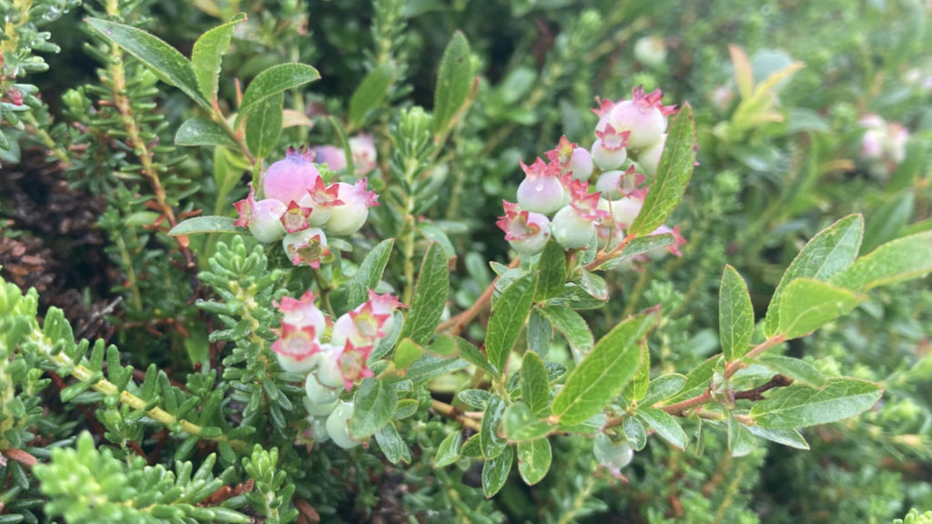
Thankfully, things slowed down remarkably after that. I began to sense that I was drying out, my rain gear not feeling as sticky. I began the ascent of Bondcliff, and there were the familiar blueberry bushes off to the sides of the trail. I was dismayed to see they weren’t even close to being ripe yet, because last year, they were delicious. Oh well. The clouds had majorly dropped, and I began looking around in earnest. Last thing I wanted to do was not see the world-famous photogenic cliff. And yep, I did indeed find it, but not very far away, it was all but invisible. Those clouds were thick!
All things in time must come to pass.
At last, it was time. The only trail remaining was the one leading back to the car. I descended into the trees one last time. The trail on the way out softened up more and more. Rocks gave way to duff. The roar of Black Brook rose up the valley sides, and before long I was crossing it, then again. A familiar old piece of rail from the logging railroads edged one side of the trail. Sleepers, where they’d been for decades, slowly degrading. The bridge over Franconia Brook, then the Lincoln Woods trail. And finally, that last suspension bridge, crossing the East Branch of the Pemigewasset. My car beyond.
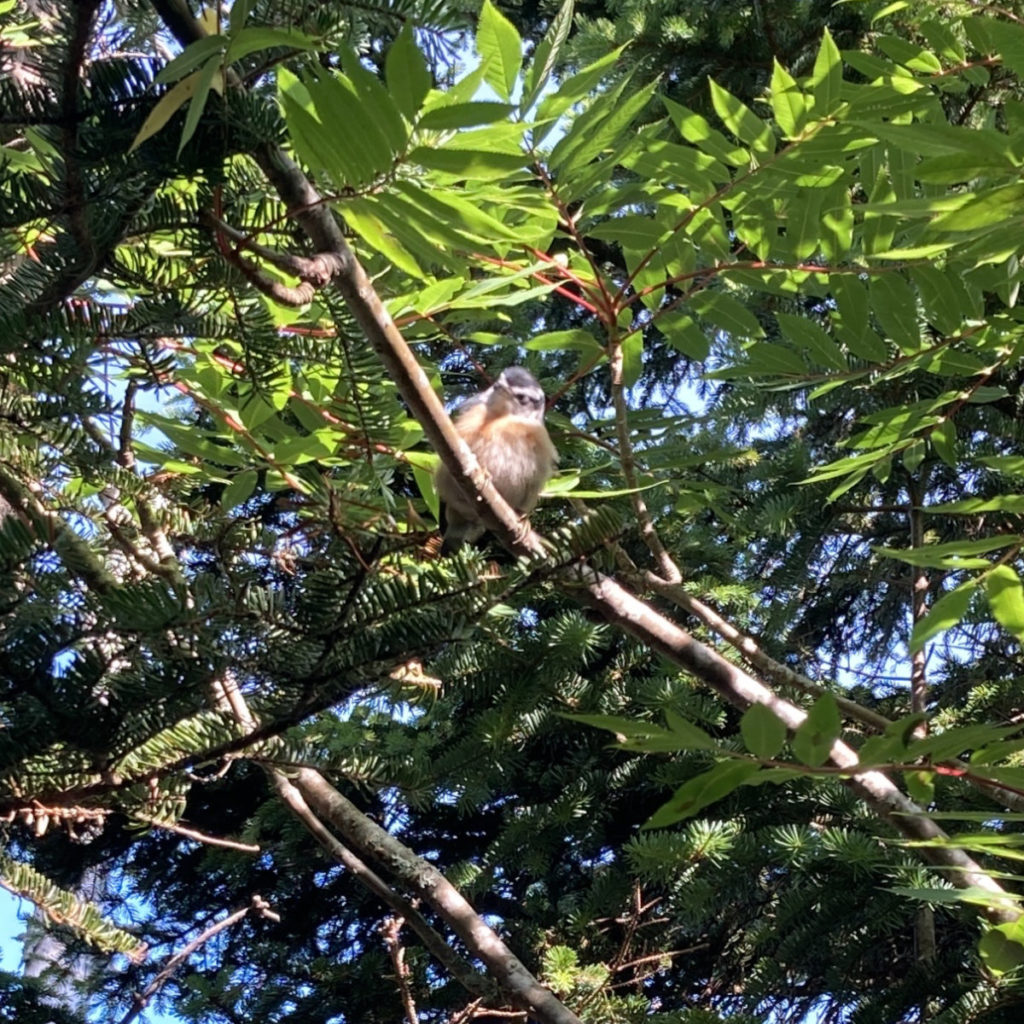
It was a long weekend for me. Fruitful — I’d wanted to bag Zealand on last year’s “ploop”, but didn’t get to do so, and so it was nice doing it this time. My list is 12 peaks ahead, for only one drive to the mountains. Also nice. And I saw a lot of creatures. Smelled a lot of smells. Heard a lot of bird song. It was a trip I needed. Next loop might be by a similar route. Then again, people were talking up 13 Falls, and I was also thinking about what’s east of Zealand… maybe an extended loop route. Who knows what tomorrow brings, but there’s only one way to find out.
As always, stay safe out there.
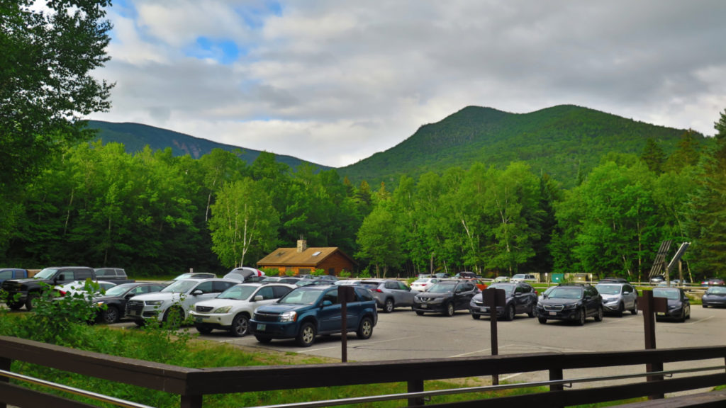

Nuts and Bolts: There are many interesting ways to loop around the Pemigewasset Wilderness, as anyone with a map can see. Mine started and finished at Lincoln Woods, which is a common starting point. From Lincoln, take 112, the Kancamagus Highway, east for about five miles, and the parking area is on the left. Please sign in at the ranger station so they know you’ll be overnighting out there.
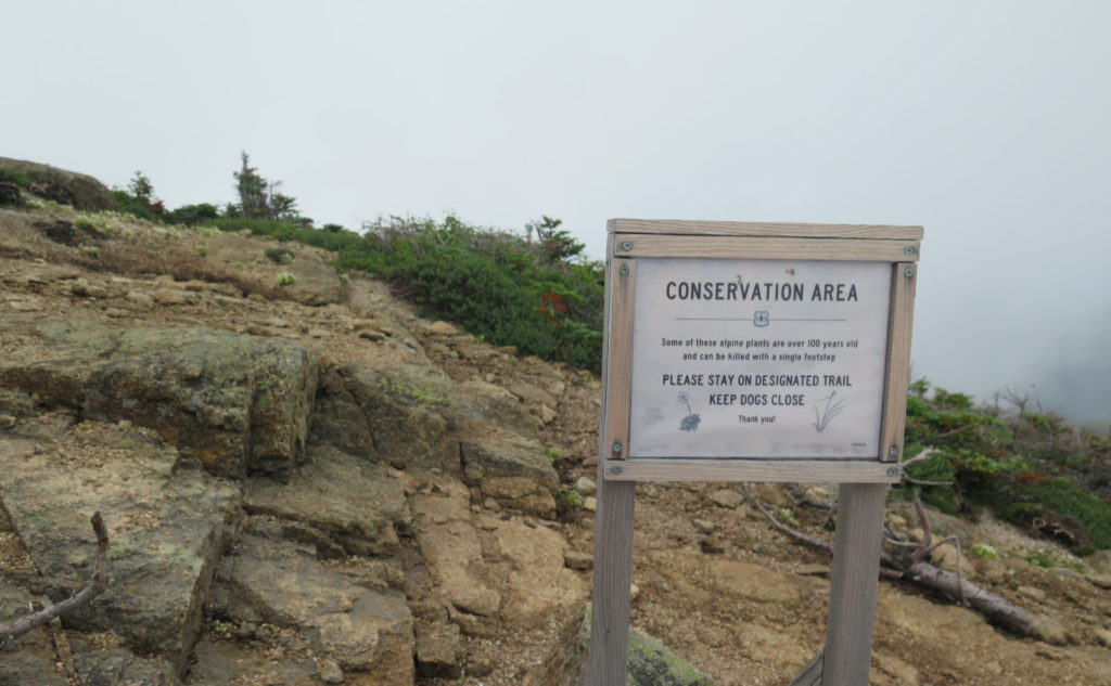
Check the AMC’s website, call if you’ve got lingering questions, and check other sources to get the most up-to-date news on closures. The situation with COVID is ramping up across America, and it’s not inconceivable that it’ll have tangible impacts here in New Hampshire in the near future. At the moment, huts are minimally serviced, although tent sites and campsites are staffed. They’re not stuffing people into shelters like sardines, which will impact how many people it takes to fill a campsite to capacity, so have a backup plan in case you need to find an alternate place to sleep.
Regarding food in the wilderness… be mindful of bears. At the campsites, there are bear-proof boxes for storing foodstuffs. Away from these, either use a bear canister, Ursack, or a bear-hang, where your food is at least 10 feet off the ground, and at least 5 feet from any branch that could support the weight of a bear, including a cub. Remember, a fed bear is a dead bear.
Water on an extended trip can be an issue. North of Liberty Springs tentsite, the only water is at Greenleaf Hut, so be mindful of your supply, especially if it’s hot and sunny out. Above treeline, the sun will be relentless. Check the AMC guide; also the Guthook App has water sources listed for those parts of the loop that follow the Appalachian Trail. And don’t forget to filter your water!
If you enjoy reading these posts, please subscribe — stay in the loop! Your email will only be used to alert you of new posts — typically 1-2 times per week. I will not use or share your email for any other purpose without your express permission. And feel free to share via social media using the buttons below.
Find me in the mountains, on this blog, or on Twitter: @Protean_Hiker https://twitter.com/Protean_Hiker/

8 thoughts on “Trip Report: Grand Tour of the Pemigewasset — AKA a Pemi Loop.”
“The two hour ride home,” that’s often the hardest part! Punching in a few hours later – once upon a time we did something involving the (not blooming) Alpine Garden, the Nelson Craig Trail, and some other foolishness and got back to the car around midnight. I had to punch in at 4 AM and if I had banged in, I would have created a 4 day weekend for myself (NEVER do this in the post office). Got home safely and to work 20 minutes late; so I sympathize greatly and hope work went well for you.
The Cocteau Twins! Did you live close enough to listen to WFNX before it got yanked? Your Bond pictures look like our 48 finish. I actually liked looking down into the bottomless abyss off of Bondcliff. Guyot is one of the most beautiful 4ks, too bad the prominence rule doesn’t allow it to count. Wonderful account. I always enjoy your stories, but this is one of the best.
Funny, I’m reading this now, and wondering if I ever got back to you. Oddly, I know what it’s like within the USPS… yep. (But one of the best jobs I’ve ever had.) Yes, I did indeed listen to ‘FNX back in the day, and once, even partied with Henry Santoro. What happens in the clubs stays in the clubs.