
Do books make a better hiker, or does hiking make a better hiker?
Perhaps the answer is closer to “a little of both, really.” Like any good soup, there’s a lot that goes into the pot, along with more than a little stirring and some time spent simmering. But surely, this can be boiled down a little, no? Indeed it can. My hiking bookshelf has dozens of volumes, but there are a few I consult much more than others. It’s fair to say I’m not too worried about how to get to a summit in the Whites at this point. Sometimes, though, I get in a rut. And at that point, even the most bog-standard, touristy books can be the change I need.
This is going to be a multi-part post, and I’m writing it from a New Hampshire-centric viewpoint, although one that includes Vermont and Maine as well. Boiling down stacks of books to a few “should reads” takes a bit of time, and if those books are truly worthwhile, then it should take time. So keep your eyes peeled.
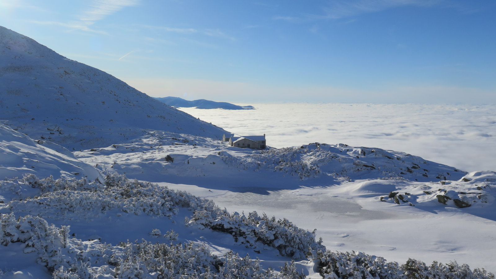
Firstly, and this perhaps should be obvious… no book, however well written, can be even a thin, watery substitute for actual boots on the ground experience. Otherwise, we could all be surgeons after pawing through a copy of Grey’s Anatomy, right? Don’t think reading any of these automatically qualifies you to knock out a single-day Presidential Traverse in January, during a storm. Coming off the couch with no other experience, you’d be set up to try something far easier on a clement day in, say, September.
I’ve said this before, and I’ll say it again…
Make no mistake: the mountains are very dispassionate as they hand out beatings to poorly prepared adventurers who’ve gone in over their heads — even experienced hikers and mountaineers. A failing grade on their pop-quizzes has resulted in death for far too many souls. Don’t let yourself become one of them. Being “dead tired” after a hike is one thing. Being outright dead gets in the way of hiking to begin with. Remember to always show up for class having done your studying, and with your two sharpened #2 pencils, so to speak. In the mountains, class is always in session. You should never think that good weather is recess.
Quite a few skills require some practice before you “own” them. If you’ve never started a fire before, it’ll probably be half a dozen or so before you get the hang of it. Sharpening your knife, same thing. So if you have your heart set on a multi-day trip where you’ll need to be completely self sufficient, first bang out a few short trips where you can get comfortable with those skills, at least to the point where you don’t need the book by your side to ensure success. The first, most important (and trickiest) part of starting a fire can easily be learned in a backyard barbecue grill — you don’t even need to leave home. Keep that in mind: sometimes, the best trip where you learn the most is the one closest to home.
Second, sourcing all this reading material. It’s cheap and easy to just click the button on Amazon and a couple days later, you’ve got the goods without leaving the house. If that’s your style, I won’t dissuade you. But I encourage everyone to shop local. Not the least, small bookshops are disappearing, and with them goes the accumulated wisdom that computer algorithms can’t match. Here’s two:
On your way to Mt Monadnock, The Toadstool Bookshop is right in Peterborough. They’re great people. In Lincoln, on the Kancamagus Highway, you’ll find my favorite, The Mountain Wanderer Bookstore. It’s a great way to support your local economy. Both allow you to shop online. Just as easy as with the big corporate behemoths, but with friendly local service that the big guys can’t offer.
That aside, let’s talk books, starting with the basics.
For hiking in the Whites, I’d like to assume that you’ve already gotten a copy of the AMC White Mountain Guide (“the AMC guide”) somewhere near at hand. If not, stop what you’re doing and go fix that deficiency. This is probably the most authoritative tome on the Whites that you’ll ever find. “More than 500 trails are covered, totaling more than 1,400 miles.” If you have no other book on your shelf, have this one.
If you’re new to any guide, I find it best to do a couple easier hikes first, and get accustomed to how the authors and editors describe the trails. Compare how their descriptions match up with your experience and expectations, and how the book times compare to your own. Each section of the book has a few suggestions for easy, moderate, and strenuous hikes at the start of the section. It’s a good, low-stress way to learn the book’s style and how it relates to your own hiking pace.
Assuming you’ve gotten yourself a shiny new copy, it should have a set of maps printed on Tyvek. If your maps are paper (I know the hardcover, slipcased 30th edition shipped with paper) then drop the extra coin and get a set of Tyvek maps. They’re waterproof, and for all functional purposes, indestructible. For most people, map 1 and 2 (the Presidentials and Pemigewasset) tend to get the most beat-up. My current “daily drivers” are a couple years old now and still doing yeoman’s duty, if that’s any endorsement of their quality.
Please, carry some kind of paper map (for varying definitions of “paper”) even if you’re planning on navigating with your GPS or phone app. Batteries die. You should always have a backup plan. If you ever meet me on the trail, I’ll have the paper map in my front pocket, ready to go.
On maps. If you examine the photo in this post, you might have noticed I’ve got quite a few past editions of the AMC book. What I most appreciate about them is how they’ve evolved. My very first copy of the AMC guide (the 25th) still came with the old hand-drawn topo maps printed in orange, on thin “bible” paper. Comparing that edition to past versions, changes over time were incremental. In the 26th edition, the maps had modernized — GPS technology had come into play, and a computer had a hand in their creation, which marked a fairly big jump. The most modern editions represent a bigger leap. They’re printed in full color, are much more readable, and quite up to date… “kinda-sorta.”
Lately, crazy-accurate surveys have been done in the Whites, and the tech is able to resolve down to within a handful of inches now. You might have heard about Tecumseh’s height being adjusted to 3,997 feet last year. So while you probably could use the old maps that came with the guide you picked up in a thrift store, I wouldn’t do so unless you had a strong understanding of the lay of the land. And even then, I’d have modern cartography somewhere near at hand, just in case. Storms frequent the mountains, trails get rerouted as a consequence. Things fall out of date.
As time goes by, check with your local bookstore or outfitter and see if your guides need updating. It’s cheap insurance against getting lost. This summer, I saw first-hand that the Dilley Trail on Mt Wolf was drastically different than my AMC guide and maps indicated — the book came out in 2017, the same year that a fire wiped out all but the top 3/10ths of a mile of trail. Those hyper accurate surveys will certainly show other changes. Obviously, I’m upgrading my guidebooks and maps once the new ones are out. And as technology continues to get cheaper and more accurate, it’s easy to foresee a time when the maps will be updated much more frequently — maybe even monthly. Time will tell, but remember that trail guides will forever be changing with those times.
That said… I have stacks of old maps, going way back, including some that predate World War Two. They’re fascinating. They’re a window into a very different world. They talk about hitching a ride on the old logging trains, and that sort of thing. Wow! They’re an indispensable tool for those occasions when I want to understand how a trail has evolved, or when I want to wander a bit off the beaten path. (Some of the old trails, campsites, and whatnot are still there, if you know where to look, waiting to be rediscovered!) But when I use them, they work hand-in-glove with my modern maps. So if you do happen across some of those old crusty and dusty relics, cherish them. When you find an odd something-or-other that you can’t identify in the current guides, they might be the key to understanding. (And don’t forget, relics like this are never really owned, but merely kept in stewardship for the next generation. Don’t hesitate to hand them down when the time is right.)
OK, back to books…
I’m organizing the rest of this list in a rough sequence. Categories of books you really should have, whether or not you have all in that category — but at least one or two of them. Moving downward, books that can help make you a safer hiker, and may even open things up from fair-weather only, to someone who feels comfortable hiking year ‘round. And toward the end, stuff that will enrich your experience, from finding new places to identifying things you saw. I don’t spend much time on any particular book: take that as an invitation to explore on your own.
Essential Guides to the Trails:
If you’re hiking in Maine (“trails on more than 300 mountains are described”) or Southern NH, the AMC has books on those areas, too. The Maine Mountain Guide endeavors to provide complete coverage of the Pine Tree State, and its heft, being comparable to the White Mountain Guide, would suggest they’ve gotten close, if not all the way there. Bear in mind that for the eastern-most part of the White Mountains, there is a lot of overlap between the Maine Mountain Guide and the White Mountain Guide. If those are your stomping grounds, the books are, for all intents and purposes, interchangeable. But go into that with eyes wide open.
The Southern NH Trail Guide, on the other hand, falls very much short of the “cover everything” ideal. The book does cover the Monadnock-Sunapee Greenway and the Sunapee–Ragged–Kearsarge Greenway, as well as their significant neighboring mountains. And it covers numerous other mountains and state parks located south of a line drawn at Route 25. The volume itself is noticeably thinner than the WMG or MMG, but where you don’t find specifics, you’ll find helpful contact information for local trail organizations (such as the Friends of the Wapack, NH State Parks, etc) where you can find more comprehensive information. Regard this in some sense as more of a “DIY companion” rather than a book that will provide all the answers. You’ll need to fill in the blanks on your own in a few places. I think it makes it more fun that way.
If you’re hiking the 48 four-thousand footers, I highly recommend Dickerman and Smith’s The 4,000 Footers of the White Mountains. A tome that’s larger in size than the AMC book, it’s entirely focused on the NH 48 list. Where it differentiates from the AMC’s book on the Whites is in far more fine-grained information on trailheads, preferred routes in wintertime, and the history of the various mountains. This is an exhaustively researched book, and when I was working on my first round of the 48, this book was essential. Even now, when I’m planning a hike, especially in wintertime, this book remains essential. There are numerous approaches to any mountain in the summertime, but often, there’s only one realistic way up once the flakes fall. Side note: Steve Smith, one of the authors, is the editor of the AMC White Mountain Guide, and he’s hiked the Whites for decades. If that’s not an endorsement, I don’t know what is.
Falcon Guides offers their spin on the 48 as well. Climbing New Hampshire’s 48 4,000 Footers is a good read. It’s got nice color photos, but devotes many fewer pages to each mountain than Smith and Dickerman’s authoritative tome. If I were buying one book, I’d go with the former rather than the latter. However, the Falcon book does have a section devoted to several backpacking expeditions where one can bag a few peaks in a multi-day outing. For a more seasoned adventurer, doing a Pemi Loop or a Presidential traverse might be straight-forward. But for those with less experience, this might be worth the extra coin.
Vermont: The GMC does strong work documenting their trails. However, it’s notable that much that’s in their wheelhouse orients toward the Long Trail, and that’s completely understandable. I have their Long Trail Guide, and their Day Hiker’s Guide to Vermont on my shelf, as well as their Nature Guide to Vermont’s Long Trail. Their individual maps are excellent, although they’re not at all comprehensive for the entire state. If you’re hiking somewhere else, like a state park or something, you may have to find resources on your own. On that score, it’s worth noting that the AT heads east from Killington, so any AT resources for Vermont will help in that area.
However, the AMC’s Best Day Hikes in Vermont is a useful companion book. And oddly, the Green Mountain Club has partnered with Countryman’s Press to publish 50 Hikes in Vermont, and that book does cover a lot of the whole state, not necessarily on the Long Trail. The two offer a lot of overlap, so I’d put eyes on both and decide which speaks your language better. (For that matter, Countryman’s Press has other “50 Hikes…” volumes covering the New England states, and my impression is generally favorable — a bit more so than the Falcon Guides books.)
OK, that’s going to wrap up the first half of this feature. Right now, we’ve covered the minimum reading you should be doing just to navigate the trails on a fair weather hike. You’ve got the map, you’ve read the guide, so you should be OK knowing what to expect. Next post will go over stuff that you can use to elevate your game, and even add some measure of inquiry and sophistication to your hikes. Perhaps even expand your season into that fourth, colder one. Stay tuned.
7 thoughts on “Literary Hiking: Books that have informed my hiking in New Hampshire and beyond.”
Fantastic read
Oh, I’m very glad to hear that! I was in fits, trying to write something that didn’t come across as wordy or just plain awkward.
Thanks!
I was reading “about” in your info. Did you hike the AT in the spring as you mentioned. What are your plans?
Check out my post from 2 January. Short of it is that I broke my ankle hiking Mt Adams on Boxing Day. That and COVID basically put the kibosh on the AT for now. I’m hopeful to get to Springer Mountain in 2021, but time will tell. If not, I still have a laundry list of hikes I want to do in New England.
Thanks for the info. I will be looking at all of your “blogs”. It sounds like you made a full recovery.
I was going to start a “flip flop” thru hike of the AT starting in April 2020 going north.
Due to Coronavirus I didn’t start as recommended by the ATC.
My plan is start a NOBO thru hike of the AT in March 2021.
1.So do any of your old maps have the trail to Hawthorne Falls? 2. Funny story about outdated books. A couple was not sure they had summited Hale, the guidebook (1972) said there’d be great views.3. Every year (but obviously not this one) we go to the Brimfield Market (giant flea market/yard sale/whatever). A guy there has the 1905 WMG!
1. I’m going to have to get back to you on that one. Stay tuned.
2. Oh wow. I can’t think of how long ago it was that Hale’s summit had a view of anything but its cairn. Then again, Carter Dome (of all mountains) should have a view, and it doesn’t either. Que sera, sera.
3. Wow. Is he willing to sell for a reasonable price?