
Mt Monadnock (3165 feet). Dublin, NH. 2020-07-23 (Thor’s Day.)
Via Pumpelly Trail. 9 miles round-trip. (Book mileage.)
82 dF at the trailhead, 80 dF at the summit. RH ranged around about 100%. Winds were negligible in the trees, about 5-7 knots at the summit. Overcast, torrential downpour, some sun at the summit. In short, sodden.
Trailhead: 1200. Monadnock summit: 1630. Car: 1900.
If you don’t like the weather, wait ten minutes. Or an hour.
This hike shouldn’t have taken seven honking hours. Five would have been acceptable, but seven?! Yikes!
To be fair, it was nothing even approaching a normal day. The forecast called for a 27% chance of rain after 1400. I figured I could make a decent run for the summit, and there might be a few raindrops on the way down, but nothing consequential. As it turned out, I got none of that.
Heading out, the trail lived up to its billing in the guide. It starts relatively sedately, and indeed, I was turning in an 18-ish minute per mile pace in the opening mile and a half or so. There was a lot of duff on the trail, interspersed with a few roots and rocks here and there. Oddly, there were “duff puddles” where enough had piled up, and yesterday’s rains lubricated them. Net effect was that the topmost layer was unconsolidated, and those patches were crazy slick. I’ve never seen something like this anywhere else. (And for reference, I’ve hiked White Dot, on the other side of the mountain, more than 100 times.)
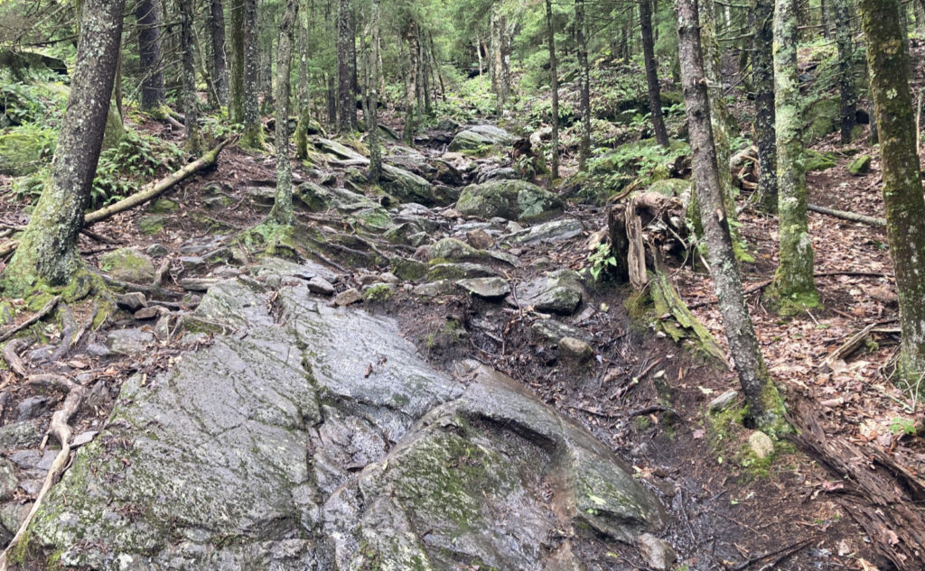
The trail pitched upward, and the part of the guide’s description that included words like “steep” and “strenuous” gained immediacy. No question I was going up. Footing wasn’t always wonderful — not just the duff puddles, but the rocks themselves were coated with crazy slick leaf snot, and I found myself slipping and sliding in places where I should have had good traction. But nothing unusual.
And then, slight rumblings, suggesting Thor was having a touch of indigestion, came to my ear. Nothing said “rain imminent” so I kept going, figuring this was just a summer rumble, of the sort that makes a little noise, but overall, doesn’t do much. I kept an eye toward the sky, such that you can when you’re below treeline, and decided that if things got weird, I’d skedaddle.
So there I was, about the halfway point, and the rain started falling. Or more to the point, it skipped the “starting” bit and just plunged head-on into a full on deluge that lasted an hour. The delicate sounds of thunder that I’d heard earlier became more ardent. And that’s when I decided to turn around and head back toward the car. I figured one of two things would happen: either I’d get to the car before things had wrapped up, and I’d go home, or the storm would blow out like a typical summer squall, and I’d head back up once the sun came out and started drying things up. Reality, of course, danced between those two bookends. The storm took its sweet time blowing out, and as a consequence, I got much closer to my car than the summit, leaving a lot of back-tracking. (Edited to Add: as it turned out, my daily mileage on my watch showed I probably added about three miles to the hike — this was becoming less typical of Monadnock and more like something I’d expect in the Whites. Proving you should never underestimate a “smaller” peak.)
I checked the weather, and when I animated the radar, saw the storm just popped up out of blank sky. Literally nothing on the radar for an hour, then bam, a knife-edge line of yellow marched across from Vermont, heading toward Portsmouth. If I were a meteorologist, I’d probably say it was pretty, and even still, I did think it was kinda neat, being so well organized. As it was, I was standing on the side of a mountain, a mountain that this very organized line of yellow storms was marching across. I had some work to do.
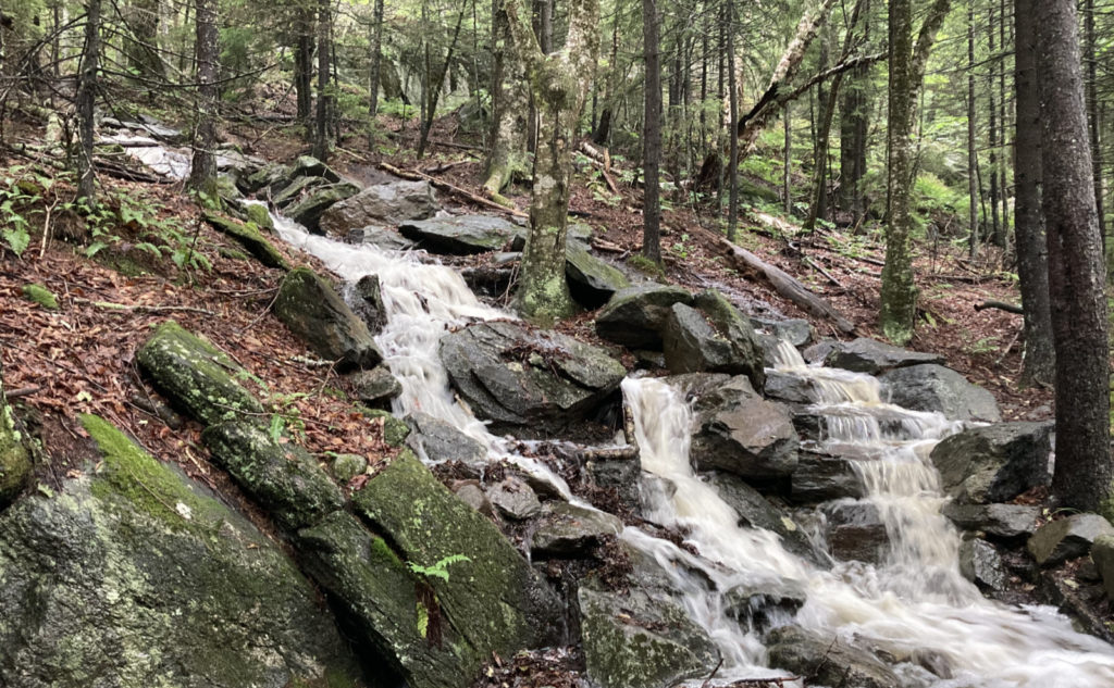
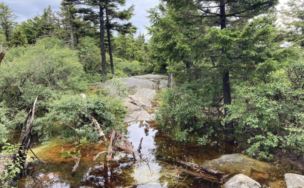
The rocks and stone stairs I climbed up relatively easily were an absolutely unbridled cascading river now, making the descent more difficult. Places I walked with my shoes totally dry were now ankle-deep puddles, completely unavoidable. I felt like a drowned rat, and honestly, I’m not sure it was fun anymore. Rare, but it happens. I’m going to point out right here and now that this trail really felt like it shouldn’t be in southern NH, but somewhere in the northern Presidentials. “Slog” felt like a good descriptor, and I’m given to compare it to the Rocky Branch trail on Isolation.
I made it almost as far as the point where the trail flattened out, and then things started to slack very noticeably. It felt like the sun was trying to poke through, even. I gave it a minute, and then cautiously turned back up toward the summit. Retracing my steps, I climbed back up the cascade. I crossed puddles that were well above ankle-deep. At this point, I was determined: the summit would be mine, come hell or… well, there was certainly water, that’s for sure.
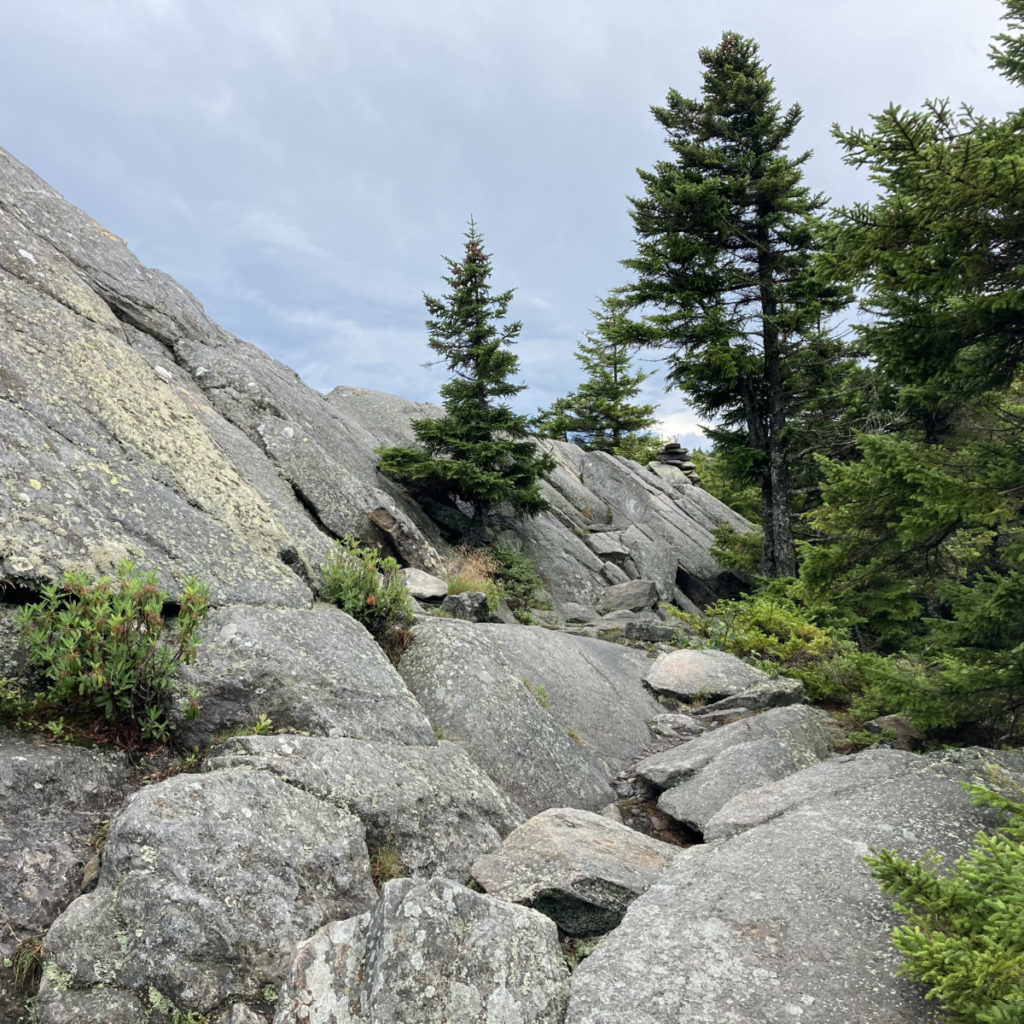
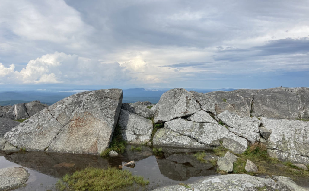
Pumpelly traverses a shoulder that extends more or less to the northeast. From the top, you can see how it reaches out, almost in a straight line. What the trees on top conceal, however, are the PUDs: the Pointless Ups and Downs. If the rain wasn’t enough, the PUDs started getting demoralizing. Looking at the time, it hit me that this trail was taking way longer than it had any right to. I kept going out of sheer dogged determination. It was getting personal.
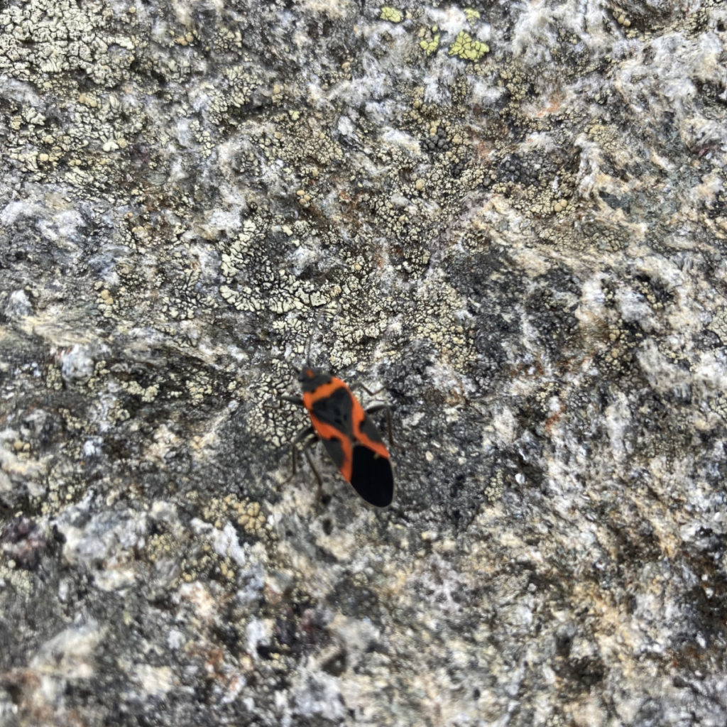
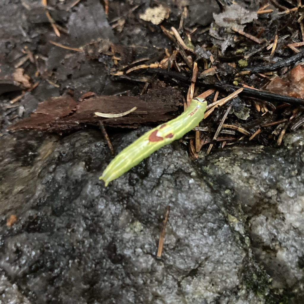
And then… salvation in blue. Looking at the sides of the trails, I noticed familiar, and very tasty antioxidants. Blueberries! And they were ripe, ready to go down the hatch! To say this was needed is an understatement. I was getting a little crispy, and these little dynamos did a lot to buoy my spirits. Every so often, I’d just pause for a second, reach down, and grab a few. Yum.
Finally, I broke through the trees and the summit was nearly always in view. Occasional PUDs would have me dip down out of sight of the summit, which was a hit. It felt like the summit, now so near, kept getting further away with each step. I just wanted to scream “all right, already!” This day was getting very long in the tooth.
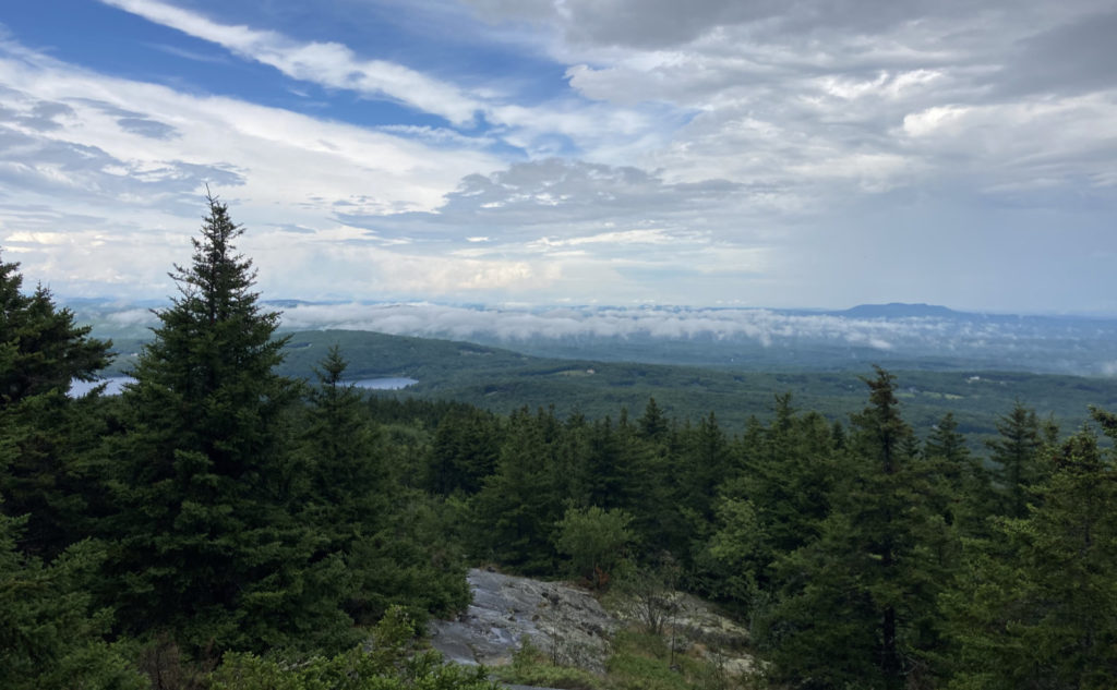
But all things in time will pass, and after passing the last cairns, the summit was just a few feet above me. I sat down by a park ranger, and we chatted for a spell. He came up Marlboro, and although he was able to take shelter under the stone arch, it was still pretty soggy by him. We both agreed that this storm felt stronger, and seemed to linger much more than normal. I had a snack, and started to feel a bit more energetic. Getting up, I finished my ascent by stepping on the summit benchmark — something I do anytime it’s not covered in snow or ice. And then, I turned back.
The guide mentioned that the descent from the bald summit could be a bit tricky to follow. My experience wasn’t so bad, and actually, it felt fairly straightforward. I returned to that ridge with the PUDs, munching on more blueberries on the way. It kept me going. The rest of the descent wasn’t particularly pleasant — being still very wet, still having well-over-the-ankle puddle crossings, slippery rocks, and everything else that had been tossed at me. But in time, I was back at the car.
Thinking about it, I’m not sure what I could have done differently. I tried to keep it in context of a date-to-be-determined hike of the AT. I mean, on that trail, it’s not like I’m going to be able to just take strings of luxurious zero-days on account of rain, and indeed, thunder. The stakes there are a tad more stark: if you don’t make mileage, you don’t progress. No rain, no pain, no Maine. Or put another way, “embrace the suck.”
And that’s how I’m taking today: embrace the suck. This isn’t my favorite trail. For that matter, the PUDs on Moriah aren’t a favorite of mine, either, despite the epic views from that mountain’s summit. But if you’re going to get anywhere, you have to take the mountains and the weather as they show up at your door. And remember that some days you’re ahead, some days you’re behind, but the race through life is a marathon, not a sprint. And the days that don’t go according to plan make us appreciate the ones that do.
As always, stay safe out there.
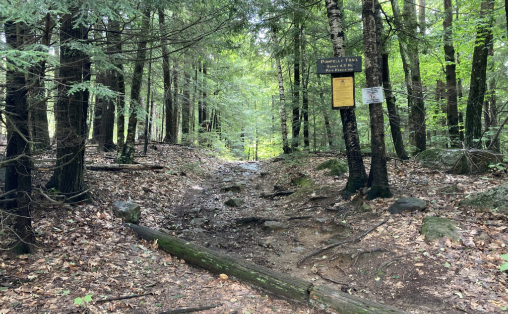
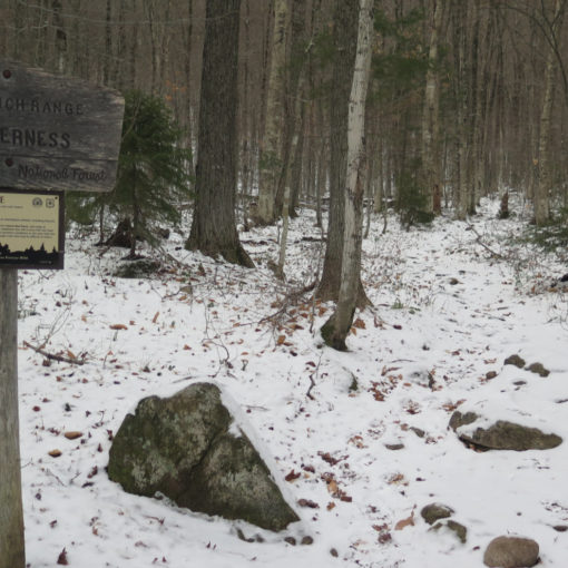
Nuts and Bolts: Find the Pumpelly Trailhead by heading into Dublin on Route 101. At the flagpole, proceed west about 1/2 a mile or so more, and take a left turn onto Lake Road. About half a mile later, you’re going to see, as long as you look very carefully, a cabin on the right, on the lakeshore. It’ll be made of vertical logs, but at first, second, and third glance, won’t stick out at all as anything special. Exactly across from this is a gap in the trees, and you might be lucky to see a couple cars parallel parked nearby. If you look about 50 feet into the woods, you might see a trailhead sign, but no kiosk. This is not the easiest trailhead to find. Parking is by the side of the road, completely ad-hoc. Obey all no-parking signs, obviously. Dublin’s a sleepy town, and I’m sure Officer Obie will have no problem towing your ride, having you sit on the Group W bench, and all that. As always, be an ambassador for the sport.
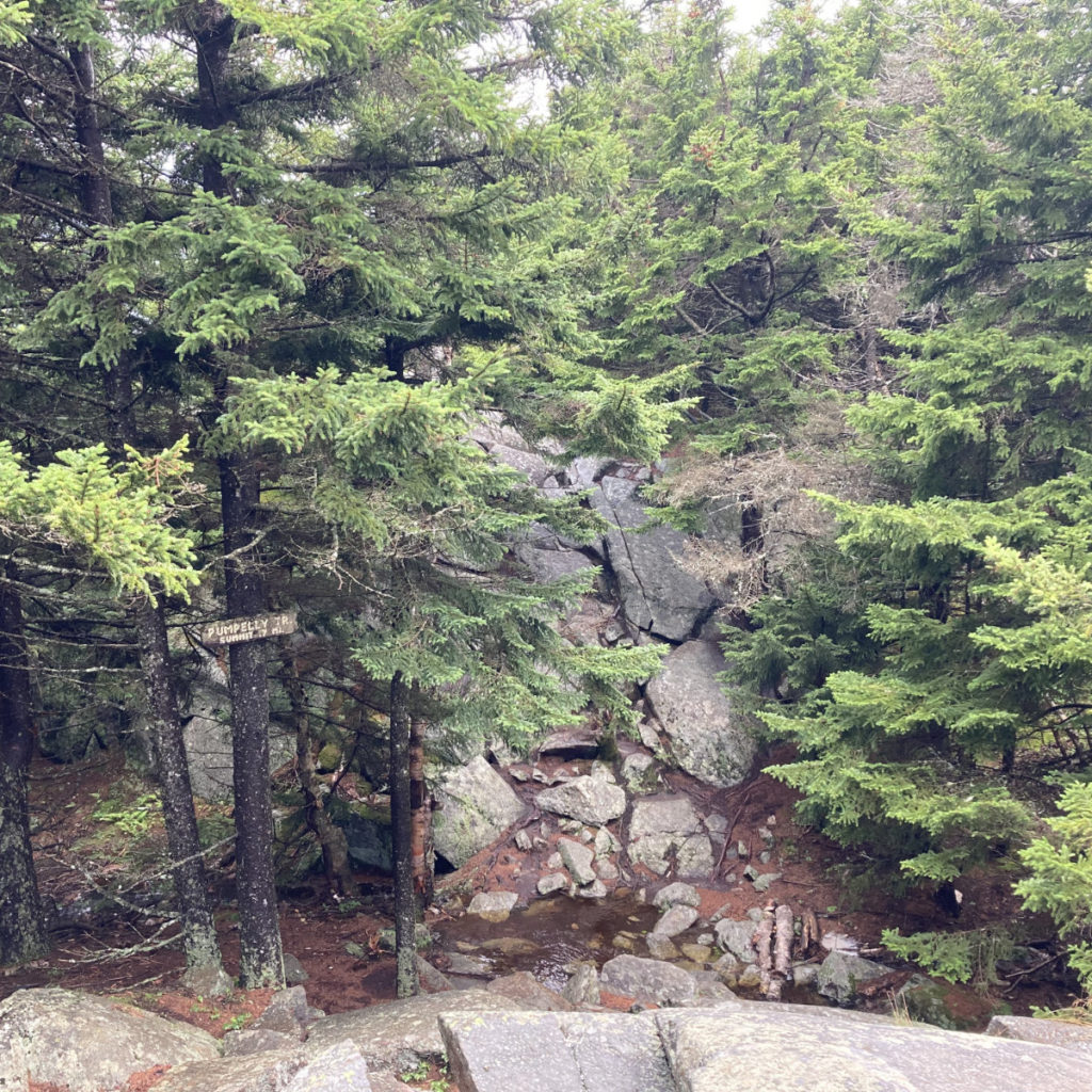
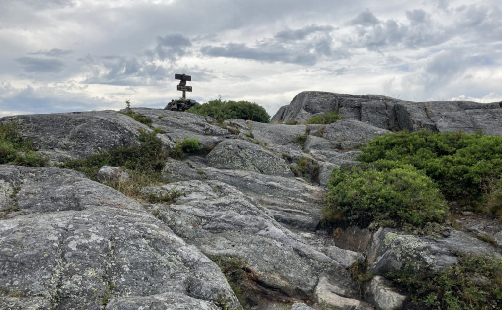
Blazes are… come to think about it, I’m not sure I saw any, except a couple arrows here and there down near the bottom. But the trail is pretty apparent, and above treeline, there are cairns spaced about as well as you could want, and the trail junctions are well signed, including painted arrows on the rock where it makes sense. For all the lack of blazes, this isn’t the hardest trail to follow, at all. But as you approach the summit, take care to note your surroundings so you’ve got good bearings on the way back down.
On the return, mostly aim yourself toward the shoulder. When you look to the northeast, it sticks out like a sore thumb, assuming the summit isn’t socked in clouds. As you step off the summit, the painted boulder pointing the way to park HQ will be about 50 feet away as you pass it on your right. You should be seeing the first cairns by then.
If you enjoy reading these posts, please subscribe — stay in the loop! Your email will only be used to alert you of new posts — typically 1-2 times per week. I will not use or share your email for any other purpose without your express permission. And feel free to share via social media using the buttons below.
Find me in the mountains, on this blog, or on Twitter: @Protean_Hiker https://twitter.com/Protean_Hiker/
5 thoughts on “Trip Report: Thor on Pumpelly: Hiking Mt Monadnock in questionable conditions”
I enjoyed reading about your frustration in climbing MM. Nice, concise and very descriptive writing!