Denial ain’t just a river in Egypt (or: “Sometimes even the good guys sing the blues.”)
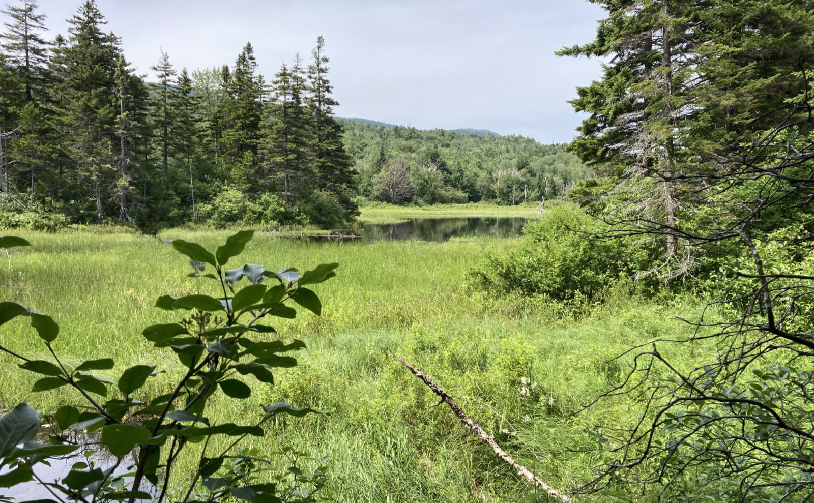
Mt Tripyramid, Waterville Valley, NH. North, Middle, South peaks. 2018-02-22. (Thursday)
Via Livermore and Mt Tripyramid trails, taking the North Slide on the way up and the South Slide on the way down. (Planned.)
32 dF +/- and cloudy. The forecast called for partly cloudy, but I never saw the sun once. Recent days saw some very unseasonably warm (some might say hot) weather — Southern NH saw temperatures well ensconced in the mid-70s, and even the Whites were warmed by high 50’s to low/mid 60s. This should have been my warning, but what did I know?
The AMC book said about 3:30 to summit North peak via the slide. It also said to seriously consider the Scaur Ridge trail in cases where the slide was expected to be wet and/or icy. The most recent trail conditions I’d been able to find suggested things would be fine, so I didn’t give it a second thought. I couldn’t have known slide was a hockey-rink, and all but impassable. Had I even an inkling of what was to come, I’d have done well to have simply looked upward at the slide, maybe taken a few pictures, turned on my heel, and spent the morning taking in the views from Welch-Dickey.
I was at the trailhead at 0700 on the nose, but by 1230, I still had around 200 vertical feet on the slide left to go. Every inch of the hundreds of feet I’d already climbed were fought for tooth and nail — I’d been bushwhacking for probably 2+ hours at that point, so emotionally, I had something invested. But it had been snowing at that point for about 15 or so minutes and visibility was headed for the dumper, making it an easier decision: hi ho, hi ho, back to the car I go. My spirits lifted perceptibly.
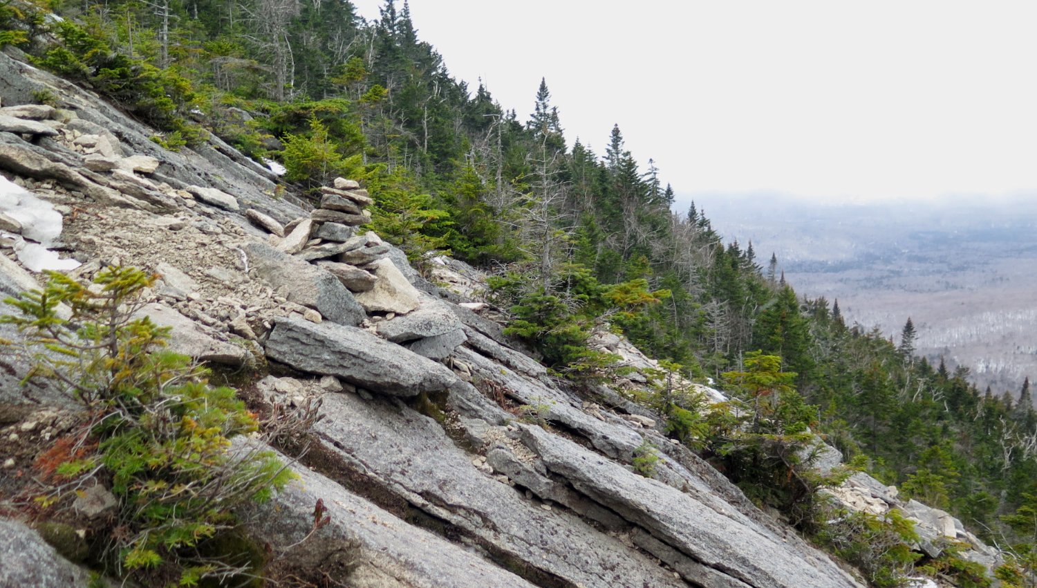
The practical consideration was knowing that most of the slide was sheer ice with intermittent snow or dry rock patches. For those who haven’t gotten a sense of scale on the steepness of the North Slide: per the 1992 AMC White Mountain Guide (25th edition), it climbs about 1,200 feet in about half a mile. (1 mile = 5,280 feet.) Compared to the White Dot trail on Monadnock, this is the technical part in the middle, except stretch that part out for about 2/10 of a mile and take away all the trees. Anything that got kicked down the hill kept going and going.
The danger is that if you lose footing, sliding on the ice will be the least of your worries — if that was it, you’d just enjoy building up an insane head of steam, joyously sliding down the mountain at approximately the speed of sound, and if you played your cards right, you might even get the path behind you to catch fire, Road Runner-style. You’d be the toast of the internet, showing up everyone who ever dared to utter the words “hey everybody, watch me!”
Instead, you’re constantly reminded that the first patch of anything not-ice will flip you ass over teakettle, and you’ll tumble down the hill to your quick doom. As I saw no-one on the trail today, I had no doubt my corpse would have had plenty of time to chill out before being found, maybe by Saturday afternoon. In short, any fall would be a recovery, not a rescue. Oh goody.
Getting down safely was cribbed from what got me into that mess in the first place: bushwhack, with a heaping helping of butt-sliding. It took half an hour to undo what took me all morning. I slid down in the relative safety of the trees, but this was not without its peril. I had been in shirt sleeves for most of my self imposed death march, and a fair bit of the trip back down. At my car, I realized my arms and my face looked very much like an angry cat ran riot on them all morning. +1 for getting down safely, but my coworkers are going to ask about it tomorrow. (“Heh. You should see the other guy.”)
This was hardly the first time I’ve scrubbed a winter hike due to time or conditions. It won’t be my last. The White Mountains have been around for thousands of years. I’m sure they’ll be around for a few more years. And at least as far as I care, bagging the peak, or even accumulating a list to earn a patch, is secondary. The primary goal is to be outside.
Besides, better to come back down early, because if you can’t, someone else will have to go up and drag your body back down, and that means others are imperiled by your poor choices. No bueno.
Stopping by The Mountain Wanderer Bookstore on the way home, I was told that route is one of the toughest in the Whites, even on a perfect day. Even more is that doing the loop requires descending the South Slide, and one would do that without having first laid eyes on the trail.
If one’s interest is in an easy hike to see a crazy route going up virtually straight as an arrow (indeed, it does look impressive from below) then one could do worse than the bottom bit of the Mt Tripyramid trail. But my next attempt to bag the two Tripyramid 4,000 footers in winter (and this goal remains on my list) will be via the Scaur Ridge trail. And if that means skipping the South Peak in the interest of saving time (and precious daylight), then so be it. I can bag that peak another day via another route.
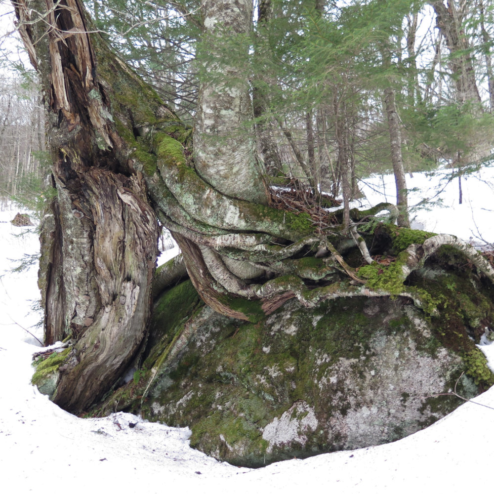
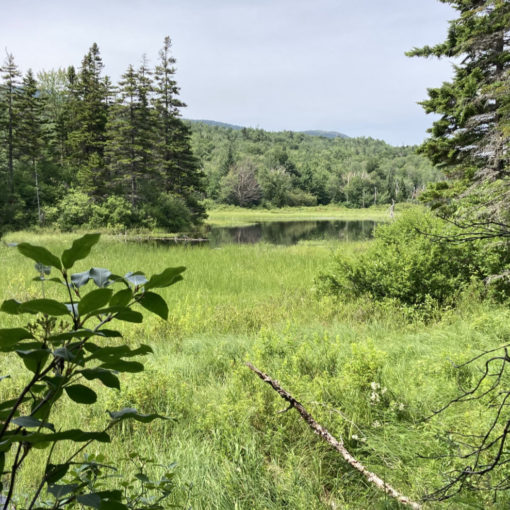
Interesting how trees will do anything to establish themselves.
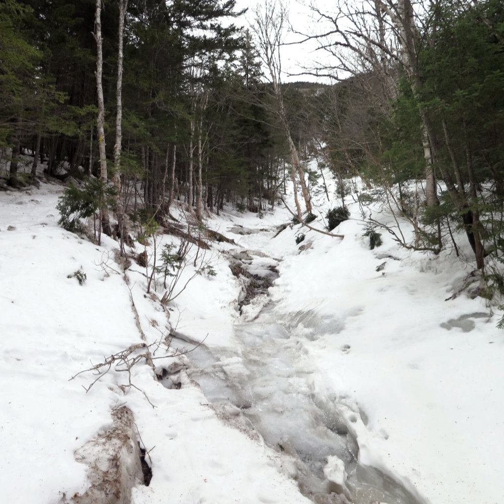
Ice on the way up: this should have been the first sign.

The upper reaches of the North Slide. Not visible are the large patches of ice, just about everywhere.
9 thoughts on “Trip Report: Mt Tripyramid Loop Attempt”
Just ran across your blog (looks like your just getting started). Nice write up! The North Tripyramid Slide is my favorite all time below treeline hikes in the Whites….albeit I wouldn’t touch it unless in decent summer weather :).
You might want to check out ‘The 4000-Footers of the White Mountains’ by Smith and Dickerman (amazing info on ways to summit these beasts, especially in the winter) if you haven’t already and continue to search through the blogs/forums. Lots of good info!
Looking forward to watching your trek for the ’48’. You’ll find Monadnock is not much more than a warm up trainer for what you have ahead.
Keep Walking!
Thanks for your comment! I had a sense going in that Monadnock wouldn’t be much more than a training “hill”, having hiked in the Whites before. Indeed, I was thinking about how I’m driving home from Monadnock within 2-3 hours, whereas anything in the Whites, that’s the point where you’re just getting started. Attitude is everything, though, and to that end, no hiking experience goes wasted.
I’ll check out that book. I’ve already got several, and scoped out a bevy of blogs as well. (My wallet cries out for mercy every time I walk into The Mountain Wanderer bookstore.)
Thanks for the kind words.
I’ve got Smith’s book (and met him in person — great guy). You’re right, it’s a valuable resource.
Monadnock did turn out to be valuable as I “ramped up” into the 4,000 footers on mountains like Tecumseh and the rest of the Sandwich Range, and it’s one I keep returning to as a trainer, or when I just have time for a “quick jaunt”. I’m finding that every mountain builds on the previous one. We’ll see if it holds up as I turn toward the Northern Presidentials.
Thanks again!
WordPress has now enabled voice comments for websites. Bring your website up to date and get the free plugin here, http://bit.ly/Voice-Comments