
Gap Mountain (1,862 feet). Troy, NH. 2021-09-22 (Tuesday.)
Via Metacomet-Monadnock Trail. 2.5 miles round-trip.
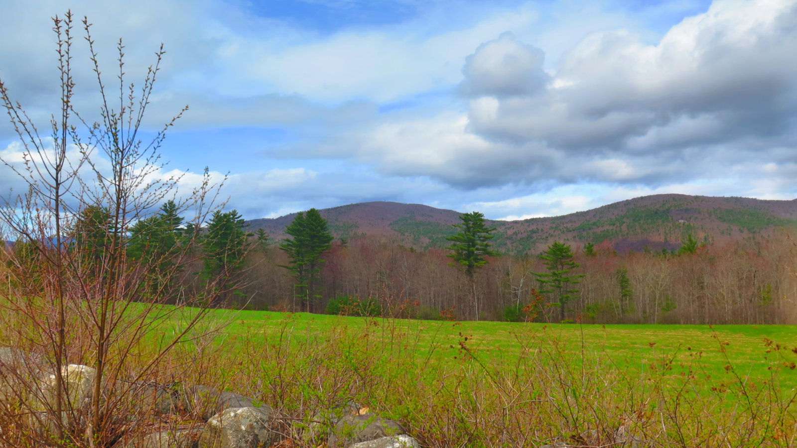
70 dF, and a partly sunny day with fluffy, lazy clouds overhead. Winds were negligible.
About 2 hours total.
Note: This hike is part of the Five Hikes Challenge, put on by the Society for the Protection of New Hampshire Forests. The Forest Society (as it’s known for short) has the aim of protecting NH forested lands for outright “don’t touch anything” ecological conservation, for research, for responsible silviculture (AKA logging), and for recreation. It’s been in operation since 1901, and protects about a million acres of forested land in the state, either through outright ownership (about a fifth of their portfolio) or through easements, land trusts, or other means. Their reservations are open to the public for various pursuits, including hiking, fishing, and hunting. Please consider joining if you’re not already a member. They’re good people.
You don’t need tough to have fun in the mountains.
There are always lists, challenges, and whatnot to spur one to action. If I didn’t have enough going on already, the 5 Hikes Challenge from the Forest Society landed in my inbox. Obviously, with the words “hikes” and “challenge”, it was obvious that I needed to do it. Being comprised of shorter, lower, and less challenging (for me) hikes, it’s a nice way to bring a friend who doesn’t get outside nearly as much as I do, and a reason for me to look around a bit further into the corners of the state that I don’t get around to much.
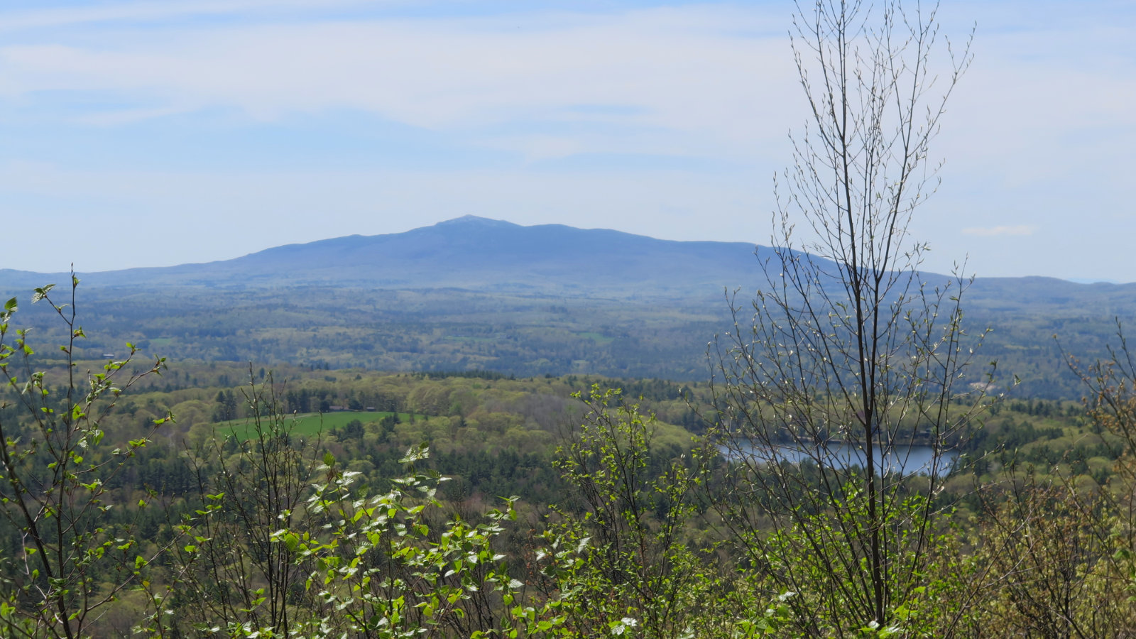
I have no idea why Gap Mountain hasn’t been on my radar until now, except for it not being in the Whites. The trailhead is literally down the street from Monadnock, and it’s impossible to suggest I have no idea where that little lump of rock lies. Besides that, there’s a trail connecting the two, and from the far side of Gap to the summit of Monadnock is around 5-ish miles. Maybe I need to get new reading glasses.
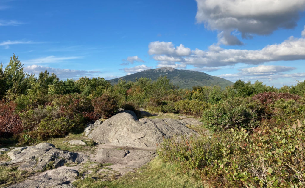
In any case, it’s a gem. We had a blast. The grades are about as un-serious as you can want, on par with Pack Monadnock, for sure. The views on the other hand? Wow, you get a stellar view of the southwest side of Monadnock, which means if you’re up there any time after mid-morning, the sun will be favorable for some great photos. It’s as good as anything you’ll find in the Whites, with a tiny fraction of the drive.
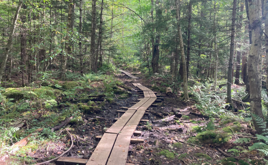
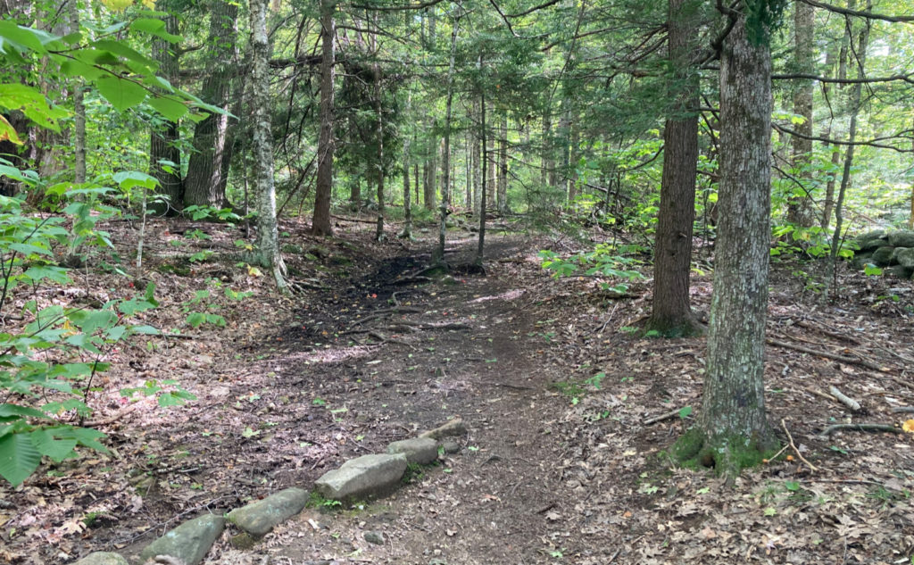
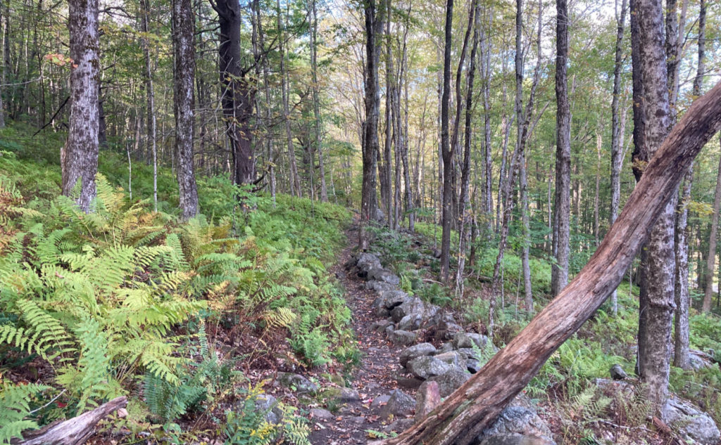
The trail is almost entirely within conservation lands; almost all of which is owned by the Society for the Protection of New Hampshire Forests, the rest part of Monadnock Memorial Forest. We passed through a mostly open forest for about 90% of the hike. Toward the summit, things tightened up a bit, but everywhere the trail was nicely maintained. A bit of muddy trail down low, a few stone steps, but mostly soft duff. Critters were making noise everywhere. Ferns were all over the place. It was very serene.
On that note… the success of the SPNHF can’t be understated here. At one point, the land would have sported 50 homes and a ski area. Locals banded together, and with the help of the Society and the generosity of donors, bought the land and prevented development. Later, other donors added tracts to the overall reservation, and today, it covers more than 1,100 acres where you and I and anyone else can go have fun.
This is a hike that yields its rewards pretty easily. There’s not a lot of “up”, although just enough that the young monkeys in any family will have a suitable challenge. On that score, the views from the north peak, looking at Monadnock, will produce a chorus of delight from children of all ages, and the kiddos will have plenty of stories to tell their pals at school on Monday. Gap Mountain checks all the boxes for “family friendly” including a decent sized area up top for a picnic. (Alas, for the grown-ups in charge of laundry duty, there are mud puddles, any one of which will no-doubt be explored by tireless young adventurers, because that’s what they do.)
The nice thing about this hike is that you get great views of Monadnock, but without the crowds. We spent a lazy couple hours going up, seeing the sights, and coming down. No stress, no fuss, just the pleasure of an easy walk in the woods. It’s short, but a distillation of everything you’d want a hike to be. Quietude, without the long drive to get there.
As always, stay safe out there.
Nuts and Bolts: Getting to Gap Mountain is as easy as driving to Mt Monadnock’s White Dot/White Cross trailhead (with the park headquarters and other visitor amenities — the one most people would think of as Monadnock’s “front door.”) Take NH Rote 124 west out of Peterborough, and drive into Jaffrey. When you see the big sign for Monadnock State Park (pointing right, up Dublin Road) stay straight on Route 124 (AKA Mountain Road.) Look for Bullard Road about 3 miles further down, on the left. Parking will be about half a mile down, on the left. Look for a prominent Forest Society sign. At the time of this writing, the foliage wasn’t meaningfully obscuring the sign.
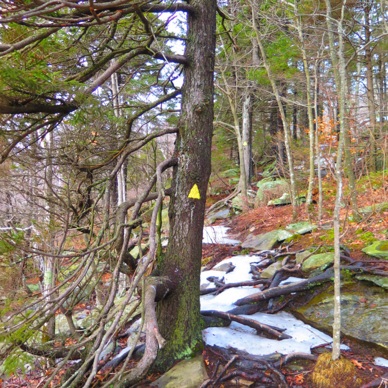
Trailhead will be on the far end of the parking area, by the kiosk. Blazes are vertical white rectangles, somewhat inconsistent in size, but generally about 2 inches by about 3-4 inches. For the most part, follow your nose. The trail is well maintained, to the point where the blazes are pretty much irrelevant to your success in finding your way. It’s a very well kept trail.
If you enjoy reading these posts, please subscribe — stay in the loop! Your email will only be used to alert you of new posts — typically 1-2 times per week. I will not use or share your email for any other purpose without your express permission. And feel free to share via social media using the buttons below.
Find me in the mountains, on this blog, or on Twitter: @Protean_Hiker