The trail is long. And straight. And level. Until it isn’t. Then it is again.
Bondcliff, Lincoln, NH. 2018-04-05. (Thursday)
Via Lincoln Woods trail, Wilderness trail, and Bondcliff trail. Approx 18 miles.
20 dF +/- at the trailhead, low teens at the summit, with 4-8 MPH winds gusting to 20-30. One gust hit 41 MPH.
30 dF back at car. Unbridled sunshine for most of the day, with patchy clouds late in the afternoon.
Trailhead: 0700; Bondcliff summit: 1230; Col: 1300; back at car: 1800. (11 hours.)
It was a huge idea: bag three summits, even though they (collectively) had a 4 1/2 mile slog just to get to the mountain. 9 miles eats up a lot of time, and it eats up a lot of leg. And feet. Even though those opening miles are on old logging railbeds — almost straight as an arrow, flattened out, easy grades — you still have to traverse that bit of trail on foot. No mechanism of any kind, human powered or machine driven will do. And right now, they’re hard packed snow and/or ice, which isn’t exactly soft and springy. Meh.
With trepidation, I read the weather report, and I wasn’t wowed. Clouds. As it turned out, the weather was almost entirely sunny. It was the wind that was soul-crushing. During the hike in, it wasn’t that bad. But at the summit, it was crazy. But more on that…
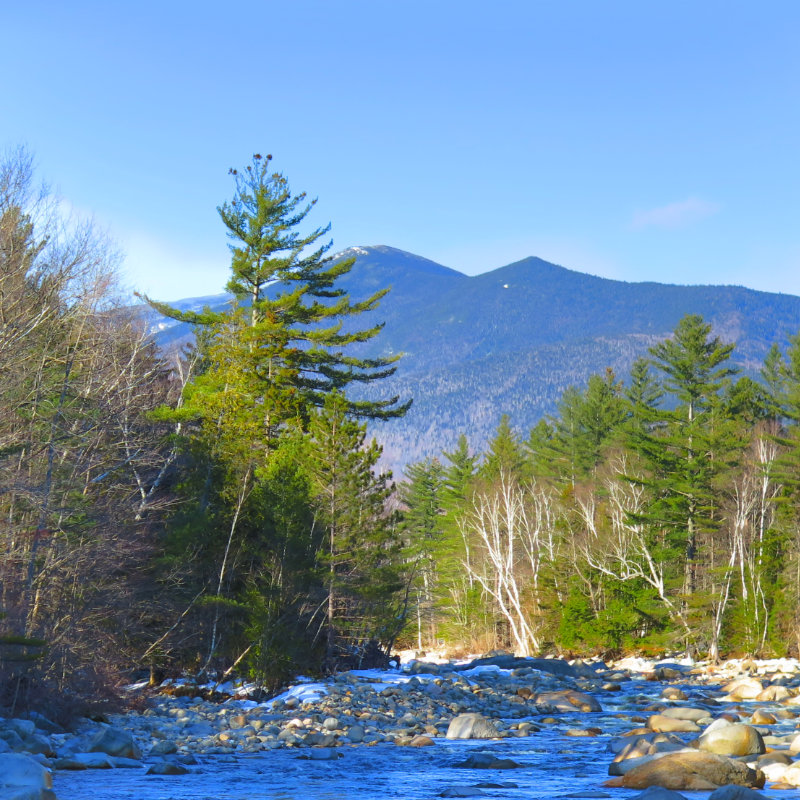
I got to the Lincoln Woods parking area in time to hit the trail by 6. I’d wanted an earlier start, but mornings aren’t for me. As it turned out, that was the best thing. Hit the trail, and made decent time to the meat of the mountain. Past the junction for Bondcliff trail, the grade got steeper. I’d seen the mountain from a distance on the Wilderness trail, and viewed it with no small amount of “Damn, that’s far.” It was. Mentally, I kept playing a game of “are we there yet?” because physically, I still wasn’t.
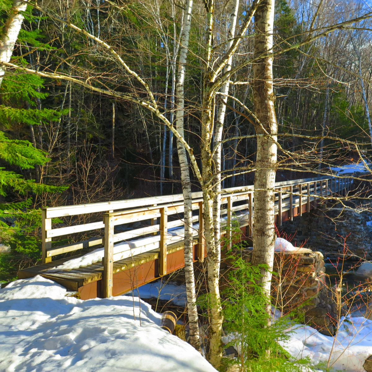
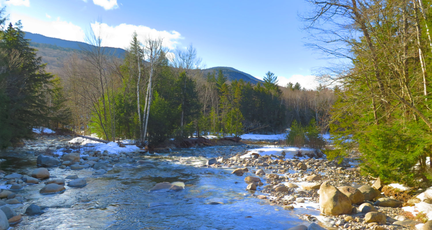
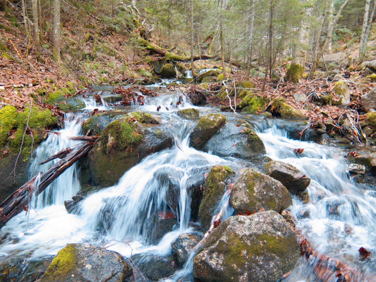
The trail (and the wilderness) was peppered with brooks everywhere. Fortunately, no water crossing was more than trivial, although everyone who’s played Trivial Pursuit knows that you need to think sometimes. I was glad for the trekking poles more than once. Per my geologist/hydrologist friend JL, you can dig around 10-20 feet down almost anywhere and hit groundwater. These percolate down the mountain to the various brooks, and then feed into the East Branch Pemigewasset river. Ultimately, to the Gulf of Maine. With the warmer weather, let’s just say that there’s a whole lot of percolating going on. The mountain is draining bucketloads of water into yonder gulf every second.
(As an aside, on those occasions when JL and I have hiked together, his patient explanations of geological phenomena have greatly enhanced the experience. Knowing the whys and wherefores of the ground you’re passing over adds a sense of awe. Knowledge is power.)
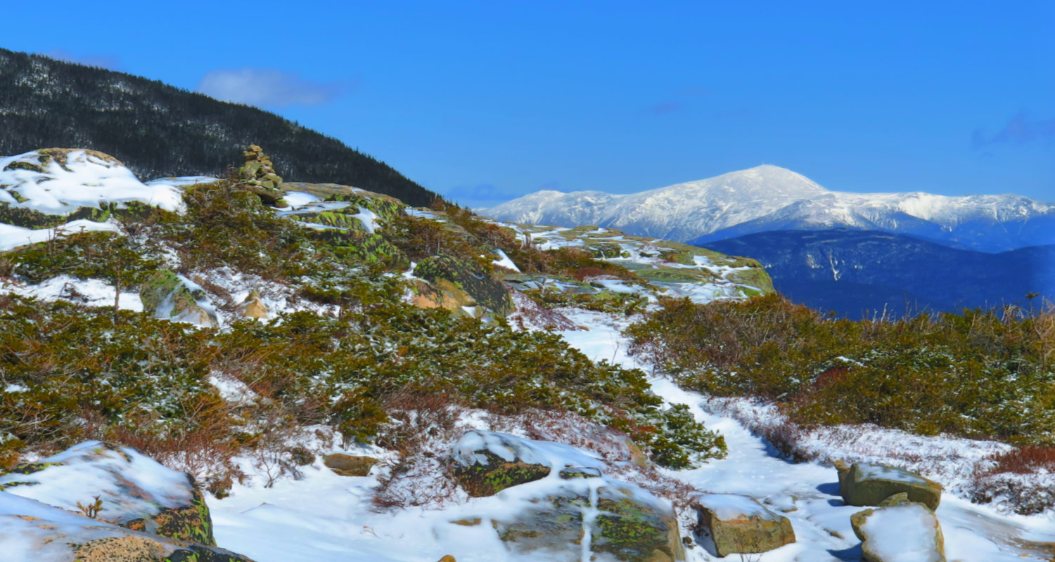
Step after step, deciduous forests turned to spruce, and finally krummholz, and the USFS signs announcing this was an alpine region; watch your step, because the plants are tenacious, but terribly fragile. The sky turned bluer and bluer, and then, the summit showed itself, with a thin coating of ice almost everywhere. I scrambled up a short bit of icy ledge to the top. And then the mayhem began.
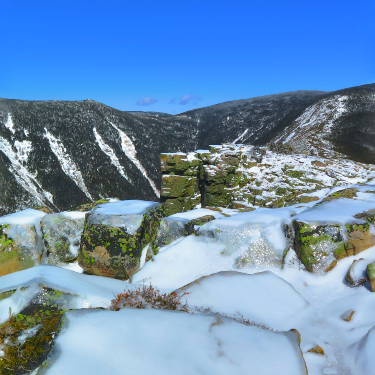
I initially clocked the wind at around 10-20. But I noticed it was getting faster. There’s a signature image of people posing on a rock outcropping — that area brackets the top end of a funnel, and the wind around it was somewhat noticeable. Chunks of ice were being lofted, high into the air. I braced myself, and moments later, my anemometer recorded a 30 MPH gust. A few minutes later, 40. Then the freight train, and I gave up recording, because keeping myself and my stuff from being blown off the mountain seemed more important. I made a tactical retreat from the edge, estimating that I’d just experienced something in the realm of around 50 MPH.
The initial objective was to snag the other two Bonds while I was there. But given the intense winds, and the fact that I was still facing a lengthy return, I decided discretion was the better part of valor. I took a quick trip down the col, just to gain a sense of what it’s rise/run was like, got scoured by the wind again, and turned back for good. The descent off the mountain was quick, but then the slog back along the old railbeds ate up more time. When I finally opened the door of my car, my legs and feet had been crying “uncle” for at least an hour. It was no small realization that had I decided to go ahead and bag the other two Bonds, I’d still be on the trail, and probably coming out by headlamp. It’ll be another day when I return to those two peaks, with another strategy. The mountains have been there for thousands of years. They can wait for me for a few more weeks. (Given the quality of views in that area, I can hardly wait to get back.)
Along the way, I spied a “perfect” alluvial fan in Franconia Brook. This is when rocks, stones, gravel, and sand get sorted by size by natural forces in a river. I don’t always see one where the sorting was almost with mathematical precision, but there it was.
On the way off the summit, I saw a small bird that may or may not have been a boreal titmouse. Unfortunately, the only picture I was able to grab had its head behind a tree branch, so I’m going with partial information. But it was a whopping 6-ish feet from me, just sitting there, seemingly comfortable with a human at arm’s reach. I had the sense that if I’d had a handful of seed, it would have hopped down and sat on my fingers, munching away merrily.
The cliff at which everyone gets their picture taken. Unless you’re hiking solo.
