I didn’t conquer a mountain. I conquered myself.
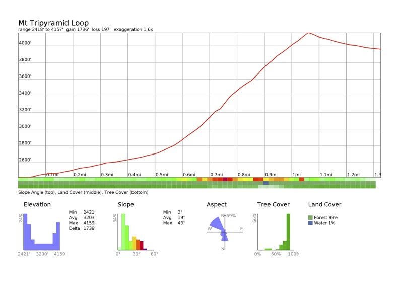
Mt Tripyramid, Waterville Valley, NH. North, Middle, South peaks. 2019-07-20. (Saturday)
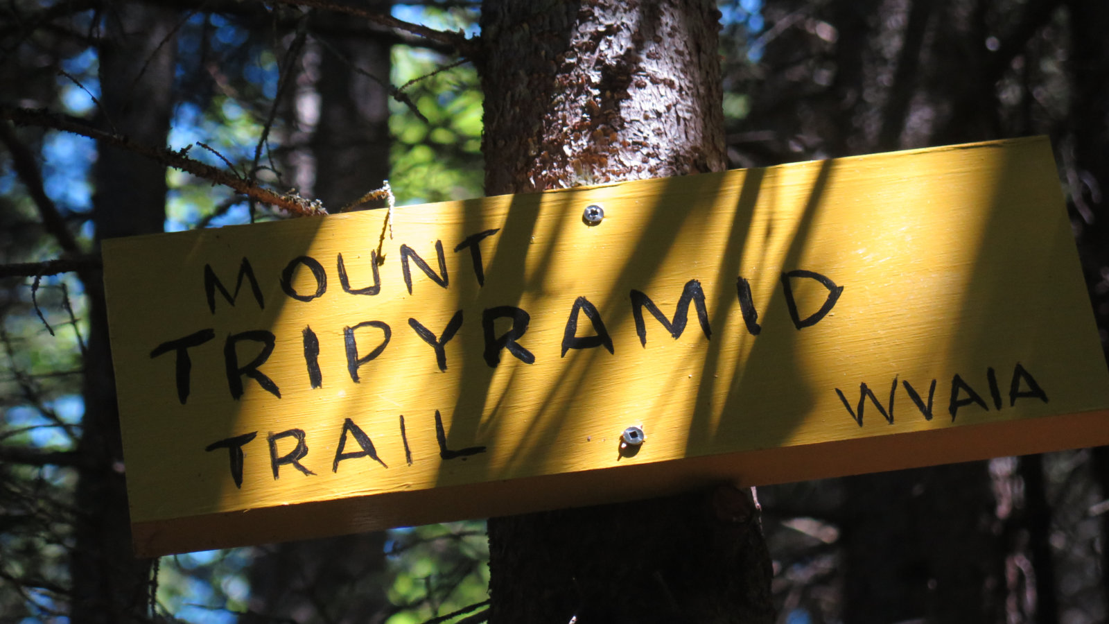
Via Livermore and Mt Tripyramid trails, taking the North Slide on the way up and the South Slide on the way down. (Success!)
82 dF +/- and sunny. Light breeze.
Trailhead: 1145. Base of North Slide: 1330. North Tripyramid Summit: 1500. South Tripyramid Summit: 1645. Car: 1845.
As with so many things these days, I have no idea how the idea planted in my mind. But somehow, I got it into my head that I’d hike the ‘slide. It was a tick-box that hadn’t been filled yet, and wasn’t bothering me. But over the past couple days, the idea planted itself, and I began to get excited. One could argue that up until a nameless day in January of last year, I had no idea I’d stand on Washington, or that I’d hike Mansfield and Katahdin; let alone make plans to hike the AT. It is what it is. Tick boxes will materialize as they do.
There was no small amount of trepidation, having been rebuffed last winter — this despite freely acknowledging to myself that hiking the slide in February had been ill advised in the first place. And people hike the slide when it’s dry and sunny, right? As I stood at the trailhead, my excitement was palpable, but the darkness of my fears was equally tangible. I pressed on.
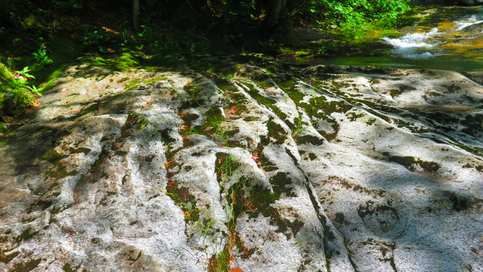
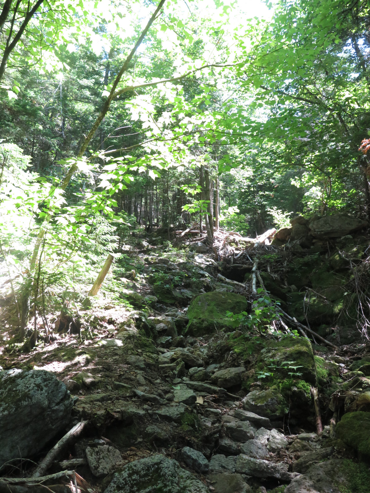
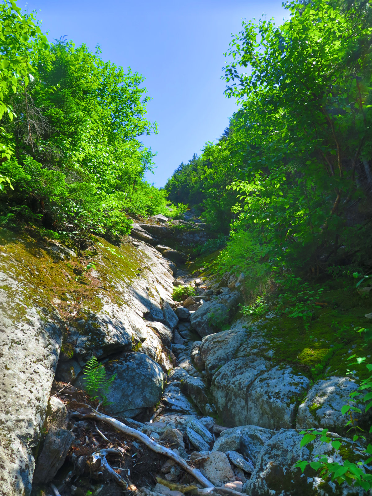
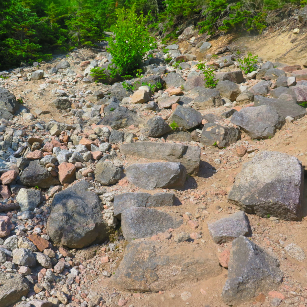
To put it mildly, the slides are very rough trails. This was easily the hardest I’ve hiked, ever. No qualification. Type II fun, but wow, every inch was fought for, tooth and nail.
Before I get older, I’m also going to be perfectly clear on one thing: If you’re relatively new to hiking… if you’re inexperienced at hiking in the Whites… if you’re experienced, but all your hikes have been on relatively clean trails, with a lack of ledges, slabs, loose rock, loose dirt, trails that require hand-over-hand climbing… if you’re not experienced at “taking the sharp end” of deciding when to scrub a hike, or when to press on… if you’re inexperienced at risk management in the mountains…
Don’t. Not this one. If you’re not 100% sure you will have multiple, effective backup plans in case things go wrong, leave it for another day — the mountain will wait for you. If your head spins when exposed to heights, north slide in particular isn’t your trail. There are other equally fine routes that will get you safely to the summit of Tripyramid. Scaur Ridge, Sabbaday Falls… you don’t need a goat path like the north slide until you’re good and ready for it.
In any case, please read on, because it’s still an amazing mountain. It wholeheartedly deserves its place in the pantheon that is the Whites.
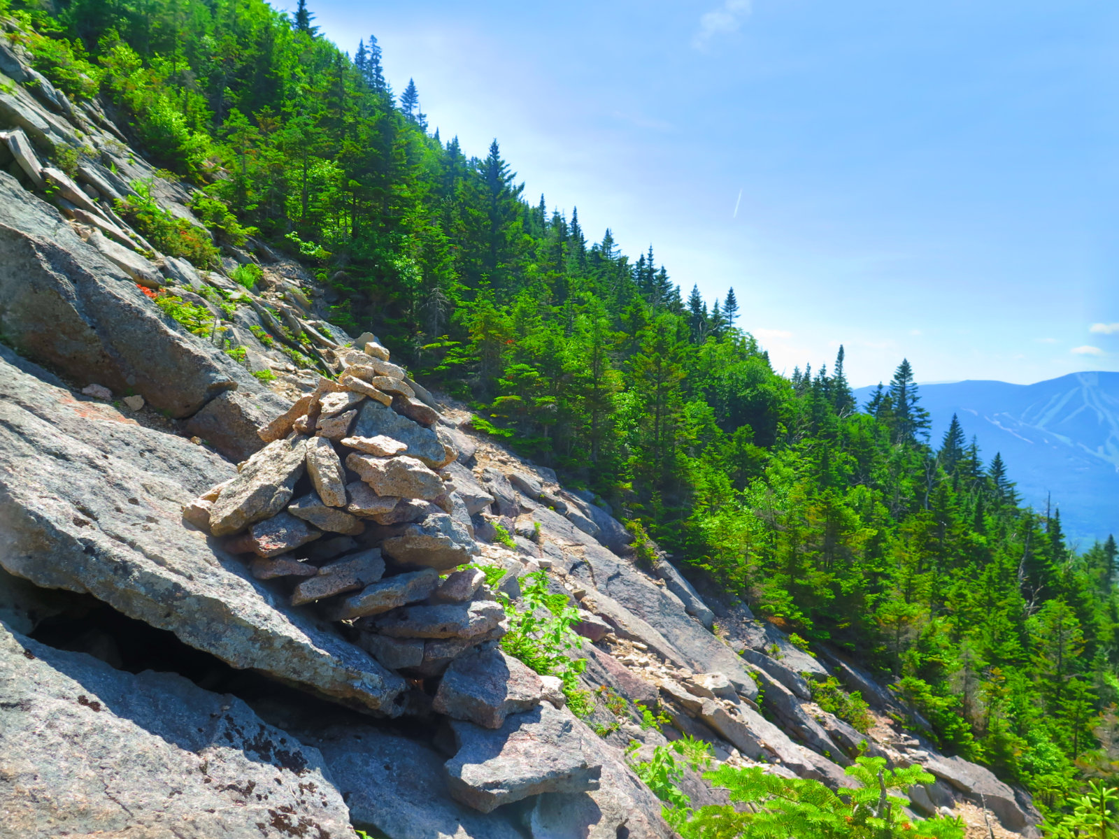
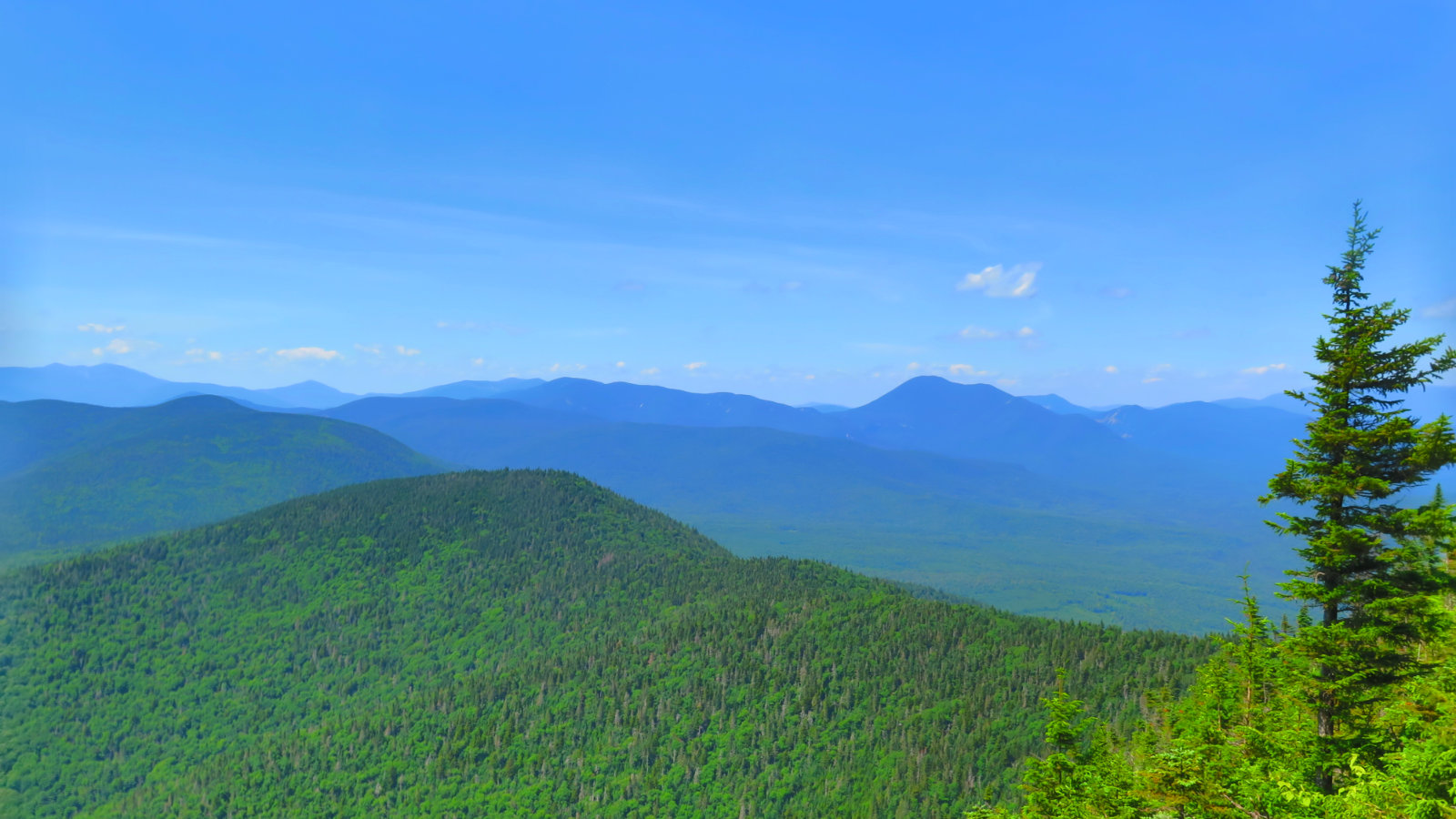
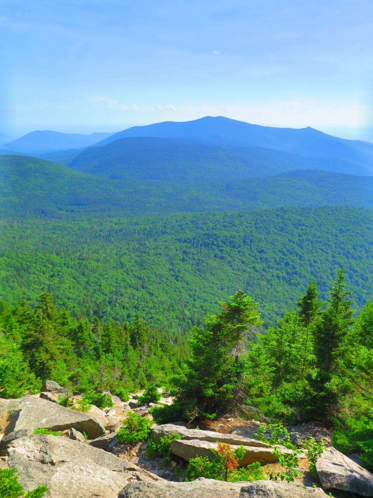
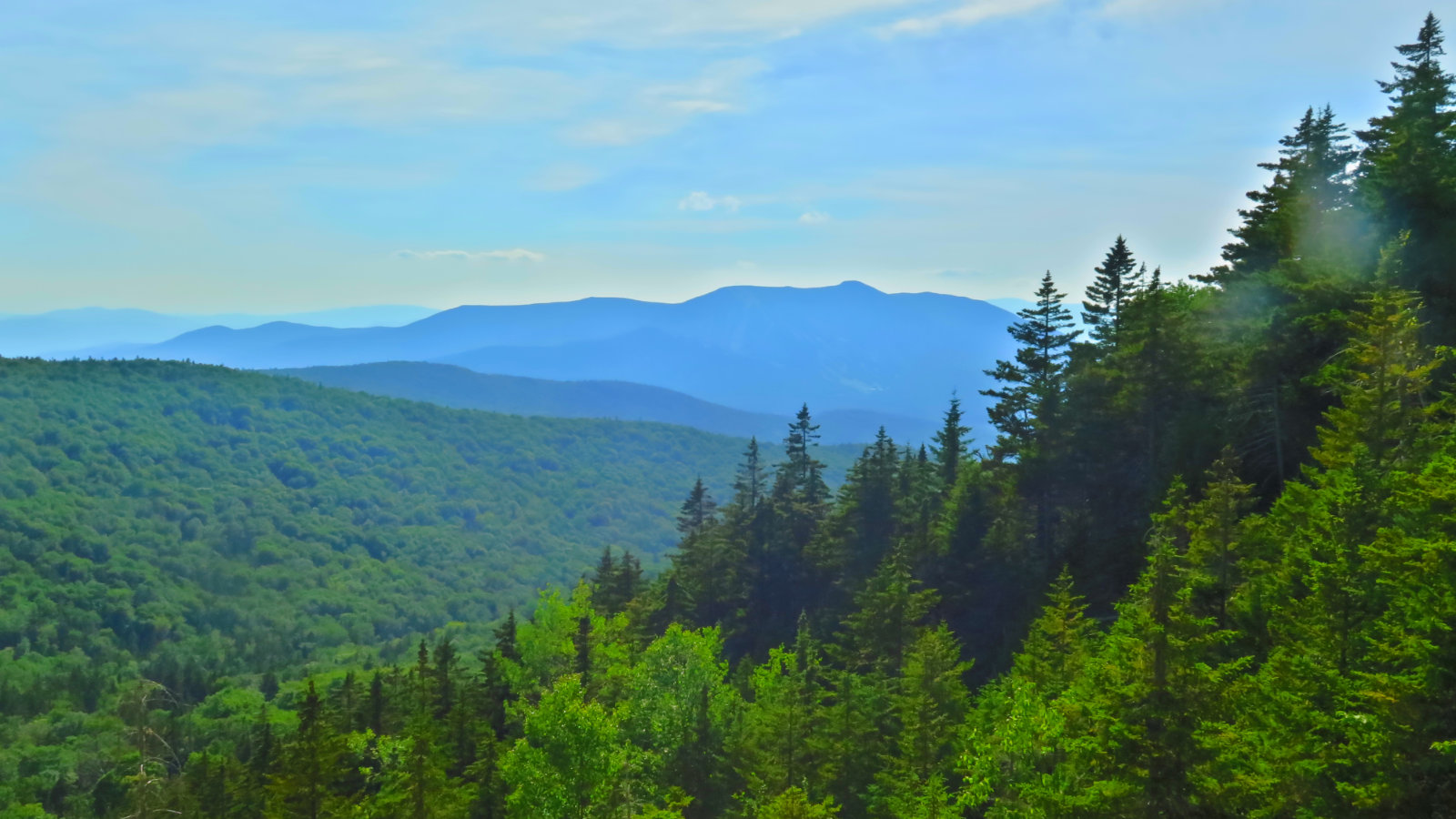
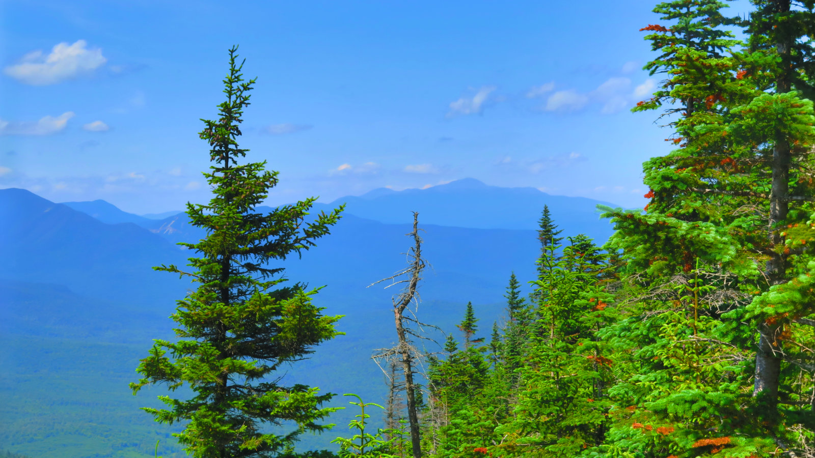
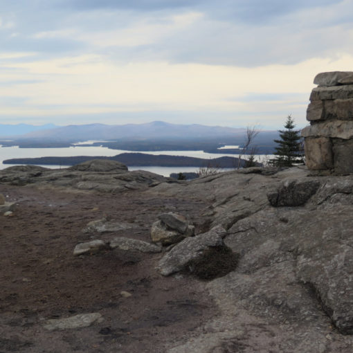
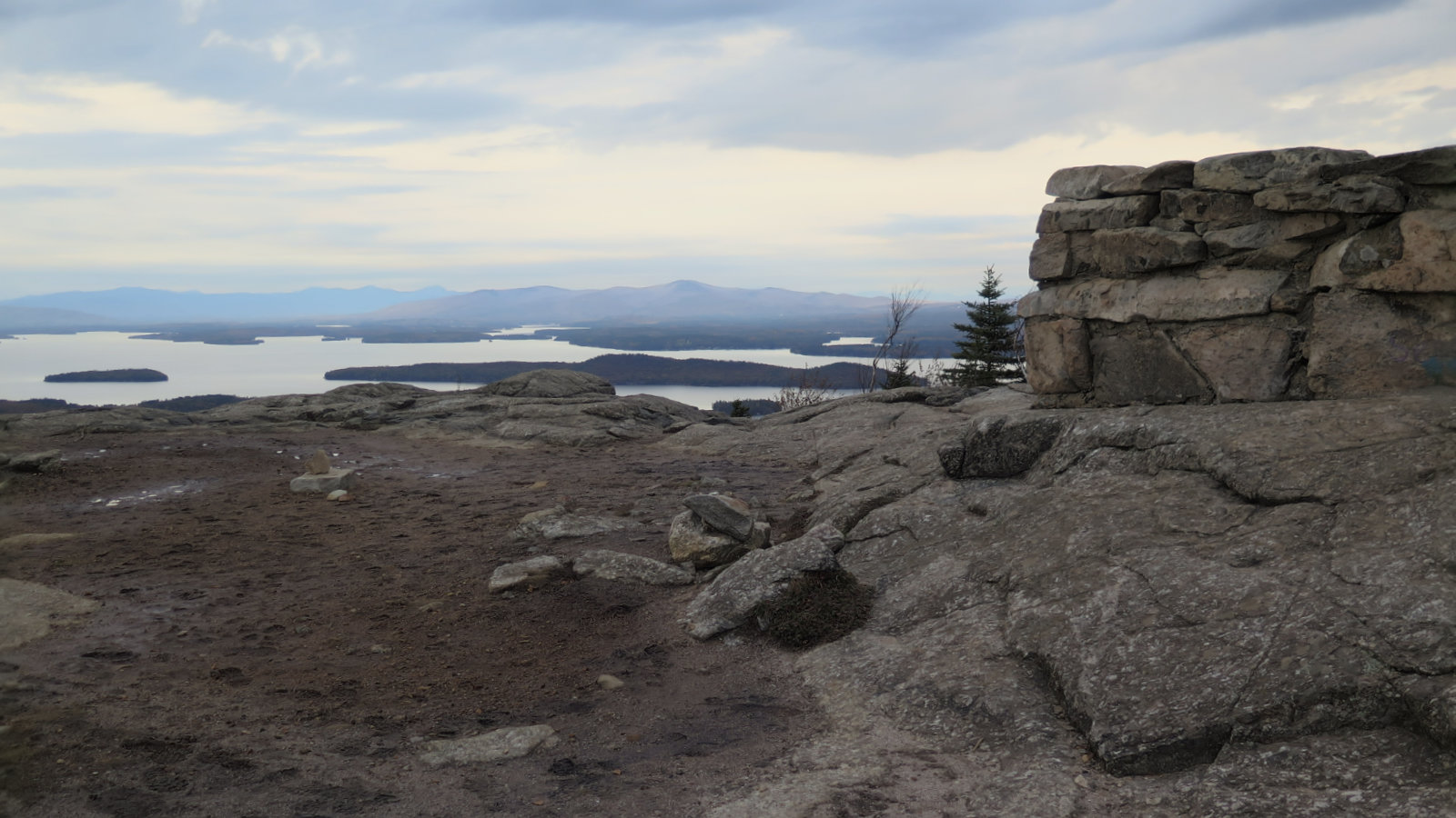
I’m going to cede the floor to the photos shortly. They tell the story better than I could. Let it be said, though, that I had an amazing time out. The books are very right about one thing: it’s exhilarating. The “trail” is the width of the slide, and in places, that means dozens of yards wide. At any time, you can turn and look out over the landscape, and as you ascend, the view becomes more and more all-encompassing. Tecumseh was ever-present, of course, but also the Osceolas, Carrigan, the southern Presidentials, Moosilauke, Lincoln and Lafayette, Garfield… it felt like at any moment, I’d see the entire list of 4,000 footers. Wow!
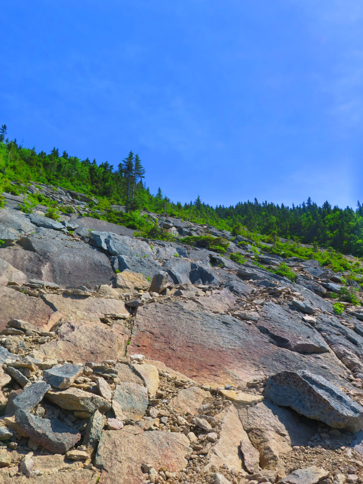
Yes, at times the heights got to me. There were places where I couldn’t stop thinking about why an entire side of a granite mountain had just slid away — that the mountain was, at one point, incapable of supporting itself. Would it support me? It seemed everywhere I stepped, there was yet another loose rock underfoot, and if they fell away, their destination was far below. Hollow, rotten rock was everywhere. Over and over, I had to dip into my toolbox of coping strategies. Physiologically, I was redlining just standing still, catching my breath. Even when the only issue is mental, it still extracts a physical toll.
The trail, once you get going, does one thing: goes up. You’re in this one for an inch, you’re in it for a mile. By the halfway point, turning back is a sketchy proposition unless you adopt my strategy from last winter. I opted, several times, to hike up in and along the the sides of the trail — here and there, a herd path was evident that would get me past a crux move. It was a hard slog, but the trees proved to be a safe option when the slabs appeared too hinky. It’s a trail that demands a lot of flexibility: an ability to see the line you need to take, an ability to secure and trust your footing, and a solid set of strategies to deal with the unforeseen.
It’s easily among the hardest things I’ve ever done. Head games aplenty, a lot of very strenuous hiking (above and beyond Tripyramid’s strenuous character), tough trail conditions, and along with everything else, a glorious sunny day… which coincidentally meant the sun was relentless. There’s no reliable water for the entirety of the trip beyond the low and flat bits. (Bring more than you think you’ll need. It’s a very slow mile.) And it’s certainly not a popular route. That feeling of complete and total isolation? Yep.
On the very cool side, despite the massive exposure and feelings I might fall at any moment, there were superlative views of… basically everything. I might have been quaking in my boots at times, but the scenery captured my attention and made me forget all else. You aren’t up to the challenge of the slide itself? There’s a bit of a workaround, albeit imperfect. Take some other trail up, and at the summit, descend via Mt Tripyramid trail for the first 50-100 feet or so. That’ll take you to the top of the slide, and footing there is half-decent. (I wouldn’t try this in wet or icy conditions.) Be careful, of course, but you should be able to take in at least some of the views. They’re magnificent. This is a fine mountain. It’s hard, ornery, and a bit insane. But it’s very good.
So, without further ado, I’m letting the pics tell the rest of the story.
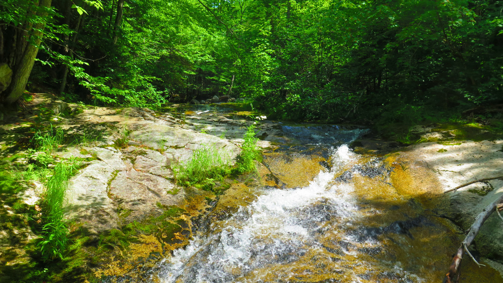
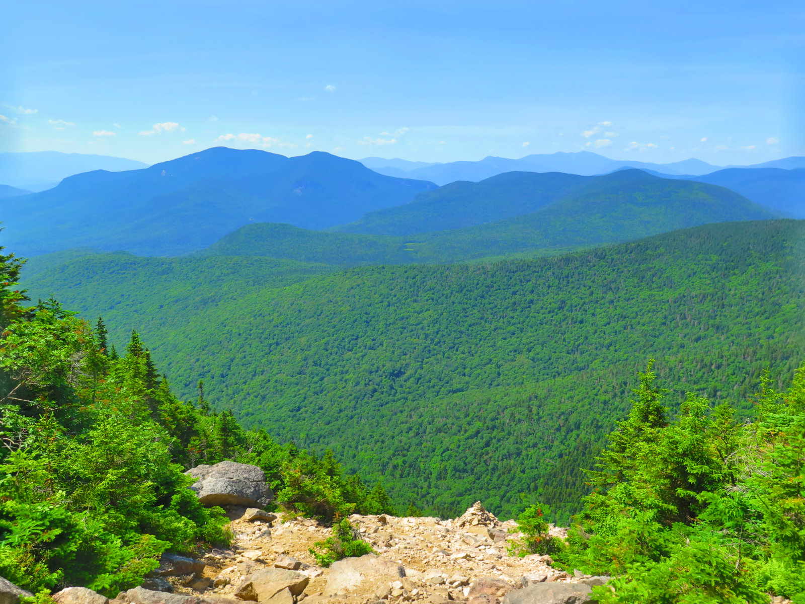
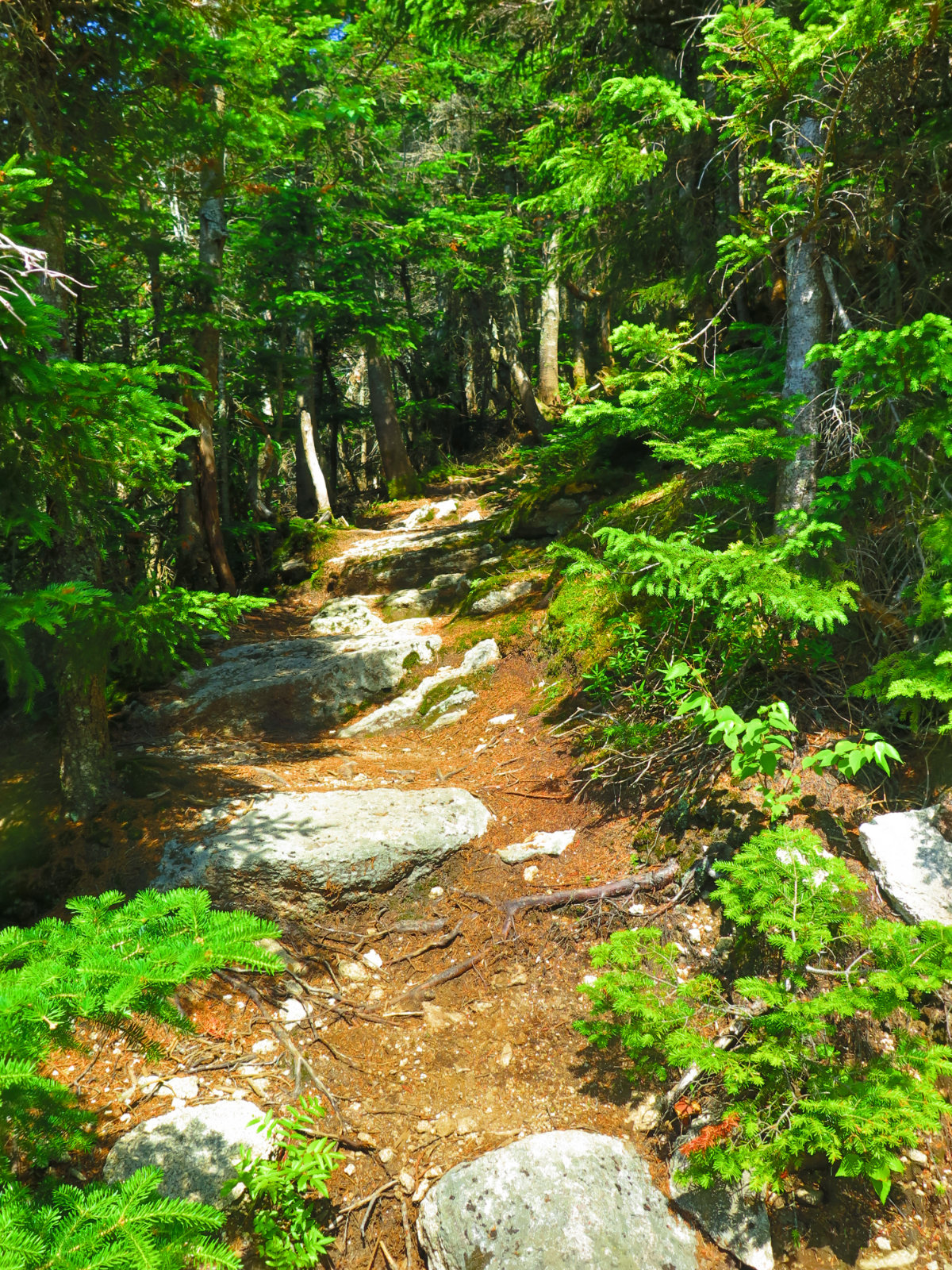
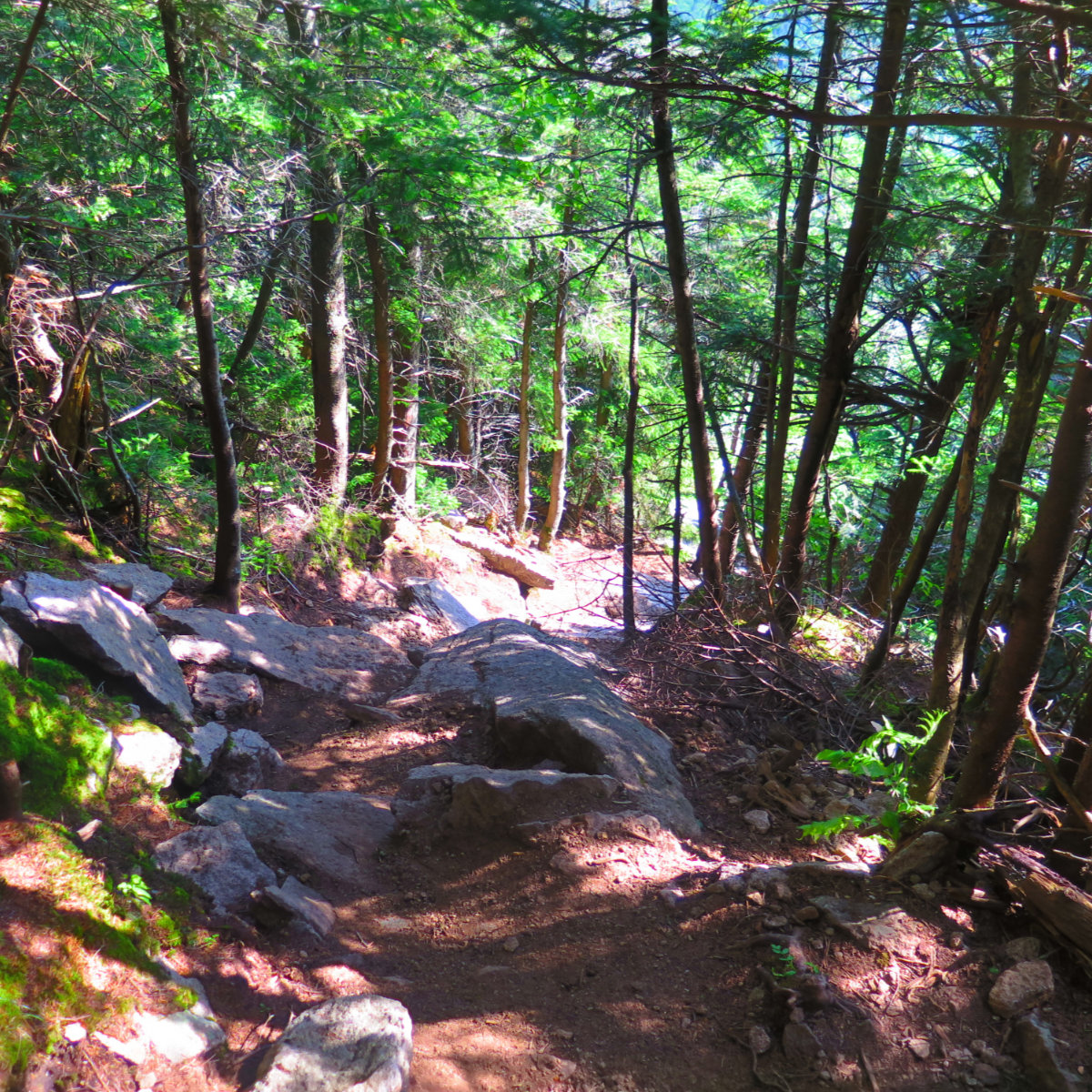
Descending by the south slide was more agreeable, but still tough. In contrast, the footing is very rocky and the trail is much narrower. The slide itself is broken up in several spots, so there’s much less of a sense that if you slip, you’ll rocket down for an eternity. But there’s a lot of loose dirt, so with all the good, there’s still a lot of uncertain footing that makes for slow going. At least it was a more normal sense of “this trail is a bit treacherous.”
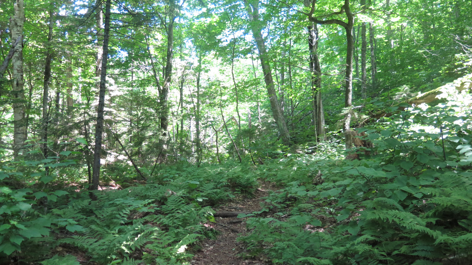
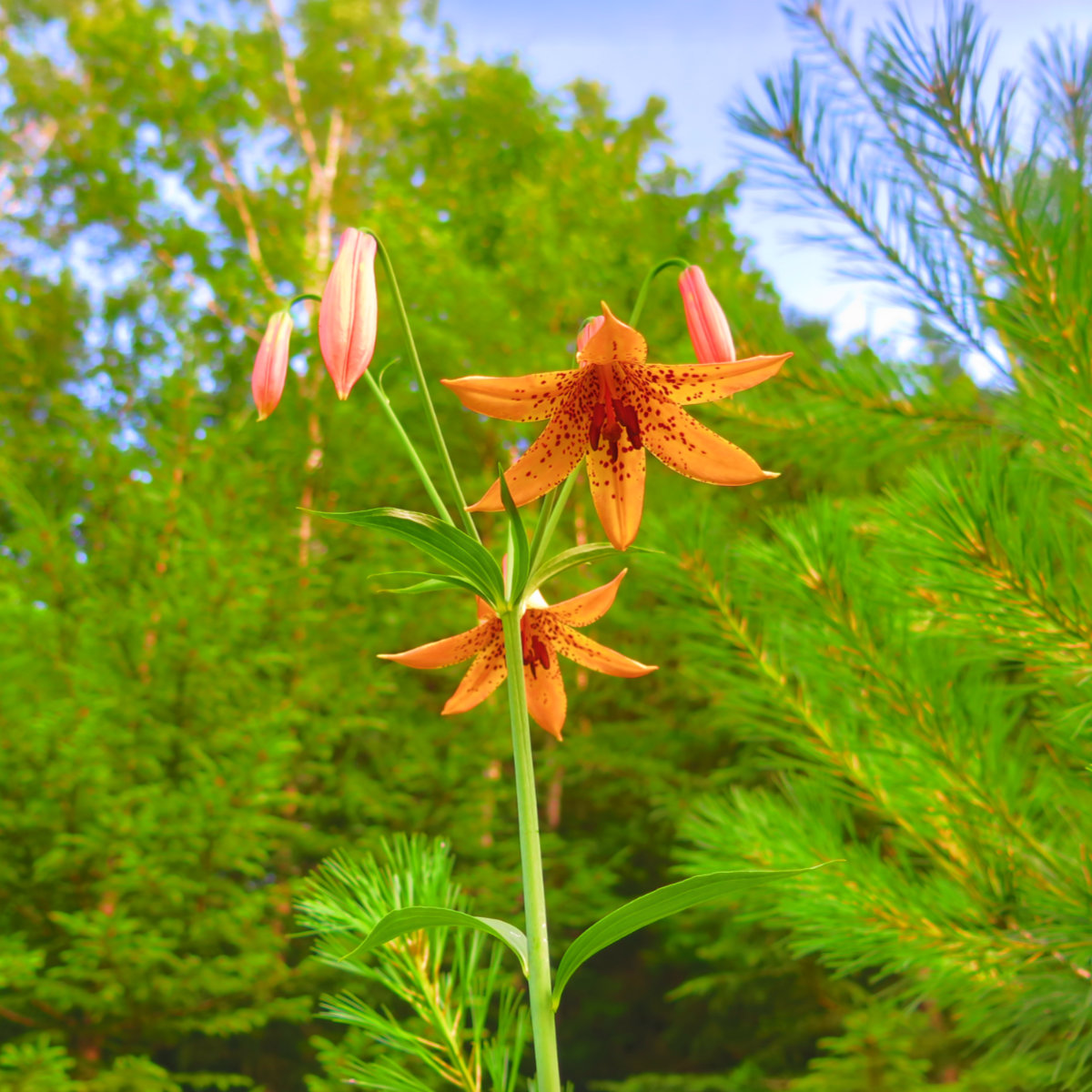
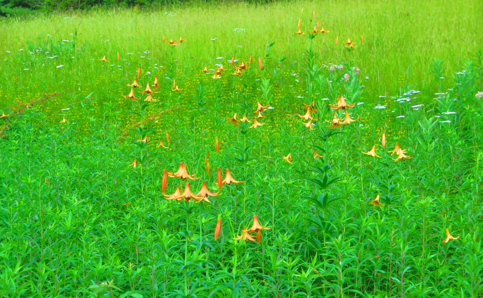
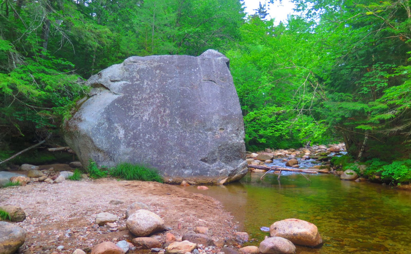
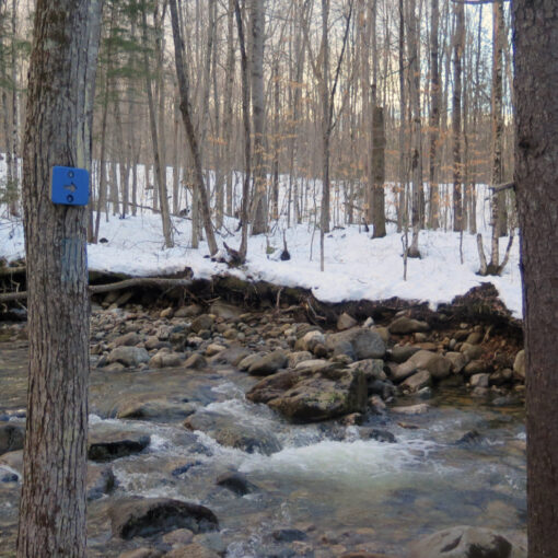
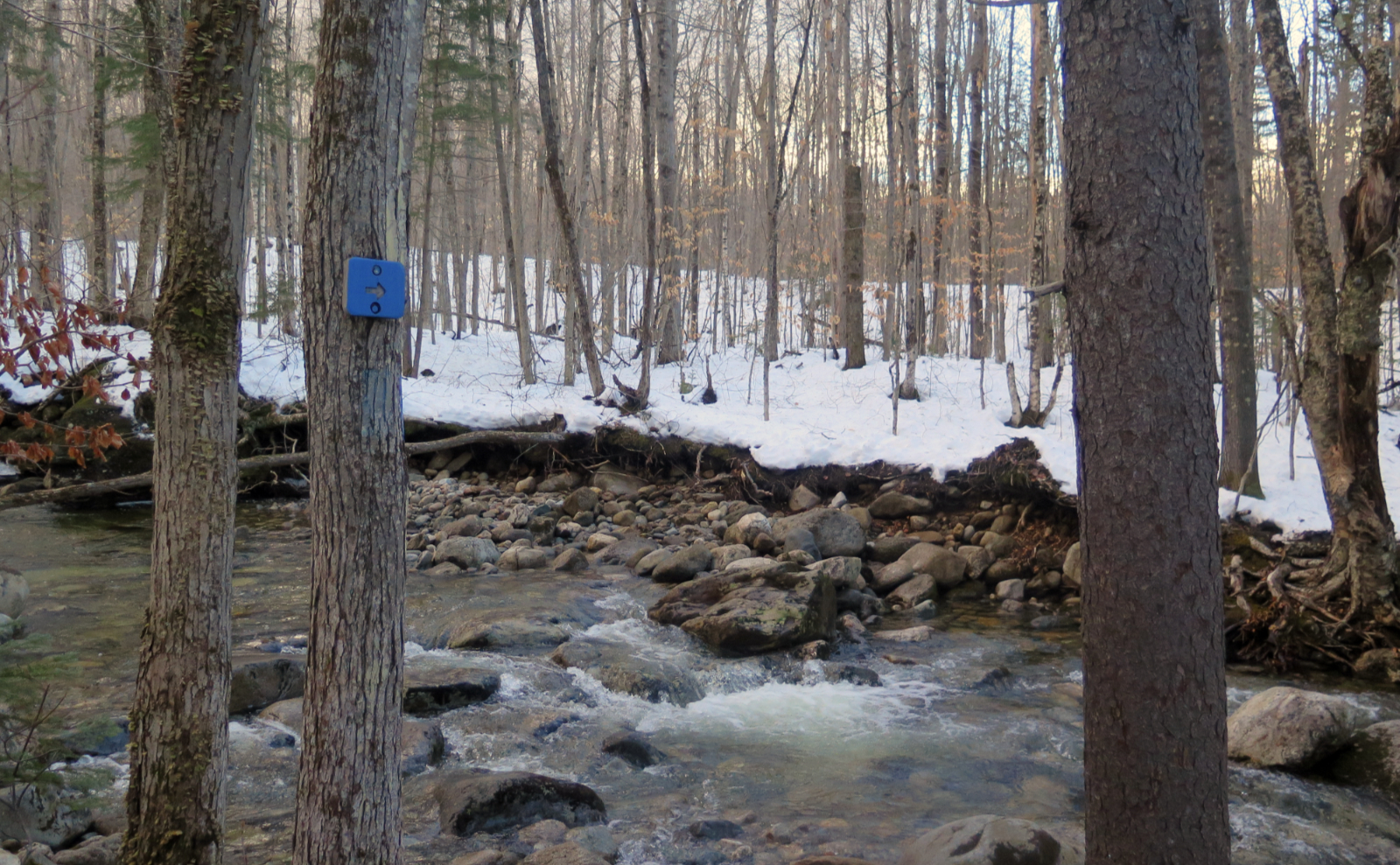
All good things come to an end, and this one was… weird. I can’t think of anywhere else that the transition from “yikes, this is steep” was so abrupt, but all of a sudden, the trail got very flat for a spell. And that was it. I had a lot of descent left, but it was back to normalcy, with a delightful path, cushioned by leaf litter. Much of it had the welcome accompaniment of Avalanche Brook. (Though late in the afternoon, it also meant the accompaniment of mosquitoes.) Hiking back along Livermore, I had the visual feast of various wildflowers — some cow vetch, black-eyed susans. A small patch that had erupted with tiger lilies! And that late-day sleepy birdsong as the forest gets ready for bed. Quietude after an afternoon of excitement. Bliss.
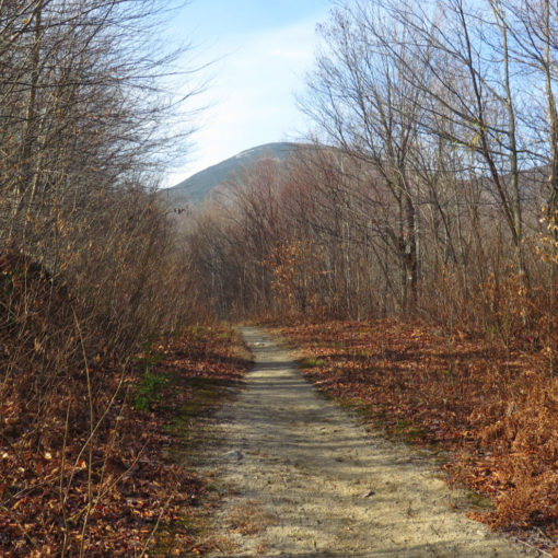
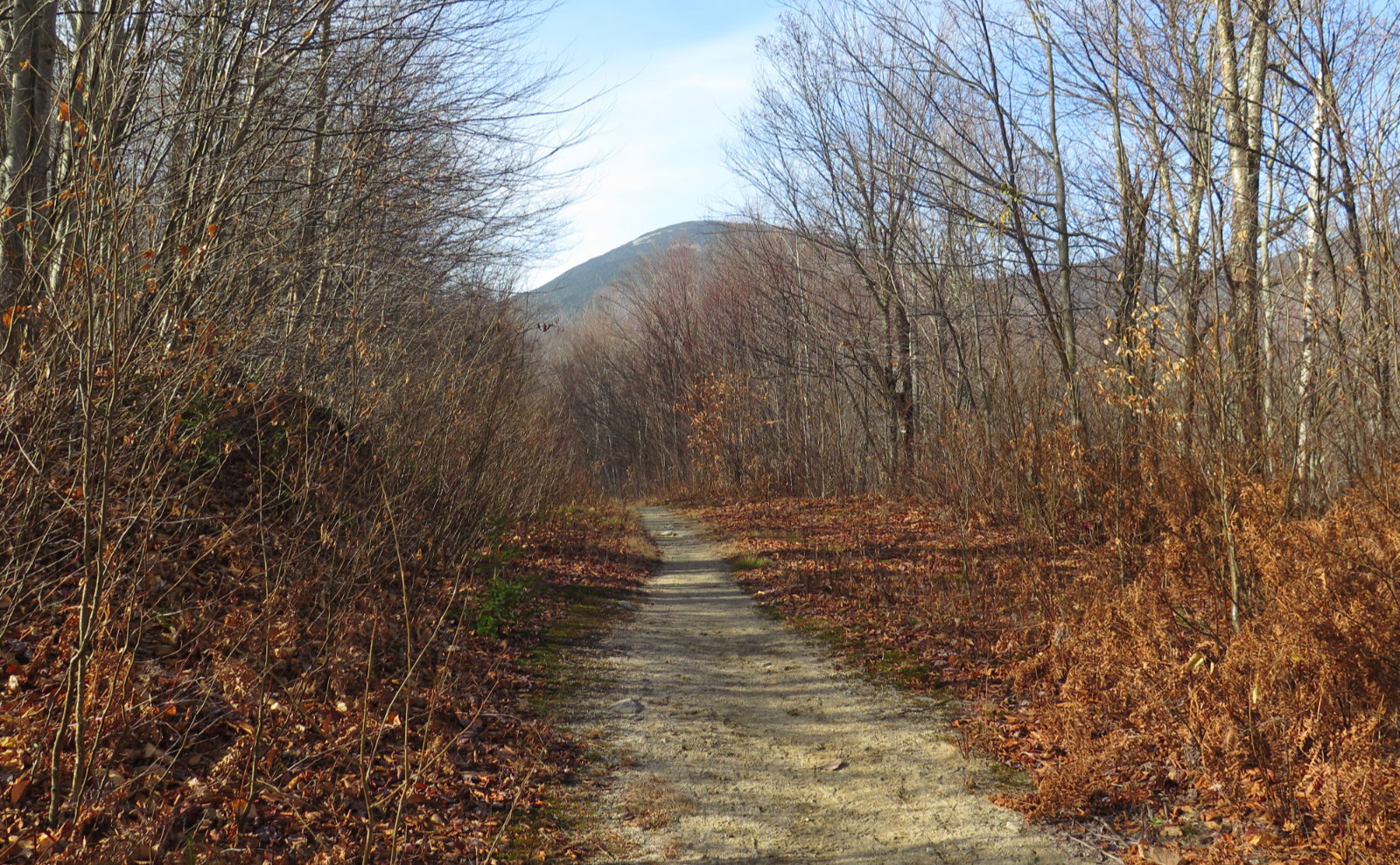
Nuts and Bolts: Take the Route 49 exit off I-93, and follow the signs to Waterville Valley. Turn left toward the ski area, and at the fork, bear right. Go down a ways, and at the bridge, take a right, then immediately after, a left into the parking area. You’ll be greeted by a typical brown USFS White Mountains National Forest sign that has “LIVERMORE” beneath. The trailhead is at the signboard. Note that until you get to the “bona fide” hiking trails, the Livermore approach is along cross-country skiing and mountain biking trails. Effectively, you’re hiking on a dirt road for a couple miles. This is normal.
If you enjoy reading these posts, consider subscribing. Your email will only be used to alert you of new posts — typically 1-2 times per week. I will not use or share your email for any other purpose without your express permission.

22 thoughts on “Trip Report: Mt Tripyramid Loop”
Did you treat or filter that water before you drank it?
I use a filter. It’s just not worth the risk, especially when it takes only a few moments, and something like giardia can completely ruin your outing. It’s nice to pause for a bit, and sit by a cool brook. Later, you’re thinking about that fresh mountain water every time you take a sip. For day hikes, you can get filters that weigh mere ounces, and take up a trivial amount of space in your pack. No need to get the huge expedition-worthy models with triple-digit price tags.
We use a Steripen and it’s worked great for us.
I have one and like it too. My only gripe is that it needs recharging. On the AT, that won’t be reliable enough for me, so lately, I’ve been giving conventional filters a workout.
Turn back! That’s how I made it to nearly 62 years old (next month)! We did this fall 2012, and I ducked into the woods a couple times when it got too unnerving. I think Prema just went straight up (but she tried to get footholds on the side of stone and brick walls at the age of two, that’s just her). A couple years ago we did Pine Bend Brook. When we got near the top, those folks coming over from the slide were setting records with how many f words ever said on a hike! All kidding aside, have you done Flume Slide or Huntington Ravine? If so, how did they compare?
I haven’t done Flume by the slide yet. That’s coming soon, although my summer plan is for a Pemi loop, where I’ll nail that one by Osseo trail from Lincoln Woods. And Tuck’s won out over Huntington. I’m trying to think of anywhere else that is that hard for that sustained amount of time.
We hiked tripyramid on the same day, we started 7:15 am last Saturday. What a hike…amazing view. You are spot on about northslide. Adding to the difficulty I also saw a snake basking in sun and freaked out.
I’m amazed that anyone else was even near that trail on the same day. This was my second time there, and maybe it’s just me, but I can imagine bumping into another party anywhere else in the Whites but on that trail. The sense of isolation was ever present in a very tangible way. Do you remember where/which side you saw the snake?
We were also amazed how isolated we were. We did meet couple of teenagers at the north peak , they were planning to descent via north slide. I gave them ample warning, it was a relief to see them in the parking lot at end of our hike. I saw the snake half way on the north slide. I was too scared click a pic ( probably just around about 43.9746806,-71.4459528, may be a bit lower than this point). We are planning owls head next. What about you?
I’ve come across people terribly ill-equipped for a hike, and yeah, it’s a thrill to see them alive at the end. In a couple cases, they’ve sagely taken my advice to throw it in and turn back. There was my Tom-Field-Willey trip last spring where I led a family off-mountain. Some very hard hiking, a lot of critical decision making, lessons learned, and yet, a lot of smiles at the end.
Owl’s head is a treat. I’m thinking of that one in a few weeks for my third ascent. My wintertime hike was the easiest, so I’m curious what summer will bring. For now, I’m likely to do a Wildcat-Moriah traverse next, if not a quickie (Waumbek, the Osceolas, or something similar) between now and then.