Greeley Ponds and Timber Camp trails. Town, NH. 2020-05-30 (Saturday.)
About 9 1/2 miles round-trip. 6 1/2 hours.
65-70 dF. Winds were negligible in the trees, about 5-8 knots in the exposed areas. Overcast to start, becoming sunny by day’s end.
Trailhead: 1200. Timber Camp: 1600. Car: 1830.
Such a good day, I laughed out loud.
There was a lot of magic today. I saw a lot of things… indeed, it was a visual feast. I met some very nice people, chatted at length with a few of them. Met some wonderful pups. Saw two picture-perfect ponds, listened to waterfalls. Heard the sigh of the wind in the trees. In short, it was another day in paradise.
I’d been wanting to get back to Greeley Ponds trail ever since starting it in March. Back then, I got as far as the Timber Camp trailhead, but due to really soft snow (and for some reason, my snowshoes were elsewhere than on my feet) I threw in the towel at that point, because the post-holing through spring snow was getting absurd. I’d thought it wouldn’t be more than a week to get back and finish what I’d started. As it turned out, snowbanks on the Kanc effectively tossed a wrench into those plans. And so it goes. I had such a nice outing on Pawtuckaway the other day, so why not try to extend that mojo?
The drive up was easy, especially for a Saturday. Thank Corona, which is probably the only good thing I can say about that. Roads weren’t devoid of other cars, but volume was certainly diminished. Then I got to the trailhead, and there was one parking space left. Would that be a sign of things to come?
Heading out, the trail felt good. Spring is in full effect, with plentiful leaves overhead. Before long, I’d fell into the groove that yep, I’d make it to Timber Camp, but to be in no particular rush, other than to get back by dark. I was back in the green tunnel, makin’ miles, and it took no time to experience the attitude adjustment. I was home again.
It’s mud season for sure… there’s no shortage of it on the trail, and in most places, it’s just plain unavoidable. But unlike in many places, the mud was actually fairly thin, with a firm underlayment, so even though I was walking through it, I wasn’t sinking down much, most of the time. So I had that going for me, which was nice. Even better, there was a fair bit of puncheon crossing some of the worst sections. About halfway along, the trail eased, as it widened into an old logging truck-trail.
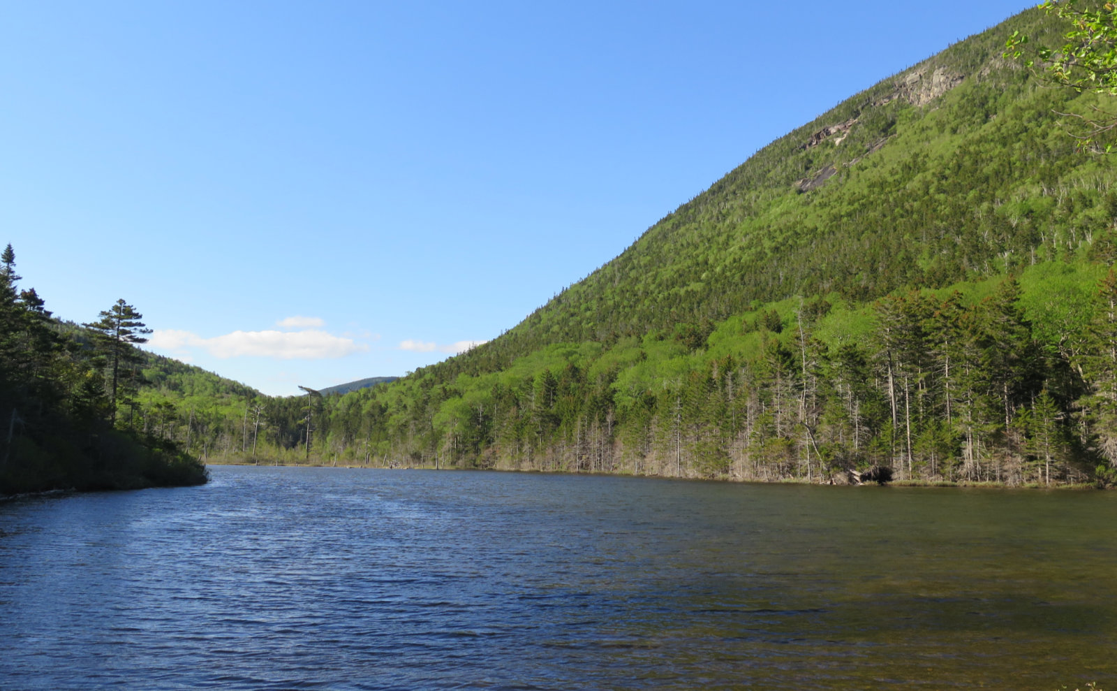
Painted trilliums lined the trail almost end-to-end. Wow, that was nice. As much as mud comes part-and-parcel with springtime, for me, the arrival of those flowers is a special harbinger of the warmer months. Some bluets as well. It’s getting to the good bit, for sure. At the Upper Pond, I swung down the side trail, and took in the site where the old shelter once stood. I found reference to it in the 1969 AMC guide, but it was absent from the 1972. No worries. On my way back, it made a lovely stop for an afternoon snack.
There were a few small groups, mainly from Waterville Valley, out to enjoy the day. A few very happy pups here and there. One very handsome German shepherd, all of about a year and a half old, stuck in my mind. He had a massive case of the zoomies, as pups do, which is always entertaining. Then there was a lovely rescue, who learned today that it’s good to meet new humans. Speaking of humans, I met a lovely couple, him retired from the military, both of them living their best lives. It was nice chatting with new people, and just enjoying a lazy day. Especially with the past few months seeming determined to be the winter of my discontent, today, with the warm weather, sunshine, and green tunnel, was therapeutic in so many ways. A crossing of the Mad River, a couple wooden bridges, a very smooth, old truck road, easy grades. It was shaping up to be a perfect outing. I continued along the trail.
And then, there I was, back at the Timber Camp trailhead, where I last was in March, looking up — it doesn’t hide the fact that it goes uphill. Its history as an old logging road is evident, being both wide as a truck and smooth as you could want. Passage was swift, although the trail itself did pitch upward rather more quickly than the Greeley Ponds trail’s lazy inclines. Looking to the sides, the ground was fairly swampy, and then I noticed lady slippers, not quite ready to bloom, but still very nearly there. Wow! And so I slowed down some more to take all that in for a spell. I can never see too many of those delicate marvels.
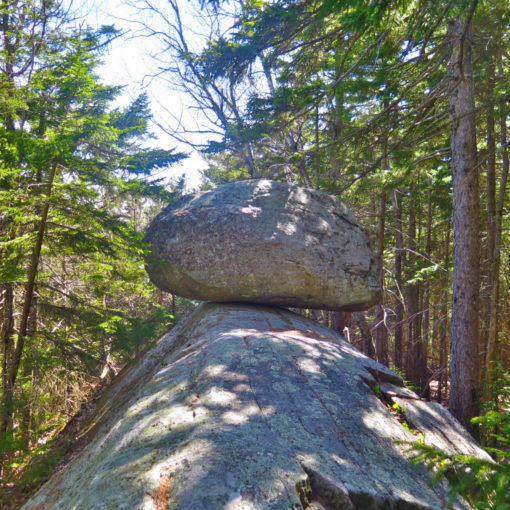
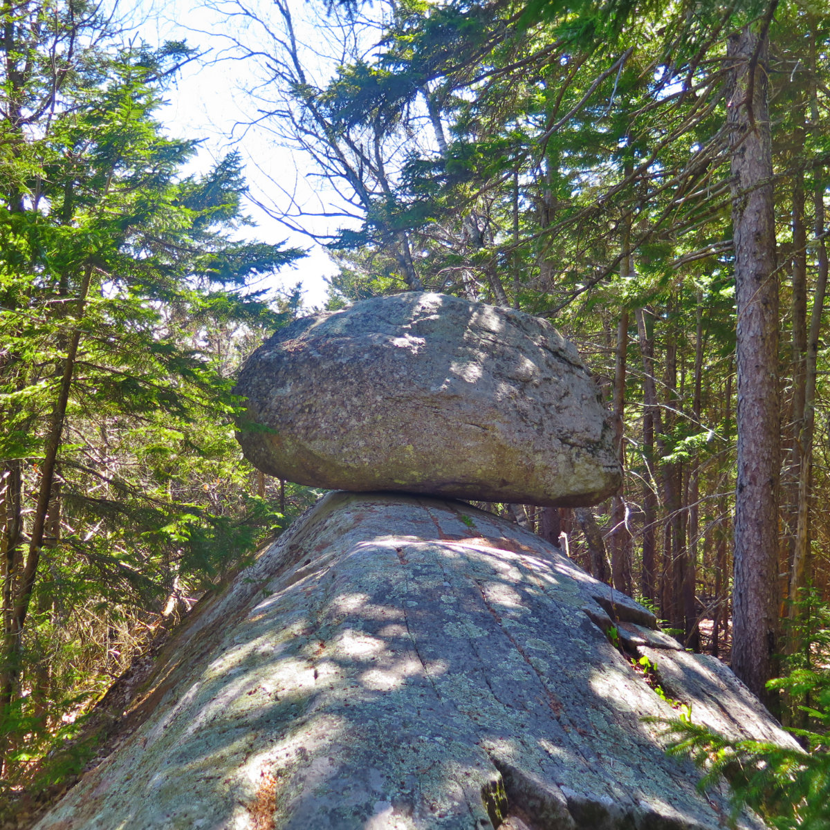
Continuing upward, the trail necked down a little. It was all new growth, the forest reclaiming the truck road for itself. I wondered what would happen, years from now. Would those cuts in the dirt, along the sides, still remain? Higher up, I came across a strange gravelly area with fine views to Tripyramid. And then shortly after that, a small cairn with a couple rusted out old fuel cans littered about. I was up top of the trail.
I explored around a little, then headed back. Spent some more time with the orchids. The sunlight was turning more and more honey colored, hinting that I ought to really start back to the car in earnest. A brief tinge of melancholy swept through, but then I looked back to the blue sky, the verdant forest… listened to the water in nearby Mad River, and was uplifted again.
I got back to the car just as the latest part of the evening sun was highlighting East Osceola. Peepers had started their chorus, and it was beginning to feel like bedtime was settling in for the woodland creatures. But there was one last surprise in store. Coming around a bend, I saw a dark shape in the trees. Moving quietly, I approached… looking, listening. Was that a tapping I heard? On some unseen chamber door? Regrettably, the corvid took to wing, but I did get one good shot, capping off a day where just out of the woodwork, I’d had so many things that made my day… indeed, my week.
The trail did indeed provide.
As always, stay safe out there.


Nuts and Bolts: Take the Kancamagus trail to the northern trailhead, or Route 49 to the southern. From the north end, there is a small (around 10-ish vehicles) parking lot off the side of the road. From the south, start at Livermore, just past Waterville Valley ski area.
Greeley Ponds trail spans from Livermore in Waterville Valley to the Kancamagus highway, east of the East Pond trailhead. Blazes are yellow, and a bit sparse. Beware that there are cross-country ski trails which aren’t necessarily maintained for hiking, and they criss-cross the hiking trail in several places.
Blazes for the ski trails are small blue diamonds, and generally speaking, there is a companion hiking-specific marker, such as a blaze, sign, or other obvious indicator, to show the way. As always, bring appropriate navigation aids that should include a map and compass, plus whatever other adjuncts that you prefer.
2 thoughts on “Trip Report: Taking the Timber Camp Trail to the Top”
1.I believe that’s Hobblebrush. 2. LOVE Timbercamp, especially that gravel spot. We did this last year at this time, but did it from WV. 3. Trillium Capitol of the world!
I love that area for hiking. I was wondering about the strange gravely area heading up timber camp too. The white flowers you pictured are hobblebush. We saw some lady slippers blooming on the East Pond loop yesterday.