South Mountain (908 feet). Nottingham, NH. 2020-05-27 (Wednesday.)
Via Mountain Trail and South Ridge Trail. Approximately 6 miles round-trip.
90 dF at the trailhead, 90 dF at the summit. Winds were negligible in the trees, about 5-8 knots with gusts to about 10 knots on the fire tower. Sun with haze clipping the most distant views.
Trailhead: 1450. Summit: 1545. Car: 1730. (Beware, you might spend more time looking out from the tower than you expected!)
A short hike with a long view!
I’ve been really hankering to get back to the Whites. Perhaps understandably, ever since my accident, it’s something that’s been on my mind in no small measure. And it wasn’t by chance that I decided to take my earliest, most tentative walks in the Pemigewasset. That’s one of the most comforting forests as far as I’m concerned. So stay tuned, great things are afoot.
But in the meantime, I’d been wanting to check boxes in the southern half of the state. It’s been an unexpectedly fun adventure, focusing on the smaller peaks that are easier to get to. I’ve made new friends in those trails. Broadened my horizons, even on tree covered summits. So there’s going to be more noodling around in these odd little places.
Pawtuckaway isn’t really “odd” or “little” — practically everyone’s at least heard of it. It’s not a small park, weighing in at about 5,500 acres, but it’s certainly not the biggest, either. Geologically, it’s fascinating, with its ring dike and boulder fields. When I was in college, I used to go rock climbing here. But that was about 20 years ago, and there’s been no follow-up until now. So there was a sense that I should return.
Today was an unseasonably scorching day everywhere else but on the trail. I have no idea why, but all day, it felt strangely clement, no matter what. The breeze was heavenly, even in the trees. Was that the park’s magic, right there? Surely that wasn’t all that was in store.
I got to the park’s entrance, and was met by three “banditos” — park staff wearing bandanas, of course. They advised that the beach was closed, but that I’d be fine hiking. I don’t know if this was a good or bad thing, but I just parked at the nearest lot, which was right after the main gate. After gearing up, it was an easy road walk, mainly downhill. And then the trailhead was in front of me.
The map wasn’t the most descriptive on what to expect, but “logging road” is about the size of it. For the most part, I sped along, with few roots or rocks to slow me down. I kept an “AT” pace, even on the uphill, and crossed the three or so miles to the summit in about an hour. It was a good workout. Sometimes, that’s what you need. If I were to characterize it, the first third of the trail itself had more mud puddles than the rest. The third mile felt the most strenuous, and might have been more rocky. In the middle, it was just plain old leaf litter and duff. Overall, this isn’t a technical trail in the slightest.
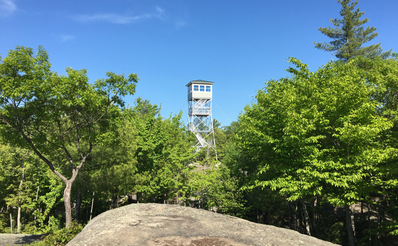
It didn’t feel like a long time before the fire tower was in front of me, even if the trees kept it hidden until just about the very end. Climbing its three flights to the uppermost platform was quick, although those stairs are quite steep. Hang on, and take care. Very nicely, the state has stapled guides to the underside of the cab, positioned at the cardinal directions, listing what’s visible beyond.
Their means of finding things is by your thumb, held at arm’s length, and you count “thumbs” to the left and right to get to the approximate area. From there, look for the water tower, or the mountain, or the nuclear power plant, or odd building. Yes, I could actually spot Seabrook, although nearby trees are growing to a height that only a fire warden in the actual cab will have the cleanest views of the various points of interest. If you have binoculars, they’re worth bringing along.
Coming back down, I spent more time looking along the side of the trail, and spotted several wildflowers. Some violets, some bluets, and one I hadn’t seen before. Occasionally called gaywings, the magenta flowers of fringed polygala are easy to spot among the greenery, despite their diminutive stature. The unexpected find capped a lovely afternoon. It had been a long time since I’d been to Pawtuckaway, and I’m thinking maybe I should have done something about that sooner.


As always, stay safe out there.
Nuts and Bolts: Exit 5 from NH rte 101 is your best bet. Follow 107 north, signs do a good job of showing you the way. Right now, the beach is closed due to COVID-19, and there may be other restrictions on the day of your visit. Check the park’s website, and if in doubt, pick up the phone.
Trailhead is about half a mile distant from the main parking area, immediately off the paved driveway. Blazes are white and a bit spotty in distribution. On the other hand, the trail is basically a skidder road, and all junctions are (currently) well signed.
If you enjoy reading these posts, please subscribe — stay in the loop! Your email will only be used to alert you of new posts — typically 1-2 times per week. I will not use or share your email for any other purpose without your express permission. And feel free to share via social media using the buttons below.
Find me in the mountains, on this blog, or on Twitter: @Protean_Hiker
3 thoughts on “Trip Report: Finding the Fire Tower on Pawtuckaway”
Did you need a bug hat?
I used bug juice, which kept the black flies at bay. I think a big factor was the breeze, especially nearer the summit. Down low, you could tell the bug juice was working hard, though.
Baxter State Park? You can bet your bottom dollar that I wore a bug net. Mosquitos are the Maine state bird, and they attack with relentless fury.