
Steep, quick, and fun — what’s not to like?
Mt Osceola and East Osceola, Lincoln, NH. 2018-03-05. (Monday)
Via Greeley Pond and Mt Osceola trails, out-and-back.
35 dF +/- and cloudy becoming partly cloudy.
Trailhead: 0940; East Osceola summit: 1145; Osceola summit: 1240; back at car: 1520.
I got to the mountain late, probably 90 minutes later than I’d have preferred. But it turned out that no-one was keeping score on that point. I got to the trailhead, got my stuff together, locked the car, and started in.
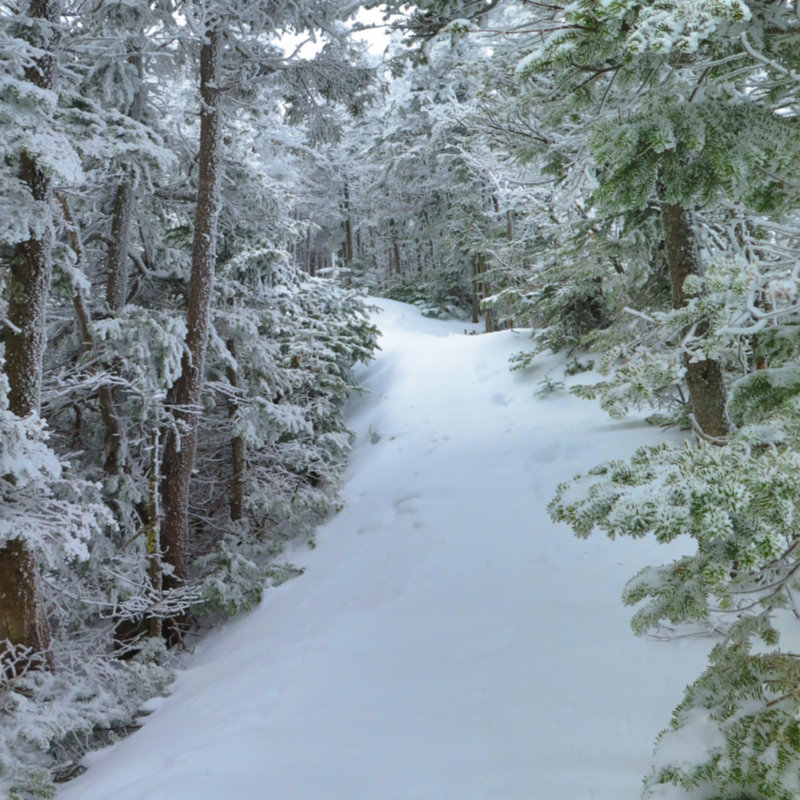
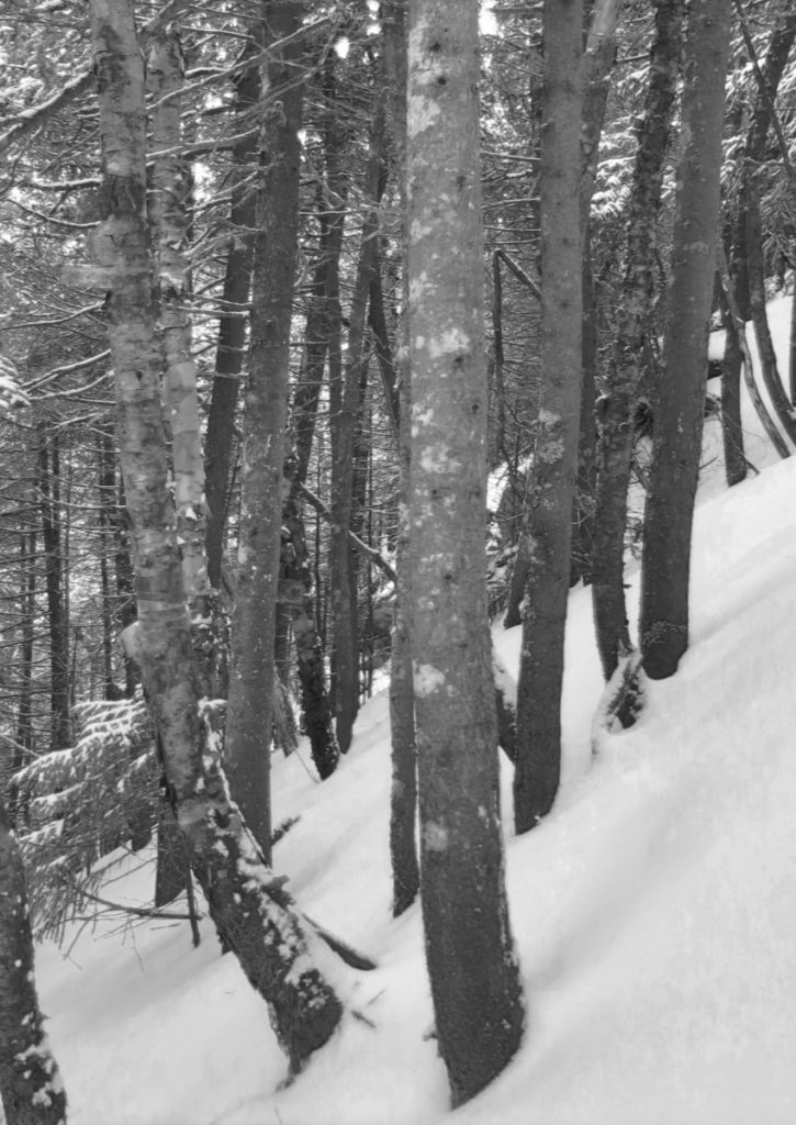
The trail was well broken, and that was a product of both traffic and the lovely spring-like weather we’ve been enjoying recently. My crampons cut through the monorail well, and I made good time. The first couple of miles were an easy grade, but with several stream crossings. Some were shallow enough to hardly be considered “crossings” but at least a few were enough to have lapped over my boots with a misstep. No issues, though.
As I continued, the day didn’t so much feel warmer, but the doubts I was having about it holding together started to fade. The trail started to get steeper, and before long, I was breaking a sweat.
I came in via the Kancamagus Highway, and so the solitude was empowering. Surrounded on all sides by seemingly vertical walls, quietude in abundance. I heard a rhythmic tapping above, and looked up to spy a woodpecker diligently hacking away.
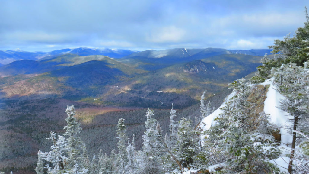
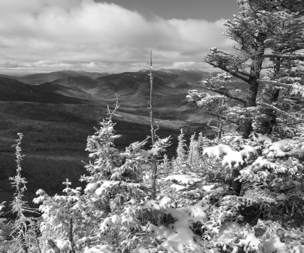
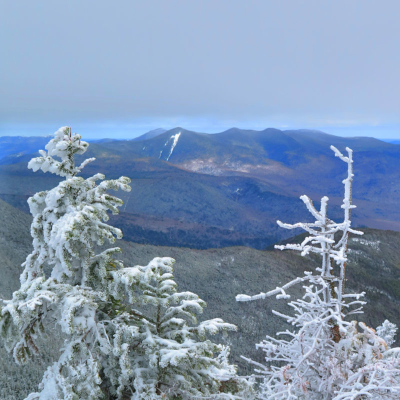
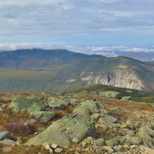
Before long, I was in the steeps, and for this I was glad to have worn my full-on crampons. Microspikes might have worked, but I moved so much faster and surer. I spent at least a mile hammering away at a horrendous hill, but periodically, I was rewarded with peeks of pretty peaks. But also, it became increasingly apparent that the ceiling was somewhere around 4,000 feet — at one point, my views were being greyed out.
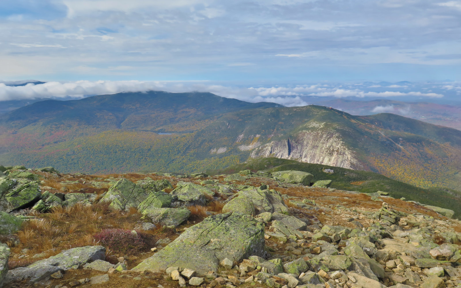
Finally. on top of East Osceola, the quandary: where the hell is the summit?! No sign, no cairn, no marker, no sudden density of rocks or anything. A fantastic view, but that was it. I pressed on to Osceola. Along the way, the sun started to push through the clouds in earnest. It was truly starting to become partly cloudy, and sometimes, even “partly sunny”.
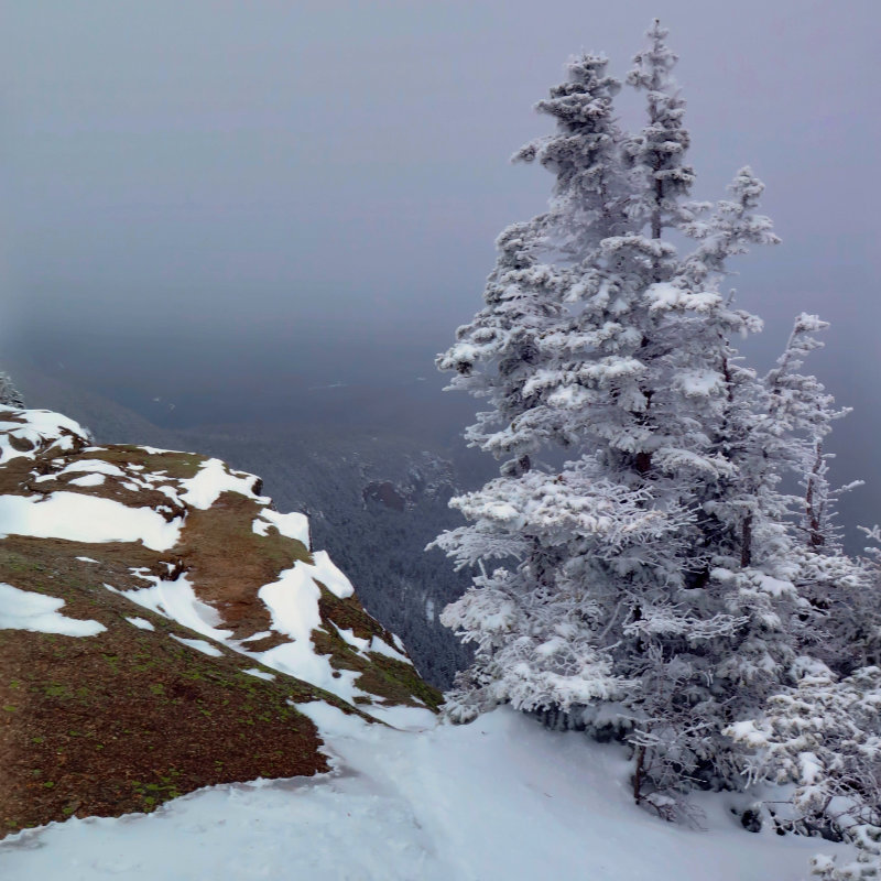
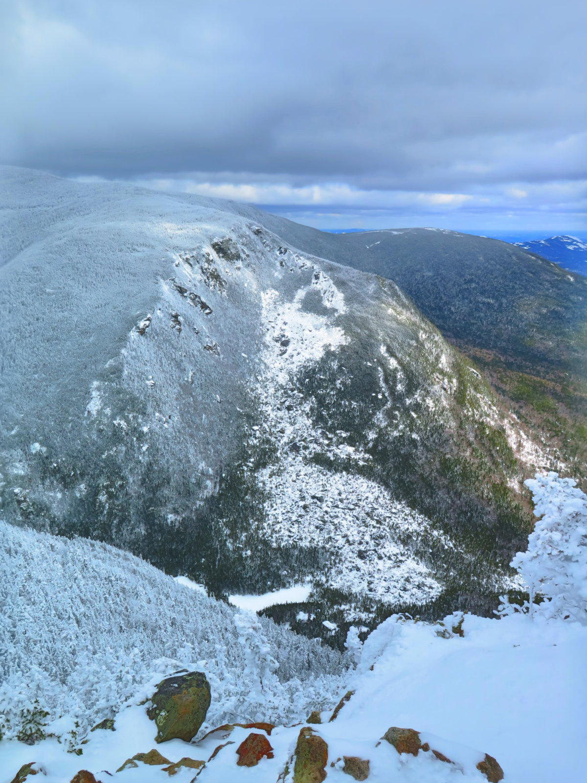
The ridge does indeed “swoop”. There is no question of prominence between the two peaks. Going down was obviously simple on the way out, going back up involved a chimney. I’d read about it, and true to description, taking the right side did make things straightforward, if not a bit hairy for the exposure. A fall might not have been a calamity, but it would have hurt. Now “officially” on Osceola, I pressed onward.
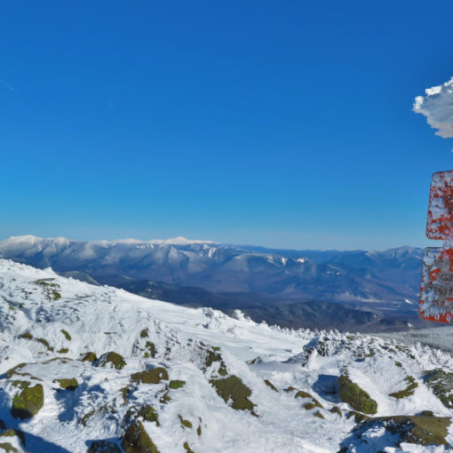
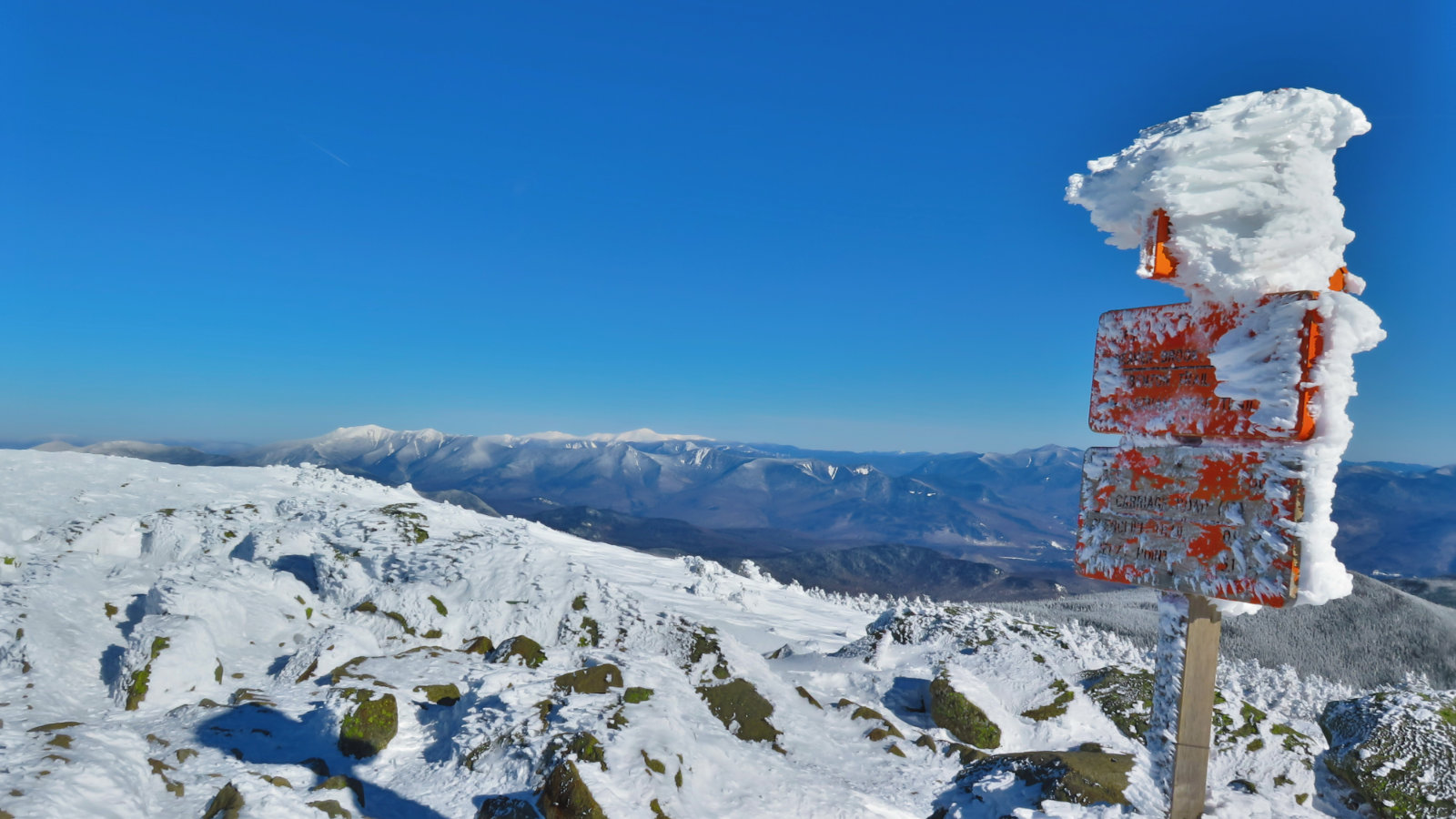
Finally, the trail seemed particularly windswept, and at its end, entirely cleared of snow, down to the ice beneath. I emerged into a large clearing with four concrete pylons; remnants from the fire tower from decades ago. Trees on one side of the summit, but a fantastic view from the other… and at the edge, a solid drop-off for far more dozens of feet than I wanted to contemplate.
My requisite pictures taken, and a lesson in why an ice axe doesn’t make the best selfie stick, I headed back. On the way, met a couple pair of hikers. One a pair of young gents enjoying a beer on East peak, and the other a pair of young men with their large dogs, both behaving as if they were puppies, so happy they were to be outside in the woods.
In short, it was a heck of a day out, despite a discouragingly late start, and initially cloudy weather.
Pictures, in no specific order:

One thought on “Trip Report: Mt Osceola and East Osceola”