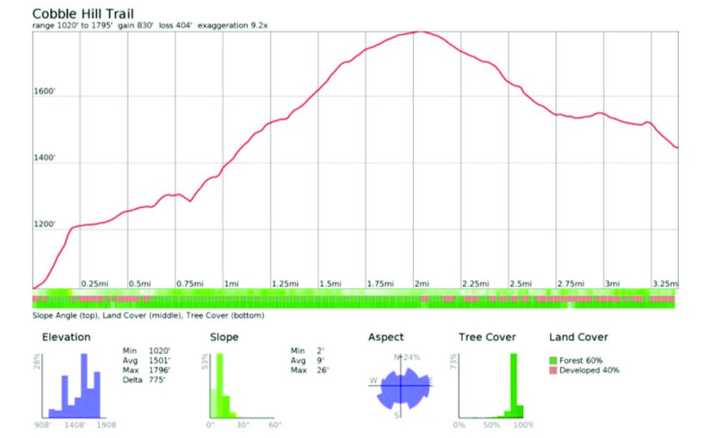
Cobble Hill Trail. Landaff, NH. 2021-08-24 (Tuesday.) 7 miles round-trip.
85 dF at the trailhead. Winds were non-existent throughout the day. (A breeze would have been much appreciated!) Mostly sunny throughout.
About an hour-fifteen out. Slightly less on the way back.
Find the trail behind the old Stimson Farm.
At some point, people are going to read this, and either not have been around to see it, or mercifully lost it in the sands of time and grey hairs. To you time travelers, welcome. It’s been very soggy lately. A combination of an unusually wet summer, and a tropical storm passing through, has me thinking of trails that don’t stick to the very side of a brook.
I’d wanted to knock off the bottom half of the Pemi Trail, and maybe a chunk of the bike path, but there’s a lot of water in those parts, and I wasn’t expecting them to be anything other than a mud puddle after the storm. So I looked around and came up with an alternative idea. Why not knock off the “tiny” trails I have left in the Cannon-Kinsman area?
This ain’t new to town…
No kidding, I was looking for the lay of the trail, and if it had changed with time. Near as I can tell, all the way back to 1936 (“This new trail…” reads that edition of the AMC book) the bones of that trail have rested just about exactly where they are today. This is important, because both Gaia GPS and CalTopo have the trail making some kind of weird jug handle, that you shouldn’t follow unless you prefer a crazy bushwhack that serves absolutely no purpose than to make you skip a significant portion of the actual trail. Trust me on this. And don’t ask me how I know.
(That said, with the exception of the Gaia GPS/CalTopo error, this is one of the few times where I almost feel comfortable saying “use any old map” because hey, going back to 1936, the AMC maps are pretty much identical. Wow!)
Some dirt has been moved around some…
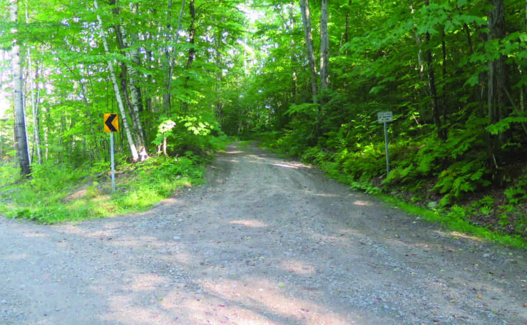
If you’ve not been out that ways in awhile, it’s worth noting that there’s a *lot* of earth that’s been moved. The “trail” on the southern end is a fine logging road for the first half-mile, wide enough to fit two locomotives side by each. It’s also important to know that if you’re totally dependent on following blazes to stay on trail, this one emphatically isn’t for you — I didn’t see a single blaze all day, and it wasn’t for a lack of looking.
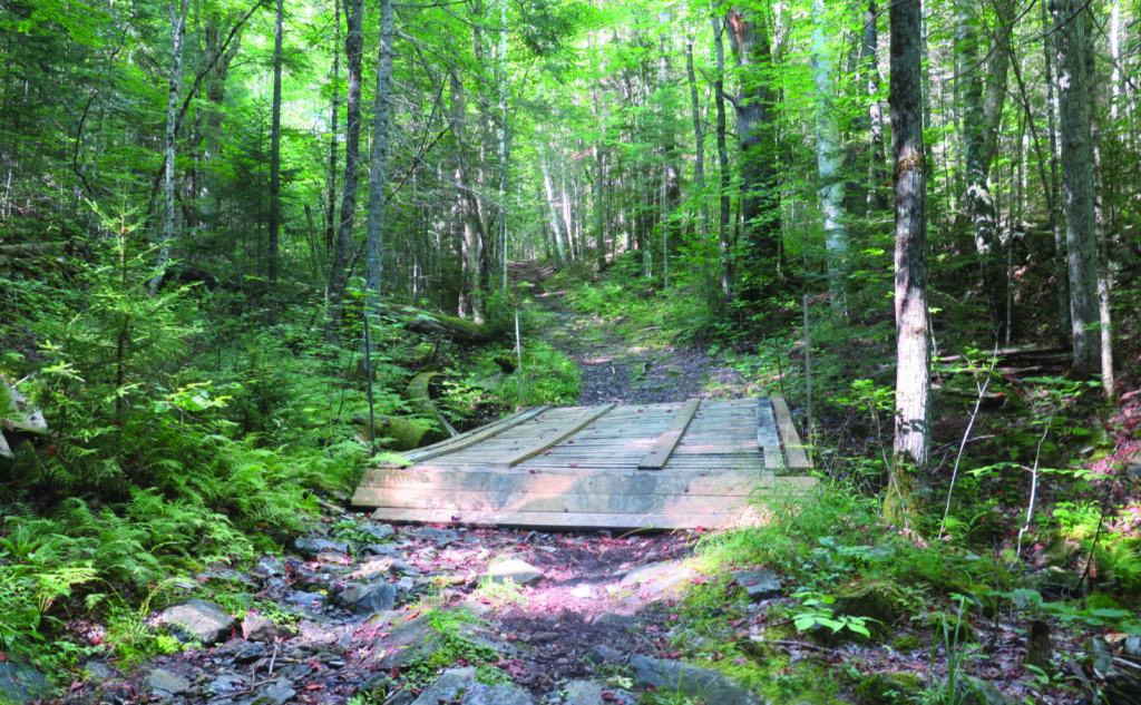
The few clues, early on, that you’re on the right track come from being able to spot the USFS Forest Protection Area sign, and there are a couple snowmobile signs when you’re up the trail a fair bit. There’s a wooden bridge about where the White Mountain Guide describes, and a couple side paths are mentioned. Everything else is just trusting that you’re going the right direction. Be forewarned.
Getting going… due up!
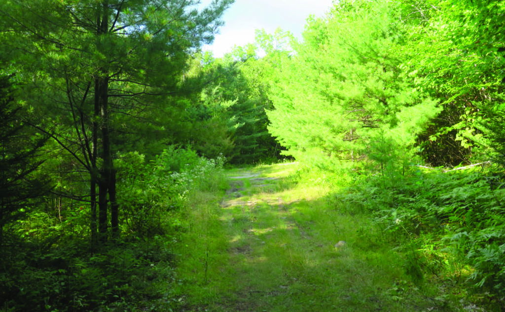
Starting out, the trail pulls no punches. It’s smooth overall, but you climb a couple hundred feet right out the gate. Thankfully, that’s about the only “hard” part. All the rest does indeed climb noticeably at times, but overall, the grades are fairly easy once you’re up that first climb.
I spent much of the day in the green tunnel, which was fine in principle. I think if I lived in the area, this wouldn’t be a bad place to take a walk in the woods, notably if I were coming in from the north. There’s no shortage of activity on the south end, and it includes a large yellow excavator and a front end loader of no small proportion. By gum, there’s a timber harvest going on, but it peters out after the first mile.
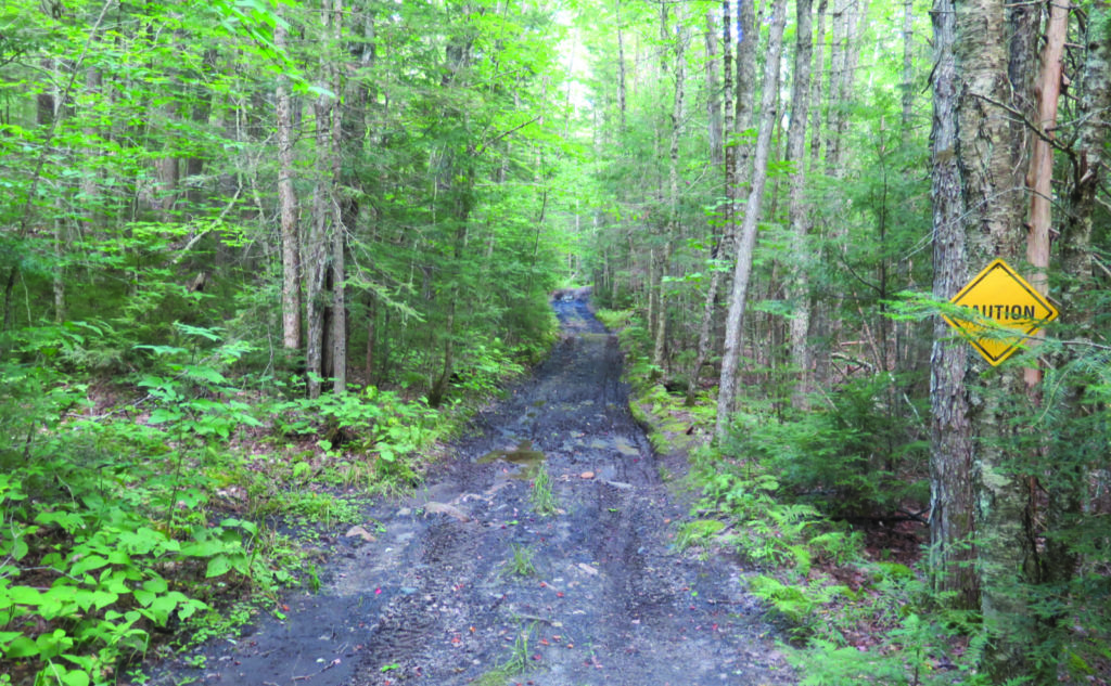
Beyond that, I saw ample evidence of OHRV use — much of the trail had tracks. Given the outrageous mud in places, it actually worked to my advantage at times, because it would either firm up the trail, or make it so the moisture had a more narrow area where it wanted to collect. Yes, regardless of how much the storm actually dropped in the area, the trail is still quite soggy. No biggie if you’re on an OHRV, but on foot, some crossings were pretty dicey.
History? Sure, or so I’ve been told.
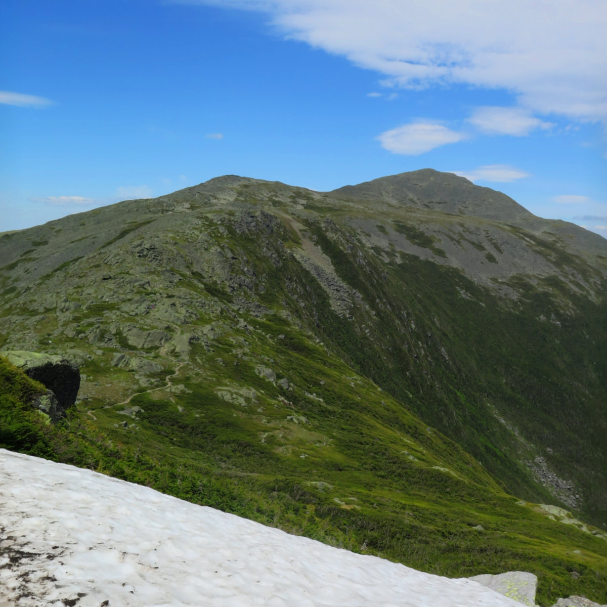
In general, it wasn’t much for being a scenic trail. Nearby Cooley Hill had much nicer views. That said, near the start, if you go left, supposedly, there are a bunch of cellar holes. Landaff has quite a history despite its diminutive size. One thing I noted was that for about 2 1/2 hours of hiking, those seven miles were tiring. I’d like to come back sometime, though, because the aforementioned cellar holes are something I didn’t get to, and yet, it sounds like it’s really worth exploring.
I couldn’t find the trail in the 1931 edition of the AMC guide, but it was there for 1936. I checked a few others to the present, and they all have substantially similar descriptions. The maps show the same shape line. As I mentioned, it’s not much for long views, and the logging operations might be a bit off-putting for some. But you can’t deny the place has history. Just that thought… thinking back to the people who trod that ground before me… the imagination takes off. The Stimson farm? Yep, mentioned in the guide. Who were the people who lived here before we got here?
As always, stay safe out there.
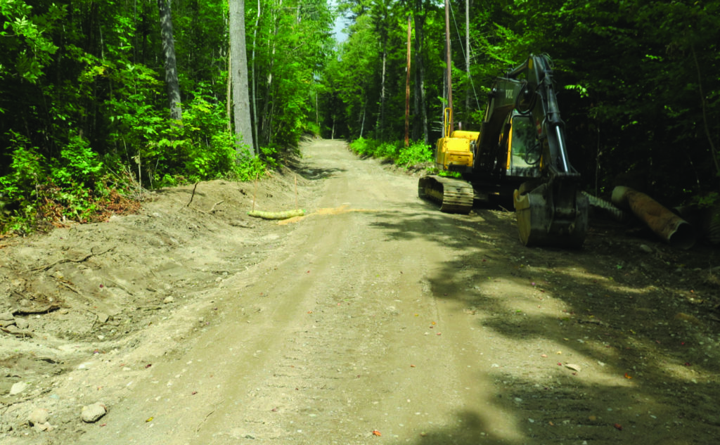

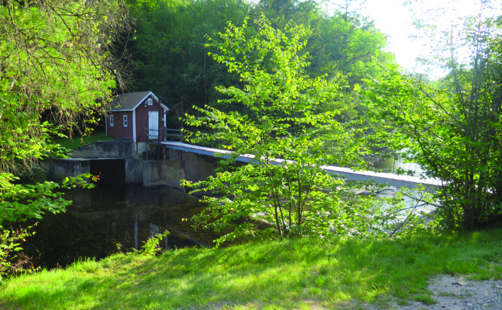
Nuts and Bolts: Take exit 32 (Kancamagus highway) off route 93. Head west on route 112 into Woodstock, cross the intersection with route 3, and drive toward Easton. You’re looking for the western-most junction with route 116, which comes after several minutes of driving. Go beyond that for about 2 more minutes. On the left, you’ll notice a pump house on the far bank of the Wild Ammonoosuc river, connected to the road by way of a long footbridge. (It’s tough not to notice that feature.) Shortly after, you’ll see a wide, new-looking gravel road on the right. Everything about it screams “construction zone!”
On the west side, tucked into the trees, you might be able to spot the USFS trailhead sign. It’s visible without any crazy contortions, but you do need to look for it in order to see it. That logging road is indeed the trail. You’ll know it, because in about 1/4 mile, also on the west side, is the FPA sign, nailed to a tree that’s a bit higher up the hill than you’d expect.
Beware the jug handle!
About half a mile in, on the right, you’ll see a very wide, grassy road head downhill, and it’ll look pretty inviting. Don’t. I mean, you can, and when you finally reach the very end of that track, you could try cussing your way west through thick forest and perhaps find the real trail, which could be about 50-100 feet away. (So said my GPS at least.) Instead, keep going straight, keeping Dearth Brook on your right, which is how the trail has existed since 1936. You’ll pass a couple signs for snowmobilers. Beware, the rocks near the bridge are more slippery than a pile of fresh bear exhaust on a rainy day.
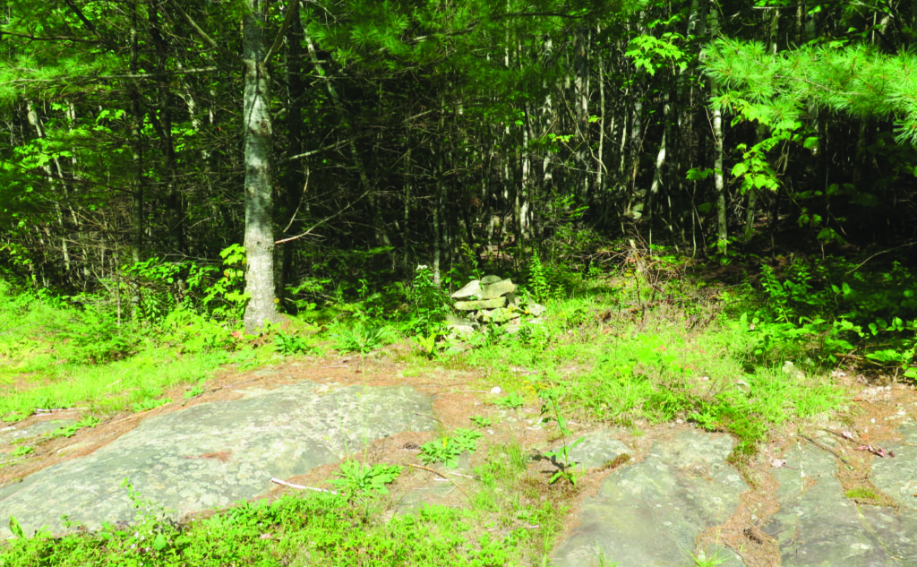
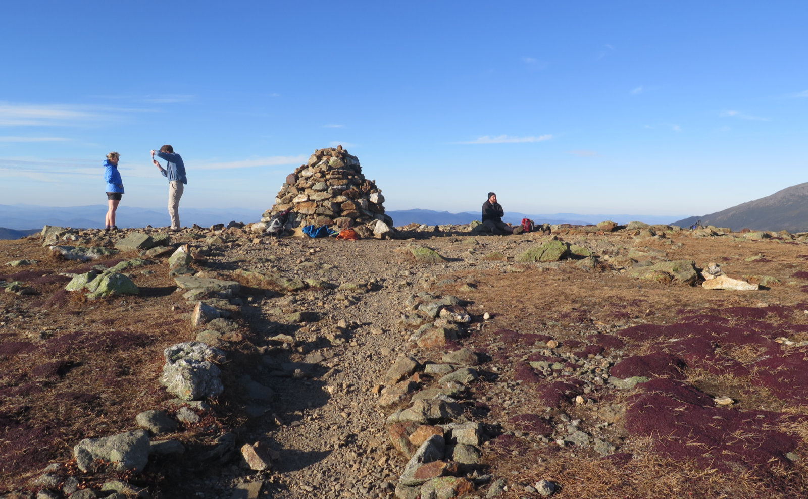
The boundary of the WMNF is… low-key. There is a clearing, it’s at height-of-land between Moody Ledge and Cobble Hill, and to the east side is a small cairn. Near as I could tell, there’s no sign. The second half of the trail is actually pretty nice, so just hike it anyway.
As far as the bushwhack?
It’s not terrible — it follows some kind of ancient logging road that’s since become overgrown. If you squint, you might actually see where some person walked that path recently, and if only someone would clean things up, this could become a fun little herd path. I saw a couple places that might make nice stealth camping spots. But when I said it dead-ends, it well and truly dead-ends.
If you’re intent on making a go of it, at the dead end (there is a handful of young conifers, seemingly out of place) you might try going west along the 1400 foot contour interval, and maybe you’ll hit the actual trail. Or maybe not. This isn’t something I’d recommend for the novice tramper. Have some miles under your belt first, be familiar with the area, and be sure someone knows roughly where you’ll be, and when to expect you home.
If you enjoy reading these posts, please subscribe — stay in the loop! Your email will only be used to alert you of new posts — typically 1-2 times per week. I will not use or share your email for any other purpose without your express permission. And feel free to share via social media using the buttons below.
Find me in the mountains, on this blog, or on Twitter: @Protean_Hiker

2 thoughts on “Trip Report: Is an active logging site good for hiking?”
We went here a couple years ago. Went as far as the height of land. We had made a mistake early on in and took a left and ended up on someone’s private land. The owner and a friend were in a jeep when we met them, really nice guys. We had stopped near an abandoned orchard when we met them. Good conversation, recommended bug spray, gave us a ride back to where we made the wrong turn. Will have to go back sometime and see the rest of the trail.
I’m thinking back, and I might have come down heavy on that trail. The opener, with all the construction equipment, certainly didn’t help anything. I hope in a year or three, things are heading back toward normal, and it’ll look like a more interesting trail. The overwhelming sense I got from the second half is that it would be a heck of a place to take the dogs for a walk, or maybe some cross country skiing, or that sort. One easily thinks that’s exactly how the locals see it.