Pemi East Side and Lincoln Woods trails. With a short side trip out the Franconia Falls trail. Approx. 8 miles.
Lincoln, NH. 2020-03-03 (Tuesday.)
51 dF throughout. RH 51%. Winds were limited to light breezes nearest the river. Sunny with clouds to start, becoming overcast by about 1600.
Trailhead: 1300. Pemigewasset Wilderness Boundary at Franconia Brook Tentsite: 1420. Pemigewasset Wilderness Boundary at Franconia Brook: 1440. Car: 1620.
Recovering. Rejuvenating. Refreshing. Relaxing.
It was a very special day today. For the past couple months, I’ve been chomping at the bit, wanting to be outside. At last, my ankle has recovered to the point where my PT guy was comfortable with me hiking on flat ground. And so I went. Lincoln Woods was the obvious choice, because yep, it’s flat as a pancake. Mostly.
The drive up was pedestrian. Knowing I wasn’t going to go long or high, I got up late, sipped my coffee while picking over the bones of the news, and eventually got out the door. Stopping at The Mountain Wanderer Bookstore to chat with Steve about my plans for the day, he agreed with Lincoln Woods trail, but advised the parking lot was very icy. He was mostly spot-on, but trail conditions were much better than expected.
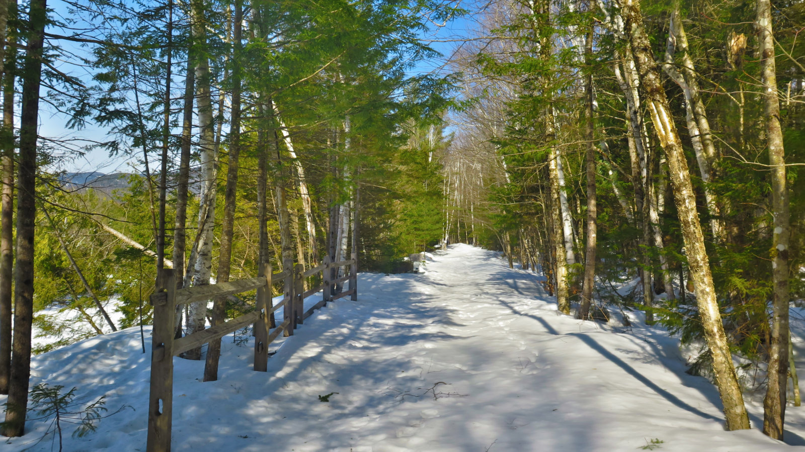
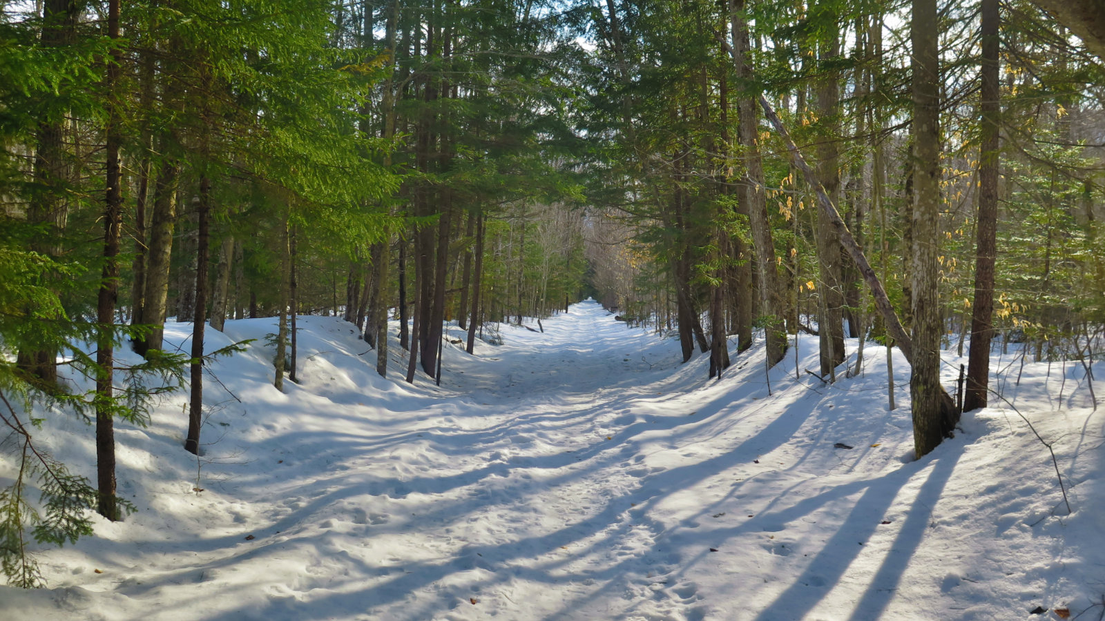
It’s been very warm, and today was outright spring-like, despite it being winter for almost three more weeks. So I was happy to see the parking area was quite icy, but doing a fine job of melting out. There were big spots that were down to bare pavement, and by the end of the week, this will only get better. The snow? It was actually a fine surface for walking. Yes, it was soft, but it wasn’t greasy — my Microspikes did plenty well at providing traction. The intermittent rains did a job over the winter at consolidating the base. For almost the entire day, I walked on a functionally paved surface, even when I stepped off the trail. And the shirt-sleeve weather was very welcome.
I got down from the ranger station and at the trailhead for the Pemi East Side trail, I made the spontaneous decision to take that out, and see what happens. I’d been meaning to follow up on a short walk I went on last October — I’d been at a professional conference in North Conway, and being in the area with an hour of daylight to kill before going home, a short walk in the woods happened. It turned out to have been an excellent choice.
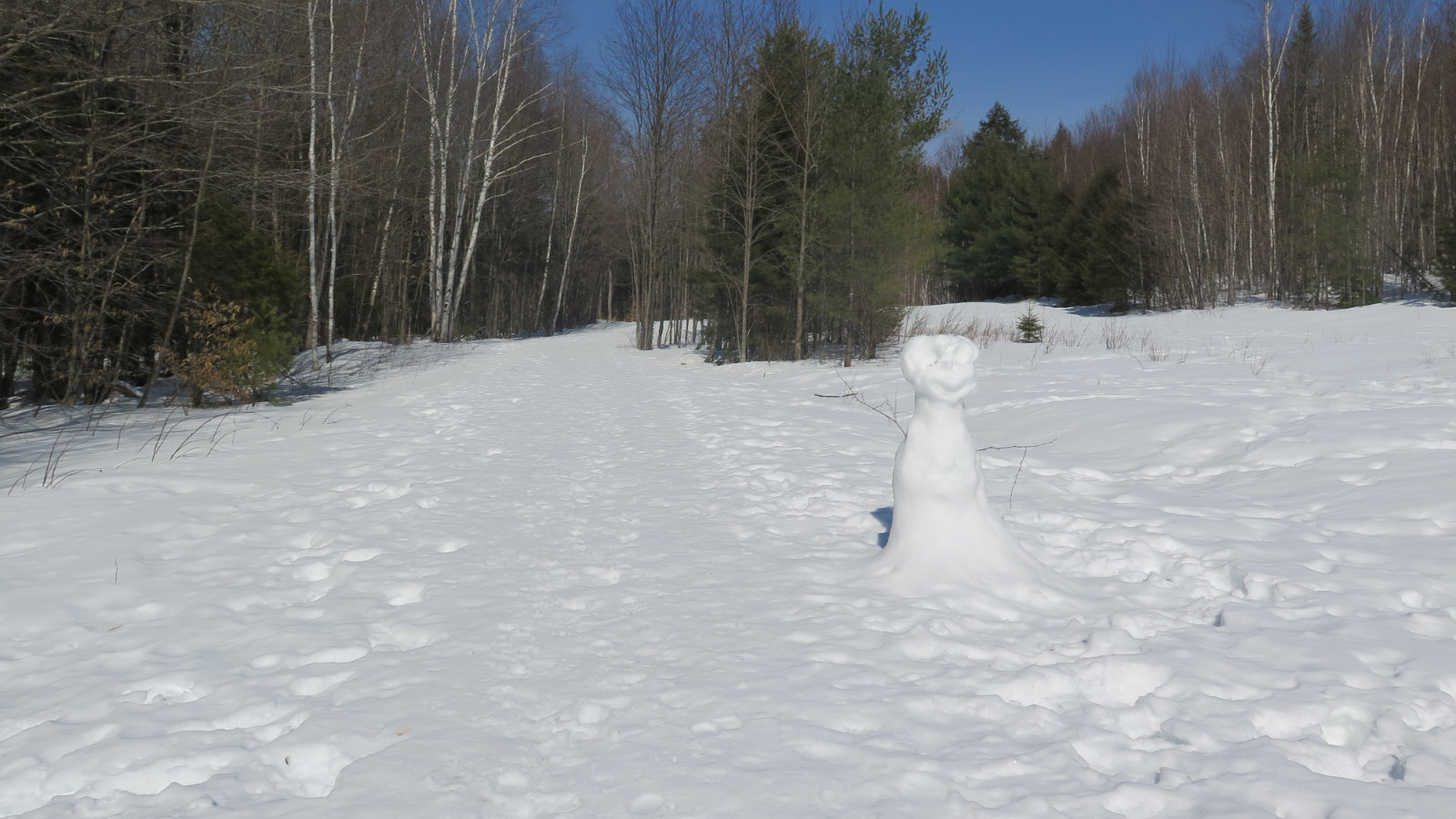
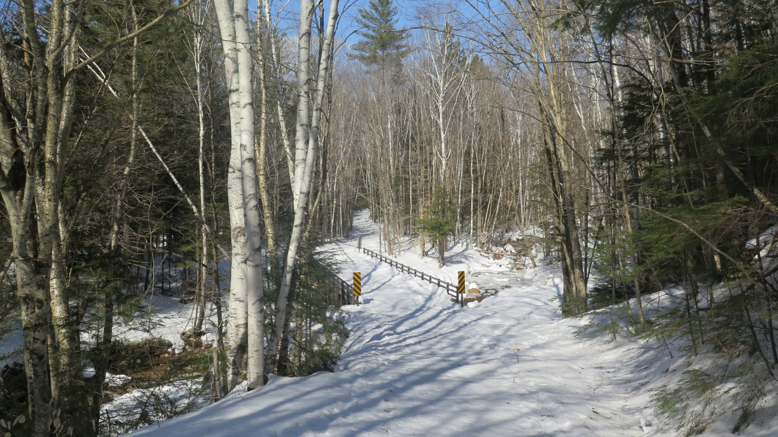
Before long, I arrived at the site of a former logging camp. Back in the day, the trail was a logging truck road (today, it still remains FR 87) and this clearing was either Boyle Camp, or Camp 2 — I’m still working out which it was. But today, it was the home of a snowman that looked a lot like the end of its days was at hand. I carried on, and shortly afterward, crossed the two truck-sized bridges that seem way out of place here.
And then the two cutoffs for the old Pine Island trail were on the left. On that afternoon in October, I explored both, noting that Irene had severed the path roughly in its middle. There is a way across, but it’s frankly not worth the extreme effort, especially when the entire length of the trail is 0.9 miles. Easier and safer to just walk around. But it’s a nice little detour, with excellent views of the Pemi river.
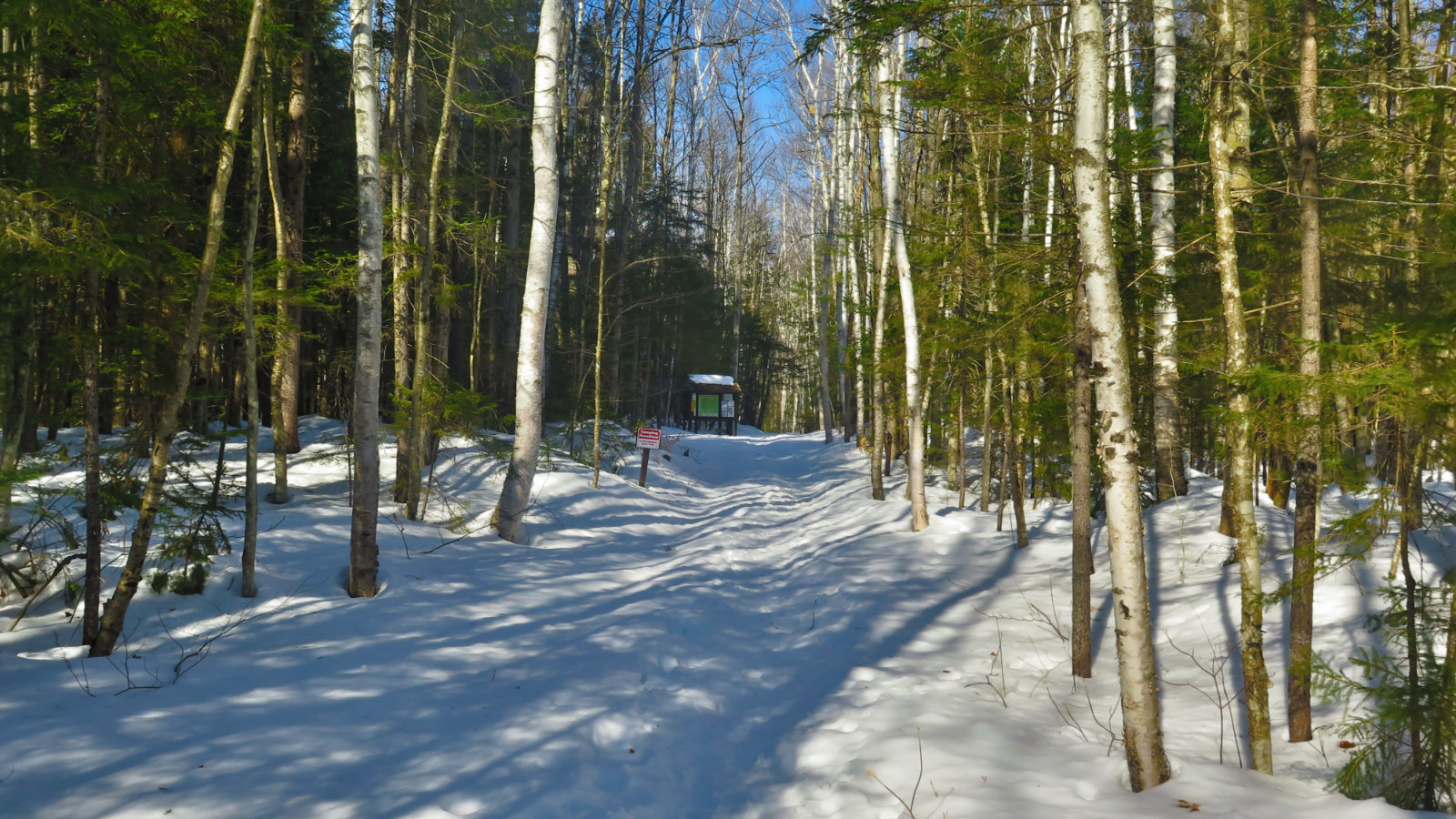
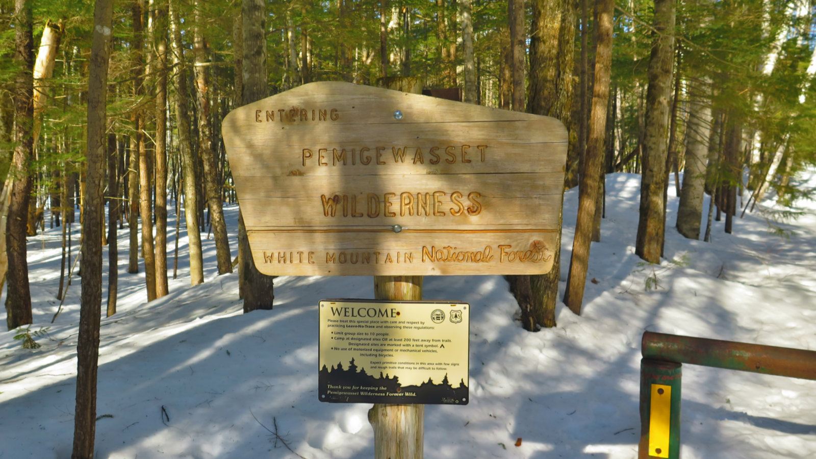
A couple miles later, and I was at Franconia Brook Tentsite. It’s got about 15 or so spots, relatively closely spaced, with a metal bear-box, and a pair of “improved” privies. (I’m going to guess they’re self-composting.) And perhaps a tenth of a mile after that was the wilderness area boundary. It’s been an uncomfortable couple of months spent convalescing, so getting to touch that sign was a treat. Up until this point, the snow hadn’t really been any kind of bother — the mashed potatoes was barely about an inch deep. Beyond the boundary, it wasn’t terribly different. Maybe an inch or two deep and slightly more slippery. But it was decently trampled down by traffic that might have been by in the past couple weeks or so. I’d hiked in about a tenth of a mile before realizing that if I left myself to my own devices, I’d carry on to something steep, and I’d probably be better reining things in. So I turned around.
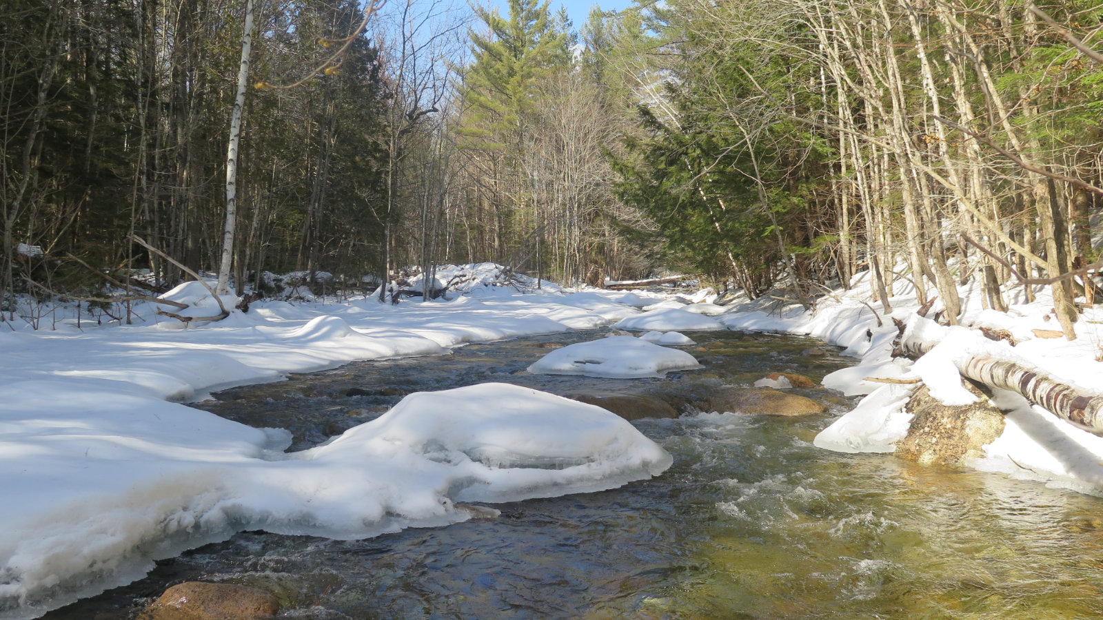
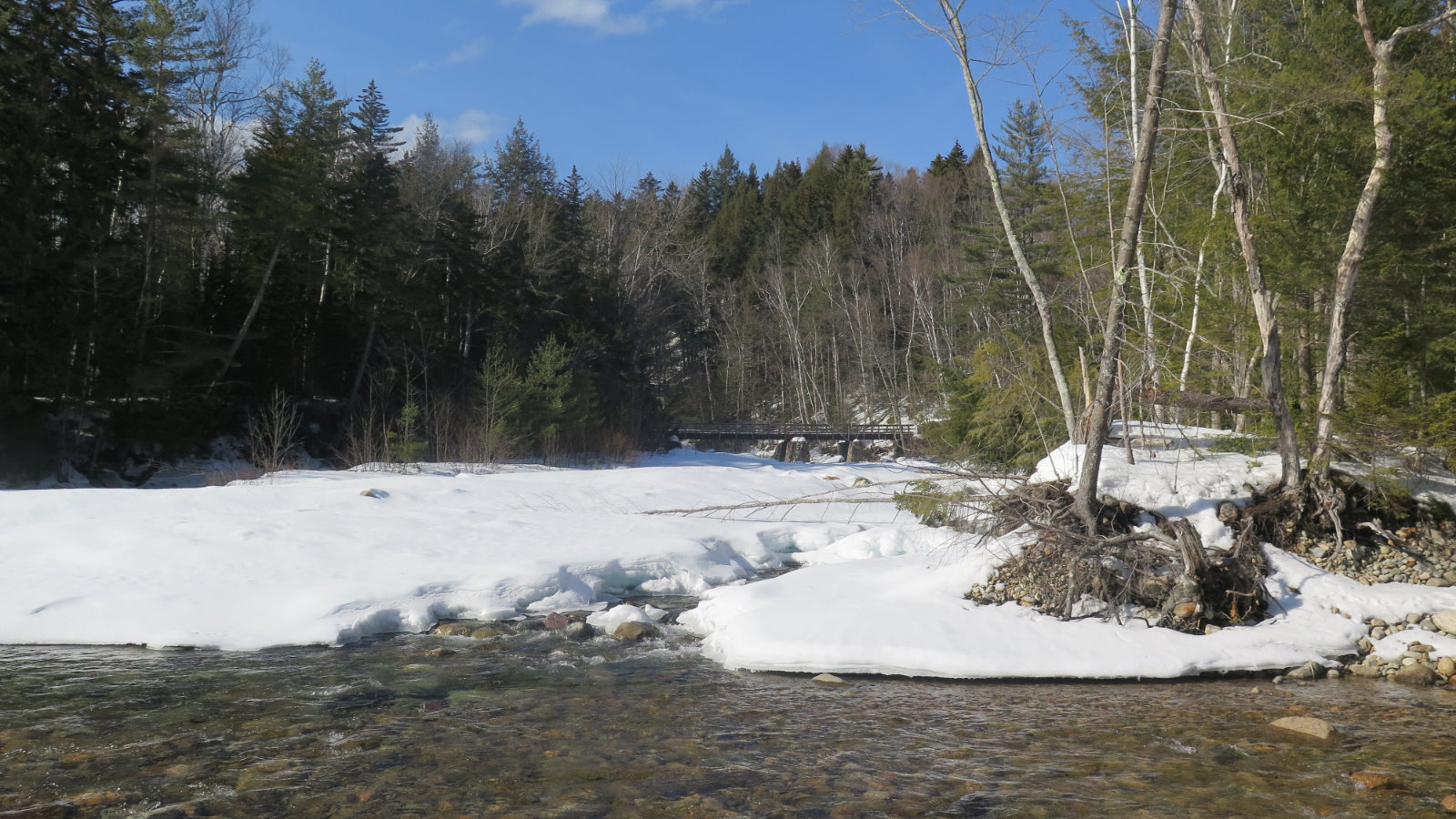
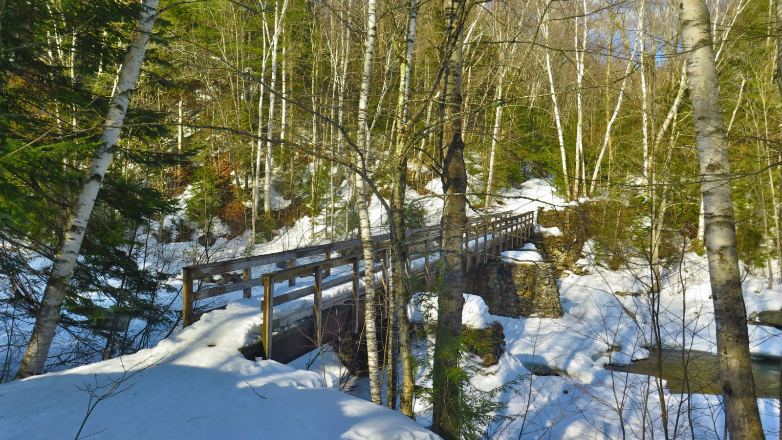
Not long after passing the tent site again, there was a side trail, going to the river, with a magnificent outlook. I saw, not very distant, the bridge over Franconia Brook. And below me, snow bridges with conveniently placed footprints, showing the way. I had to at least try, right? I mean, how often do you get to cross the Pemi on foot?
So there I was, in the middle of the river, plodding along. I will point out that it was potentially very dangerous, and people really shouldn’t do this. (Really, don’t do this.) Luckily, the snow and ice was still thick, and I got away with it. I passed under the footbridge, and climbed the far bank. And that’s where I touched the other wilderness boundary sign. The one I’ve passed several times, on so many outstanding hikes. My first, and craziest ascent of Owl’s Head. My “all three Bonds in a single day” hike. The return of my Pemi Loop. So much happiness triggered by touching that sign. I crossed the bridge, heading back.
…And promptly decided that, while I was here, I might just as well duck down the Franconia Falls trail. I mean, it’s just a 0.4 mile add-on, right? My ankle wasn’t giving me grief, so no reason not to. I’ll have to come back to this one in the summer, though. There was still so much snow and ice everywhere, and besides, I want to snoop around and perhaps see if I can join that up with the Black Pond bushwhack. The whole thing smacked of “snoop around, dummy!” But alas, it was getting on late in the day, and time to head back for real.
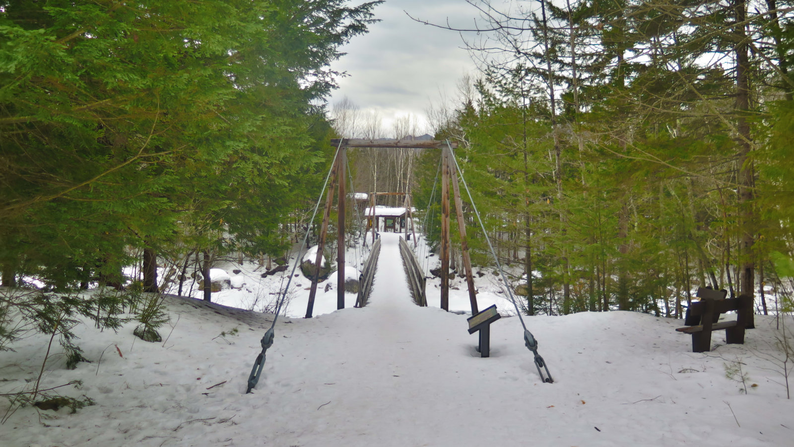
Back on the Lincoln Woods trail, the path I had originally thought I’d start out on. It felt cooler than on the other side of the river, and being late in the day, the sun was already behind the nearby hills. But I always seem to make good time on that trail, and today was no exception. It felt like no time had passed when I glanced to the right, and was surprised to see I was almost on top of the suspension bridge at the trailhead.
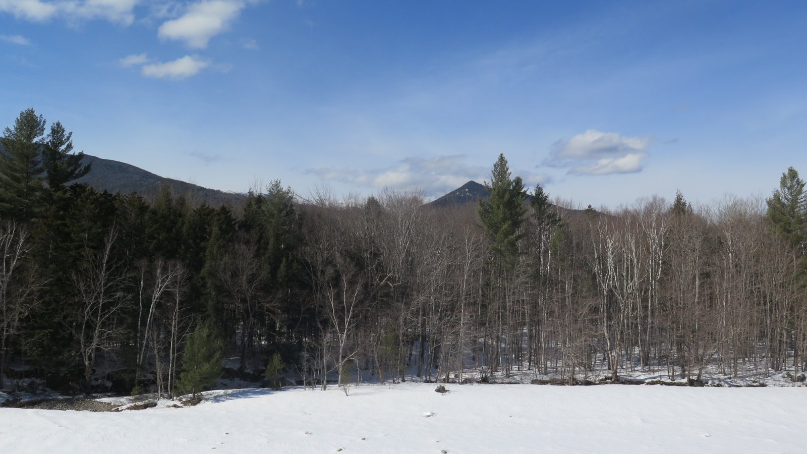
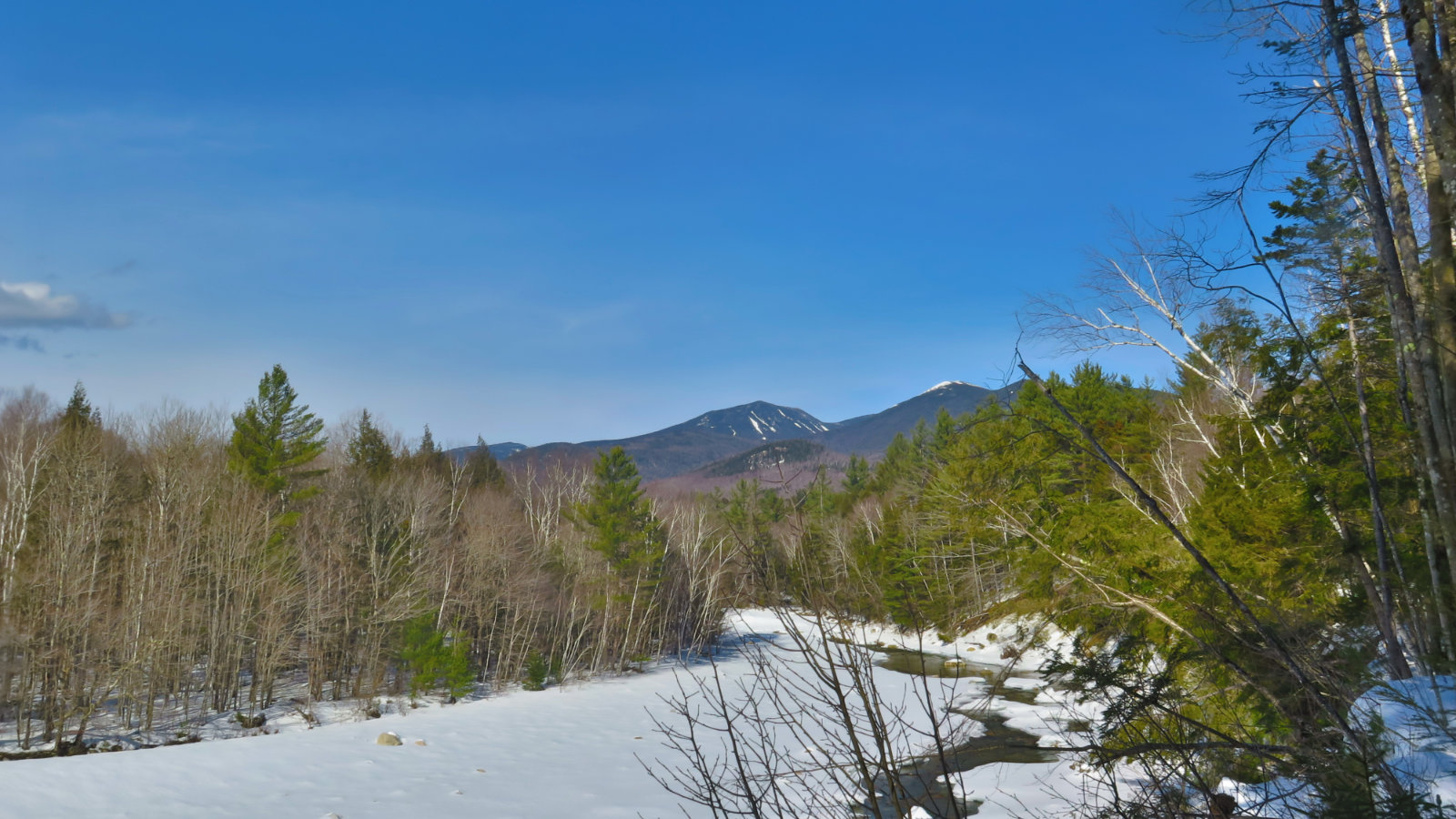
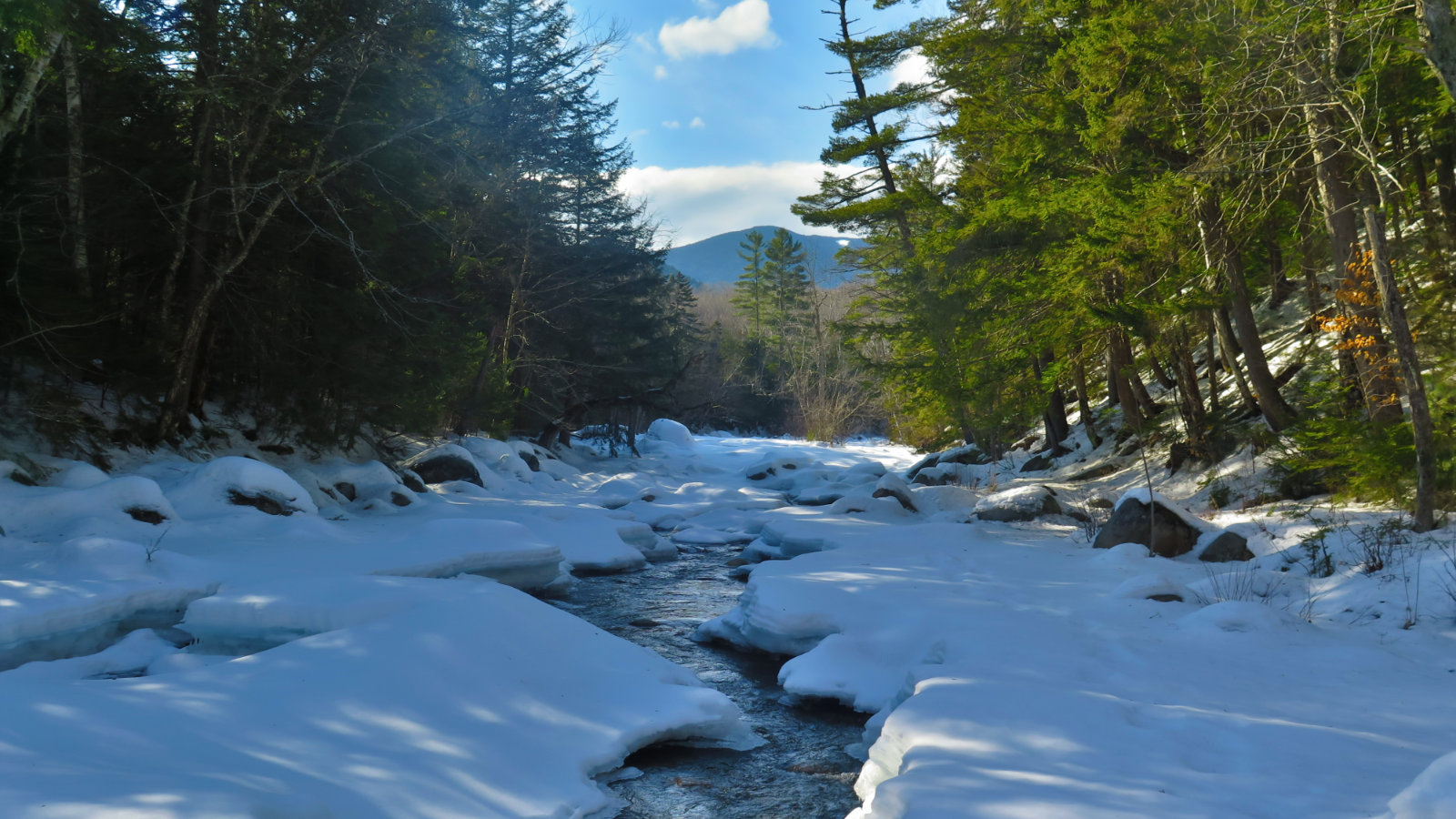
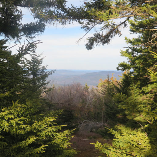
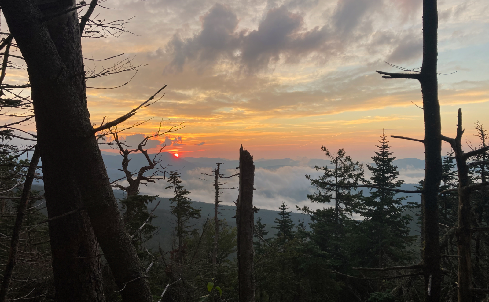
It was about eight miles round-trip. There was a certain amount of noodling here and there, because from the edge of the river, you can almost always see the nearby mountains in spectacular form, and many have tramped out convenient paths to those outlooks. Looking at my GPS track for the day, I did this at least half a dozen times. How could anyone not, especially with the rare alignment of snow-covered peaks, blue skies, and gorgeous weather? It was all good. I caught glimpses of Franconia Ridge. I saw all of the Bonds at various times. I almost never see it, but today, I found the right place to see Galehead is from the east side of the river. Owl’s Head. South Twin. Flume. And it took me long enough to realize that the Osceolas are smack dab in front of me when I’m walking back to the Lincoln Woods trailhead.
There was good weather. A well-tramped out trail. Sunshine in abundance. Spectacular views. Two months to get here. Happiness. And oddly, that sense of melancholy on turning back for home. Familiar, and I was ironically happy to note it, because I hadn’t felt any of that for the past two months. And, y’know, I was home. Weird, right?
On crossing the Pemi on foot: Given the above-freezing temps that are forecast for the week, it’s a poor idea to think the snow and ice bridges will remain suitable for crossing any longer. If you’re thinking of taking that chance, please don’t be foolish. The water is swift, ice-cold, and you won’t last long when the footing gives way. Certainly not the amount of time that it would take for the authorities to come fetch your body. (i.e. it’ll be a recovery, not a rescue.)
On gazing at the views from the edge of the riverbank: Almost ten years later, Hurricane Irene’s distinctive mark is still apparent all throughout the Whites; perhaps nowhere so accessible as the Pemi. There are many areas where the riverbank erosion was so severe that cornices remain, even today. Be careful when stepping out to any edge, as the ground may not be able to support your weight, resulting in a fall to the rocks and river below. If in doubt, find another spot to take in your view.
As always, stay safe out there.
Nuts and Bolts:
Lincoln Woods trailhead is about five miles from I-93. Take exit 32 and drive east through town, past all the ski area condos. You’ll come to a causeway bridge, and immediately after is the parking area on the left. A large USFS sign should be plainly visible. All trails are accessed in winter from a downward ramp that’s on the other side of the ranger station. Note that there are no safe, durable crossings of the East Branch Pemigewasset river. If you take the East Side trail, don’t count on being able to cross over to the Lincoln Woods trail, and vice-versa. However, know that each trail is a fine outing in its own right, and both are worth separate trips to enjoy. Those seeking more solitude will be happy to note that the Pemi East Side gets about 1/10th the foot traffic as Lincoln Woods trail. However, if you’re interested in seeing the historical artifacts from the JE Henry logging days, know they’re on the more traveled path.
If you enjoy reading these posts, please subscribe — stay in the loop! Your email will only be used to alert you of new posts — typically 1-2 times per week. I will not use or share your email for any other purpose without your express permission. And feel free to share via social media using the buttons below.
Find me in the mountains, on this blog, or on Twitter: @Protean_Hiker
2 thoughts on “Trip Report: Pemi East Side and Lincoln Woods trails”