Spring has sprung. Not always a good thing just yet.
Mt Whiteface and Mt Passaconaway, Wonalancet, NH. 2019-04-24. (Wednesday)
Via Blueberry Ledge, Rollins, and Dicey’s Mill trails, loop.
45 dF +/- and cloudy. Wind at upper elevations was 5-7 knots.
Trailhead: 0930; Whiteface summit: 1400; Passaconaway summit: 1850; back at car: 2130.
Approximately 3.6 miles to Whiteface summit, 3.5 miles to Passaconaway summit, 4.6 miles back to car. Approximately 11.7 miles total.
“So, we meet again!” is the common refrain from countless movie villains. I can’t say this mountain is necessarily a villain, but after a second stab at it, I find it’s still a challenging hike. More than that, despite a longer day, I still came out under the stars. On the plus side, they were a stunning add-on.
We got a fairly early start to the day, hitting the trail before my usual 10AM or later. Unfortunately, with all the melting that’s gone on, the trail wasn’t apparent in the early stages, so we spent a bit of time route finding until the forest thickened up enough that the trail became more obvious. So that ate up some daylight. Oh well.
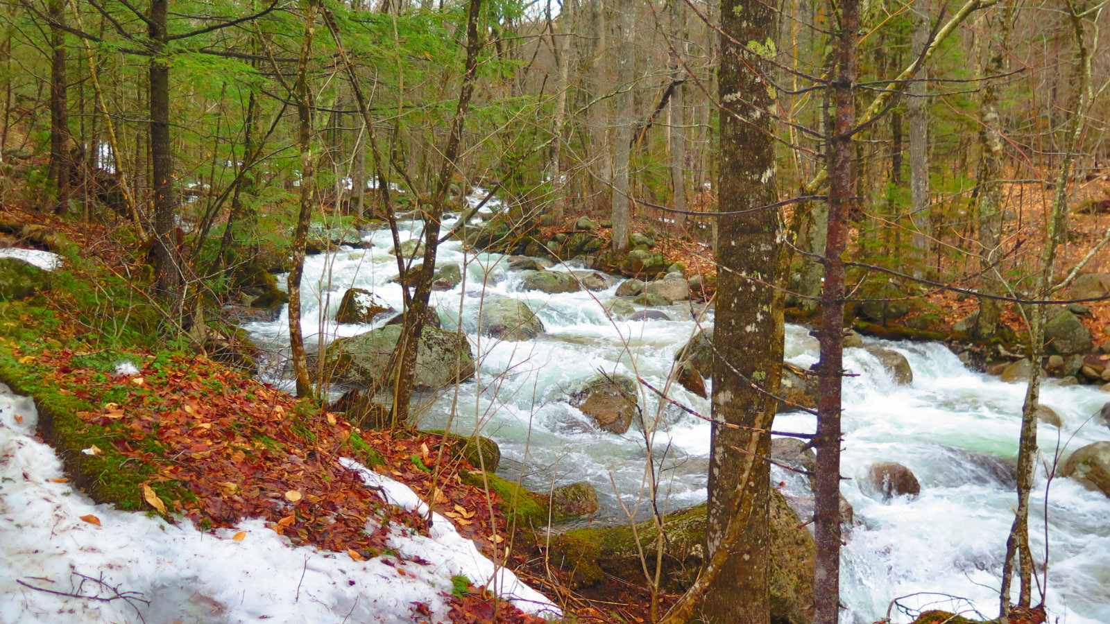
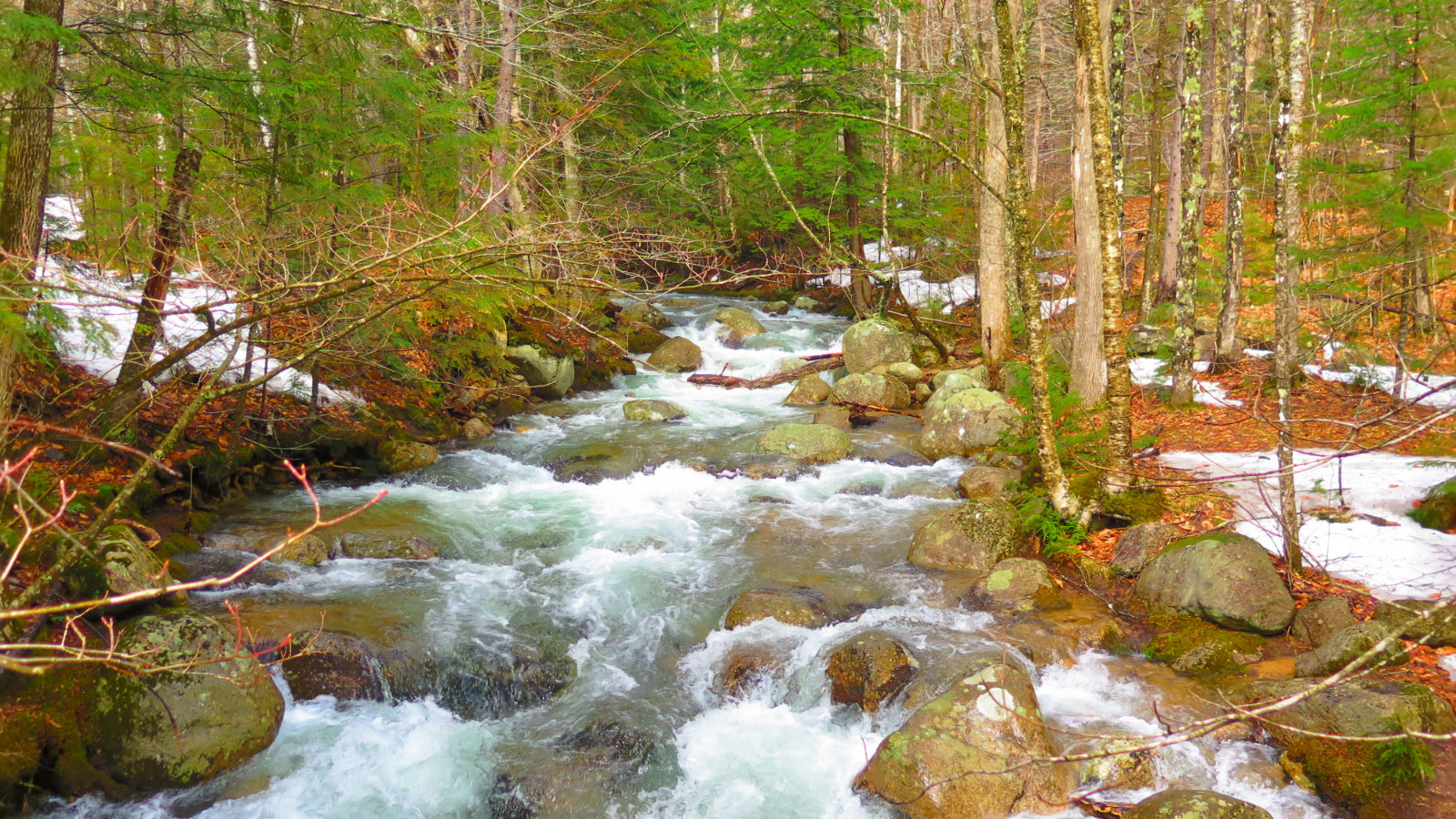
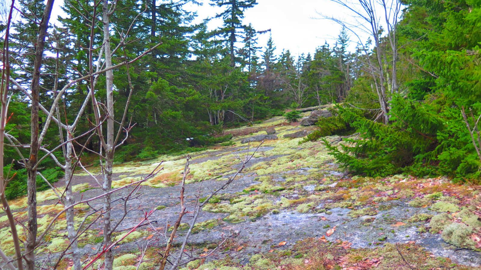
We noted the brook was raging. Wow, what a little bit of spring warmth will do. Glad we didn’t have to cross that bad Larry. But the trail was “bitsa.” As in, bits of this, bits of that. There was snow, there was bare ground. Then there was snow again, and bare ground. That first mile or so was frustrating, because I wasn’t sure whether snowshoes or spikes were a better idea. Resigned to that, we pressed on, and before long, it was snowshoe time.
I wish I could say the trail was either snowy or bare ground. As it was, the monorail was unstable at best. A lot of springtime mashed potatoes. It was a very challenging way to go, with a lot of sliding around, occasional unexpected postholing, and almost anything else that could result in poor footing. A mile usually takes me between 30 and 45 minutes. Yesterday, a mile was upward of an hour. A hard fought hour. (On the plus side, after that early bit of route finding, the trail was pretty much always apparent, and generally well blazed, signed, and maintained — the wilderness trail that felt more like the AT. Whole-hearted thanks to the Wonalancet Outdoor Club!)
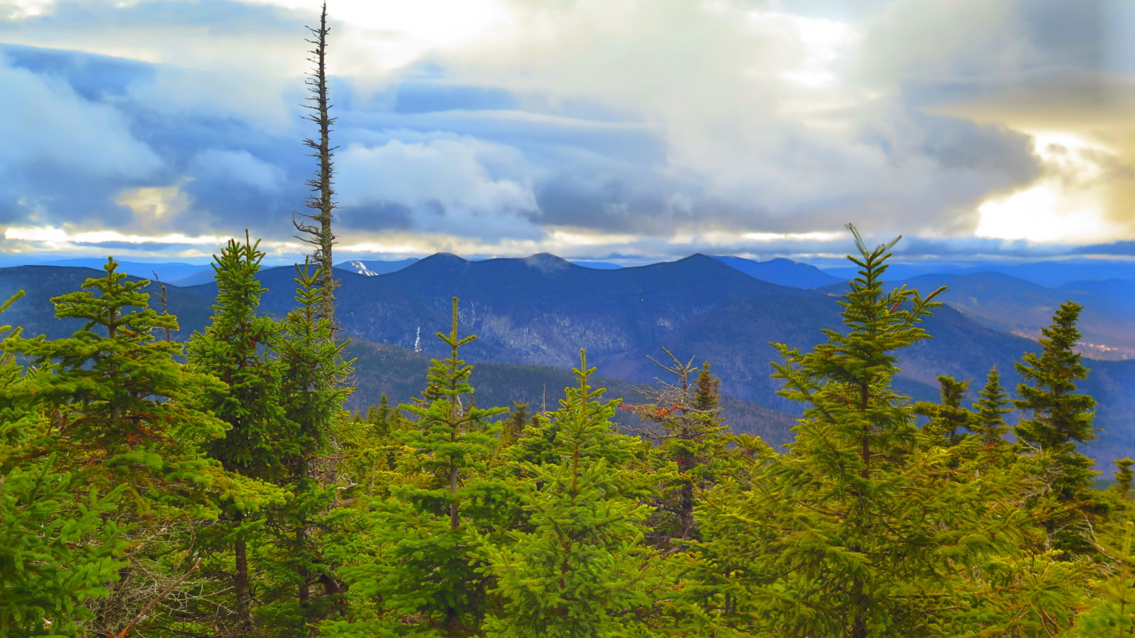
But the Blueberry Ledges! Yes, there were clouds, and the views weren’t perfect by a long shot. But we did have views. We spied Chocoura, Tripyramid, and Tecumseh. I saw the majesty of the Bowl, wherein lies virgin forest, untouched by the woodsman’s axe. And it was still waking from winter’s slumber, but it was good. I never got a clear view last time, so it was a treat even seeing it on a cloudy day in early spring.
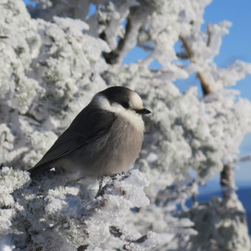
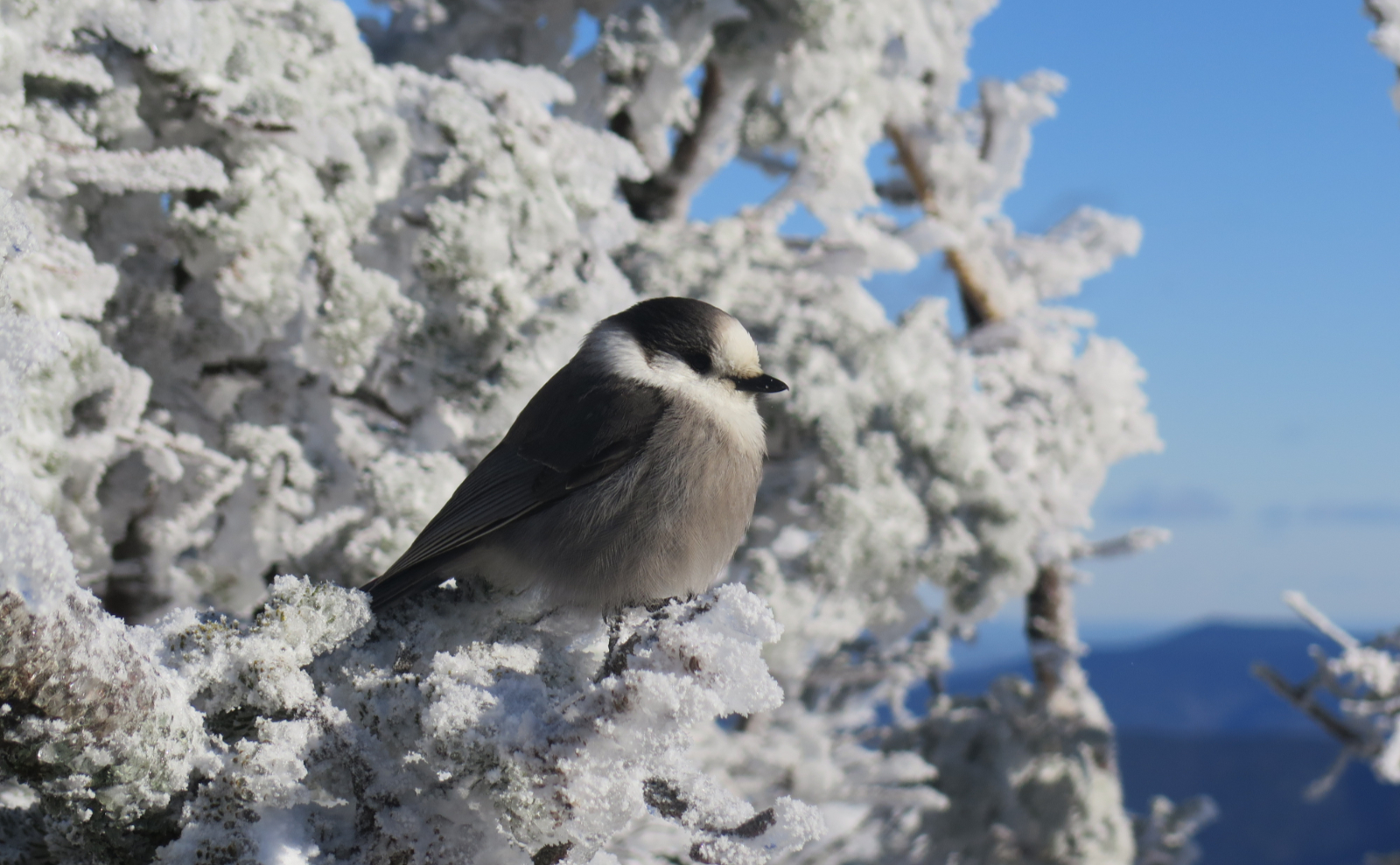
Sidebar: we took a short break on the trail to Whiteface, and a chickadee alighted on a branch by my shoulder. Pro Tip: don’t go for the camera first. Give the critter a few morsels — a reason to hang around. Then go for the money shot. Trust me on this, and don’t ask me how I know. (Duh!)
I’d been worried about two things. We’d brought along Cannon, the wonder dog, who’s a year old Siberian husky. Would he be able to endure a long hike? And what about the ledges? Well, I’d find out about his endurance, but as far as the ledges, that pup powered past. No ice would slow him down. As far as me? I was recalling how swiftly I made progress last time with my ice axe as I flailed my way upward. Note to self…
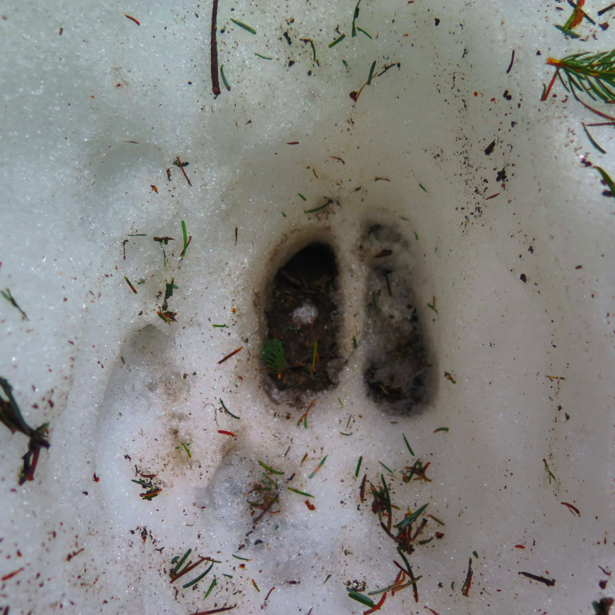
Once on the top of Whiteface, we turned to Passaconaway. On the col, we suffered an additional indignity. A moose had stomped through, postholing the scant sliver of a monorail to smithereens. What had been tenuous traction now became a mess. But we were determined to finish at this point, come what may. And so we sallied forth.
Finally, Passaconaway’s summit. Victory. For me, I have three remaining springtime four thousand footers — the Wildcats, and Tecumseh. We had only a downhill hike to the car. Along the way, we paused so I could don my headlamp, and at that point (around the ten mile mark) Cannon found a spot to rest in the snow. The pup was pooped. But some encouragement, and he carried on.
Down in the flat part — basically the last mile and a half or so — Dicey’s Mill trail was a brook. There were a few dry parts, but for the most of it, we hiked down a running stream. There’s an awful lot of rapid melting going on, and anything that can carry water off the mountain is doing so at the moment. We had to cross the raging brook at one point, using a log as a bridge, and that was sketchy when done by headlamp. (This was the one point where Cannon’s resolve faltered, but ultimately, he was coaxed across.) Heck, it would have been sketchy in daylight, too.
Finally, we saw the houses that marked the end of the trail. In an open field, we gazed upward and saw a cacophony of stars overhead, against a sky that was so velvety black as to appear truly limitless. It was enchanting. My mind got lost almost instantly in the infinite void.
All told, I’m glad we got to go out. Cannon the wonder dog was truly in his element, playful in the snow, living his best life. I ticked two off my springtime list. As has happened in the past, and will no-doubt happen many times again, I had some unexpected Type II fun. The trail was crummy but passable, and tho the views were attenuated, they were still spectacular. We emerged tired and sore, but jubilant.
And as always, I can’t wait to hike that one again…
Nuts and Bolts: From 113A in Sandwich, turn onto Ferncroft Road. After a bit, you’ll see a familiar brown hiker sign with an arrow, some signs saying “No Hiker Parking”, and a field with a trailhead sign. Park in that lot. You’ll have to walk about half a mile to the trailhead proper. If you’re taking Blueberry Ledge trail up (recommended, as the ledges are a bear on the way down, especially if it’s wet) you’ll hike over a short wooden bridge on your way.
If you enjoy reading these posts, consider subscribing. Your email will only be used to alert you of new posts — typically 1-2 times per week. I will not use or share your email for any other purpose without your express permission.

4 thoughts on “Trip Report: Mt Whiteface and Mt Passaconaway”