
Mt Whiteface (4,020 feet). Sandwich, NH. 2020-12-03 (Thursday.)
Via Blueberry Ledge Cutoff, Blueberry Ledge Trail, Rollins Trail, and Dicey’s Mill Trail. Approx 10.5 miles.
35 dF at the trailhead, low 40s in the mid-elevations in protected areas, and in the mid-30s at the summit. Winds were negligible in the trees, perhaps 2-4 MPH in exposed areas, if that. Unbridled sun throughout the day, with a thin high-level haze. An exceptionally clement, bluebird day.
Trailhead: 0900. Summit: 1220. Car: 1530. 6 1/2 hours.
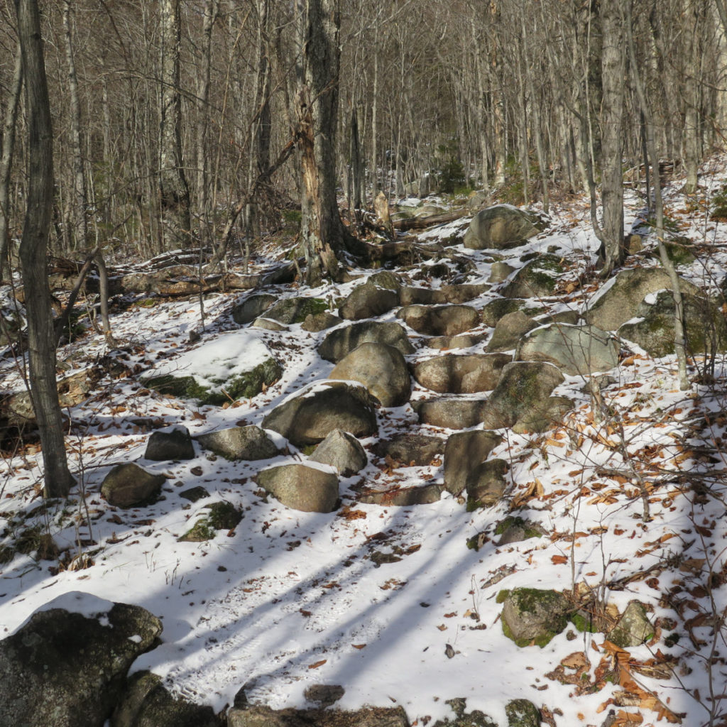
Stone Stairs, Scary Scrambles!
I really should work harder at that “get out of bed early” thing. Today was an object lesson in what kinds of things you can miss by chronically coming off-trail in the dark. Aside from that, I was, for the most part, hiking solo today, which is actually a first for me on this mountain — I didn’t meet anyone to hike out with until I was almost off the mountain. Hike the first, I met a group of college professors just the other side of Whiteface’s summit. Hike the second was with a friend and Cannon, the wonder dog. And hike the third was with a different friend. Today being solo, I found myself looking around a lot more, and distracted by conversation a lot less. That made it a much different mountain this time around. Vive la différence!
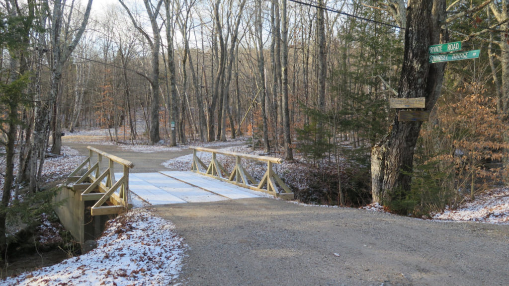
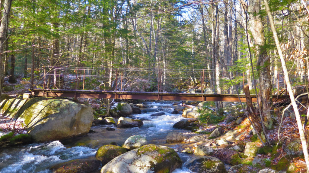
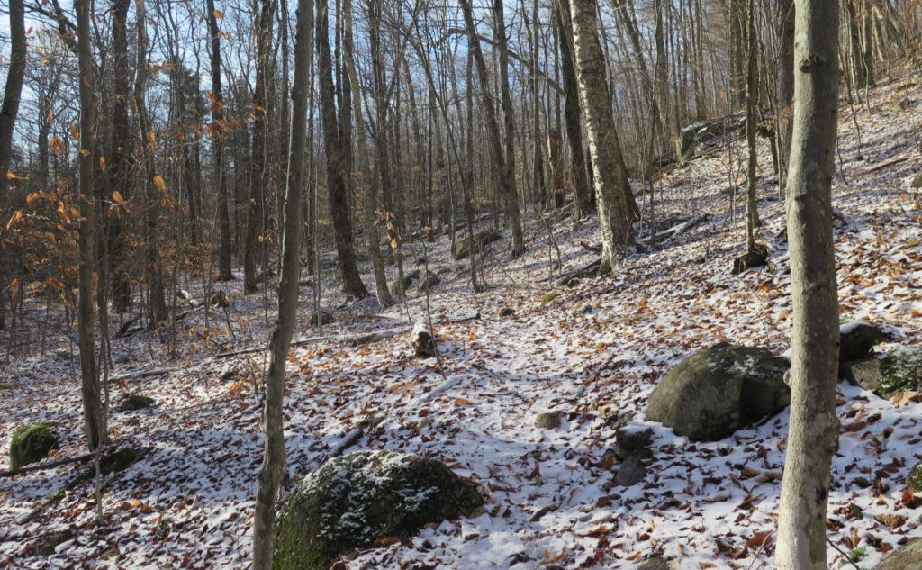
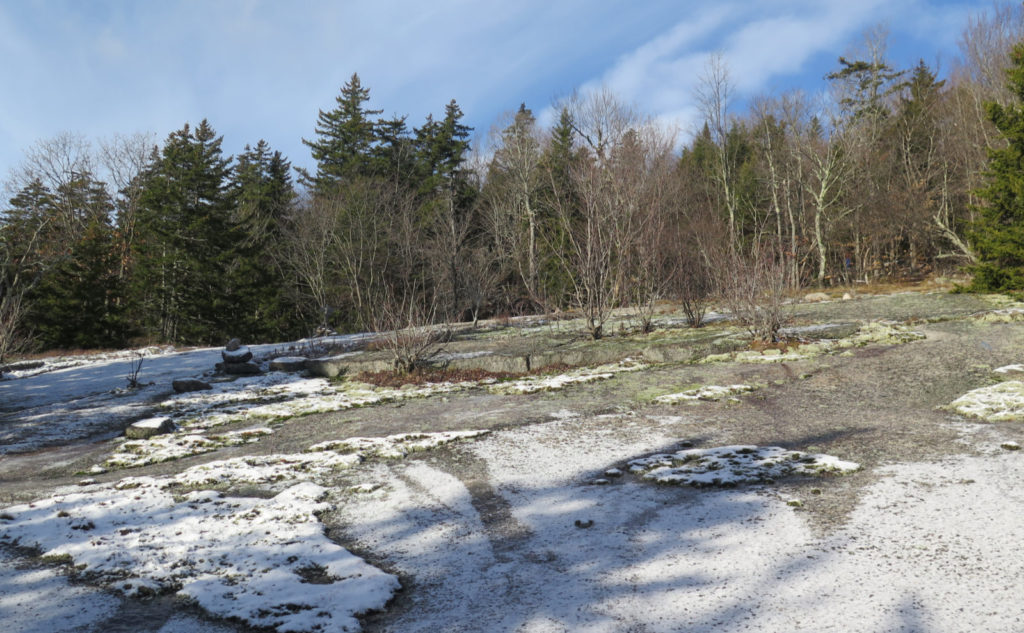
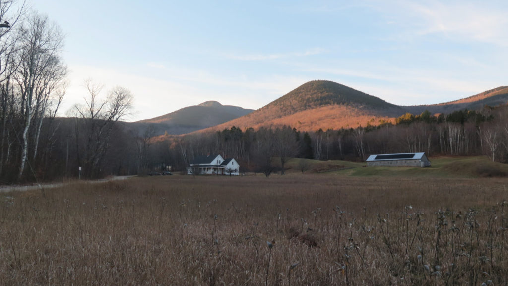
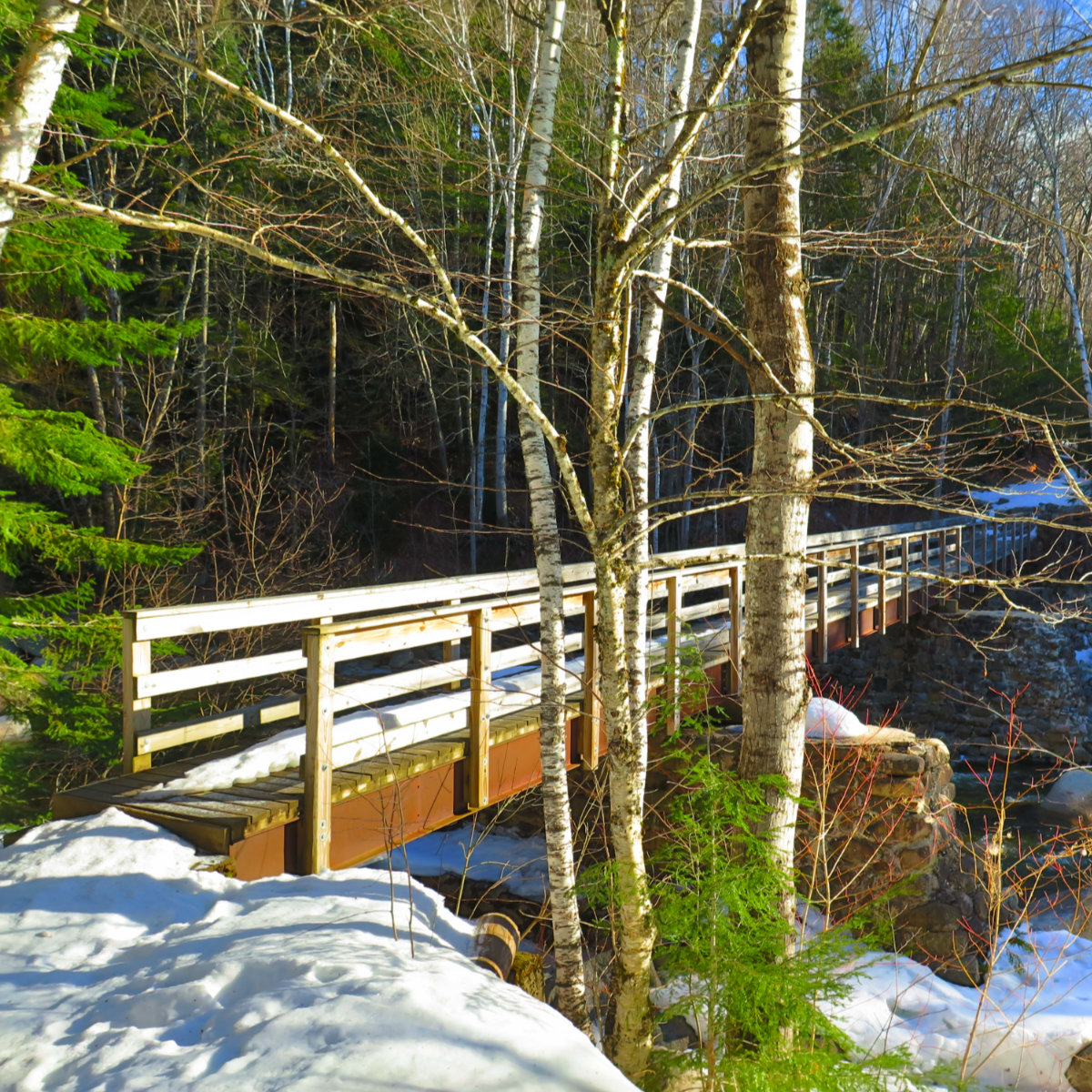
I got going with the morning sun cooking off a thin dusting of snow that had fallen on the fields. Driving in, I was treated to occasional views of the mountain, and now, walking down Ferncroft Road to the trailhead, those views were that much closer. Excitement was building! I got to the wooden bridge, and then the magic started.
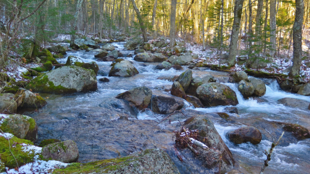
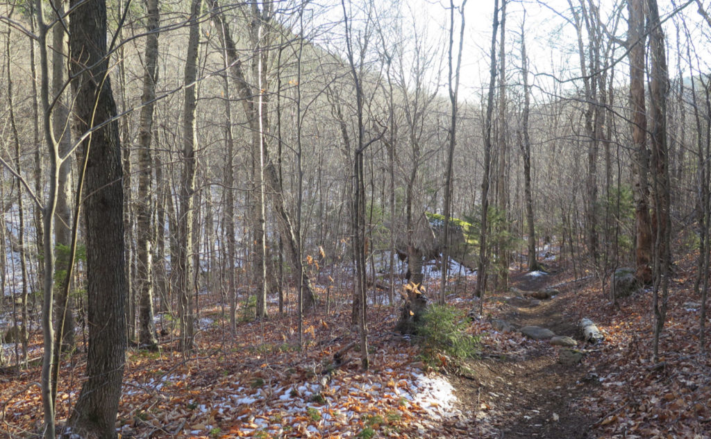
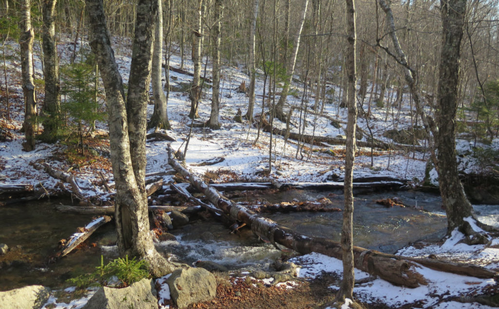
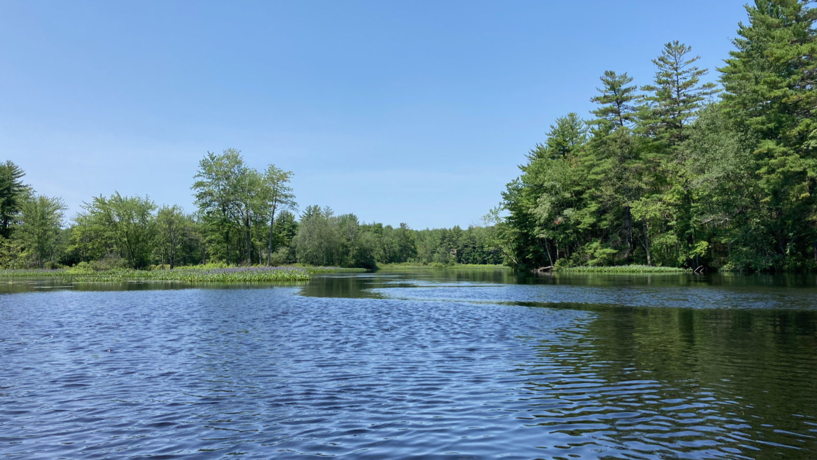
The first mile or so passed easily, with the bubbling of the Wonalancet river keeping me company. The rains we got this past week had the river quite swollen. Happily, I didn’t need to cross the river yet, and so I pressed on.
But first, a quick sidebar about water crossings…
Yesterday, I’d planned on hiking this mountain, but from the McCrillis trail. And that required a crossing of the Whiteface river. I’m not exactly sure what the local totals were, but all of New Hampshire was forecast to receive 1-2 inches of rain from a storm earlier in the week. I know where I was in the southern end of the state, yep, we certainly got rain in no small measure. (And given the drought we’ve been experiencing, I say “bring it on!” We most definitely need the rain.) All evidence points to the Whites getting their fair share, too. And so, when I got to the river crossing, anyone can imagine my dismay when I was confronted with a raging torrent, and no clear passage forward. You could very rationally argue that I should have known better, but there it is. I had to content myself with the tried-and-true “well, a bad day on the trail is still better than a good day at the office” as I turned back for the car. (And this was after no small amount of noodling around, trying in vain to find a sensible way — indeed any kind of way — forward.) So this is to say, watch the forecast, and remember what happened as far back as a few days ago. It can have direct, material effects on the success of your outing. (And if any guidebook mentions a crossing might be tough at high water, take it seriously. That might just be telling you that a smart move would be to plan a different hike.)
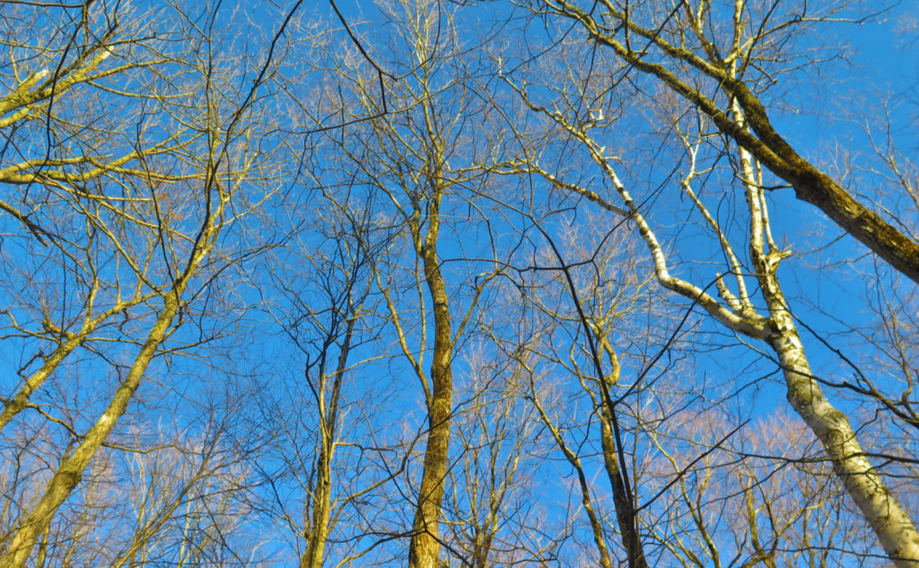
Today wasn’t hampered in the slightest by that kind of silliness. Indeed, today was an utter “wow, that was just freaking awesome!” kind of day. Let’s start with the weather. It was clement. It started out cold, but warmed up quickly, into the upper 30s, and even into the low 40s. There was no wind, and no clouds of note. Hello Mister Blue Sky! Holy unbridled sun, Batman!
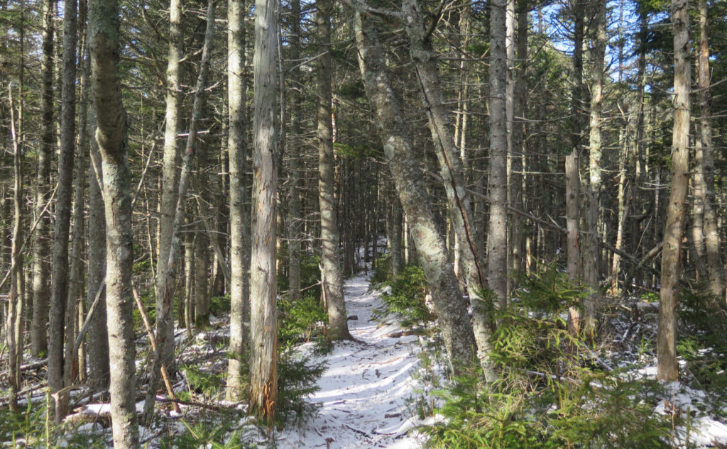
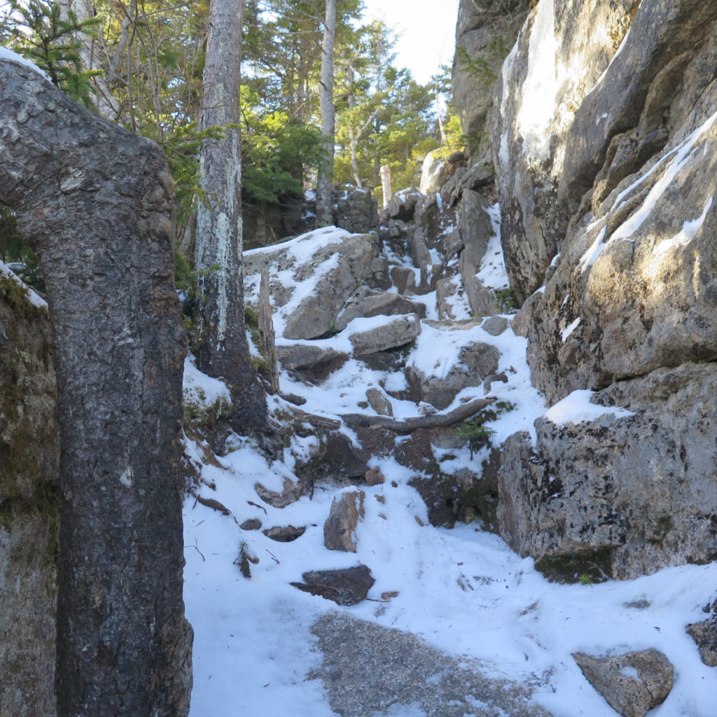
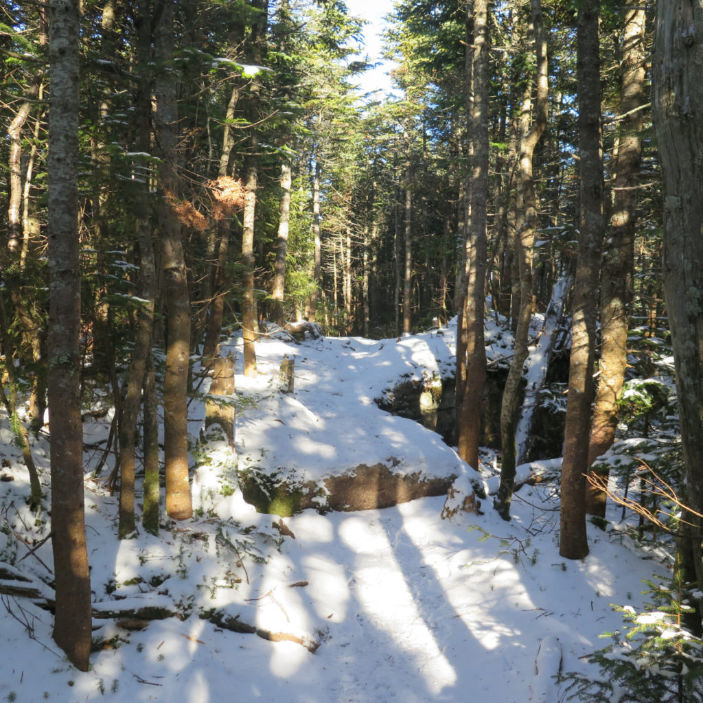
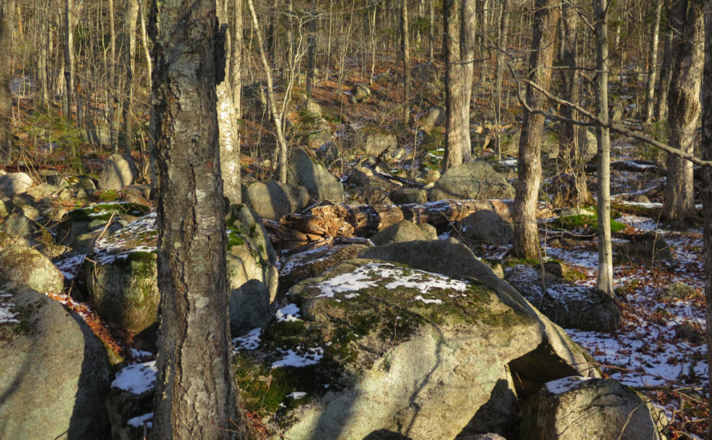
And the trail? Well, for the most part, it was quite decent, although that snow “dusting” was a bit more of an issue higher up. As far as basic trail maintenance, I have to give total props to the Wonalancet Out Door Club. They do fine work keeping their trails in tip-top shape. As I ascended, the dusting was more persistent, more slippery. There’s a lot of leaf litter on the trail, and combined with the flakes… it wasn’t “slippery” per se, but I did feel a slight give with each step. Just a touch of lost effort, and I might have called the conditions “slightly greasy.” But it wasn’t even slightly horrible; just a bit off of “pretty good.”
I got to the stone steps that heralded many more, and started a much steeper ascent. It wasn’t technically hard, but it did get me breathing much quicker, and I was feeling a bit of a burn. Which isn’t unwelcome, if you, like me, appreciate the visceral sense that you’re making an effort. I don’t mind a trail that gives up the goods easily, such as Waumbek or Cabot. But at the same time, if you’ve got to fight a little, it gives you something the easier hikes don’t. But just because Cabot and Waumbek feature easy trails doesn’t mean Whiteface can’t. To that end, there’s a nice, easy section just after the last of the almost unbroken chain of stone steps. And it’s marvelously bucolic. The forest is quite a bit tighter in that stretch, but at least to me, it was delightfully serene.
Sometimes, a hike breaks down into neatly defined chunks
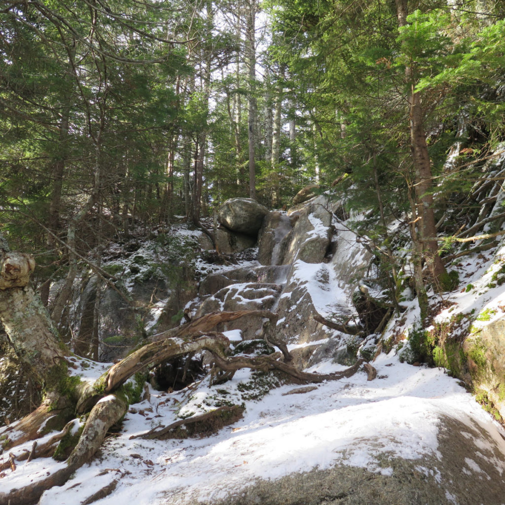
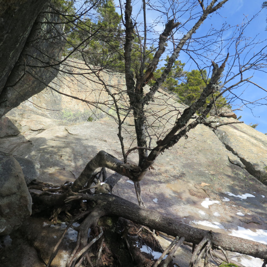
I can describe this hike in thirds, where the bottom part is an easy walk across leaf litter on easy grades. Followed by the stair climb. And that last third? Hoo-boy! They don’t call this the Blueberry Ledge Trail for nothing. Higher up, you get to an easy ledge, reminiscent of the upper bits of Welch-Dickey. But that’s just a side-show. You don’t know the definition of “yikes!” until you get to the last bit before the top. And yet, of all the times I’ve been on this trail, I still get excited. I’m still jazzed to be there. It gets my pulse to quicken, in a good way.
There were wooden steps at one point. Today, there are the mounting holes as the only remnants, leaving you screaming “why?!” in anguish as you clamber up a steep ledge. Falling is everything that’s on your mind. And then there’s more scrambling, more treacherous ledge, more “who came up with this crazy trail?!” I don’t remember ever having an easy time of this bit. It’s a total thrill, to be sure. But it’s not easy, and falling is always foremost on my mind.
The big question is “was there a view?”
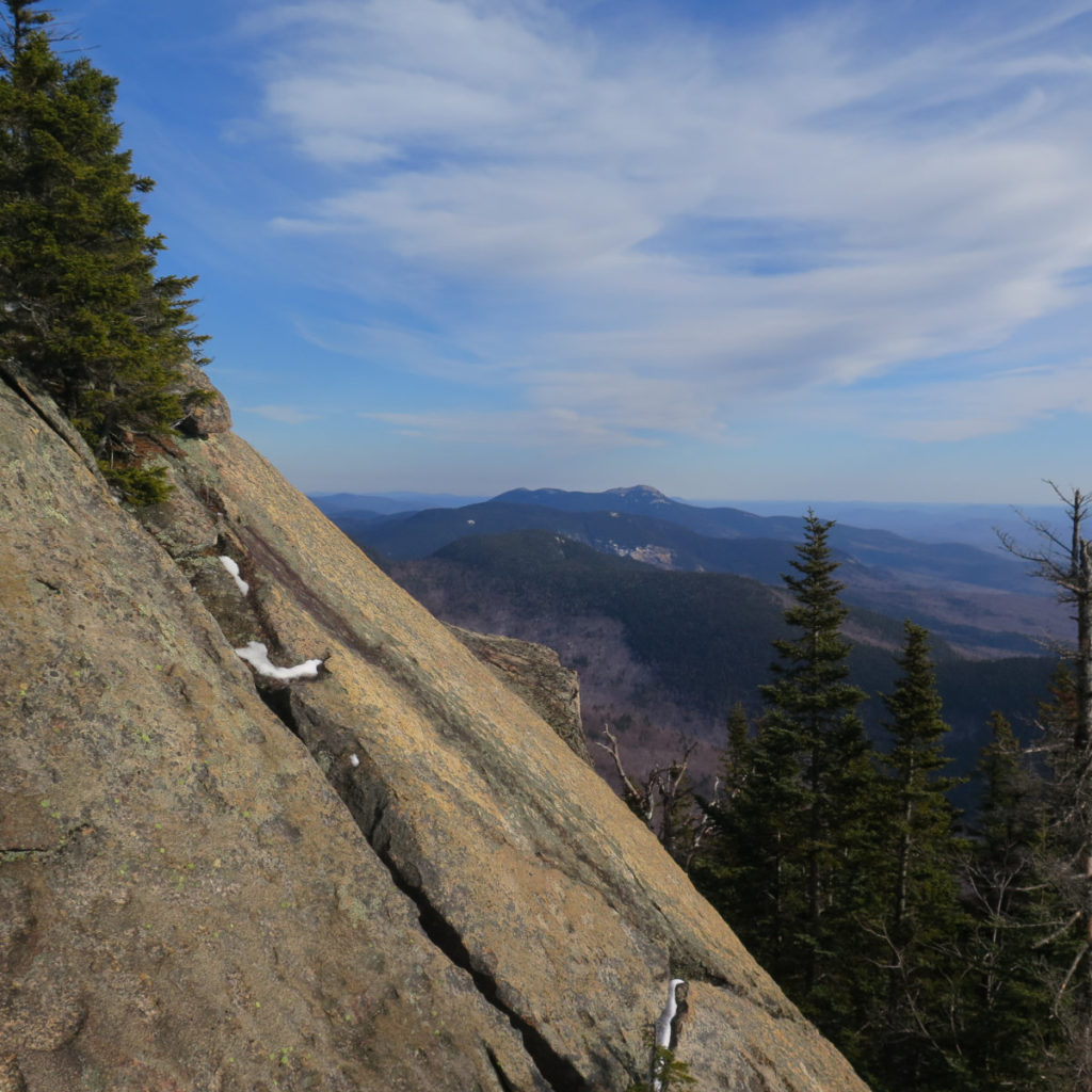
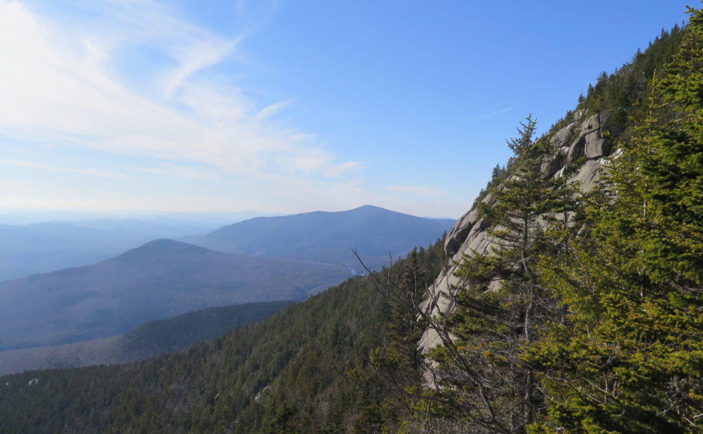
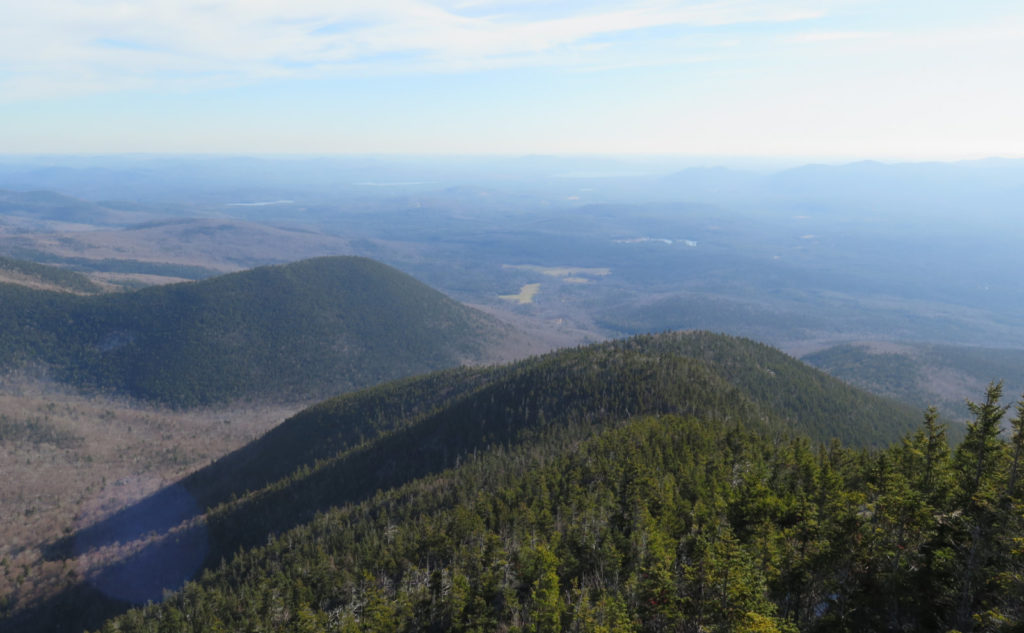
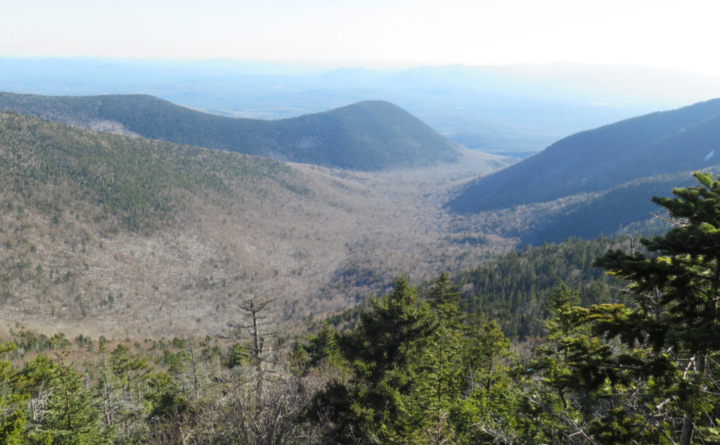
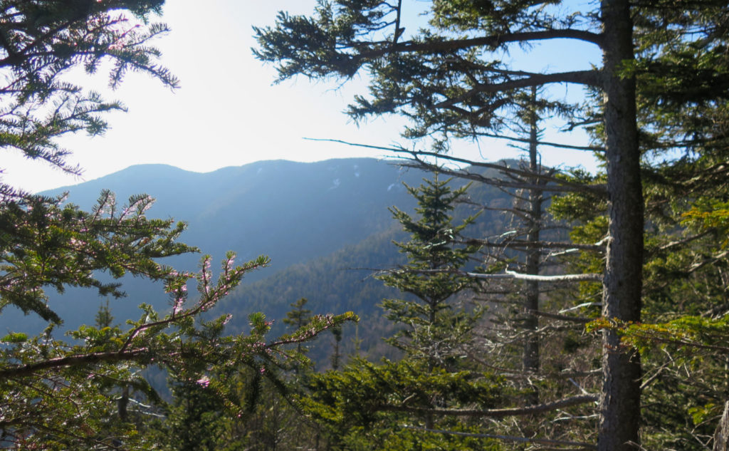
In short? An emphatic “Yes!” For all that struggle, it felt like every few minutes, I’d be rewarded with yet another amazing view. Much of it trended toward either Sandwich or Chocorua. More than once, I could look down into the depths of The Bowl. (That’s part of the minuscule percentage of the Whites that didn’t get logged into oblivion. I can’t even think of those woods without thinking about how precious they are.) There were views of Mt Wonalancet, and the SE ridge of Whiteface. It’s really neat, how on a clear day, you get a very clear look at the lay of the land, and how it influences the hydrology. You wonder why the streams are so full? There’s your answer! Today, I saw out to the lakes. It was just phenomenal.
I passed the junction for the McCrillis trail, and then shortly after, the Kate Sleeper trail. This is one I’ve been eyeing for quite some time, and starting out this morning, I was giving consideration to possibly dashing across. But finally I got there, and realized it just wasn’t in the cards today. I did, however, content myself with a short jaunt, just a few dozen yards down the trail, to get a taste of what it’s like. And that’s when the trip got epic. I spied some paw prints in the snow, possibly a snowshoe hare, but a rabbit nonetheless. Wabbit Twacks! Cue the Wagner! Visions of Fudd, with his spear and magic helmet, Bugs as the diva, complete with long golden braids. And the horse, because packing those diva-esque curves into Bugs’s lanky frame just wasn’t going to happen. Yeah, I was probably getting a bit tired at that point.
Finally, a last push and I was greeted by a tiny cairn at the side of the trail, just on top of a small ledge, hidden by a tree. But there it was, the summit. Better yet, I didn’t have to rely on the “if you find yourself going down by a lot, you’ve probably passed the summit”.
How do you get down? Out and back?
Thankfully, it’s not every trail, but sometimes you read in the guidebooks that a trail is much better taken one way rather than another. Generally, sketchy trails are best taken on the way up, because down-climbing is fraught with peril most times. And in this regard, Blueberry Ledge totally fits that bill. I know someone has done it, but honestly, I can’t imagine what it would take for me to think it’s a good idea. Many handholds are better grabbed from below. Almost anywhere, a slip would mean a recovery, or a very nasty rescue. I don’t recommend anyone try this trail in the reverse.
And here’s where I take another sidebar, about the value of turning back. I bumped into a guy, just below the ledges, who had passed me down in the lower stretches. He’d gotten to the ledges, found them just a little more icy than his ‘spikes could support, and decided to call it right there. Sometimes having a companion near can make the difference between scrubbing a hike and pressing forward, so I made the offer, but he was done. And I’m fine with that. We both agreed that the mountains, having been there for about 12,000 years, would likely be there for a few more. Always hike your own hike. If conditions are beyond your comfort level, turn around and come back another day. The mountains will wait for you, and it’ll be all good. Most importantly, staying safe means being able to hike again and again.
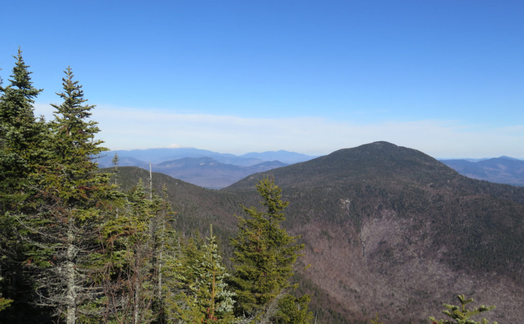
But getting back to the question… probably the most reliable way is to hike around the rim of The Bowl, and down Dicey’s Mill trail back to Ferncroft. One could probably make an extended outing to Walden trail, and down Old Mast Road. But the shorter route is down Dicey’s Mill. Which is what I did, and I’m so glad I made that choice when I did. That said, hiking down from the summit isn’t easy to start with. It’s very rocky, and there’s a lot of clambering down before you get to what you might think is the rim of The Bowl. There were moments when it felt as endless as the stone steps coming up.
But once I made the transition from Whiteface to the rim, hiking became a lot easier, and I could make time again. It felt like half an hour, but it was probably 45 minutes, and in all that, there wasn’t much climbing. Then the signs for the junction materialized: to the left, Passaconaway’s summit. To the right, the car. I went right. The second summit will wait for another outing. I’m perfectly fine with that.
Just setting this out there, because it’s been tumbling over and over in my head. But somehow, I get the sense that the mountain is “guarded” in a curious way. Think about it: you hike up from Downes Brook, it ain’t gonna happen in high (heck, even medium) water. Ditto for McCrillis trail. Blueberry Ledges guard that approach. You can come over fairly easily from Passaconaway, but you’re hiking over another mountain to get there. Same if you take Kate Sleeper, from Tripyramid. So yeah, this is one that doesn’t give up the goods even remotely easily. And all that for a peak that’s on the list by a measly 20 feet. Huh. You’d think Smaug was keeping all his gold somewhere.
Hiking down, initially it was somewhat steep. That feeling when you keep having to slow yourself down with every step. Your toes get mashed in your boots, and the fronts of your thighs start to burn. But in time, the trail eased. And then I got to the old birch log that was the bridge across the Wonalancet river. That one where a roaring river scared the crap out of Cannon the wonder dog. And honestly, I didn’t like that crossing either. Today, the river was swollen and to some extent rocking and rolling. But far more sedate was its burbling than when it was roaring that evening with the petrified pup. Hey, I’ll take my victories wherever I can. And so, I crossed, my entire mind focused on balancing and not falling in the drink. Wow, that would have been a tad inconvenient. And cold. On the way across, I marveled at the gin-clear water. You only get that in the Whites.
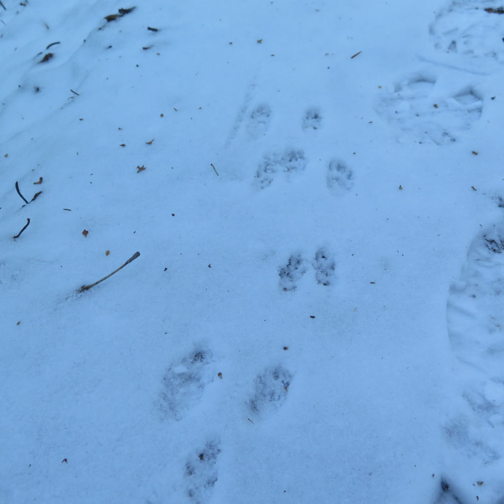
Just before the bottom junction of Tom Wiggins Trail, a fellow came out of the woods, who’d been tramping around the woods in The Bowl. We chatted a bit on the way down, which was nice. Even nicer was the rustling we heard just ahead. A big dark shadow resolved itself into a large bull moose, crossing the trail, only to disappear before I got my camera out. Drat. How a gigantic animal like that can disappear in the forest, as if it were no bigger than a squirrel. But hey, even if the picture you take is with the camera of your mind… yep, I got to see a moose today! I took a picture of the hoof print, only moments old, and posted it to my iNaturalist account. Seriously folks, if you haven’t already, get the app, create an account, and help science. It’s easy, and its free. The good feeling you get from helping push humanity forward? Priceless.
We broke out of the woods, into the familiar farm. I’m forever thankful that the landowners open their property to hikers. But especially that farm… I thought back to the night I emerged, looked up, and gazed millions of light-years into the depths of infinity. Wow! We stopped for a moment to chat with a guy who was renovating one of the homes along the road. He’d been hiking those trails since he was a teen, and wow, that was neat hearing a couple tidbits of his experiences.
I got to my car thinking that I’d made a really good choice today. I wanted to finish my autumn 48 on Passaconaway — ever since standing on Square Ledge, and viscerally feeling its massive hulk, I’ve wanted to just hike that mountain, and hike just that mountain. So while it would have been easy enough to add a second summit to today’s hike, at the same time, it was better for me to leave it for another day.
Instead, I got to concentrate on Whiteface. I got to answer the question of why the loop feels so darn hard. It’s not hard, but two summits together with no small amount of elevation gain, and after all the ledges and whatnot, makes for a long day. I think it’s better to separate them. And to that end, I’m really looking forward to next week, when I can lavish similarly singular attention to Passaconaway. I can’t wait.
As always, stay safe out there.
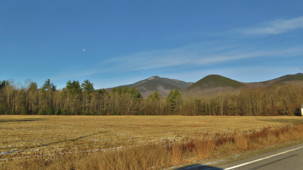
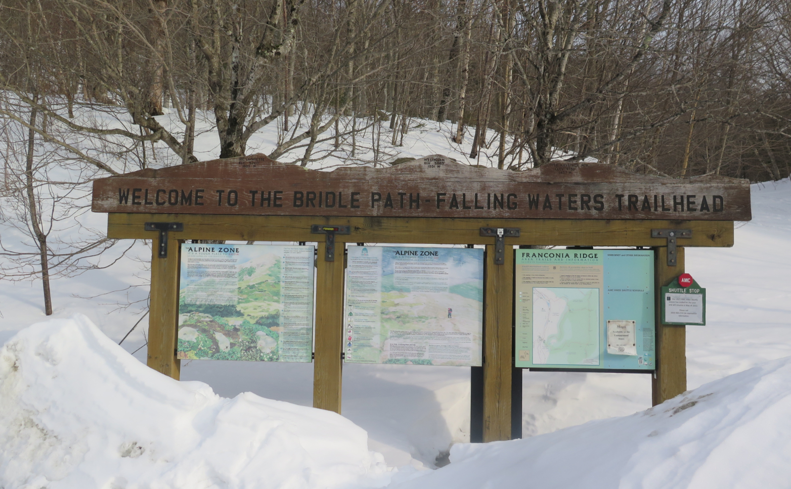
Nuts and Bolts: From 113A in Sandwich, turn onto Ferncroft Road. By the end of the road, technically you’re in an unincorporated village, but practically, you’ll be more in Tamworth than Sandwich. It’s a long dirt road, and nearer the houses, you’ll see a lot of No Parking signs. After a bit, you’ll see a familiar brown hiker sign with an arrow, some signs saying “No Hiker Parking”, and a field with a trailhead sign. Park in that lot.
You’ll have to walk about half a mile to the trailhead proper. If you’re taking Blueberry Ledge trail up (recommended, as the ledges are a bear on the way down, especially if it’s wet) you’ll hike over a short wooden bridge on your way. But the signs leading you to the trail (and not down someone’s very long driveway) are easy to spot and very helpful. Follow your nose.
6 thoughts on “Trip Report: Seeking Solitude on Whiteface”
Fantastic trail report and pictures as usual.
Thanks! Different tone to this hike. Not going for the two-fer made all the difference I think.