Mt Hale (4,054 feet). Bethlehem, NH. 2021-02-18 (Thursday.)
Via Fire Warden’s Trail. 9 miles round-trip.
25 dF throughout the day. Winds were nonexistent. In the clear, under cloudy skies. (The same mostly held true for visibility on the summits of the Presidential Range, as of mid-afternoon, though winds and temperatures were almost certainly a bit more stern.)
Trailhead: 1100. Summit: 1430. Car: 1700.
A Hard Hike? Hardly!
I’d originally planned on hiking Jefferson. And as so often happens, this morning, I couldn’t get out of bed on time. Not for love or money… it just wasn’t happening. Heading to the mountain, the realization that I wasn’t going to have enough time to get back to the car even an hour after twilight, and knowing snow was forecast… it made progressively less sense to keep with that plan. So I thought about another trail. Hale was on the list. And so now I have 35 winter peaks done, even though Jefferson remains outstanding.
I likely won’t get the winter list done this season, but realistically, I’m down to as few as 9 more trips to finish. Given the fickle nature of winter… who knows when I’ll be done. But there it is. If a broken ankle taught me anything, if hiking through pouring rain, endless mud puddles, and being turned back by swollen rivers, it’s resilience. I remain sanguine, because hey, getting outside is the goal.
The fire warden’s trail is a bit of a secret handshake. In winter, it’s not hard at all to find, but the weather has its obvious way of thinning out the herds. Throughout the warmer months, you need to know where to look. And so in keeping with the sense of it being there for those who truly seek it, nothing more substantial than this will be said regarding its whereabouts. But for those trampers who are given to wander, the solitude is amazing.
What about the trail itself?
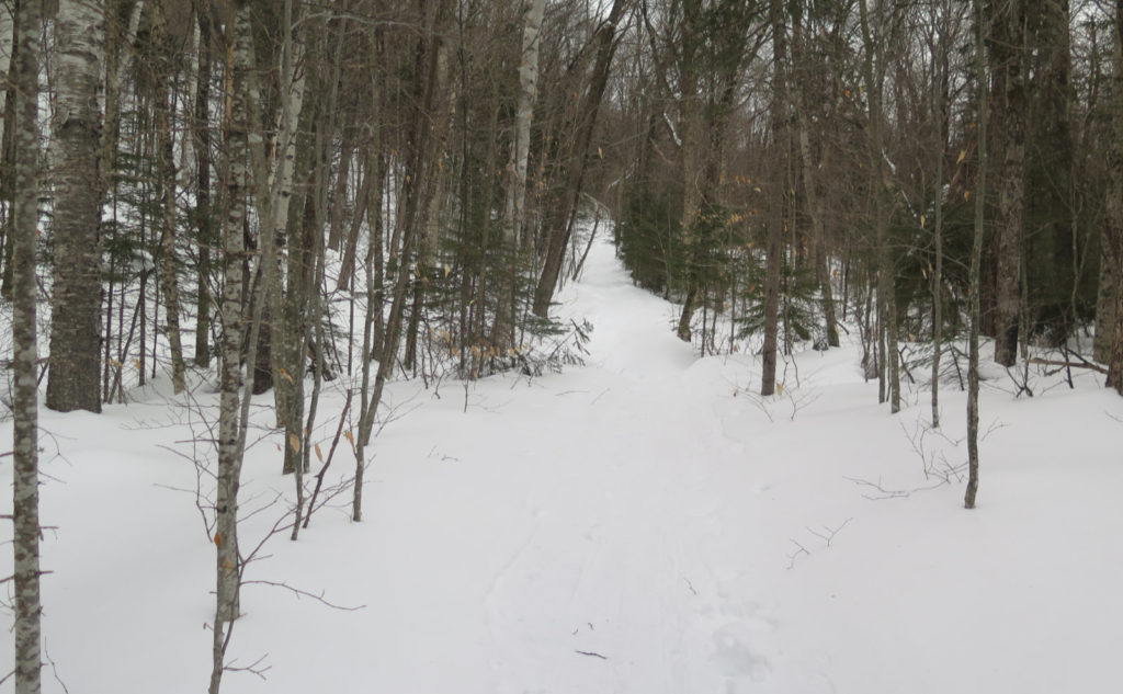
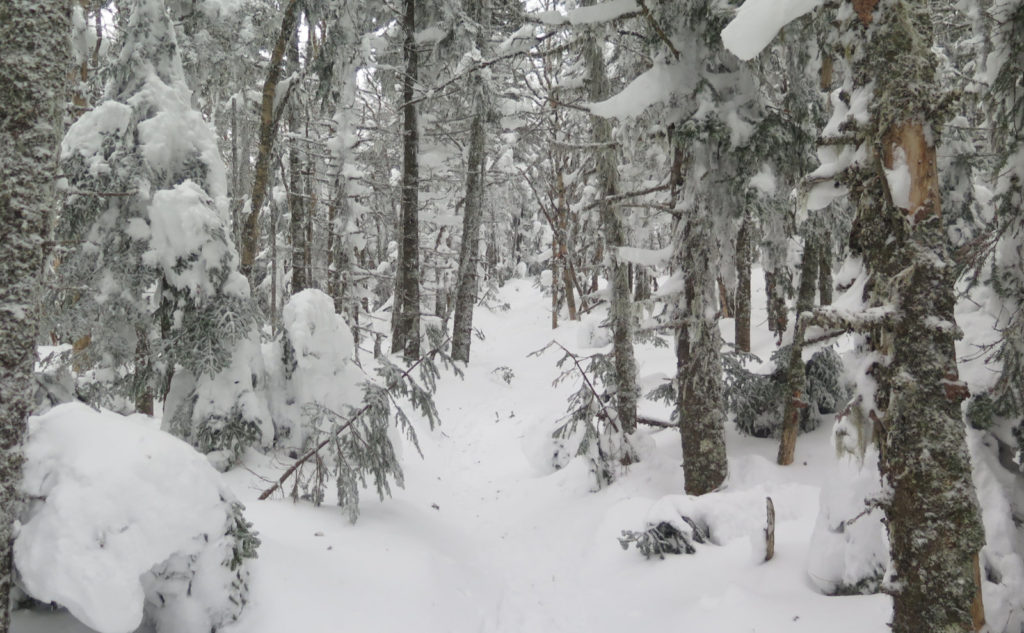
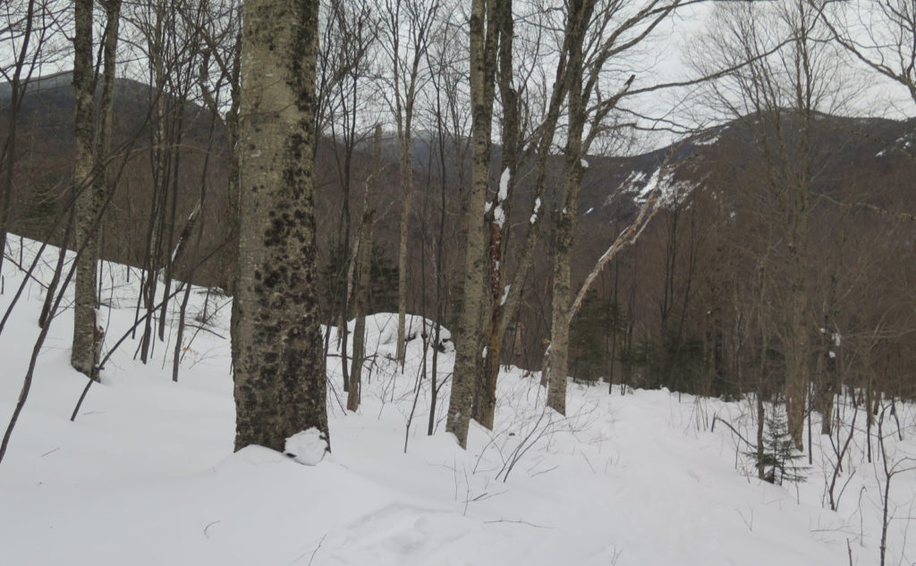
The recent warm-ish weather did wonders for the monorail. That the trail is also excellent for skiing no doubt helped, and indeed, I did pass a couple guys doing just that. I made excellent headway on trails that were utterly solid, almost step-for-step from the car to the summit. It was only in a few places, and there only for a few paces, that the footing was compromised. Down low, the offender was a post-holing moose. Folks, yes, you can bare-boot it, but please, do the right thing and wear snow shoes. We have hares that are snow-shod, we’ve put men on the moon, so surely the scientists can engineer a snowshoe moose. At least this one did the right thing and left his exhaust off trail, well into the trees. Hooray for little victories.
Up on high, around where the old oil barrels are, there were some boot prints. I can only think it was because the trail gets a tad squirrely in a few places, and bare boots made more sense for someone. Just about everywhere else, though, the trail was this majestic, pristine, perfect monorail. Oh my, the stuff dreams are made of. I doubt I will ever see a trail so nicely set up. Every step was pure bliss.
Anything to be seen up there?
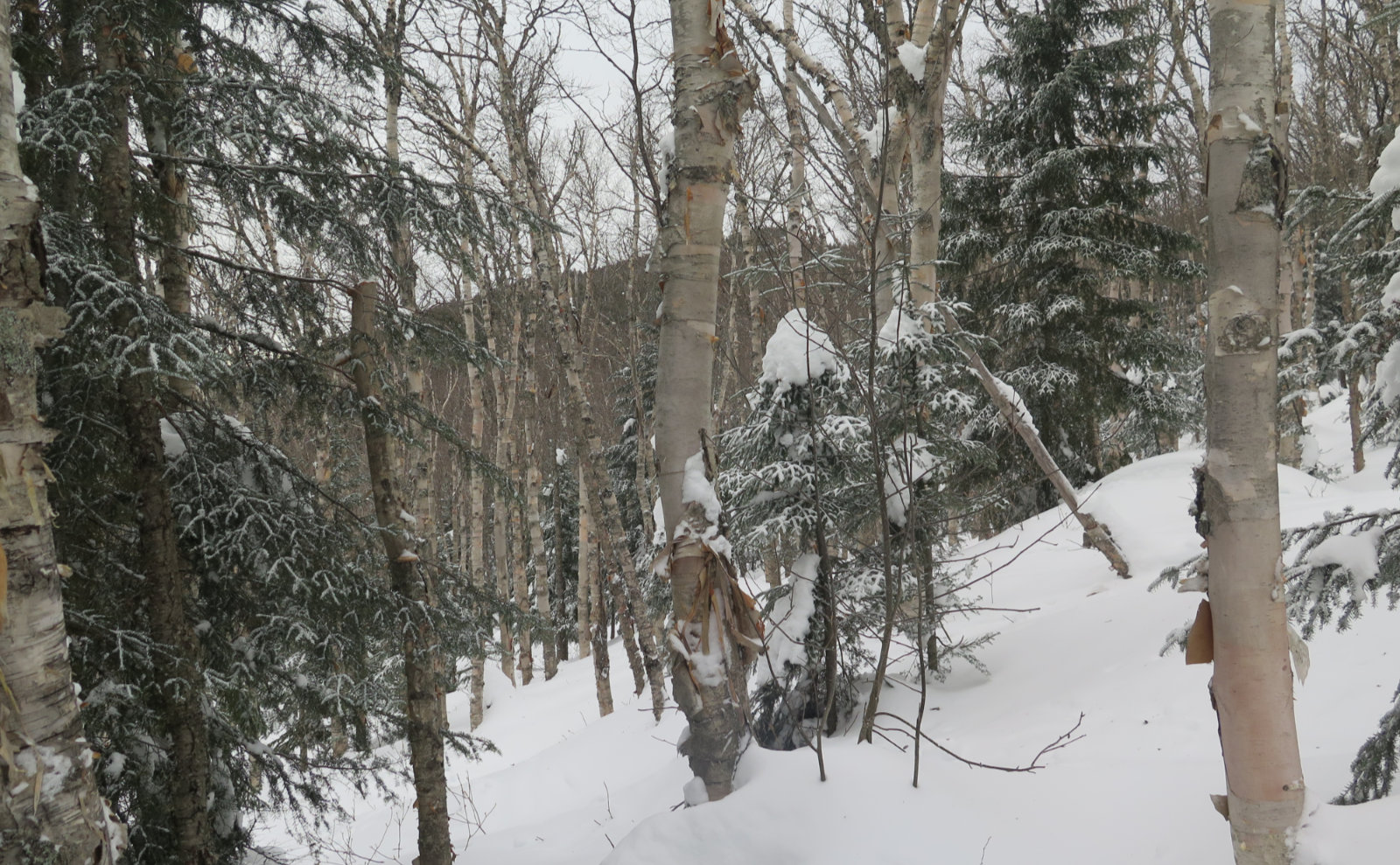
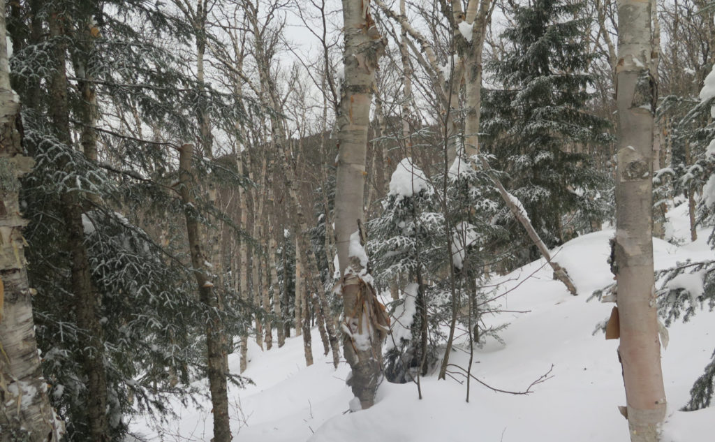
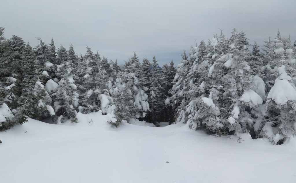
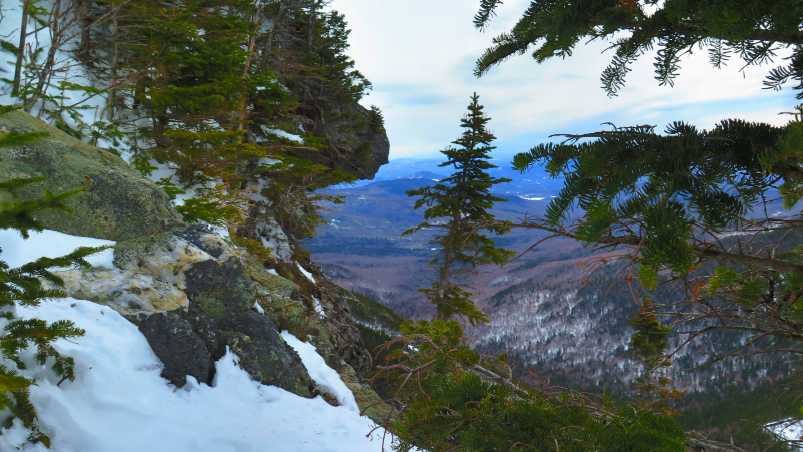
The clouds were a thing. Once again I hiked under very flat light. But that said, the trees were quite pretty. There was snow everywhere, and as I ascended, the trees were less sylvan and more like marshmallows. But before I forget, wow, the birch glades. Every so often, evidence of massive fires at the turn of the century (19th to 20th, not twenty-odd years ago) laid itself bare with these amazing birch glades. They afford good browsing for various critters, and on that score, there was much nattering about.
While I hiked, two things caught my attention, both flying overhead. One was the squadron of A-10s. Noisy. I get it, they have to train, and where they come from (the Springfield, MA area, primarily) has very congested airspace. The Whites offer a place to cut up the sky without the risk of inadvertently running into a passing 747. But still, noisy. And I think of the past four or five hikes, they’ve been a constant throughout. I’m given to wonder if the skies over the Atlantic aren’t as empty.
What else was flying overhead?
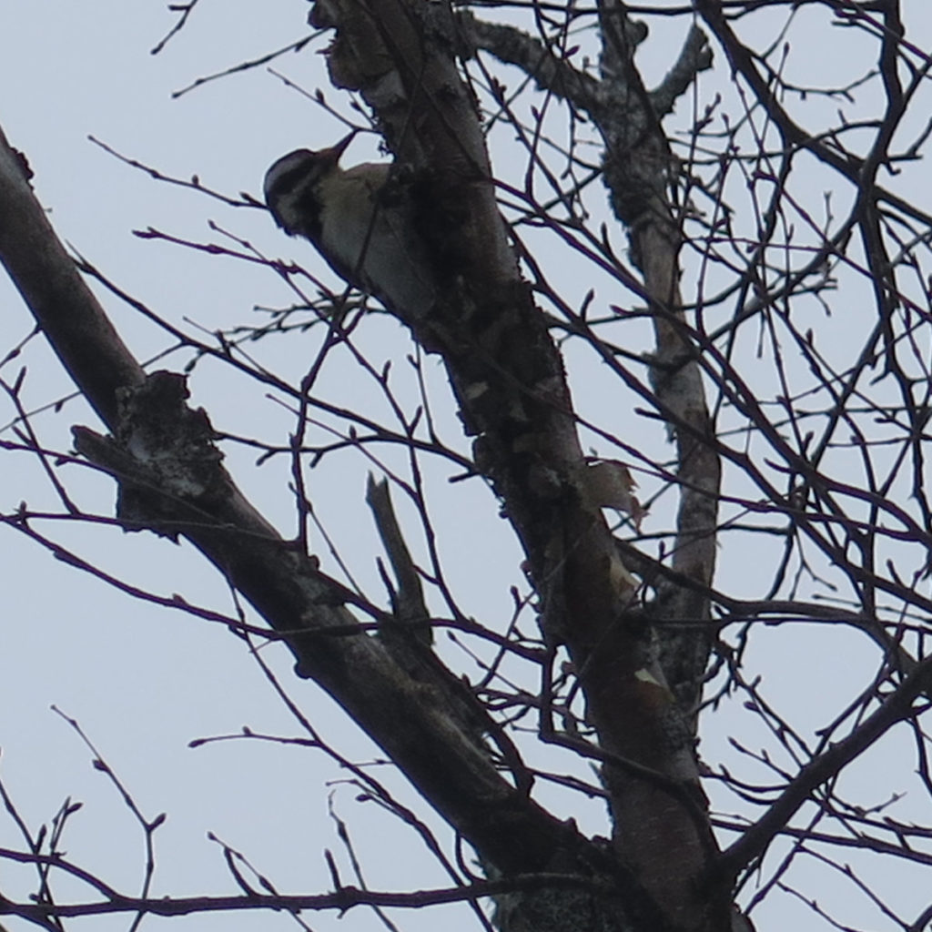
The noise I found more interesting, though, was the tap-tap-tapping of sapsuckers. A variety of woodpeckers, they peck the birches, seeking… (wait for it) …sap. Oh wow, all afternoon, the sapsuckers seeking sustenance. All over the place. Suddenly, there came a tapping. As of someone gently rapping… let me see then, what thereat is, and this mystery explore… Unfortunately their plumage, that they were back-lit, and high up in the trees made them a touch difficult to find, but I did lay eyes on a few here and there. Given how many were out, it wasn’t terribly hard.
For those who didn’t know, birches are a successional species. When the forest is disturbed, as by fire or the woodsman’s axe, they’re among the first to take root on the rough and unready ground. And in so doing, they bring order back to the forest, and nurture the conditions by which other species can flourish. So is the forest rejuvenated. But at the same time, birches can soldier on for centuries. Hence we get glades that captivate us. Note many of the trees are pretty hearty and hale, having grown to remarkable circumferences. Nice.
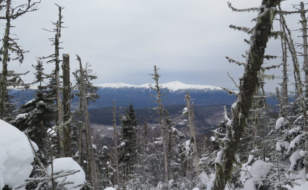
And along the way, those glades afforded slightly compromised, but still very nice views of the lands beyond. Up near the top, I spied Washington and its adjacent peaks, and quite clearly at that. Those who say Hale is viewless don’t know what they’re talking about. You just have to look, and be prepared to have a view from somewhere other than the summit, that might be attenuated by a few trees.
The goal is to return safely, but reaching the summit is nice, too.
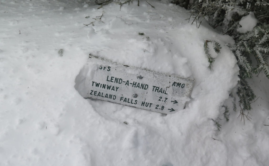
At the summit… well, it’s Hale’s summit. For me, it’s a nice one. Understated. Quiet. A nice place for a picnic lunch and perhaps a nap if it’s warm and sunny out. Today, the stone marking the foot of the stairs leading up to the warden’s fire tower was well and truly covered over with snow. I took a quick few steps down the Lend-A-Hand trail, just to see how it looked. And then thought I’d have bagged Zealand if I’d only gotten out of bed a tiny bit sooner. Oh well. Next time. (And yep, that trail is a good one.)
I turned back, and made good time to the car. In front of me was the mass that is the Peak Above the Nubble — for a Hundred Highest aspirant, that one’s on the list. I spied North Twin, and at times, looked over the towns to the north. As easy as it was to ascend, the trail was even easier on the descent, and so I made exceptional time. Before I knew it, I was back at the car, heading home with the last vestiges of daylight. And thinking at the same time, I was leaving home once again.
As always, stay safe out there.
Nuts and Bolts: In accordance with the circumspect nature that Smith and Dickerman described the trail in their book on hiking the 48, little more will be said here, in an effort to prevent overuse of the trail. But research involving some of the earlier editions of the AMC White Mountain Guide will provide all the info you need, and indeed, will make your outing much more meaningful for having made the effort. And hey, you’ll have learned the secret handshake, too.
ADDENDUM: Ken McGray just sent me a note regarding parking and hiking in the area of Seven Dwarfs.
At the second bridge on the way to the North Twin trailhead, immediately after is an unmarked herd path leading south by east, and its southern half roughly parallels Haystack Road. The trail is marked, at its northern end, as being off-limits to hikers. And yes, hikers are specifically enumerated. More than that, the sign outlines that parking at the end of the road is also off-limits to hikers.
Further down the fire road, a bit after the cellar hole whose stone chimney is visible on the right, there’s another trail marked with a small green sign reading “Trail”. That land is owned by someone else, and the landowner welcomes hikers who respect his property. This, obviously, is a gift that can be rescinded, so be mindful. Take off your spikes and snowshoes as you cross the bridge, as requested. It’s the right thing to do.
So why the difference? Historically, there were some unscrupulous folks who started fires, left trash… in short, were disrespectful. I think given that, anyone would be not just well within their right to put the clamp on hikers passing through, but almost expected to do so. When someone opens their land to hikers’ passage on the way to a summit, it’s imperative that we be especially careful to leave no trace of our having been there.
Time may heal old wounds. Until then, and even if it doesn’t, please do your part. Don’t trespass. The “long way” in this instance is only marginally longer, and really no greater effort. Take only photos, leave only footprints. (And keep them to the trail!) Be mindful of your trash, and pick up any you find. In short, leave the forest in better shape than you found it. It’s not hard, and the satisfaction you get is pretty amazing.
Thanks to Ken, author of New Hampshire’s 52 With A View: A Hiker’s Guide, for this information.
One thought on “Trip Report: Hiking the Hidden on Hale”