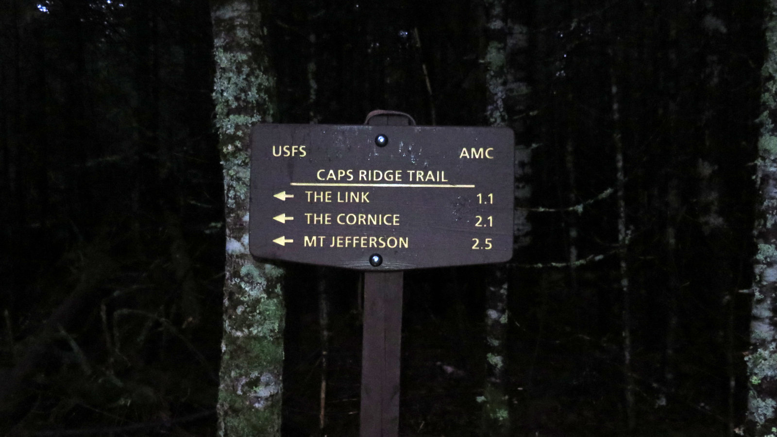
Mt Jefferson, 5,716 feet. 2019-10-28 (Monday.) Via the Caps Ridge Trail. Approx 5 miles, 2,700 feet of elevation gain.
50 dF at the trailhead. Winds in the 20-25 MPH range, moderated by tree cover until treeline. Winds had decreased to approx 10-20 MPH by summit. Heavy, wet low clouds/fog until near the summit. Undercast on the uppermost reaches of the mountain.
Trailhead: 1315. Summit: 1600. Car: 1800. Approx 4.75 hours.
It’s long and slow (and need I say rocky?) but wow, it’s so worth it.
I can’t escape the thought that if I’d gotten going a little earlier, I might have done the suggested loop around the summit trails. But then again, I did the “short and sweet” Caps Ridge trail top to bottom, and there was a certain zen to that. So my decision to do the one, and not much else, is good enough for me.
Recently, I was looking at my peak tallies, and a couple things popped out. One, my entire springtime list (for the 48 in 4 seasons) is done. But then, “duh.” I had 38 done from my initial 48 list last year, so this year, I charged through the other ten before lazily doing a few “palate cleansers” like Chocorua, Red Hill, and so on. Springtime was a lot of fun like that.
But then it also dawned on me that between my winter and summer lists, I’d be the best part of the way through a second 48. And indeed, I was all of five mountains away: Adams, Jefferson, Zealand, Madison and Hale. So now, I just have Madison and Hale to go, and I’ve done a second 48. Fun!
Starting out today, I felt a little sluggish and the weather wasn’t helping. Getting to the trailhead, I got out and was instantly confronted by a heavy, wet cloud. It was going to be one of those days. The Higher Summits Forecast said it would begin clearing up as the day wore on, but I wasn’t holding my breath. At least it wasn’t totally bad news, in that there wasn’t snow and ice forecast. Experience told me that I was flipping a coin on the skies clearing up.
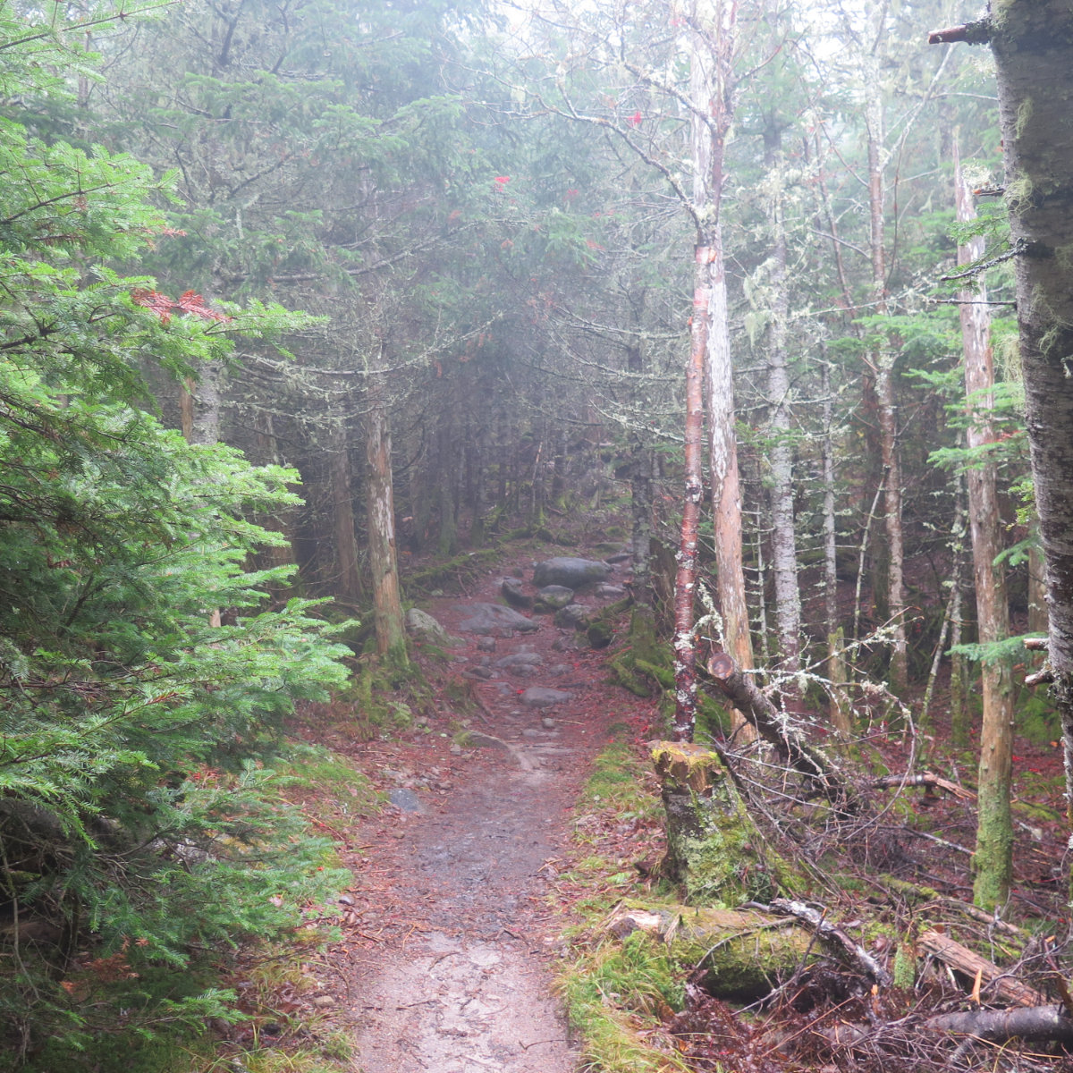
Out on the trail, it was so darn wet that you could see the water droplets/vapor floating in the air. Ick. Worse, it was coating everything with a minuscule layer of some pretty slippery water, and so even accounting for the muddy trail, I got slowed down even more. Footing was generally fine, but it was that tiny slip on a wet rock every so often that made me slow down. I thanked my lucky stars that it was at least fairly warm.
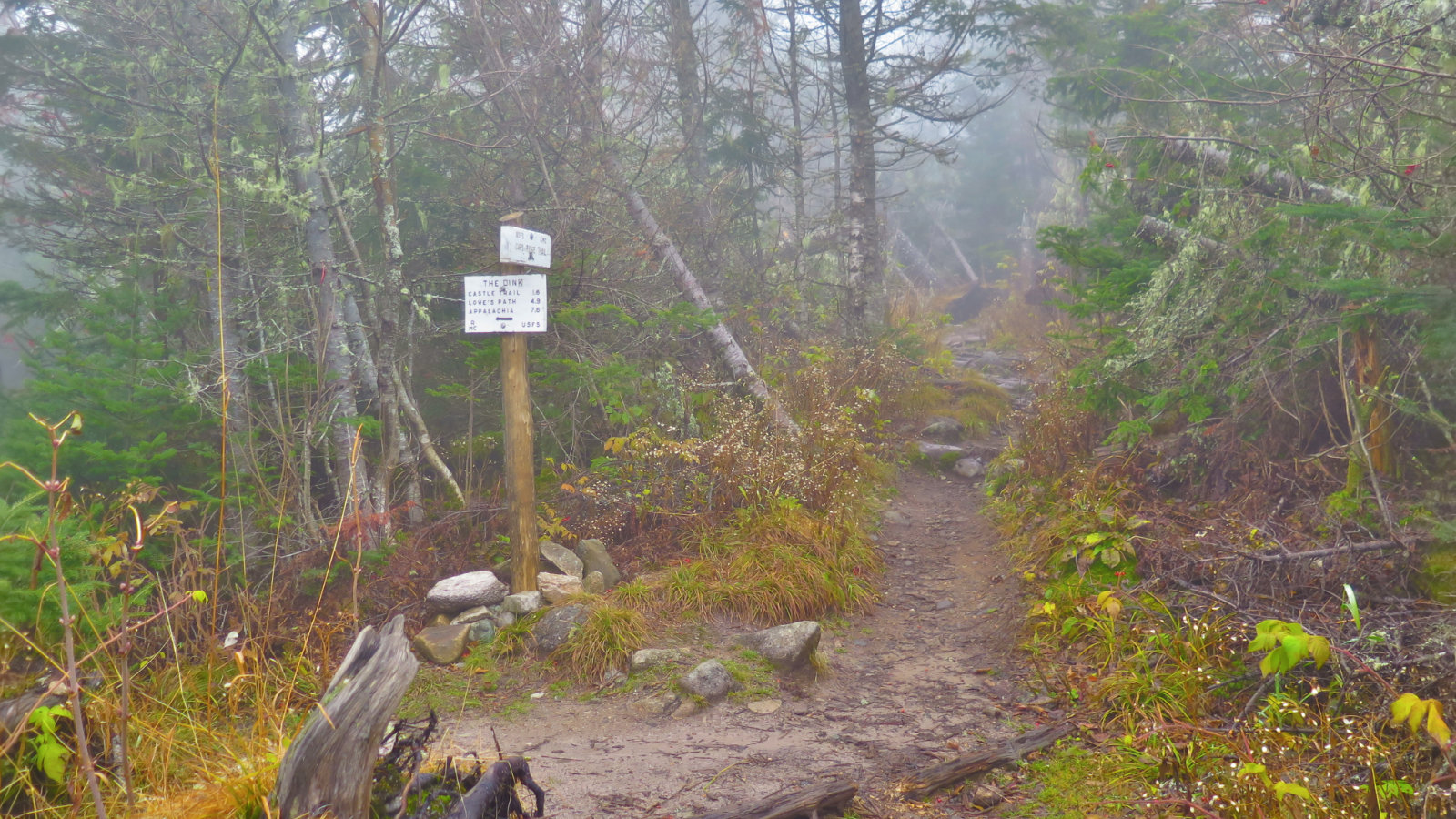
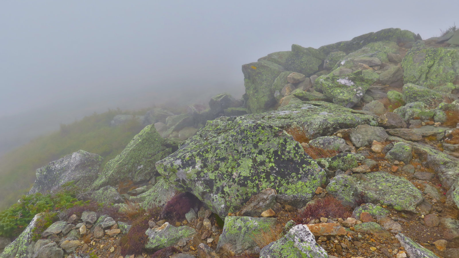
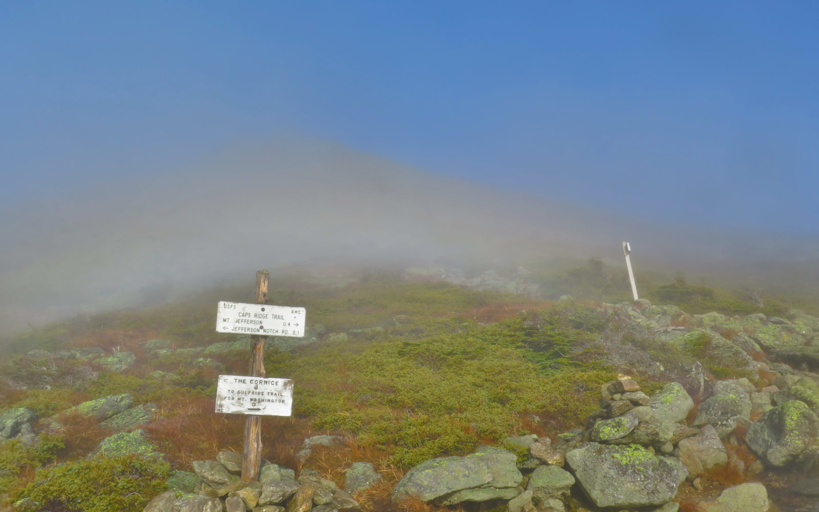
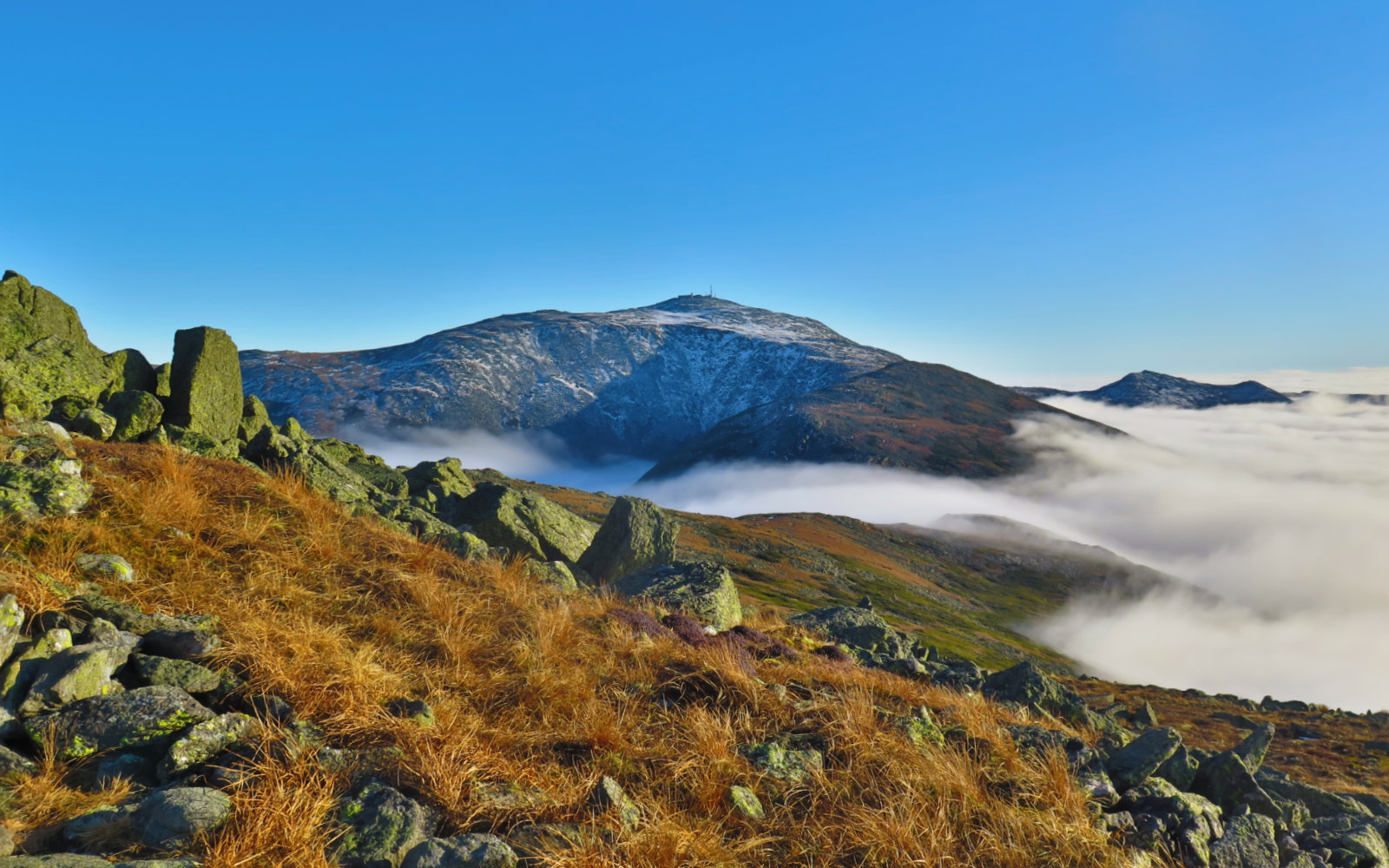
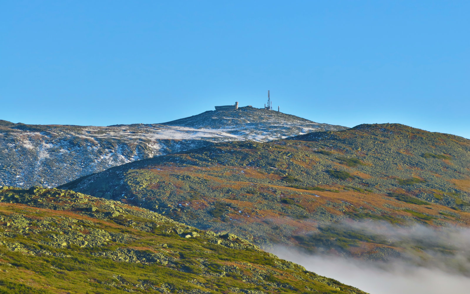
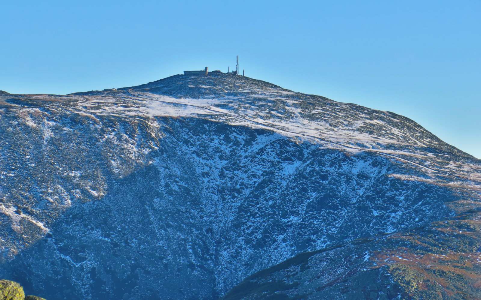
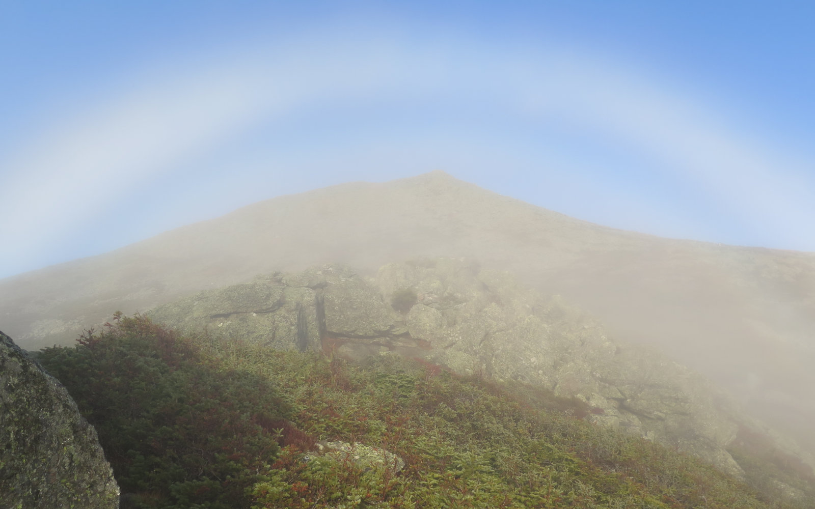
Caps Ridge divides up pretty well by thirds. In the bottom part, the trail wasn’t bad. Partly rocky and partly packed dirt, and a reasonable grade, I made good headway. But then at about the point where I crossed The Link, things pitched upward remarkably, and the rocks got to rock-hopping size. I had to start picking foot placements. By about the midpoint of the entire hike, I was confronted by a string of hand-over-foot scrambling that went on and on. In warm, dry weather, this would have been fun. But with the visibility being nil (up higher, it was a shade better than having to go cairn to cairn) and the rocks being slippery, it was trending toward Type II fun. Then past the Cornice, things got even harder. Now, the trail wasn’t just rocky, it was the jumble of sharp rocks that brought me to a crawl. Finally, the summit, but even that wasn’t straightforward. Jefferson’s is an unadorned pile of rocks. After picking my way to the summit cairn, there was nowhere decent to sit for a spell. Ah well.
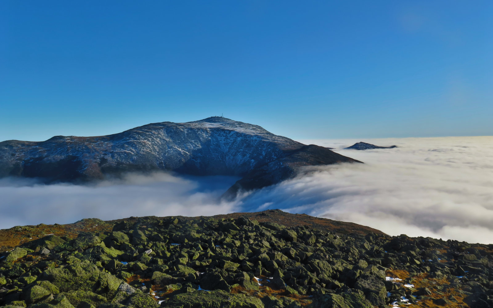
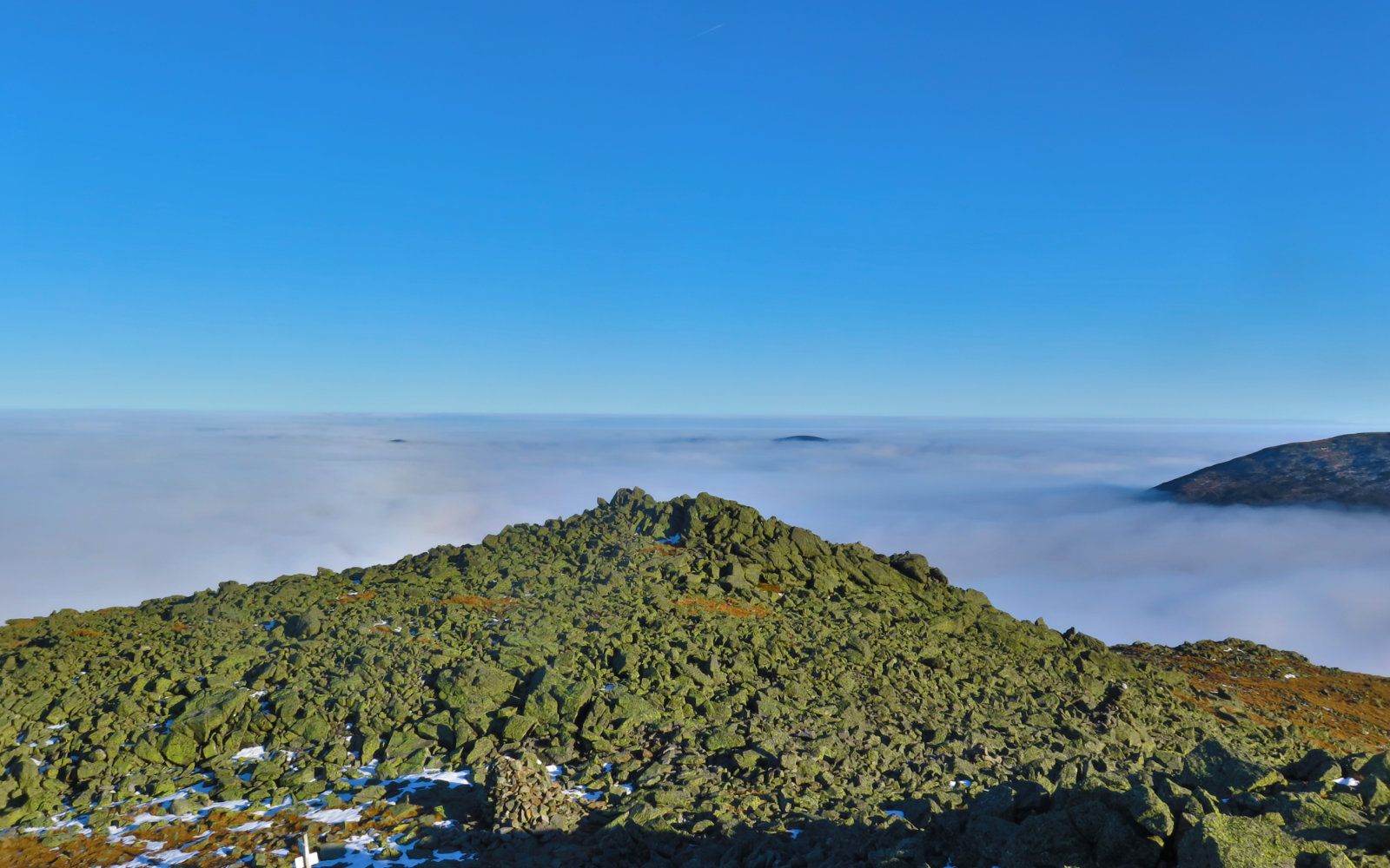
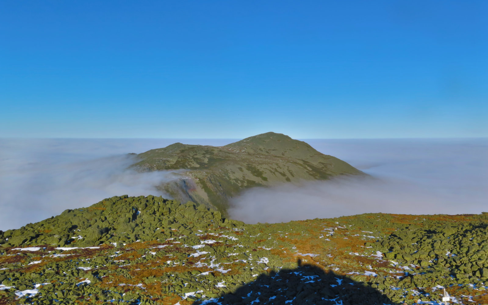
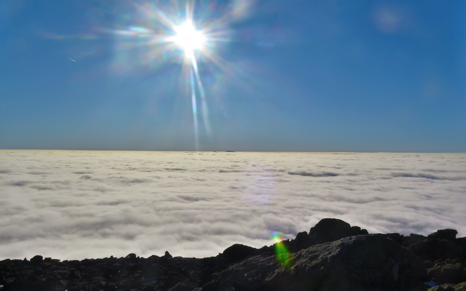
Good thing there was a view. I bumped into a fellow hiker just below the Cornice, and he told me about the undercast visible from higher up. And wow, it was like someone took the cosmic broom and swept away the clouds from a few summits. Looking out, I could see Lafayette, Wildcat, and one of the Carters. What a treat. Better still was the view of Mt Washington and the Great Gulf on one side, and Mt Adams on the other. With the blanket of clouds below, and unbridled sun and blue skies above, it felt like I was on a completely different world. Time almost stood still. With the sun overhead and not much of a wind, I warmed up quite a bit. It was very nice, and I wanted to stay and just stare at the views, but time wasn’t having any of that. Part of the magic of the mountains is the ephemeral moments that etch themselves into your memory, but being ephemeral, they of course don’t last forever. Reality intrudes.
With all of a couple hours of daylight left, I made a dash back down for the trailhead. Of course, I had my headlamp with spare batteries, but the wet and the rocks weren’t anything I wanted to deal with in the dark. Stopping infrequently to take pictures, I pressed ahead as if possessed. There were a couple of hairy parts, but overall, I made it down without incident. The bits where I’d had to scramble up were easier on the way down; still a bit tough, and more than a bit slow. But finally, I made it down with just a sliver of very dusky daylight left.
Overall, it was a good day to be outside. The clouds were a downer, but the undercast and great views made the day. Having the sun on my face certainly lifted my mood very perceptibly. It was nice. I’m glad I got out, as always, but even more so because there was that unexpected view from the top. You can’t always count on seeing the northern presidentials, but today certainly delivered.
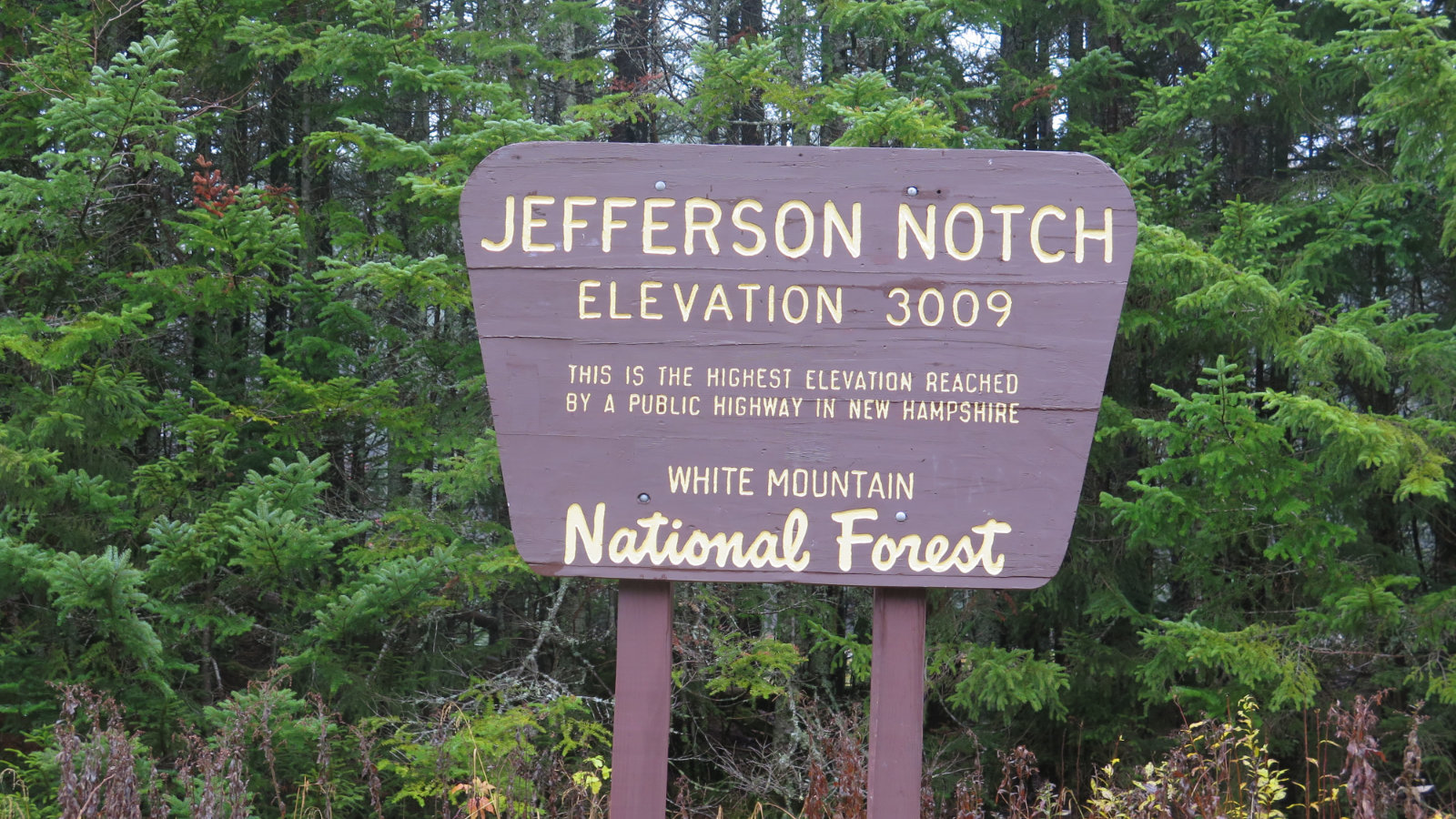
Nuts and Bolts: From Franconia Notch, continue north into Twin Mountain, and then turn onto 302. Head for the Cog Railway. Once on Base Station road, look for the four-way intersection after a couple miles, and then turn left onto Jefferson Notch Road. At the parking area, park. The trailhead is obvious from the sign and the map-board.
As of Monday night, 28 October 2019: Jefferson Notch Road is still open. It’s in as good shape as any other graded dirt road in the Whites — nothing remarkable as far as potholes, washouts, etc. I wouldn’t go whipping down at highway speeds, but if you’re “making time” at a stately 10-20 MPH or so, you probably won’t have much to worry about. As you should always do when driving, when in doubt, ease off the gas and cover the brake. The scenery is nice on that road. Take it slow and enjoy the ride. It’ll get you in the right state of mind for the trail and whatever lies beyond.
If you enjoy reading these posts, consider subscribing. Your email will only be used to alert you of new posts — typically 1-2 times per week. I will not use or share your email for any other purpose without your express permission.

5 thoughts on “Trip Report: Mt Jefferson”
How’s the condition of Jefferson Notch Rd? Decent enough for a sedan?
Great shots of the under cast, looks similar to my view from Lafayette a few Sundays ago
I drove it in mine!
I made an edit to my post; see above. Basically, it’s in the same shape as the other graded dirt roads right now — if you drove into any of the trailheads on the Pemi — Zealand, Garfield, Carrigain, etc — you shouldn’t have any surprises on JNR. Usual seasonal wear and tear is all. Take it slow and you should be fine.
Good God, that’s one of the most beautiful things I’ve ever seen! Your persistence was rewarded!
It was a fairly profound act of will to pick up my jaw, and drag myself back down the trail. I had to keep reminding myself that the sun sets faster these days, and that unnecessarily coming off-trail in pitch darkness is pretty dumb. I’d have stood there staring until the setting sun made the decision to head back down for me.