Mt Madison, 5,366 feet. 2019-10-30 (Wednesday.) Via the Great Gulf and Osgood trails up, Daniel Webster Scout trail down. Approx 5 miles up, 3,500 feet of elevation gain. Approx 3.5 miles down, 4,100 feet of elevation loss.
50 dF at the trailhead. 59 dF at the summit. Winds in the 10-12 MPH range above treeline. Mostly hazy/cloudy with frequent sunny breaks until the summit, cloudy for the descent. “Shorts and long sleeve tee” weather, if you keep moving.
Trailhead: 1045. Summit: 1445. Car: 1900. (Includes a substantial detour to Dolly Copp campground at the base.) Approx 8.25 hours.
Steep and sweet.
Towards the end, things got frustrating. With barely 1,000 feet of trail to go before I got back to the car, I find numerous signs reading “DETOUR”, and I’m sent on a very long walk through the dark on an old logging road. But that was the last surprise, and admittedly, it was somewhat self-inflicted. But before that happened, there was a hike.
A lot of thru-hikers kept mentioning the descent off Madison as being one of the hard parts of the AT, so naturally, I had to give it a whirl. Given time constraints, I shortened the lower section. Daylight comes way earlier these days, right? *Groan*
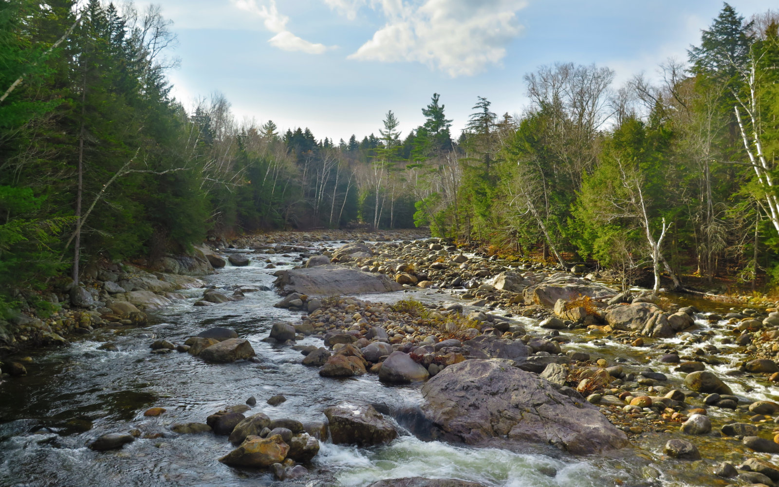
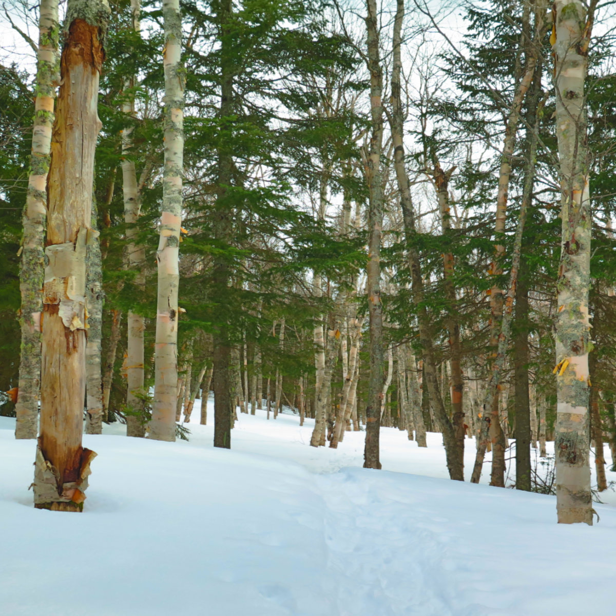
I crossed the footbridge almost right away and as seems to be the custom, that very act worked its magic in getting me to a mountain state of mind. My feet bounced across as the Peabody river roared below, and with a little sun on my shoulders, I pressed forward. Footing on the trail on the opposite bank was fine — mainly some leaf litter with some rocks and roots, and it was a very easy grade. It’s an old logging road, so I made good time.
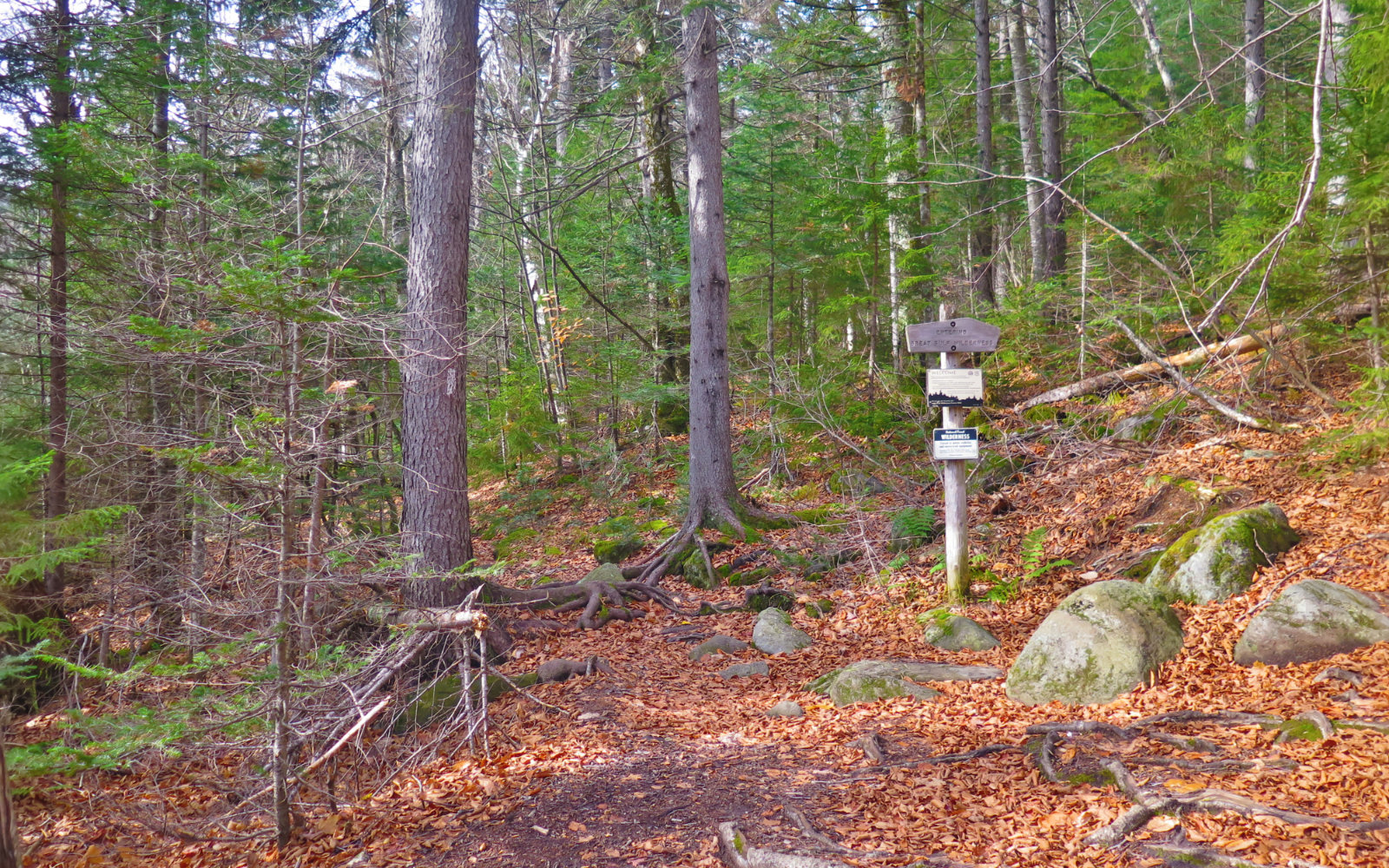
I arrived at the turn for the Osgood trail and things pitched upward a fair bit. Footing was still good overall, and about 90 minutes after I left the car, I was passing the sign for the Osgood tentsite. Amusingly, “(AT) NORTH” is carved on the backside of one of the signs for the NOBO hikers — rather than litter the place with signposts and blazes, everything seemed aimed at the local hiker heading up Madison. (That being said, the AT hiker will find ample signage and blazes.)
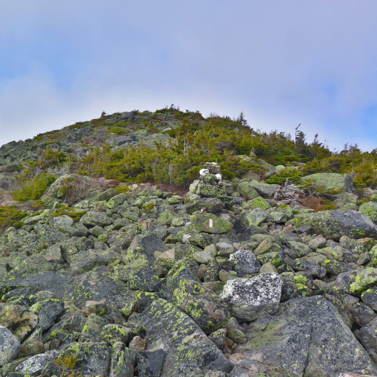
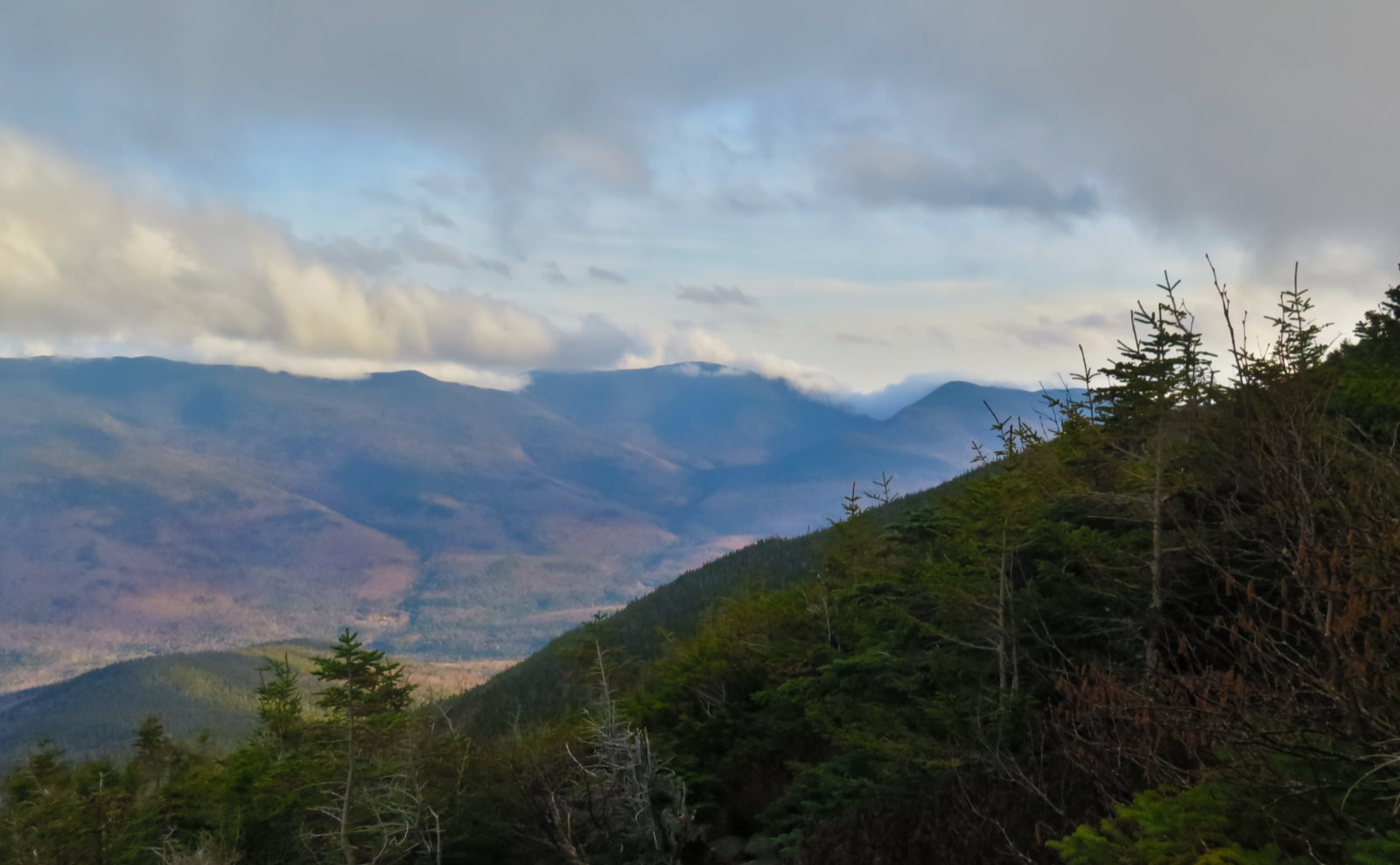
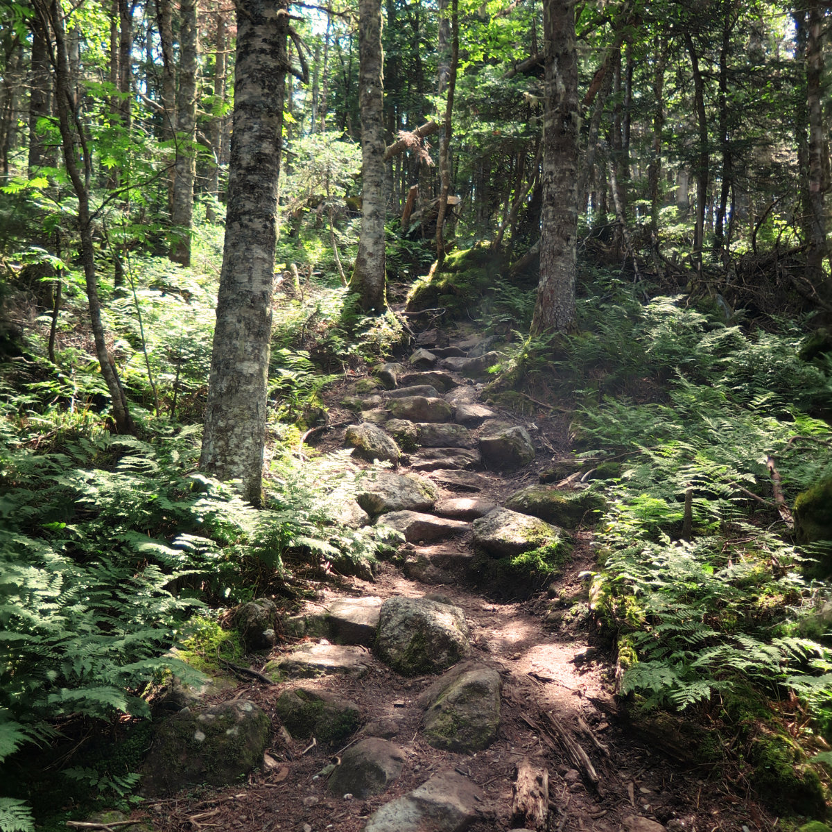
That was the point where things started to get hard. Not long after passing those signs, the trail got steep, and I’d be on some kind of rocky terrain for much of the remainder of the hike. As I ascended, trees got closer to the trail — it wasn’t the more open forest I walked through until that point. Occasionally, I could look over my shoulder, and glimpse the Wildcats and the Carters. Clouds swirled around their tops, revealing, concealing, revealing again, ever changing. It was enchanting, and I wished for some clearer views. But the summit is bare, and clouds willing, I’d get them soon. I pressed on.
From the Higher Summits Forecast, I was expecting it to be colder at treeline — they called for temps around 40 or so. I’d unzipped my pant legs when I got to the Osgood trail, and was expecting to need them again, but there I was, making my way in very warm conditions. I might have rolled down my sleeves, but that was about it. This was a fantastic day to be outside, especially now that it’s mid-autumn.
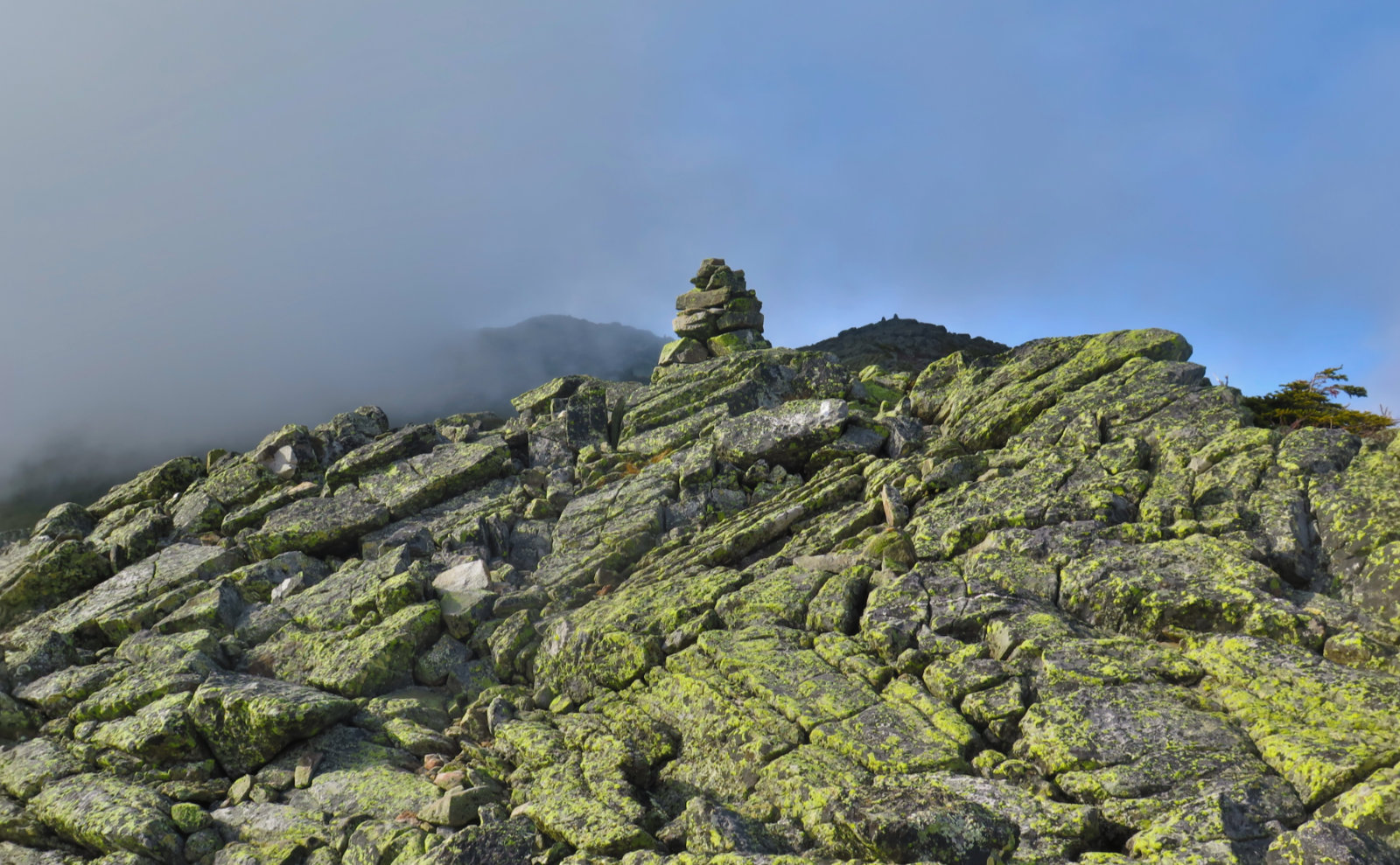
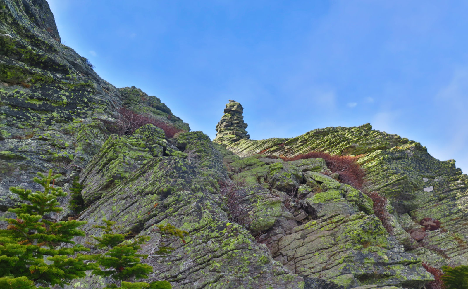
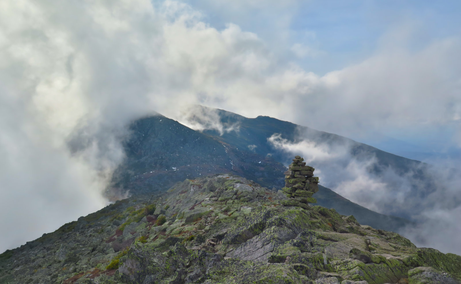
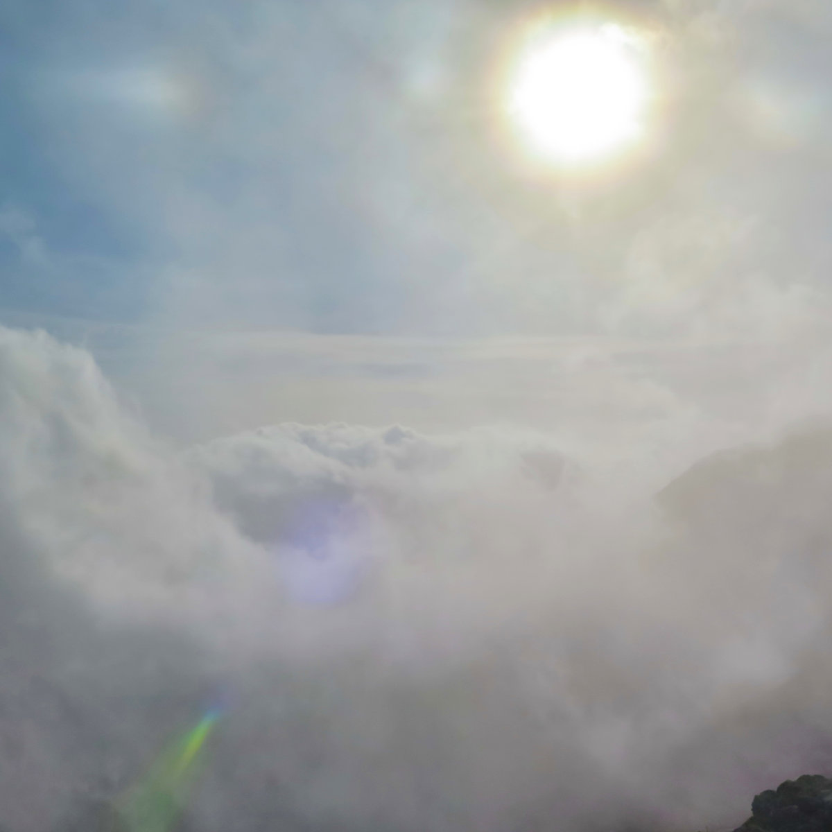
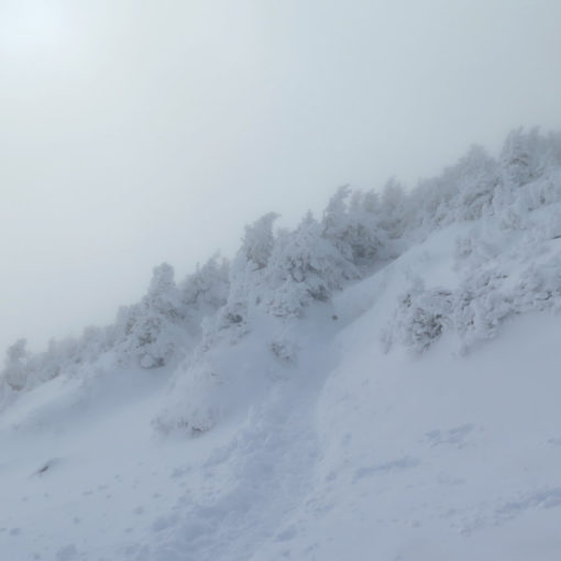
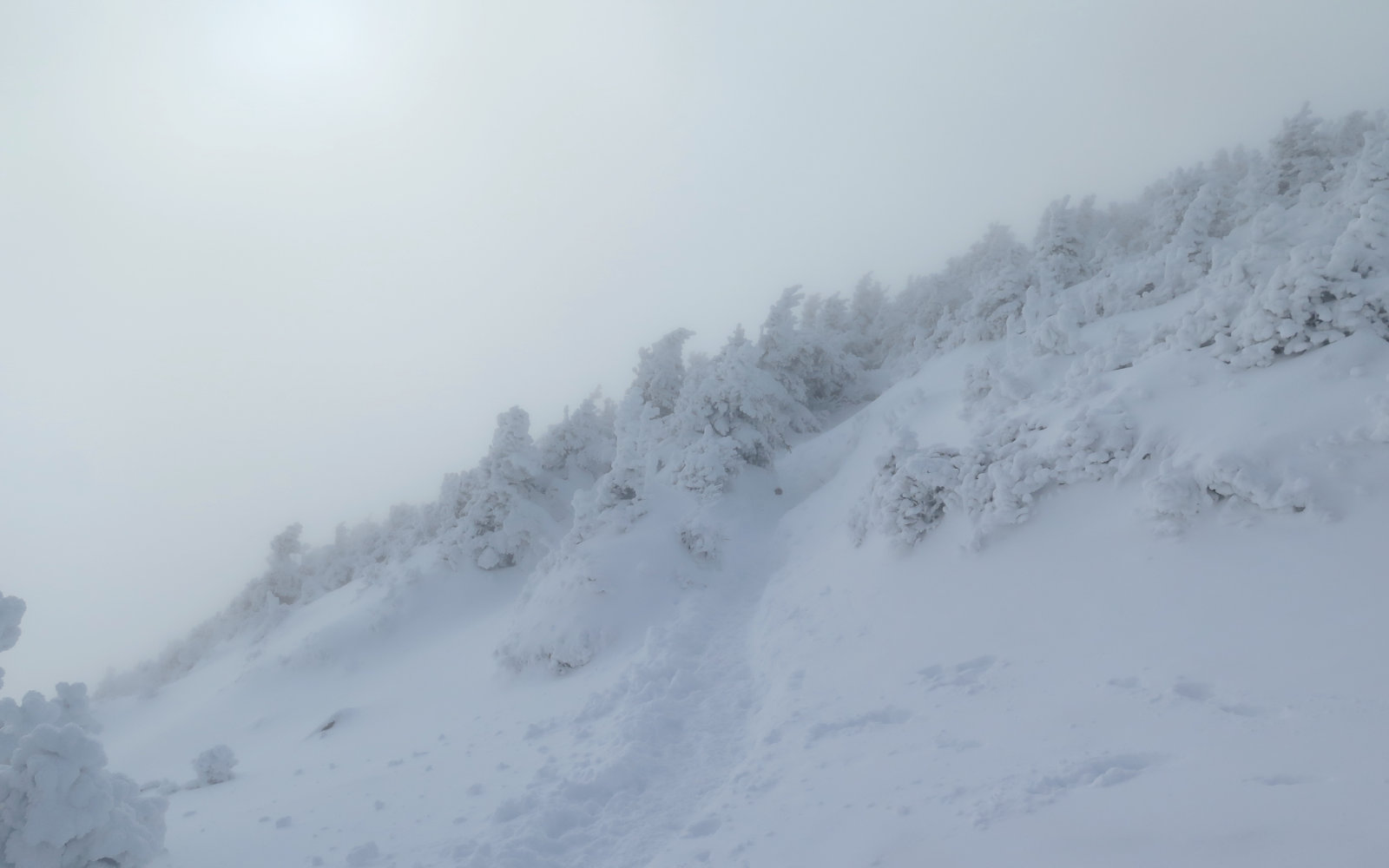
The trail got rocky across the upper shoulders, and progressively turned into a Northern Presidential rock-hop. (Comparatively, though, it was easier than Adams by a fair bit.) Looking up from treeline to just below the summit, false summits were the word of the day, and it felt like each was followed by a sag before pitching back up again. It was getting seriously cloudy at that point, too. But then, the summit, and all around were tiny scattered spots of snow from last week’s storm. There was the tiny little nail-thingy buried in the rock, and a whole lot of clouds. I took a little time to look around.
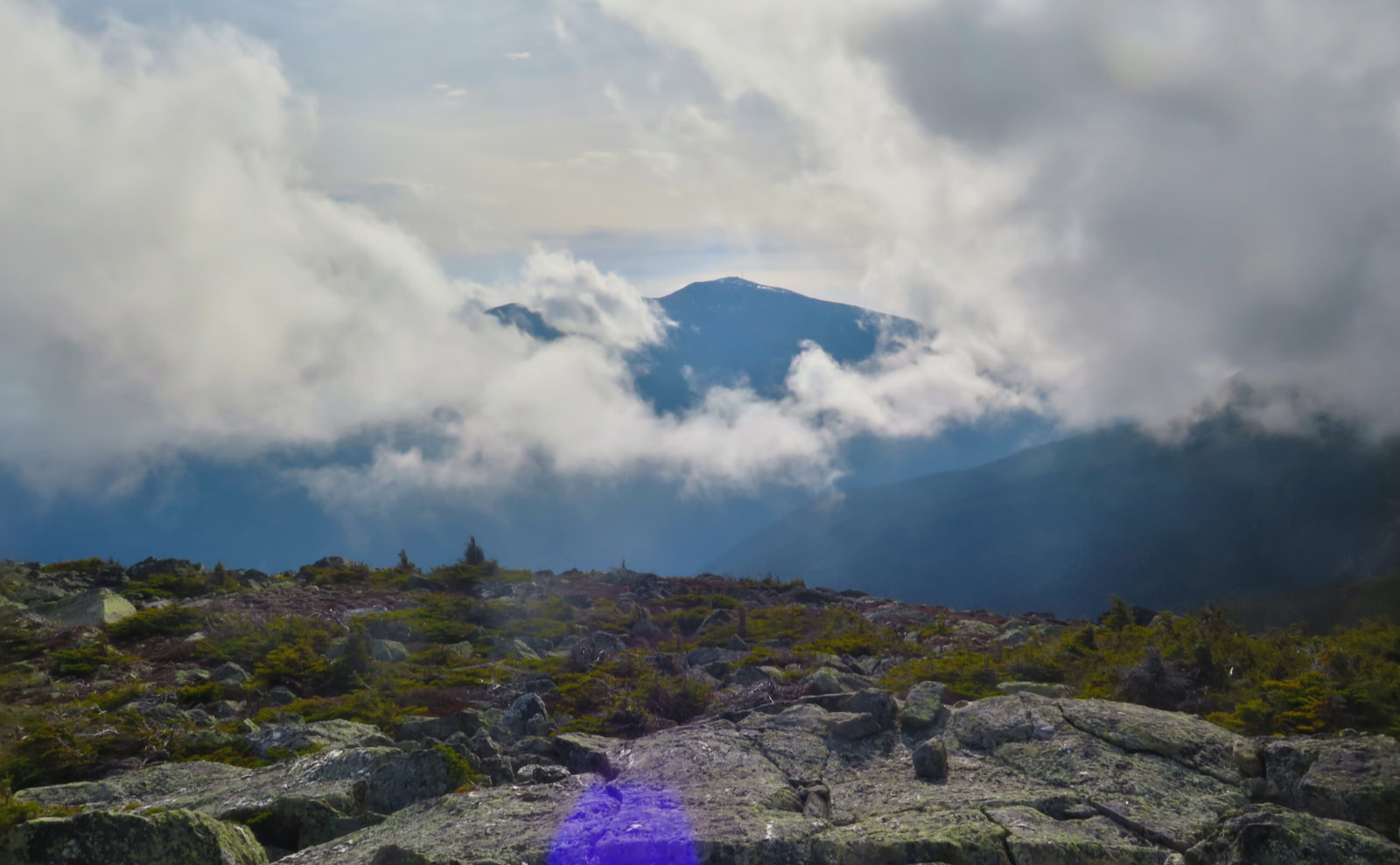
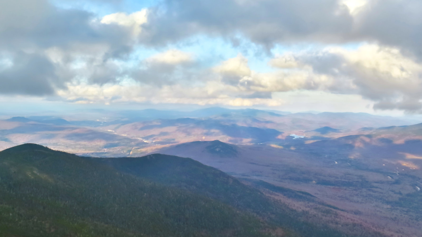
So the clouds were indeed thick, but occasional holes would pop up here and there. The views were obviously attenuated, but a few minutes of waiting and watching, and I could see into the Great Gulf. I got occasional glimpses of the weather observatory. And what I can only describe as the “heaven shot” — a hole, pointing south, where there was almost a “valley” of clouds, with cumulus on either side. It’s the kind of image that you’d expect Hollywood uses to portray heaven in some kind of cheesy flick. On the northern side, I had fairly reliable views into Gorham and Berlin. Across Route 16, I could see the Wildcat-Carter-Moriah ridge “well enough”, and their summits periodically. Not the superlative views one would want, but adequate to say I saw something from up there. It wasn’t viewless, for sure. It just took patience.
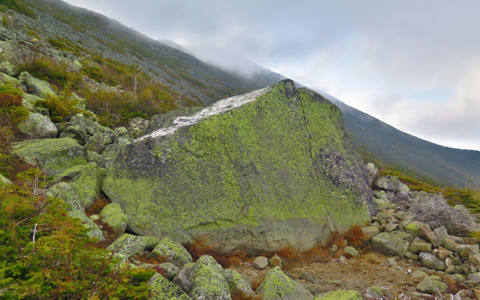
Heading down, I made an on the spot decision to take Daniel Webster Scout trail, because at least on paper, it was shorter, and I thought it wouldn’t be harder terrain than Osgood. Most of this bore out, though the initial descent is a lot rockier than Osgood. I probably spent an hour descending the first 1,000 feet from the summit, and trail-finding wasn’t very easy. There are cairns and there are blazes, but owing to the nature of what’s basically a gigantic talus field, you really have to keep your eyes peeled. (On the way up, this might be easier.) Look for rocks that are either reddish and free from any lichen, or those that have obvious spots where lichen has been rubbed off by foot traffic. The difference between cairn and the surrounding rock often came down to looking for rocks that were more bunched up. A few had school bus yellow-painted rocks on top, which helped immeasurably.
It’s also worth noting that the trail is pretty much east-west. Great Gulf also tracks that direction, but the difference in elevation makes a huge difference in footing. Up high, on the rocks, the trail was very wet, presumably due to less sun. And with the lichen that was a universal blanket on everything, that meant extremely slippery footing. My shoes generally stick to anything, but on this trip, they were having none of that. Be forewarned, because that’s going to gobble up time.
Once back in the trees, the trail got noticeably easier almost immediately, though. It wasn’t a cakewalk for sure, but footing improved a decent amount (though it still stayed sketchy) and I made better time down. Sunlight was running out, so I wanted to move. Down on the lower levels, the trail turned into a drainage that did double duty as a trail. Once again, footing became sketchy. There’s a lot of fallen leaves on the trail, and with the water and mud, it made things a soppy, soggy, miserable mess.
And then, the detour. There’s trail maintenance going on near the trailhead. Unfortunately, I can’t find anything about it on the web. But, all traffic is being routed along an old fire road/ski trail to Dolly Copp while they do work on the trail. The road is wide, and footing is good, but beware that there are a few brambles here and there. From Dolly Copp, one can take the Great Gulf Link trail back. I decided, because darkness was full-on at that point, to just take the road-walk. It was more 0.4 miles longer, but the footing was obviously guaranteed.
In total, it was a good day out. I’d have preferred if the forest service had maybe posted a sign on relevant trails advising of the detour — Osgood would have been a bit sketchy on the downhill, but vastly preferable over the pointless detour. I’m sanguine about the views. The clouds were mesmerizing at times, and maybe it’s not for everyone, but they were placid in their way, and I’m always fascinated by how they lay bare the wind patterns in the various valleys and ravines.
Since last year, when I did a long and hard Jefferson-Adams-Madison trifecta, I’ve been wanting to make peace with those mountains; to have different memories than just the pain of a long, hot, relentless day. Adams is still hard. But Jefferson and Madison are giving me new reasons to see them differently. And maybe more than some other peaks that I’ve said this about, these past couple of trips have made me excited to come back.

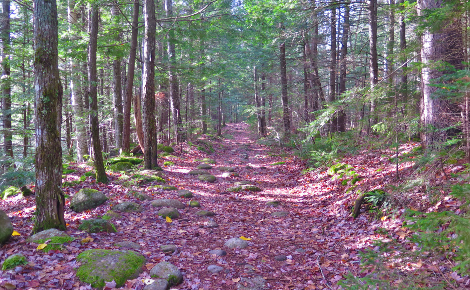
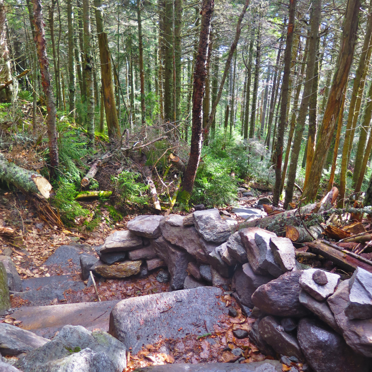
Nuts and Bolts: Great Gulf trailhead is on Route 16 in Jefferson. Look to the west for a big brown USFS sign, typical of the large trailheads in the area. It’s roughly between the Dolly Copp campground and the Mt Washington Auto Road — around a mile and a half from either — and has enough parking for 20-30 cars. Great Gulf trail all the way out to Osgood is mainly dirt and leaf litter with a few rocks and such, and very easy grades. Osgood, on the other hand, gets steep very quickly, until that point on the topo map (which coincidentally, is around treeline) where things crest a shoulder. At which point, you’re on the summit rock-hop. The ‘Scout trail is a crazy-rough rock garden going down — it’ll gobble up a lot of time over the distance until treeline. After that, the trail becomes normal woody-steep down until that point on the topo map where things begin to level out. At which point, you’re in a gigantic drainage.
Both approaches are wide open for a significant distance above treeline (and that’s at about 4,000-ish feet) which means both amazing views on clear days, and unflinching exposure to weather, both good and bad. Bring your camera, but also bring foul weather gear. This is the home of some of the worst weather on earth, folks. Don’t count on bluebird days, even when it’s exactly that elsewhere in the Whites.
If you enjoy reading these posts, consider subscribing. Your email will only be used to alert you of new posts — typically 1-2 times per week. I will not use or share your email for any other purpose without your express permission.
7 thoughts on “Trip Report: Mt Madison”
Hey thanks for saying you thought it started to get hard past the campsite. Now I don’t feel so bad…We stayed at the campsite and went up the next day, my 62cd birthday. Didn’t get as far as you. Took too long and some NOBOs (my birthday is in August) told me storms were expected soon. Damn, I wanted a bowl of soup at the hut to celebrate! Was fun, anyway. Such a beautiful place. And blueberries, too.
The heaven shot reminds me of what people call the God light; the beams coming down .
Look at it this way (as far as your loop went), you got some redlining done!
Nice writing Beautiful photos!
I’d read your post somewhere about not wanting that trip to be exactly your 62nd year. I concur. It’s a tough trail. I didn’t mention in my post, but there were a few blueberries left (now, there are fewer. Yum!) And yes, you saw through my plan to redline. Although I’ll have to go back and get that silly 1,000-ish feet of DWS trail that I couldn’t get last night.