
North and South Kinsman Mountain (4,293 and 4,358 feet, respectively). Lincoln and Easton, NH. 2023-02-14 (Tuesday.)
Via Mt Kinsman and Kinsman Ridge Trails. 10 miles round-trip, approx 3,900 feet elevation gain.
Low-mid 30s throughout the daylight hours, falling to the freezing mark just after sunset. Winds were negligible in the trees, a light breeze on the ridge. Cloudy to start, with the skies opening up to full-on sunshine by mid-afternoon.
Trailhead: 1220. North Kinsman summit: 1440. South Kinsman summit: 1530. Car: 1750. Approx 5 1/2 hours.
When what you feel isn’t necessarily what’s going on
Two days later, and I’m still working out how I feel about Tuesday’s hike. Which isn’t necessarily weird. I ran a marathon once, which was one of the hardest and most painful physical activities I’ve ever done. I’ve done many half marathons — it’s a good distance for me. But I debate doing another full 26.2. And so I remain sanguine about whether Tuesday was a good time, or booking mileage. Perhaps it was both, and I’ll remain open to that idea as I continue to mull it over.
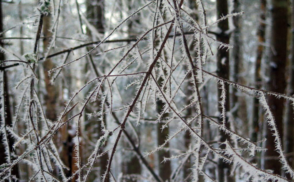
For those wondering, the trail was fine. Up to the ridge, it was frozen snow, with odd patches of blue ice here and there. If your spikes are sharp, you’ll manage with aplomb. On the ridge, it was a bit drifty here and there, but again, nothing huge. A pair of knee-high gaiters is plenty to feel covered, but still light. (This assumes it’s still warm when you hike. Check the forecast before heading out!)
Heading up the Kinsmans for me is generally a fun outing. I prefer going up the west side, only because it feels more straightforward. I did once do it by Reel Brook, which felt hard, but I’ll probably try it again, just to come to grips with it. And so there was no shortage of familiarity. Unlike Lincoln, which feels overly busy and occasionally outright mobbed, driving into Easton feels much more serene. When your local airport is all about sailplanes and gliders, it broadcasts a message.
Getting going, weather is weird.
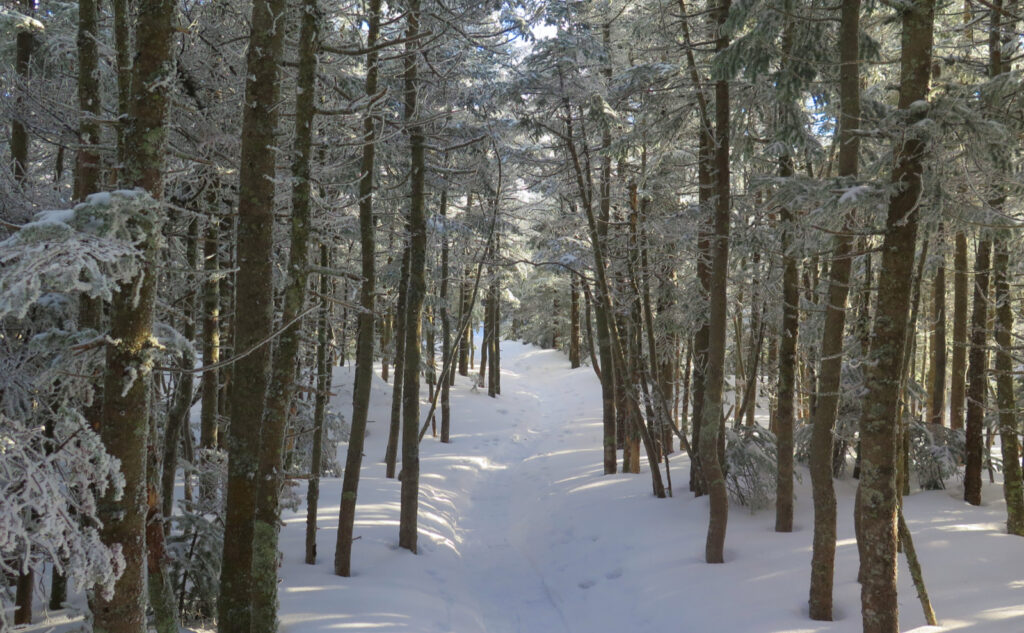
And so there I was, once again setting out from the trailhead. My general impression has always been that this is one of the easier trails in the Whites. By no means the easiest, but certainly nothing that anyone would say “watch out for the hard bit.” The conditions left me feeling a little surprised. It is, after all, still mid-February. The way this winter has been going… as a kid, I had a teacher who was fond of saying “March comes in like a lion, and goes out like a lamb.” All lions start out as little kittens. Whether this year’s lion grows up to become king of the jungle in the next couple weeks remains to be seen. I remain skeptical.
Putting in the miles, it felt like I was making great headway. I’d gotten my usual late start, and wanted to make up a little time. Coming out in the dark is no big thing for me, especially on this familiar trail, but at the same time, I was hoping to move quickly. But as things got steeper, I started feeling more tired and achy than I thought I should. No idea what was going on, but at a certain point, I was wondering if this was still fun. I got to the ridge, and decided to press on.
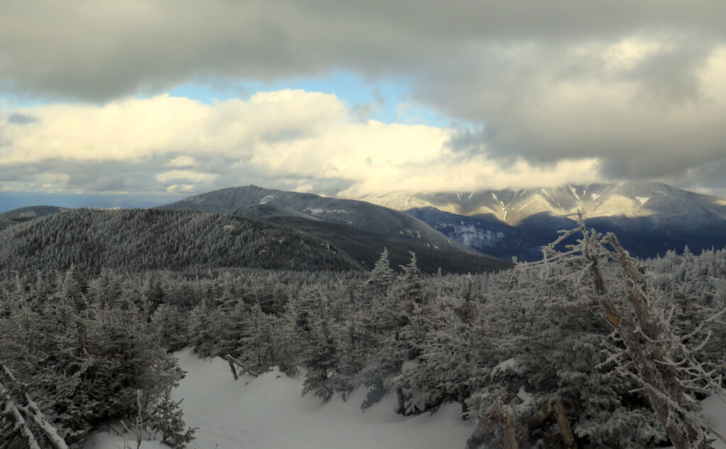
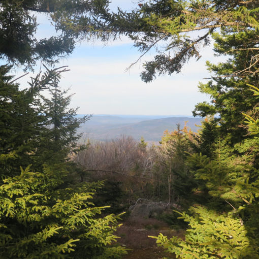
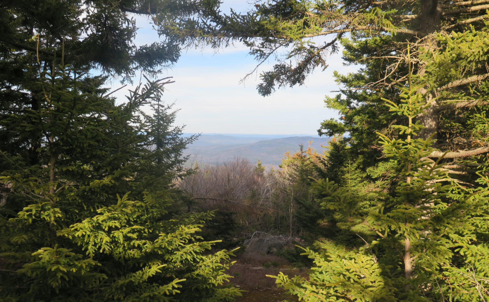
Maybe it was the weather. Yes, it was unseasonably warm, but it was cloudy. At the vista near the trail junction, I looked out to Franconia Ridge, and spied the lower half of the mountains. Cannon was in full view, but everything else was pretty gloomy. Meh. OK, I was booking mileage, I guess. I crossed North Peak with hardly a pause, and continued south.
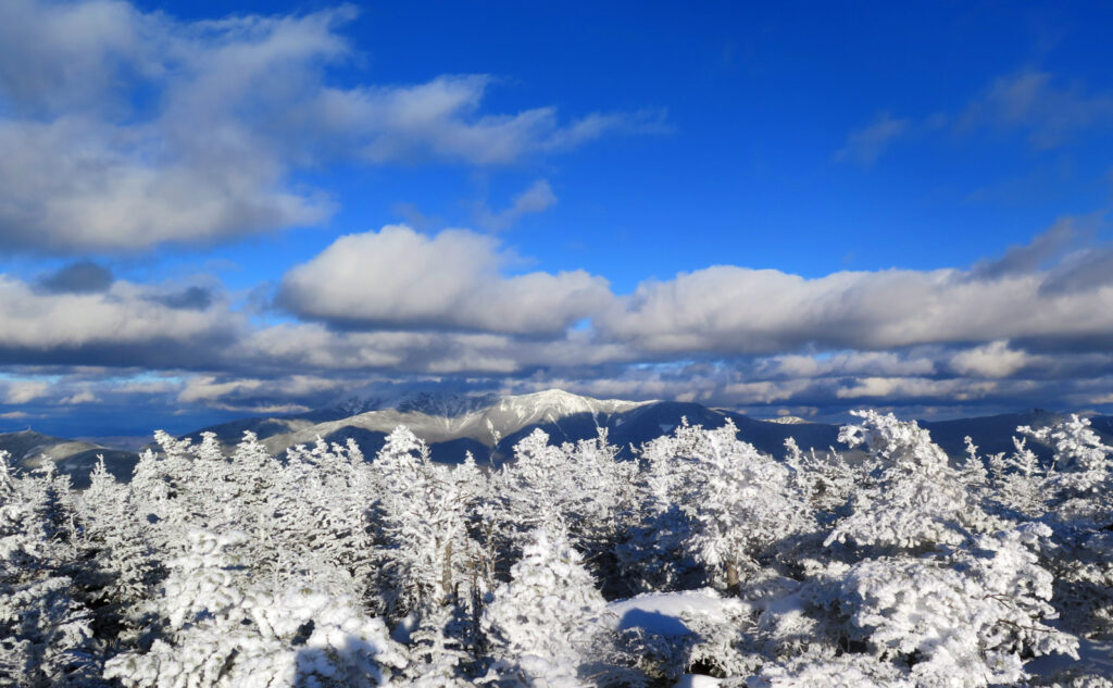
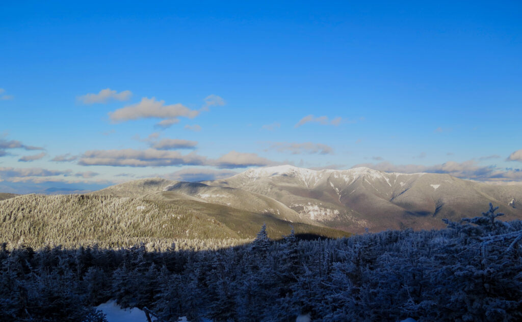
As the clouds lift, so too do the views get longer
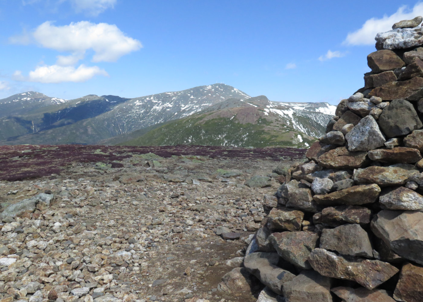
Slowly, as I kept moving, so too did the clouds. As luck would have it, I got to South Peak, and had a mostly clear view of Lafayette. Energized, I pushed back north, hoping I’d have the view I wanted by the time I got there. And yes, it was magnificent. The clouds had pushed over more to the east, making a dark grey backdrop to the brilliant white snow on the nearby mountains. I was still achy, but the view couldn’t be beat.
With the view unexpectedly achieved, I turned back down and made my way back to the car. I didn’t quite make it without my headlamp, but it was close. Turns out this was one of the fastest hikes of the Kinsmans that I’ve done, and maybe that’s what left me feeling strange. No idea. Either way, I got a good view out of it, and on the drive home, I stopped by the side of the road to catch views of Jupiter, Uranus, mighty Orion, with his bow, and Sirius. In the light, the mountains looked amazing. In the dark, the stars took center stage. My legs were still complaining, but the rest of me was just gobsmacked in awe. When the stars punch through the vastness against such a deep, velvety background… what, me worry?
Looking back, it wasn’t a bad outing. I’m content to leave it as it is: a bit achy, a bit tired, a lot of unexpected wow.
As always, stay safe out there.
Nuts and Bolts: Take exit 32 off I-93 (the Kancamagus Highway, in Lincoln) and head west. Stay on 112 until it intersects with 116, and then head north toward Easton and/or Franconia. As you pass from Easton into Franconia, be on the lookout for the trailhead sign. If you see a tennis summer camp, you’ve gone about 100 yards too far.
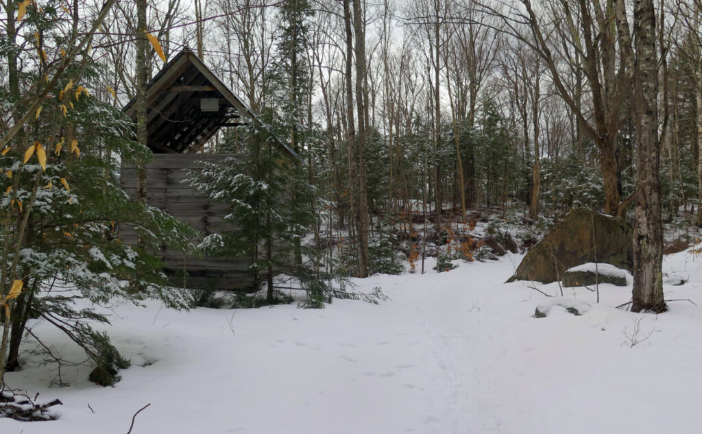
Trailhead will be right in front of you, but it’s a small sign that marks the start, and it blends in pretty well with everything else. There’s also no kiosk. On-trail, blazes are blue until Kinsman Ridge, where they become AT-white, and fairly plentiful. Mind where you’re going around the sugar shack. There’s a truck road that splits away from the hiking trail, so on your way down, just watch out for the sign. In general, it’s not hard to stay on track. Just keep your wits about you and you’ll be fine.
If you enjoy reading these posts, please subscribe — stay in the loop! Your email will only be used to alert you of new posts — typically 1-2 times per week. I will not use or share your email for any other purpose without your express permission. And feel free to share via social media using the buttons below.
Find me in the mountains, on this blog, or on Twitter: @Protean_Hiker https://twitter.com/Protean_Hiker/
Additionally, for all the cool kids who sit in the back of the bus, find me on Mastodon: https://mastodonapp.boston/@Protean_Wanderer
Help support this blog! Visit www.photos.proteanwanderer.com to buy some of my signature images.
Note: the map linked below includes the Reel Brook Trail; without a car-spot, this will include around 3-4 miles of walking back to your car. Either plan accordingly, or do the out-and-back from Mt Kinsman Trailhead.