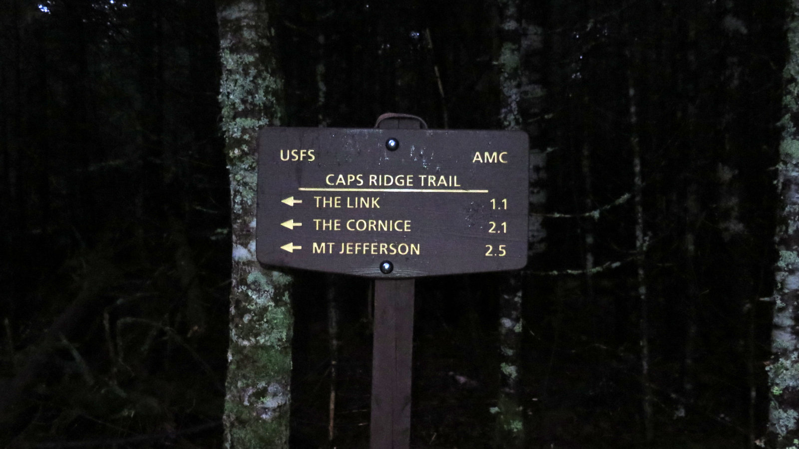
Mt Adams (5,799 feet) Randolph, NH. 2023-04-09 (Sunday.)
Via Air Line Trail. 4.3 miles one-way. 4,500 feet of elevation gain.
40 dF at the trailhead, maybe about 25 dF at the summit. Winds were negligible in the trees, about 30-45 MPH at the summit. Gusts were substantially stronger at times near the headwall of King Ravine. Unbridled sunshine all day long.
Trailhead: 1120. Summit: 1510. Car: 1820. Approx 7 hours.
Fairly short. Wicked hard. First, get out of bed.
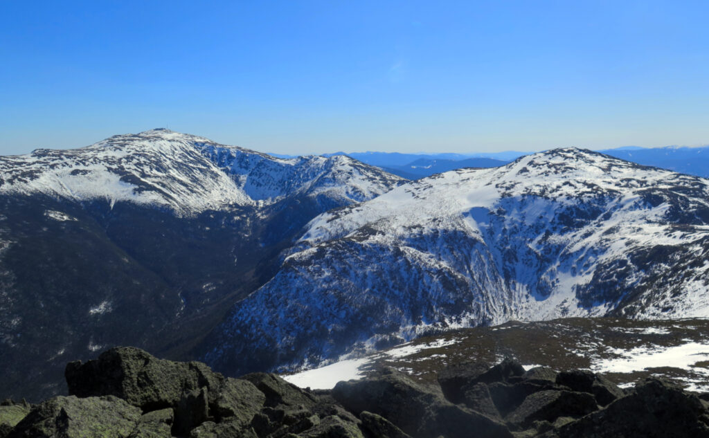
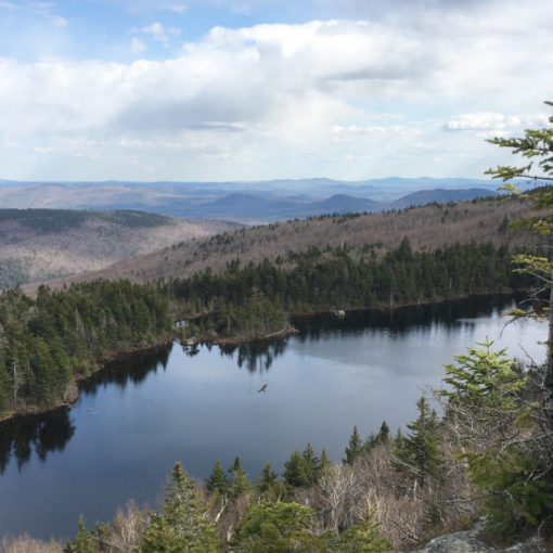
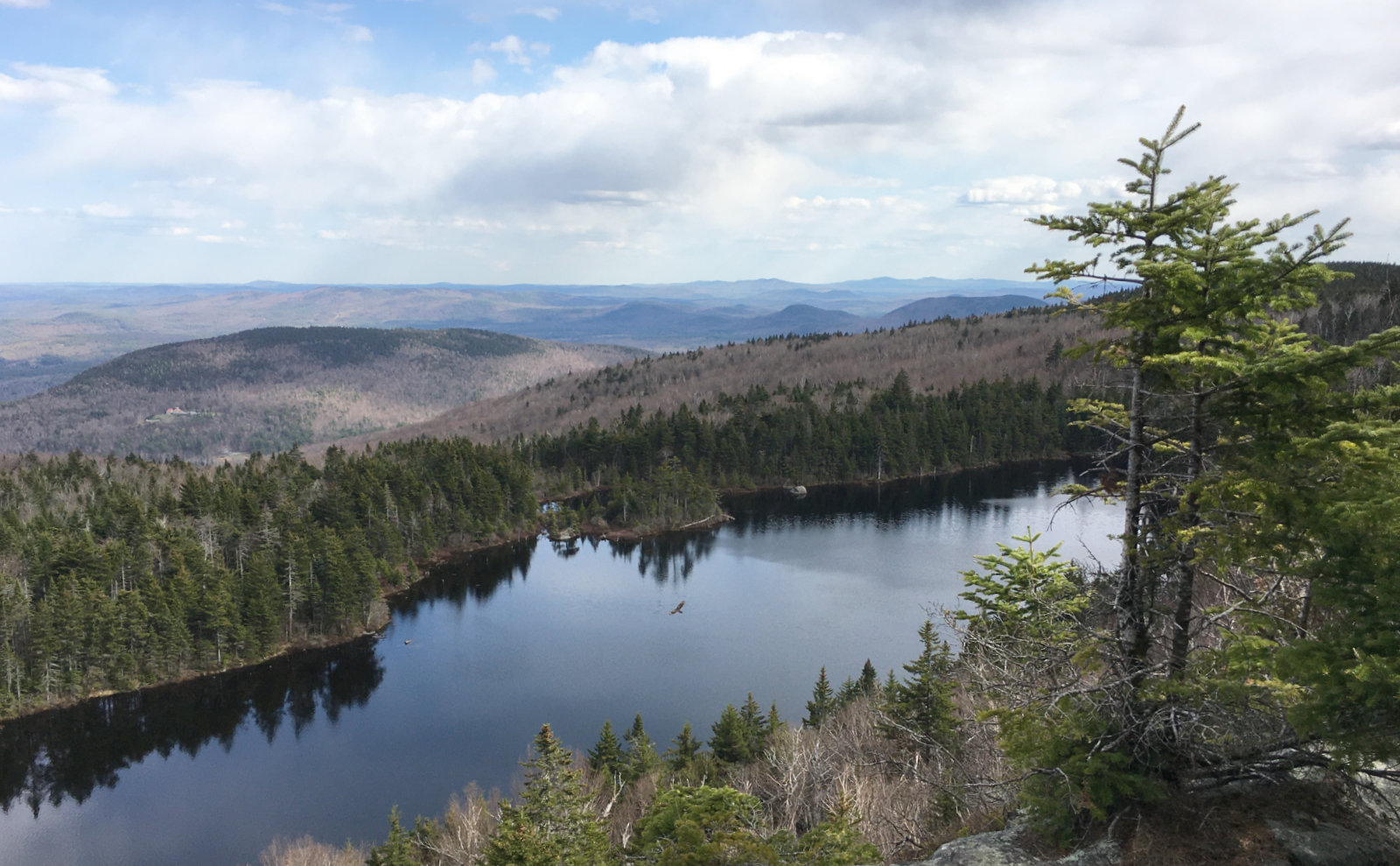
Do Airline, I thought. It’ll be fun, I thought. And on many levels, yes indeed, it was a good day out. Standing on that parapet and gazing out over King Ravine never gets old. I love that it’s just too wide and too deep to capture in a photograph. If you want to be dropped to your knees, you’re just going to have to go there. But I completely failed my saving throw v. The evil mutant leg destructor. By day’s end, I was wiped out. Done. Finis. Stick a fork in me.
But first, I had to get there, and as always, it entailed dragging myself out of bed. Coffee, get dressed, whatever…
Indecision bugs me.
My alarm went off, and I laid in bed for awhile. I was no closer to a decision than I’d been last night before I climbed into bed. The bugaboo in question lay around 20 miles (as the crow flies) from my ultimate destination. I’d been wanting to hike Owl’s Head for a bit now. The trouble with that plan was the most recent trail report that I could find, which suggested the snow bridges were nearing their seasonal end. The last thing I wanted was to make that last crossing before the Brutus Bushwhack, and then realize I’d have a soggy return trip. This winter has been such a wash, and I’ve been reading things suggesting this was a particularly early start to spring. As always, think ahead at least three moves. In hindsight, I’m comfortable with how the day turned out in the end. I’ll be back on Owl’s Head this summer for sure, and another April will come around for my grid.
It took some looking at the spreadsheet of doom. Some reading of New England trip conditions. Finally, I just bailed and went with Adams. Yep, I just did it a few short months ago, but hey, it’s worth doing many more times. What I found out today, though, in a very unavoidably visceral way, is that snow conditions matter. The trail extracted its pound of flesh, for sure. The warmer weather might have other things to say about the matter, but at least in spring snow conditions, that trail is tough.
What makes this trail different from all other trails?
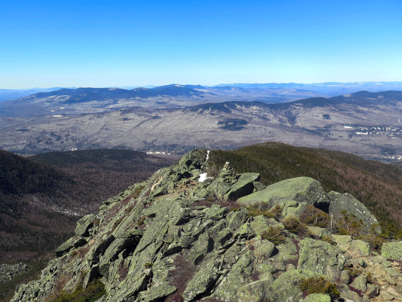
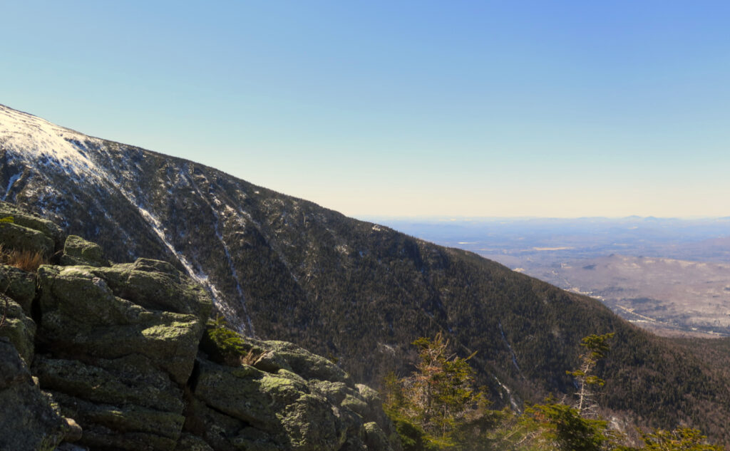
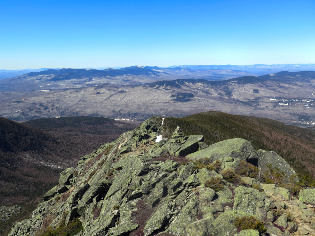
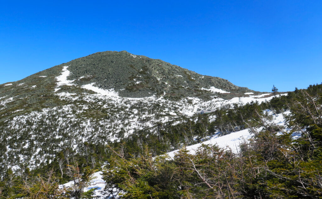
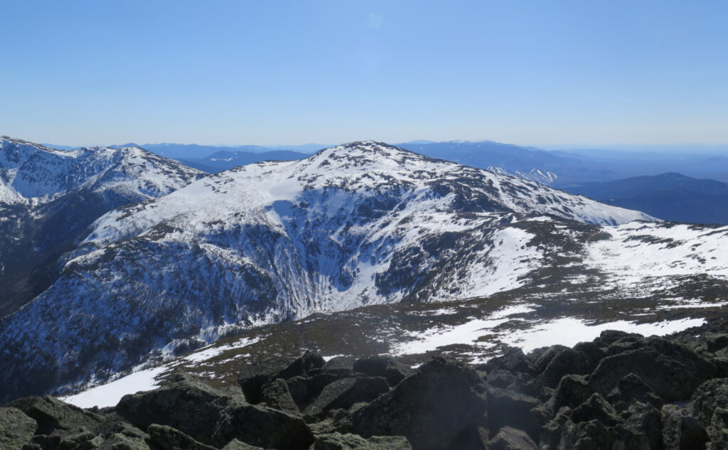
When I walked along the exposed edge of the trail, gazing down into King Ravine, I looked toward the headwall, and wondered. At some point, long ago, someone was wandering around the bottom of the ravine, and that makes a certain amount of sense. Every time I gaze downward, I’m immediately struck by its savage beauty. But then that person gazed upward, and evidently thought it a good idea to plot a course “due up.” And not enough that they did that one, but they looked to the right, and cut another trail. And then Chemin des Dames.
Airline doesn’t scream “this one will crush your legs!” at first blush like the ones that cut through the ravine. When you compare it to Valley Way, knowing nothing else, you’d see two parallel trails. One follows the valley, the other cuts across the knife edge of Durand Ridge; both “pop up” at some point, but you never think it’s anything major. But look closer at the contour lines, and it hits you. Getting up to that knife edge is the kicker. Then, there’s all the rocks you’re stumbling and bumbling over, just after your legs got torched. Oh, and then there’s the big rocks on the summit cone that you’ve still got to traverse before you get to that summit pin. Ooof. I broke a sweat just now, just thinking about all that work.
Day and night, night and day
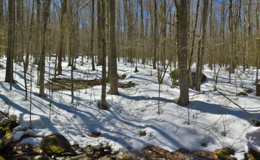
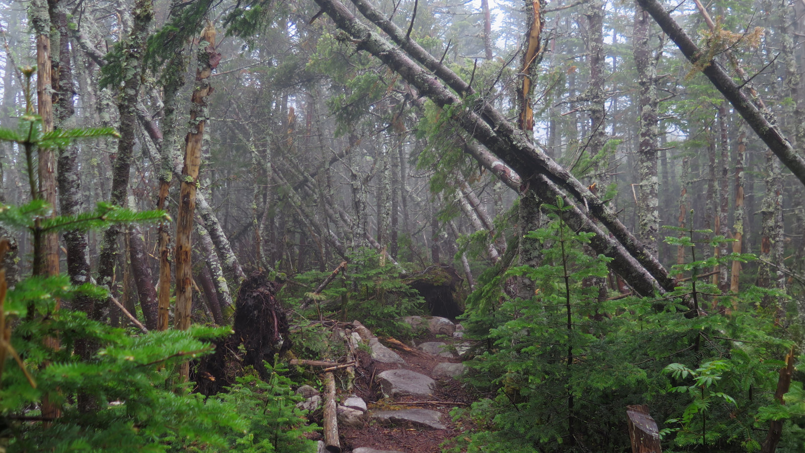
In the warmer months, this isn’t a huge problem. You’re ostensibly in lighter-weight shoes, you don’t have traction devices strapped onto your feet making you walk funny, and not for nothing, but it’s warmer, so you’re wearing lighter clothing. In the middle of winter, most of the rocks are entombed under miles of snow, and the trail is pretty smooth overall.
In this crummy-snow season we’re currently enjoying a bit earlier than most years? It’s almost like a Cole Porter tune: this torment won’t be through, until the mountain has its way with you. On the one hand, I was truly digging the warmth and the sun. On the other hand, the snow down low was mashed potatoes. Higher up, it was frozen granular, spiced with a hefty dash of blue ice and rocks.
Above treeline was at least a mile of torment. Probably about two thirds of the snow was melted away completely. I couldn’t ditch my traction and skip across the rocks with bare boots. I couldn’t walk above the rocks on a sidewalk-smooth layer of snow. And in plenty of places, inches-thick blue ice made upward or downward travel a bit more treacherous than I’d have liked. It may be springtime, but that ice was solid as armor plate steel. More than once, my spikes just couldn’t get meaningful traction. The upshot was this hike was a lot of work, and on a mountain with a mind-boggling amount of elevation gain — some of the most in the Whites. (No kidding, my watch gave me an award for the most elevation gain on a hike!)
Home, where the Great Gulf’s waiting
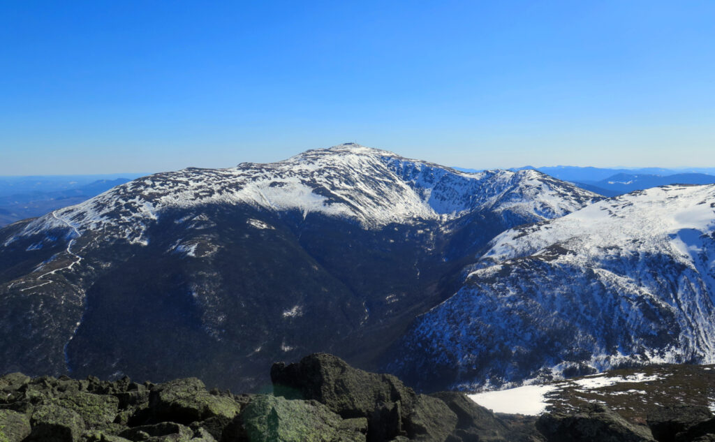
I was thinking, this afternoon, about my first time on Adams. It was a relatively hot day, I was bagging all the northern peaks, I was tired and thirsty, and the peak was crowded to the gills. I headed back down vaguely jubilant that I knocked off three peaks from my first 48 list, but still wondering why Adams was such a big deal. A couple years later, I broke my ankle coming back down from the mountain. There’s history, there’s been blood. But oddly, I’ve found peace with that peak. Maybe the mountain was testing me. Crazier things have happened.
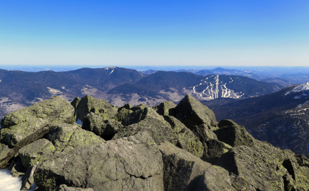
And so it was that I stood up there yet again. The wind, to be true, was howling like a banshee, and had been pretty much since I broke treeline. Looking across to Washington, the Great Gulf worked its magic yet again. The sky above was a heavenly, unbroken azure from horizon to horizon. I counted all the 4,000 footers all around… lots. Strangely, the wind turbines on Jericho Mountain in Berlin weren’t turning, even though there was no shortage of wind today. I looked out, and “home” was the only thought that gripped me. Yep, that’s where I was. The forecast called for decreasing winds, and I think they pooched that part. But the bit about a cloudless sky and abundant sunshine? Oh yeah. For the moment, I stood there contented, the pain of getting there blown away on the wind.
Aching, not empty
I got back to my car after a long and achy hike down. Happily, I noted a couple things about the trail. One is that a nascent monorail is forming. Stick to the middle, and footing is pretty good. Snowshoes are superfluous — wear them only if you want the heel elevators, and you’re happy with the extra workout from having all that weight on your feet.
Second is that someone (or a few someones) stepped to the side of the trail in the steeps, and post-holed some rudimentary steps. The monorail is mostly unblemished, for those heading up. But on the way back, when you’re taking those heavy downward-steps, having those little ladders made the miles much more manageable. I don’t know how that could be codified into hiker etiquette. For now, I’m just enjoying that it happened.
Because of the tiredness, I’m not sure I’d call this outing an unbridled success. The wind was a total bear, even if it didn’t do a thing to derail my plans. It was still a visceral thing, hanging around in the background, and certainly for all the time I was on the summit, trying to enjoy that rare view. All the same, I had glorious weather. Imperfect trail conditions, but hey, one never gets perfect. I’m sure tomorrow, and even next week, I’ll continue to refine this one. But for now, I’m calling it “not bad in the slightest.” I’m still at peace with Adams. I mean, hey, those views… sometimes you gotta fight for them, but wow.
As always, stay safe out there.
On footwear:
I’ve been wearing the same Lowa Camino GTX boots for the past five winters, and it’s time they go back to the Mother Ship for some loving care. As luck would have it, a hiker I met today mentioned he has the same boots, and sent them in for service. Came back in like-new shape, which was heartening. By their website, it’s $150, which is about half of what I paid for my boots new.
I make a point of tossing my running shoes every few months, and absolutely by the time I’ve knocked out 400 miles. As luck would have it, Newton Running recently switched to recycled coke-bottle plastic, so I don’t feel as bad tossing my latest pair of kicks. It could be better on the landfill side, but that said, shoes wear out way sooner than most people think. Bad footwear translates into joint problems everywhere from your ankles to your hips, and beyond. For my day on Adams, I logged more than 26,000 steps, of which well more than 20,000 were in my Lowas. (The rest were getting there and back, puttering around the house, etc.) 20,000 times the soles got trodden on. Microscopic damage each time, but it’s a classic death by a thousand paper cuts.
Thinking about it, even if I only averaged 100 miles per winter, I’ve long since blown past 400 miles by now. The soles are cooked. I’ve been suffering that truth since at least last season. Heck, I’ve tossed at least three pairs of trail runners already in the past few years. Lowa wants boots re-used, not made into landfill. This warms the cockles of my heart. The uppers of my boots have plenty of life left, so if new soles are an option, I’m game. Stay tuned.
(For anyone splitting hairs, no I don’t get anything from Lowa for that above commentary. There are no affiliate links on this site, nor will there be. If you want a pair, go to their website, easily found with a brief web search.)
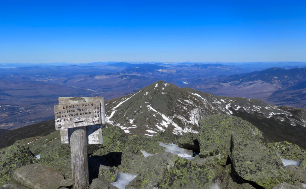
Nuts and Bolts: Make your best way to Twin Mountain. Go through the four-way intersection that’s still located near Foster’s hole-in-the-ground (soon to be rebuilt general store!) staying on Route 3. After you pass the UPS depot, make a right onto 115. Follow that until you hit Route 2, and make a right onto that. Drive through Jefferson. About four-ish miles later, you’ll come across Lowe’s gas station on the left. Keep going for another couple miles. When the road seems really straight, slow down. Appalachia trail head is on the right. Recognize this by the fact that there will be a slew of cars parked off to the side. In epically warm weather, you’ll see cars parked on the side of the road for a half mile before you get to the trailhead. Don’t worry, you’ll find a spot to park your car in the next half mile.
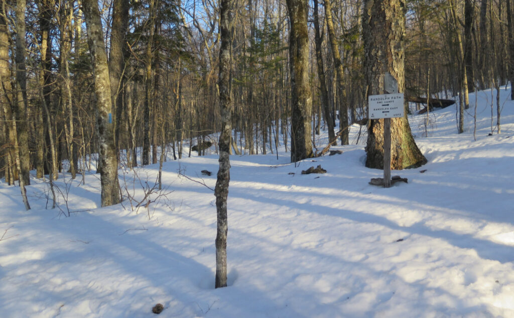
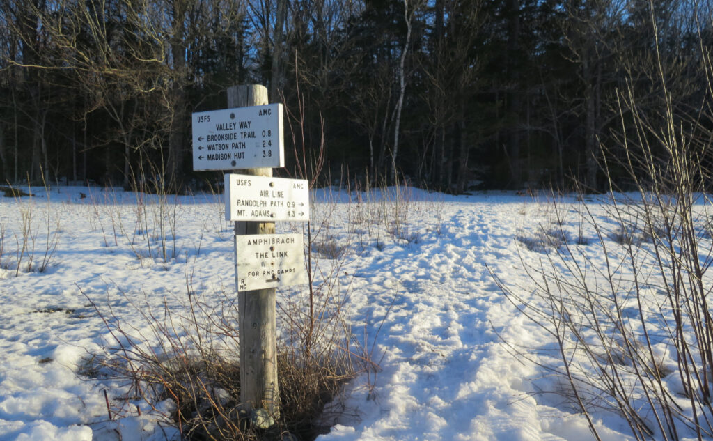
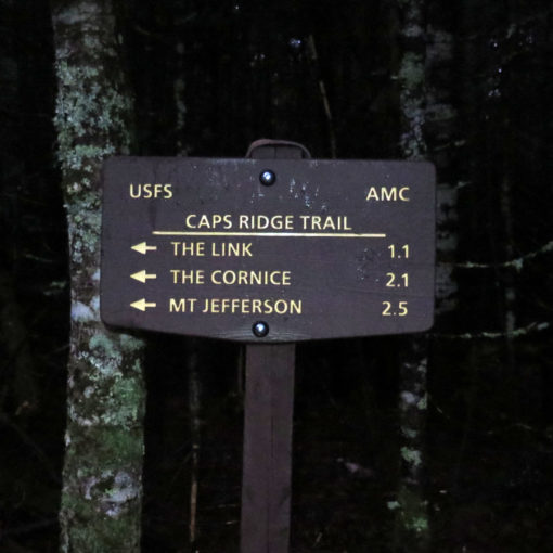
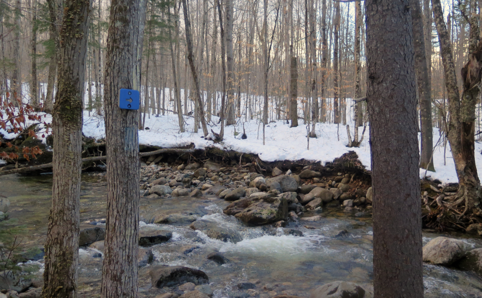
Trailhead will be by the big sign that reads “APPALACHIA”. For Airline, blazes are Blue. Most junctions (if not all) will have signage specifically for Airline; if you get lost, you really did something wrong. (Huge shout-out to the RMC for their awesome signage!) This is a very easy trail to follow, especially below treeline. Coming off of Great Gulf Trail, watch the signs and cairns. Once you’re back on Airline, things get much easier to follow.
If you enjoy reading these posts, please subscribe — stay in the loop! Your email will only be used to alert you of new posts — typically 1-2 times per week. I will not use or share your email for any other purpose without your express permission. And feel free to share via social media using the buttons below.
Find me in the mountains, on this blog, or on Twitter: @Protean_Hiker https://twitter.com/Protean_Hiker/
Help support this blog! Visit www.photos.proteanwanderer.com to buy some of my signature images.
2 thoughts on “Trip Report: Airy Aerie on Adams”