Cannon Mountain (4,100 feet). Franconia, NH. 2023-04-24 (Monday.)
Via Kinsman Ridge Trail. 4.2 miles round-trip. 2,200 feet elevation gain.
45 dF at the trailhead, both ways. Winds were negligible in the trees, about 20 knots at the summit, breezy on the exposed ledges and at the summit. Mostly clouds, though the sun began to break through here and there on the way down.
Trailhead: 1330. Summit: 1530. Car: 1700.
What to say about something so immediate, so familiar?
By design, today was a late start. I went to bed undecided, but with a few ideas. I wasn’t sold on anything in particular, so I left it to the morning. The weather this week has been sodden, and with rain and warm temps soldiering on, the trails higher up are crummy in no shortage of places. Given the pain of Adams (and yet, such sweet, sweet views!) I wasn’t looking forward to a posthole-fest. Per New England Trail Conditions, that basically knocked the Wildcats and the Carters out of contention. The Higher Summits Forecast called for snow and breezy. There went the Presidentials. What now?
There was some delicious coffee this morning. So much so that on the drive back home this afternoon, I was still thinking about it, and honestly debating whether I’d have a second cup this evening — yes, mere hours before trying to go to bed. I grind my beans fine, they go into the French press, and a few minutes later, heavenly goodness goes into the mug. A small bit of sugar; my brew does fine without milk.
And so I sat at the kitchen table, picking over the bones of the news while I ruminated on where I’d go today. The weather was being a royal drag on things. This was not helping my indecision.
Time to fish, or cut bait
The moment came when I just called it, almost out of frustration at myself. Cannon. Sturdy, but short. Close-by. The clouds can do what they will. I can come back again, next time on a brilliant day, and enjoy those humbling views. It wasn’t going to be a duo (or trio!) that would knock more than this one off my April list, but whatever. The bird in hand, and all that.
I was thinking about the time I did this last summer, and what a day it was! But the reality of today fell quite a bit short of that fine afternoon… maybe a bit closer to when I hiked this grand mountain in January of ’21. On the walk back down, though, I reflected on today’s outing, and as happens, it got complicated.
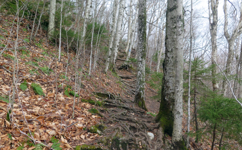
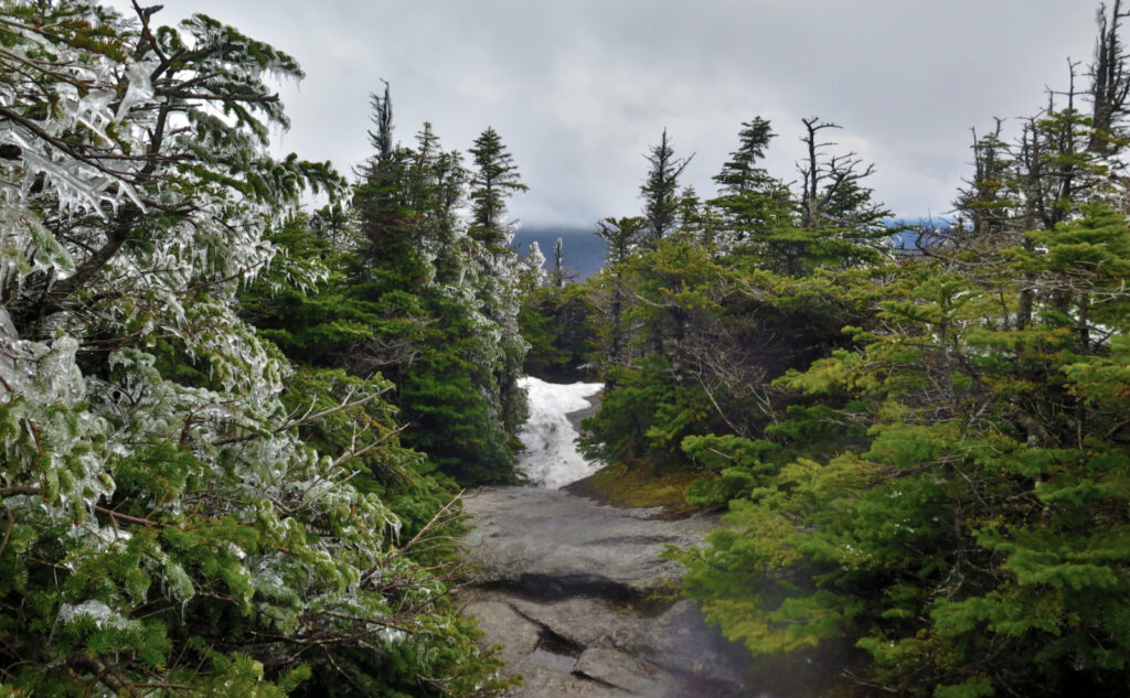
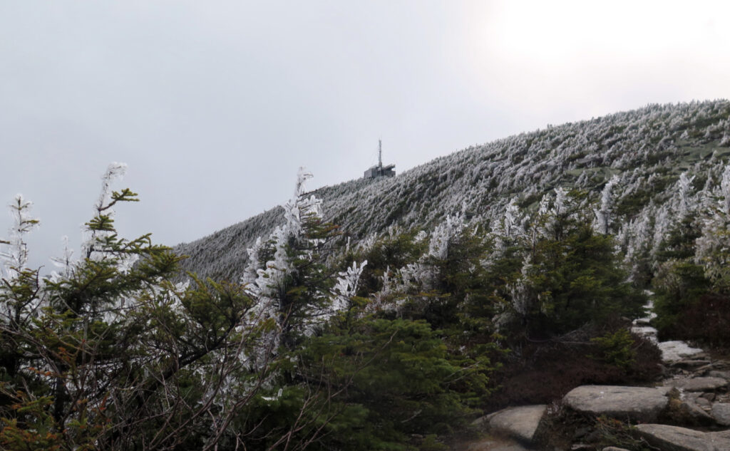
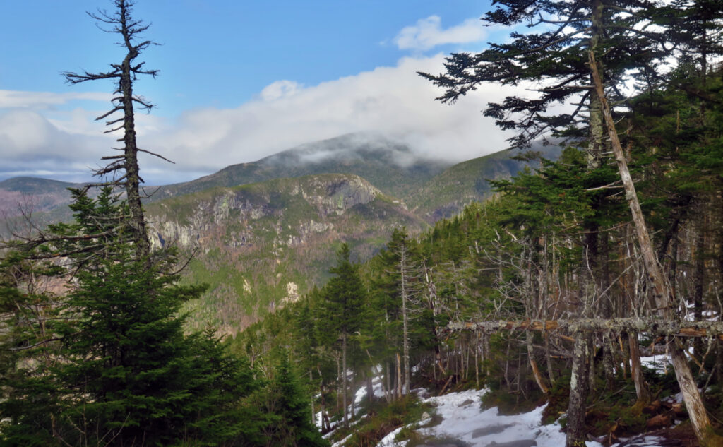
The trail starting out was bare earth, and that lasted until just shy of 2,500 feet — which is to say, around 20 minutes. The monorail started out as soft ice, and so with spikes on my feet, I kept moving upward. It’s not an easy trail, but for all the seeming slowness, you do actually make progress. Snow, in a real sense, entered the scene maybe around 3,000 feet, and then once I’d hit the shoulder, near the vista, I was seeing ice on just about every tree branch.
Sometimes you look out, sometimes you look in.
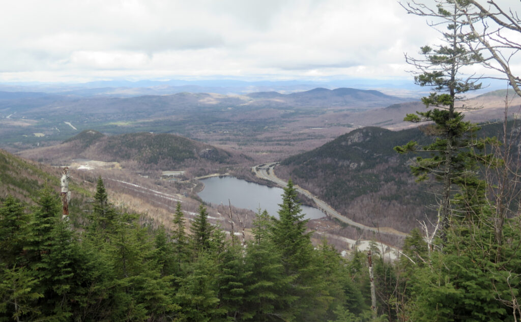
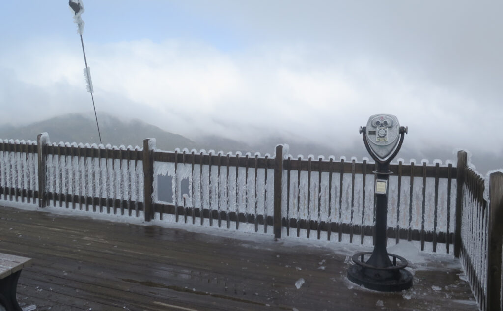
I’d made a lot about the views being compacted by the clouds. In reality, I think the views got compacted by the ice. Being somewhat inside the ping-pong ball, I stopped looking out so much as looking closer in, and wow, that ice. It’s hard to say it’s a winter wonderland up there, when on almost every front lawn, you can see daffodils, and I know for sure my crocuses have already come and gone. But the beauty of the ice on those branches couldn’t be denied. Even under the clouds, it sparkled.
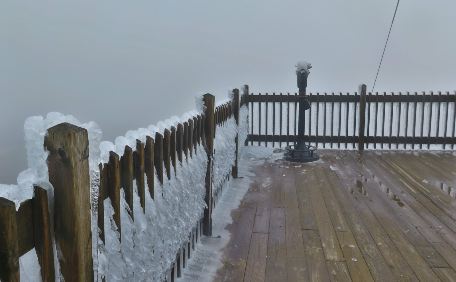
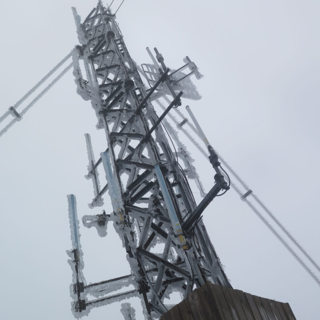
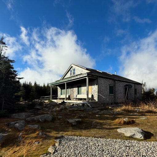
At the top of the ski area, I hoofed around and made my way to the summit building. The wind had been a presence for quite a while at this point. I wasn’t planning on spending much time as it was. Nearer the stairs to the observation deck, and I started hearing all kinds of banging. Then it made sense. Once I was around the level of Cannon’s eastern shoulder, the sound of melting was everywhere. On the summit, it was ice, falling off the antenna and its guy cables. You wouldn’t think it, but that ice was at least an inch thick in many places. Safety became a question.
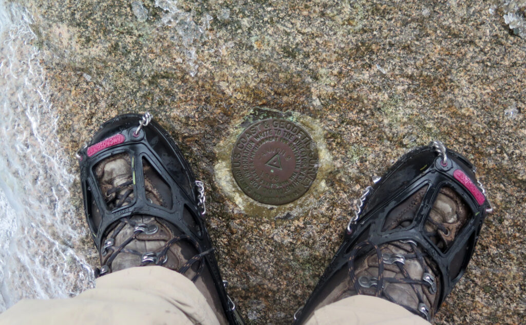
After observing for a bit, I decided the risk was worth it, but just as far as it would take to stand up top, look around quickly, and then head back down. As luck would have it, ice fell around me, but never on me. I’m not complaining. Below the structure, I found the summit medallion, and then headed back.
Slow up, and slow back down.
All on the way up, there were plenty of points where I wondered how miserable I’d be on the descent. I’m happy to report that my feet remained underneath me the whole time. There were a few sketchy spots, and with further melting… I have no idea what they’ll be like this coming weekend. But with nature’s handrails here and there, and some slow and methodical movement, every sketchy bit was managed successfully.
Cannon was the last peak on my first round of the 48, and for that alone, it’s a memorable peak for me. The more I do it, the better it gets. And really, though a very popular peak lies just across the road, you can’t see Lafayette from Lafayette. For that and many other reasons, it remains one that I’ll return to again and again — even after my grid is complete.
As always, stay safe out there.

Nuts and Bolts: 93 North, to exit 34 B — you’re following the signs to the tramway. Once in the parking lot, stay to the left, and at the back side of the parking lot, you’ll see a small white trailhead sign that points you left, up a short dirt road. At the end of that is a much smaller parking area, suitable for most hiker traffic.
The actual trailhead is at the back end of the lot, on the left. No kiosk. Blazes are blue and generally where you’d want one.
Note that as I write this, the ski trails are barren. This isn’t “I’ll use my beater skis” but rather “you’ll abrade your bases through to the bottoms of your boots in one hot second.” It feels kinda quick, because the last couple times I was up this way, the ski trails seemed to have at least passable cover. No more.
Coincidentally, the ski lodge at the summit is buttoned up for the season, and at least today, the tramway was closed. Don’t expect to be anything other than on your own when you get to the top. You’ll need to be as self-sufficient on Cannon as you would be on Cabot, Isolation, Owl’s Head, or Bondcliff.
If you enjoy reading these posts, please subscribe — stay in the loop! Your email will only be used to alert you of new posts — typically 1-2 times per week. I will not use or share your email for any other purpose without your express permission. And feel free to share via social media using the buttons below.
Find me in the mountains, on this blog, or on Twitter: @Protean_Hiker https://twitter.com/Protean_Hiker/
Help support this blog! Visit www.photos.proteanwanderer.com to buy some of my signature images.
3 thoughts on “Trip Report: Cloud Cover on Cannon”
We were up over the weekend, skinned up and skis Mittersill on Saturday. Excellent snow top to bottom.
Maybe that was just Mittersill? The top of Cannon featured dirt, and at least from the road, I saw a lot of bare ground lower down on several trails.
I did find the amount of melting on the hiking trail to be remarkable — it felt like the mountain was furiously shedding snow as fast as it could.
I drove through Franconia Notch this morning (for work, unfortunately not for hiking). It was one of those rare days where the notch alone was under blue skies and sun, while surrounding areas were shrouded in low gray clouds. It seemed like a rare inverse of conditions, wish I could have captured it in a picture.