Mt Moriah (4,049 feet). Gorham, NH. 2022-01-02 (Monday.)
Via Stony Brook, and Carter-Moriah Trails, and the summit spur. 10 miles round-trip, approx 3,100 feet elevation gain.
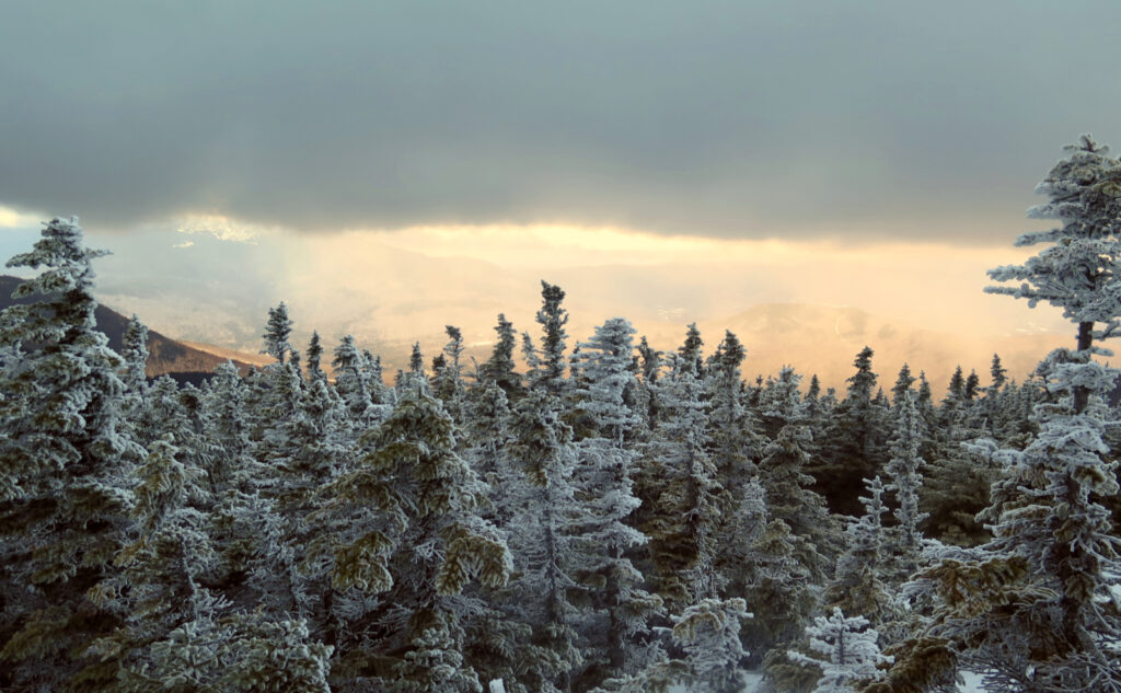
36 dF at the trailhead, about 30 dF at the summit. Winds were negligible in the trees, a felt breeze in the exposed areas. Cloudy throughout.
Trailhead: 1110. Summit: 1520. Car: 1840. Approx 7.5 hours.
Good, bad, mostly ugly.
In many ways, the day ran wildly away from what I’d hoped. Plans were rent asunder almost from minute one, trail conditions much grittier than anyone could expect. When I was finally back at the car, I was long past ready for the day to be over and done with. At least I got one peak for January knocked out.
Out of the gate, I inadvertently made a mistake, though I think it’s forgivable: I decided to hike Wildcat from the ski area. My first foray on the mountain was by this very route, and for a whopping ten bucks, the resort would let you hike up Polecat (the left-most route as you look up from the parking lot). Ski Patrollers were almost overwhelmingly friendly and helpful. It was a fun day to be in the mountains.
Since then, someone decided that this was an unbearable risk. The front desk staff were vague, but someone mentioned a snowmobile may have been involved at one of their other resorts. Wait… don’t staffers ride those? If it’s risky for hikers, what about the skiers?
Regardless, it was clear from the get-go that my plans were already scorched, and in dealing with the ski area, I blew a bunch of time. No shortage of disappointment. I made hasty plans to go do something else nearby, and then headed back up Route 16.
*Wondering why I didn’t check Wildcat’s website first? Yeah, about that. It’s about as clear as mud what their policy really is, unless you do some interpreting. The only thing I could find was their “Uphill Policy.” It lined up with what the front desk folks said, but in much more vague terms. Rather than say “hike,” they say “uphill access,” without clarifying what that could mean. Don’t you take the lifts to go uphill?
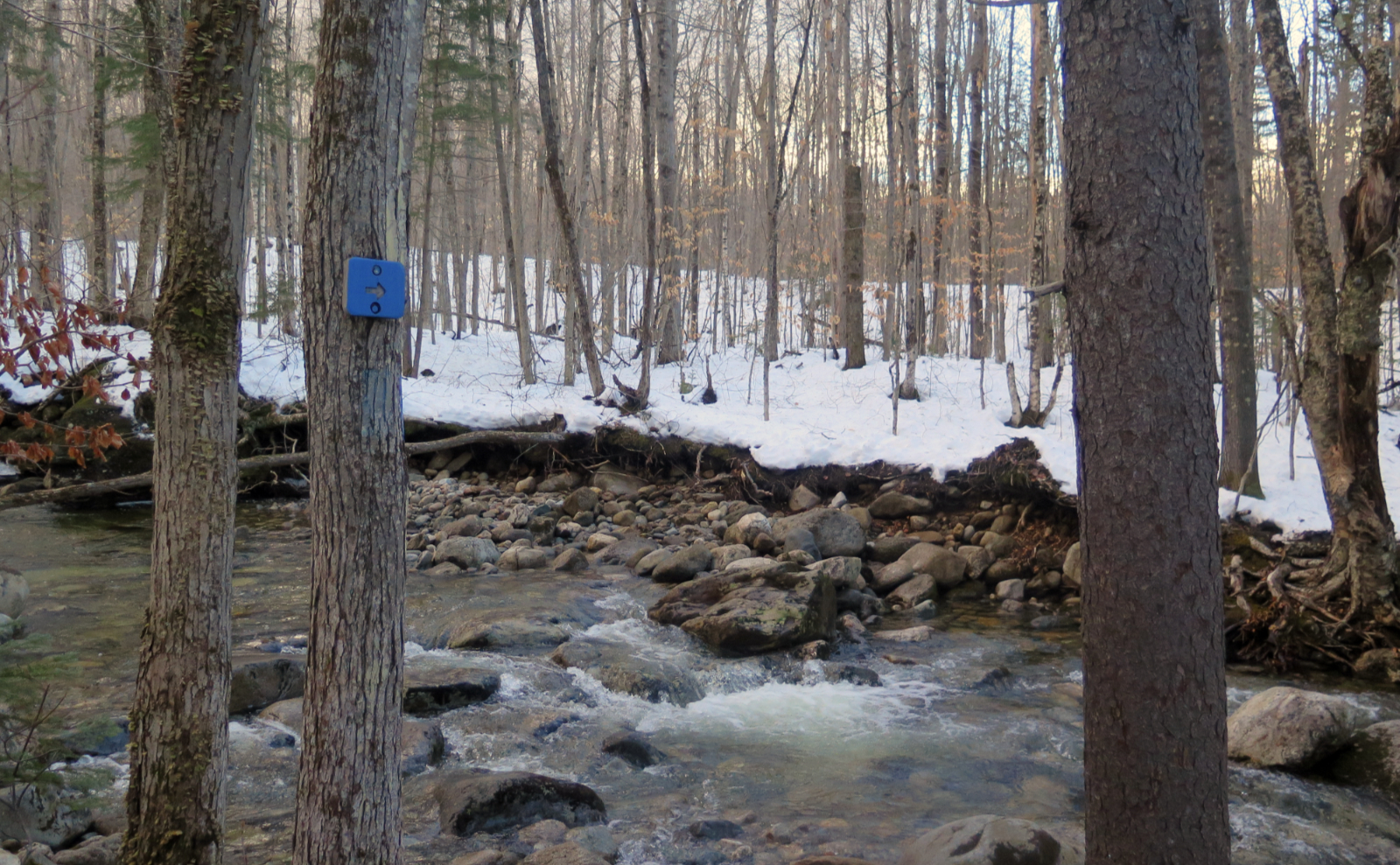
Mileage-wise, Moriah by way of Stony Brook seemed to make the most sense. Sticking with the Wildcats would involve the much longer route that starts out on 19 Mile Brook, adding more than two miles (and at least an hour) to my hike. Moriah’s summit would be about five miles away from its trailhead. Even in the snow, I should be able to bang out the round-trip in half a dozen hours or so. Just a couple years ago, I did just that and had a great time. And so, minutes later, I pulled into the Stony Brook parking lot and got myself put together. Pack, poles, snowshoes, mittens.
As I’d find out, Wildcats, Moriah, or even Kilimanjaro wouldn’t matter. I wasn’t going to get back to the car even remotely near sunset.
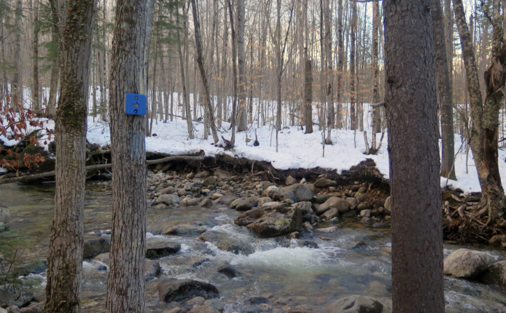
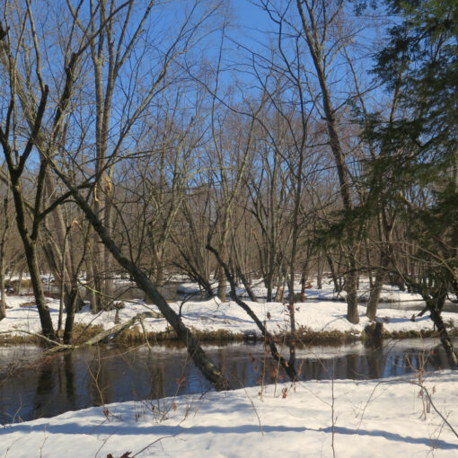
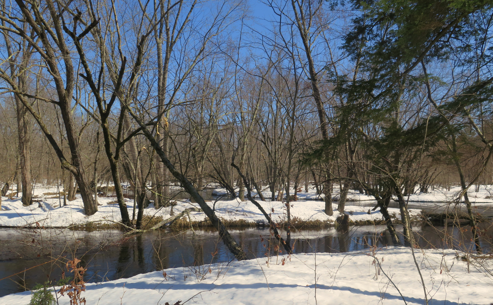
Starting out, some sogginess.
I made my way up Stony Brook trail, not having seriously considered that the presence of “Brook” in a trail name typically means something. And yep, the temps were well above freezing much of the day. The trail was soggy in more than a few places in the first half. Even on the way down, I “enjoyed” the wet — it wasn’t deep, and the soggy leaves and stuff made for a softer trail. On the way down, this was well received by my tired feet. And however wet it was, the ice was fairly tame. Seriously, it could have been a far bigger issue. Gore-Tex boots work, what can I say?
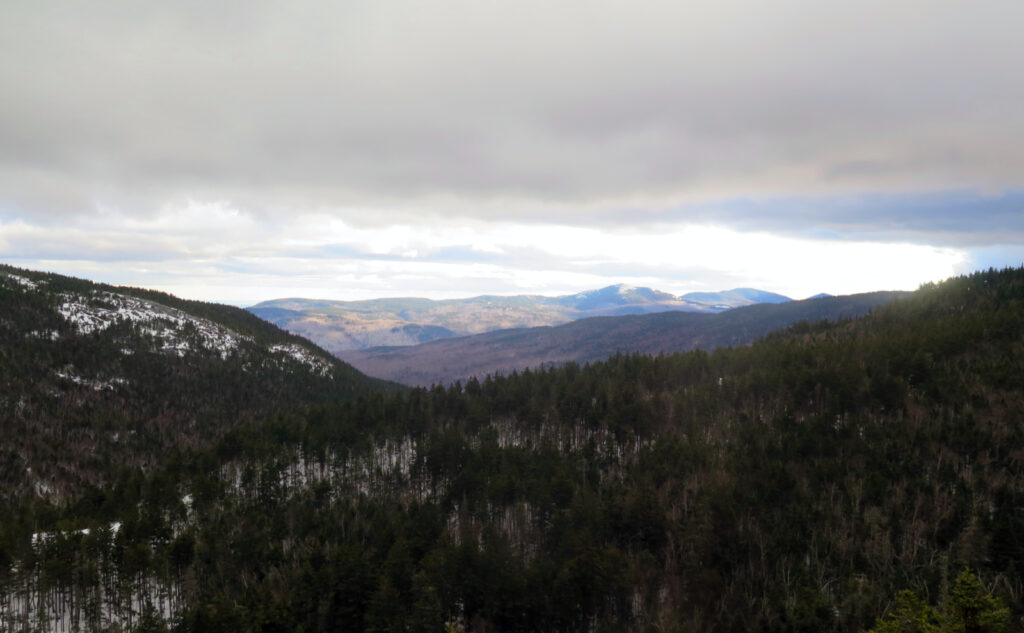
As far as the snow? That was weird. I passed through Franconia Notch, and there was snow… about 3,000 feet up. The talus field on Cannon was bare rock for the most part. This continued into Twin Mountain, where the snowmobile bridge was totally unfit for snowmobiles. Even as far as Appalachia, things were pretty thin. Finally, in Gorham, I saw snow-covered front yards, but it was a few inches at most, with plenty of patches of grass showing through.
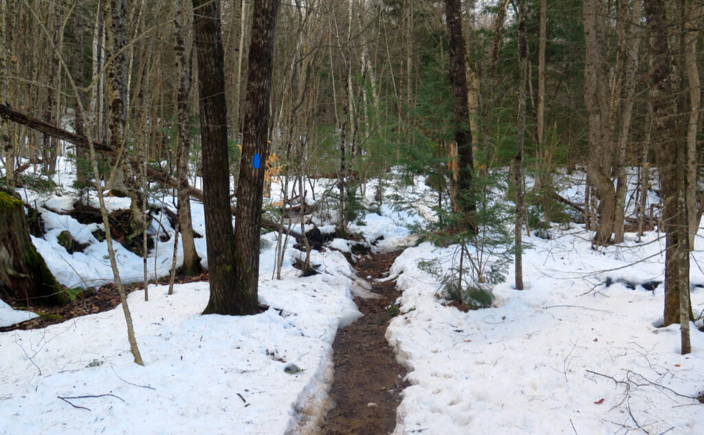
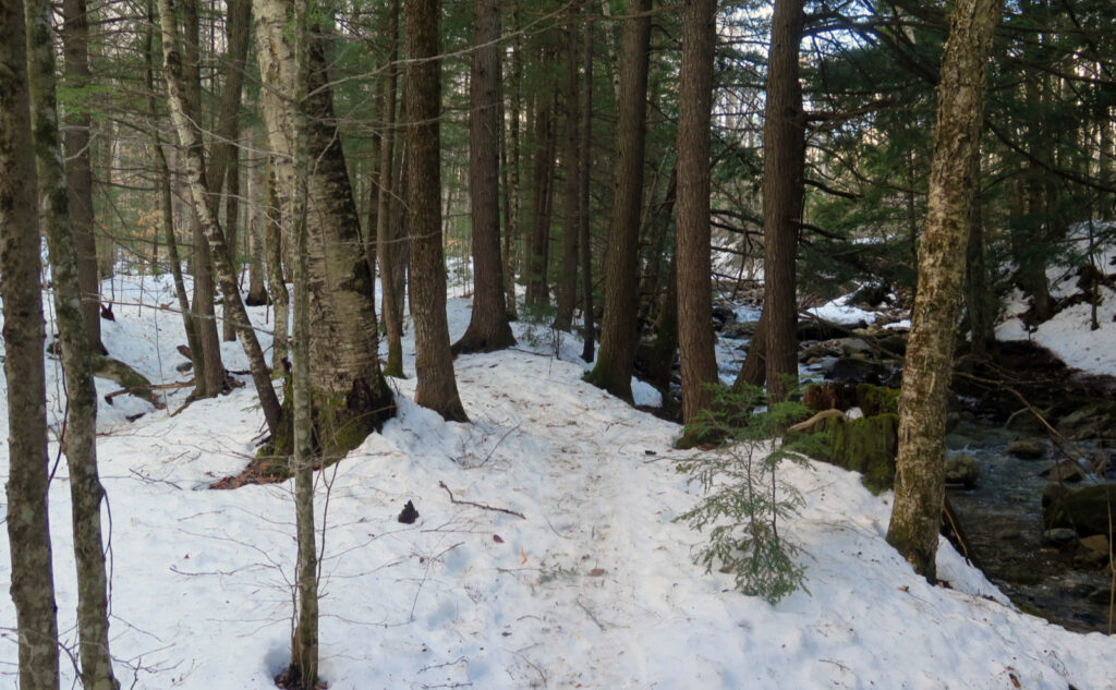
On the trail, it was a fair bit better. A bit lumpy and bumpy, but not terrible. There were significant places where water was draining off the mountain, but overall, I’d say at least 95% of the time, I was on snow of at least a couple inches. I made decent headway at a mostly-normal speed. You could tell people had bare-booted, but with the snow still only a few inches deep, the effect was minimal.
Climbing to the ridge.
At the first crossing of Stony Brook, things were spirited, but my feet stayed dry. I met K and her mom H, two hikers who were out to spend the night at Imp. We enjoyed lovely conversation for a couple hours, which made the miles melt away. The next crossing was much easier, and the ones thereafter were just one-step wonders. The trail got a little lumpier as we ascended. The snow was deeper higher up, and there were a bunch of postholes from previous hikers. It took a little longer than I expected to get there, but finally, we got to the junction with the Carter-Moriah trail.
My plans for the summit and their plans for Imp went in two different directions, and ultimately, so too did we. K and H did actually try to bag the summit for a short bit, but it soon became clear that the way going was slow, and sunset was approaching. With plans to make camp before dark, it didn’t make sense for them to continue. It was a good call. They turned back toward Imp. I carried on toward Moriah. All was well in that regard.
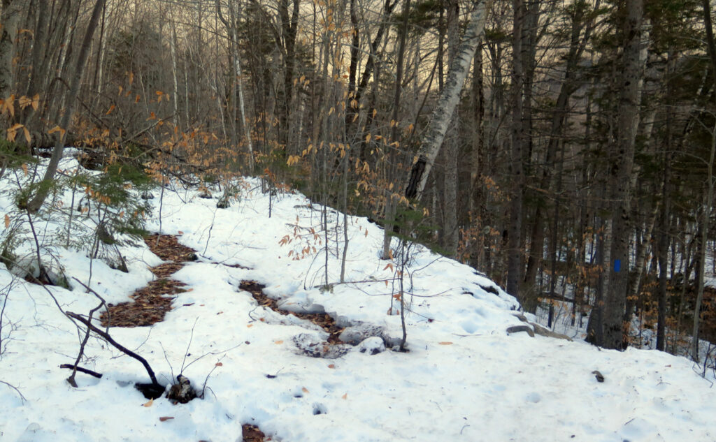
The ridge featured significantly deeper snow than the hike up, and this is where my pace slowed to a crawl. Almost the entire distance from the trail junction to the summit was roto-tilled into oblivion. I knew from my trip this past September that the last mile on Moriah wasn’t as easy as, say, going between the two Twins. In normal conditions, it’s rocky, but now, the postholes were significant and burdensome.
A question of good hiker ethics.
This is where I ask “what does ‘leave no trace’ really mean?” LNT is all about not being boneheaded. The first few principles cover the land itself — don’t litter, camp on durable surfaces, be careful with fire, and be mindful of wild- and plant-life. Even my most cynical and curmudgeonly self will grudgingly acknowledge that most people actually hit them pretty well. I make a point of grabbing trail trash as I see it, but usually this is all of 2-3 food wrappers, and maybe one or two hiking pole tips. Not bad when you think of the sheer numbers of people on the trails every year, and I’ll gladly assume most of it is stuff inadvertently falling out of people’s pockets and whatnot, unseen and unknown. Life happens.
The last principle is “be considerate of others.” The LNT folks define this as taking care not to be loud in terms of visual and audible impact. Yield to other hikers. Keep your dog under control. Wear earbuds if you want to listen to your tunes. That kind of thing.
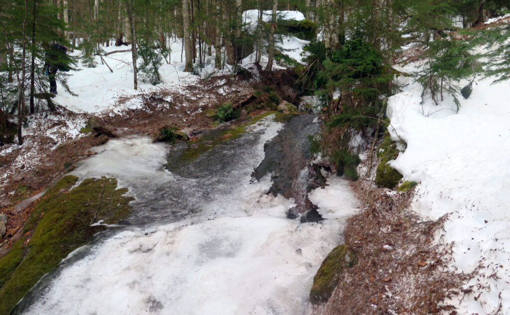
All those are great, but LNT fails to address winter footwear. Specifically, it leaves out why it’s important to wear snowshoes, and not make endless postholes on the trail. Postholes are a huge trace left by the passing hiker that remains for everyone after to “enjoy.” They slow you down, they can turn an ankle in no time… they’re a blight, they’re a pox on the land, they’re miserable to deal with. Let me tell you how I really feel.
Stagger, stumble, slip.
I found a trail that was demolished by bare-boot hikers, likely from the unseasonably warm weather we’ve had over the past week. Since all that traffic, the snow froze solid, leaving behind a pockmarked moonscape to stumble across. I enjoyed a sidewalk-smooth trail on Tecumseh a couple weeks ago, but I guess now we’re not allowed to have nice things. It’ll take a solid foot of snow (at least!) and a bunch of snowshoe-wearing hikers to repair the damage — or just wait until June.
It was pretty frustrating not being able to take a good stride in that mile and a half. It was also very tiring, having to always be vigilant, always at risk of turning an ankle (or worse!) All the while, I was confused. Who in their right mind would tolerate postholing over and over, in snow that was often shin-to-knee deep? I put that one between tidying up the Aegean Stables, and fetching the Golden Fleece.
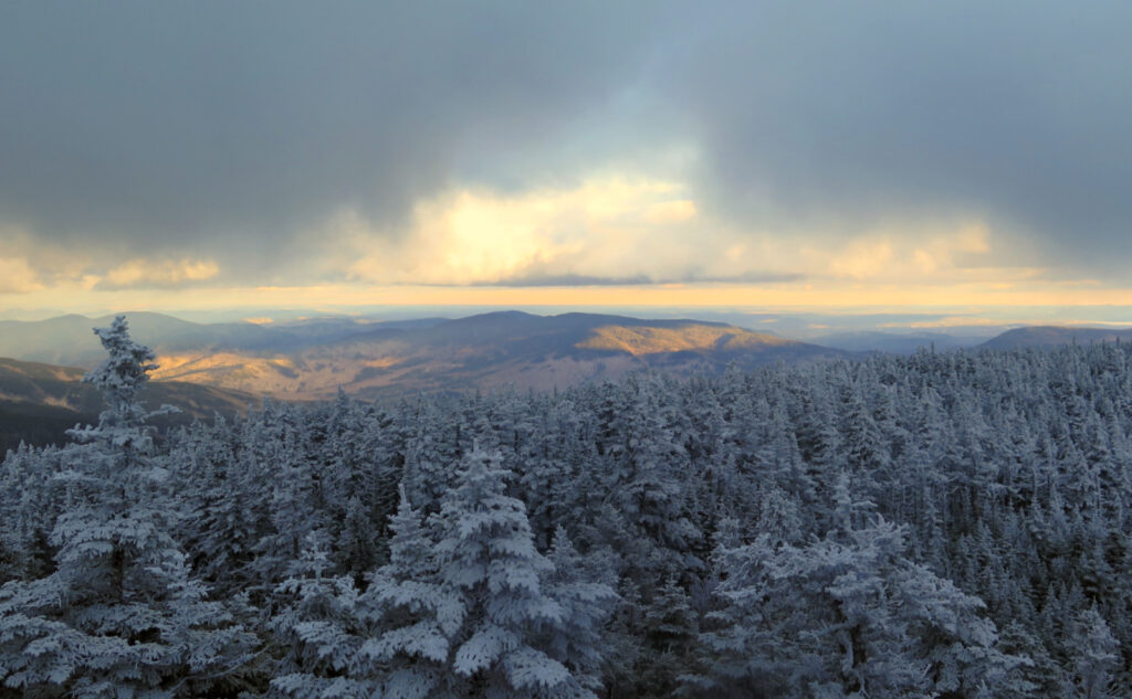
Finally, I got to the summit spur. The climb up was pretty straight forward, but I’d find out later why it wasn’t as nice as it could have been. But still, within a few minutes, I strode across bare rock, looking straight down at the summit medallion. Tired, more than a bit frustrated, and with low-hanging clouds everywhere clipping views on almost all sides, I spent hardly a minute looking around before turning back. This was a day to book mileage, and little else. The views were crushed by clouds, which was pretty crummy.
On the way down, I stumbled and bumbled over those postholes. Just before the last water crossing, I broke left, and took the fire road to the residential street. After miles of moonscape, level land was warmly welcomed. A short road-walk back to the car, and I was done. It was a long outing. I was cooked. But hey, I managed to summit, even though it took way longer, and was way more strenuous than I expected.
On trusty old gear.
So the push up the summit spur could have been nicer. It wasn’t bad at all, but later, I made a surprising discovery. I’d long noticed that my trusty MSR snowshoes were getting worn. Before heading up the trail, I joked to myself that the side teeth are so ground down that I could put my ‘shoes on the hood of my car without scratching the paint.
Imagine my surprise when I got home, looked harder at them, and realized the front point crampons had broken off of both snowshoes. Wow!
It’s not something that I’ll race out tomorrow and get a new pair. They did fine on Tecumseh, they didn’t let me down on Moriah. On the Osceolas, nary a peep from them. I think, from what I’m planning in the next few weeks, that they’ll do fine for now. I’ll choose my mountains and trails thoughtfully, for sure. But while I’ll get at least a few more outings out of them, it’s safe to say they’re heading into retirement in fairly short order. I’d like to run out the season in them, but no more than that.
In all fairness, MSR made a great product that owes me absolutely nothing. Over the years that I’ve had them, I’ve “lovingly” beat the hell out of them, and they made no fuss about it. Miles of smiles, and they never once let me down.
I’m looking at what’s out there, but it’s very likely that I’ll get another pair. That said, I’ll be inspecting the new ones more regularly. Being metal, you wouldn’t think the crampon points would outright break off (and quite cleanly at that!) But it did happen. Nothing that would have stranded me, but on the summit, the absence of those points was noticeable.
So yeah, put eyeballs on your gear from time to time, maybe a bit more often than you’d think was necessary.
As always, stay safe out there.
Nuts and Bolts: Take 16 south out of Gorham. About a mile and a half down is a bridge over the Peabody River. Immediately beyond the bridge is Carter Mountain Road on the left. Turn here, and you’ll see the trailhead straight away on the left. You should be able to see the kiosk and sign from Route 16 — the trailhead is about as easy to spot as Appalachia is from Route 2. (The sign is about the same size, too.) Unlike the Carter-Moriah trailhead on Bangor Street, there’s actually a small parking area. Woo-hoo!
Blazes are blue for Stony Brook, and white up on the ridge — you’ll be on the AT with its customary markings. From the south, the sign for the summit spur faces away from you. But you’ll figure that out just fine. Be alert to the fact that the Carter-Moriah trail joins in with the summit spur. Make sure you go out the same way you came in, or it’s a long walk back to the car.
If you enjoy reading these posts, please subscribe — stay in the loop! Your email will only be used to alert you of new posts — typically 1-2 times per week. I will not use or share your email for any other purpose without your express permission. And feel free to share via social media using the buttons below.
Find me in the mountains, on this blog, or on Twitter: @Protean_Hiker https://twitter.com/Protean_Hiker/
Additionally, for all the cool kids who sit in the back of the bus, find me on Mastodon: https://mastodonapp.boston/@Protean_Wanderer
Help support this blog! Visit www.photos.proteanwanderer.com to buy some of my signature images.
10 thoughts on “Trip Report: A moonscape on Moriah. ”
Just fyi MSR does repair the snowshoes for a modest fee. I broke my front crampons coming off East Osceola last winter and sent them to MSR and for 35 bucks they fixed them. Biggest expense is shipping them out there but still cheaper than a new pair (though I bought a new pair with the paragon binding).
I’d actually heard about their repair service. Alas, the side rails are almost ground completely flat. It’s not like I didn’t get my money’s worth these few years.
How do you like the new binding?
The new binding is great. I at times had hot spot issues with the straps (not really sure why it happened sometimes and not other times) but this binding eliminates that completely. It is more secure and the straps are held down better also. Highly recommend especially for the terrain for the winter 4000’s
Awesome. Yet another reason to upgrade. Thanks!
Another vote here for MSRs with the paragon bindings. I love them, set them and forget them, and trek on. They have reasonably priced replacement bindings for sale too, in case of oopsies. I got them in 2021 and don’t have tons of miles in them, but more than enough to love them over other binding systems I have had.
OK! Another data point! It would seem that perhaps I’ll be upgrading sooner than expected, given the support.
Thanks!
Bummer! Just missed you as we hiked from the Gorham side on the same day. Similar trail conditions there, frozen deep postholes up high and mud down low.
Drat! That would have been fun to meet up.
It was so great to meet and hike with you!! We we’re bummed to split from you early, but grateful to make it to Imp before dark as the 0.7 along Carter-Moriah to the turnoff for the shelter was hard going with postholes. Rest assured we both spent the whole time hiking out talking about how we are never winter hiking without snowshoes again! Thank you for passing on that wisdom 🙂
H is going to email you some pictures from our night and some of the kayaking/eating places you two talked about. Overall, it was a great first winter camping experience for H (she actually felt toasty overnight) and a fun trip for both of us, and meeting you made it extra great!
Hey! I got H’s photos, and it looks like you had a great time. I think you made the right choice in heading to the shelter when you did. I got off trail some number of hours after dusk.
These are the ‘shoes others have commented on, and my likely upgrade path. https://www.msrgear.com/snowshoes/ascent-series/womens-lightning-ascent-snowshoes/womens-lightning-ascent.html The MSR Lightning Explore ‘shoes are the ones I currently wear, and they’re also a fine choice.
Cheers!