
Mt Garfield (4,500 feet). Franconia/Bethlehem, NH. 2023-01-08 (Sunday.)
Via Garfield and Garfield Ridge Trails. 10 miles round-trip, plus 1 1/4 mile (each way) road walk.
Mid-20s throughout. Winds were hardly a whisper in the trees, a bitter 10-15 knots at the summit. Unbridled sunshine all day.
Car: 1145. Trailhead: 1210. Summit: 1510. Trailhead: 1545. Car: 1735.
A safe bet is to budget about half an hour to walk from the parking area to the trailhead. At the moment, there is a nicely tramped out footpath that makes for comfortable travel. However, this is as likely as the weather to remain the same for as long as three days. Play hooky from work: strike while the iron is hot!
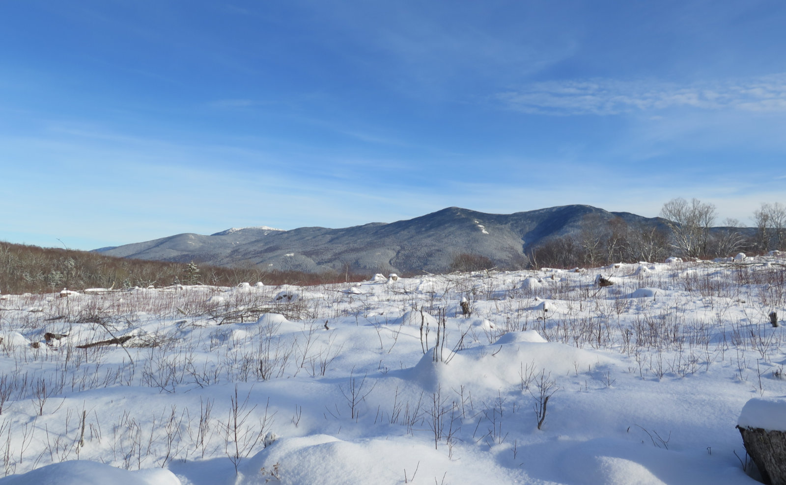
The blue, the white. The wind, the night.
It seems to be a recurring theme: my alarm rings, and then I promptly hit snooze approximately as many times as there are rocks on Mt Washington. Which is to say “way too many.” On the drive home this evening, I was given to wonder if it really mattered this time. Realistically, probably not. But I had to ask.
One tiny thing that slowed me down was that my White Mountains parking pass expired. Fun fact: 95% of the fees collected from parking passes stays local. The annual pass is a whopping $30. Daily passes are five bucks. I usually get mine at the info center in Lincoln, just across the Kanc from where the 93 North exit dumps you out. Having a sticker means not having to deal with the iron ranger. Do the right thing. Trails don’t maintain themselves.
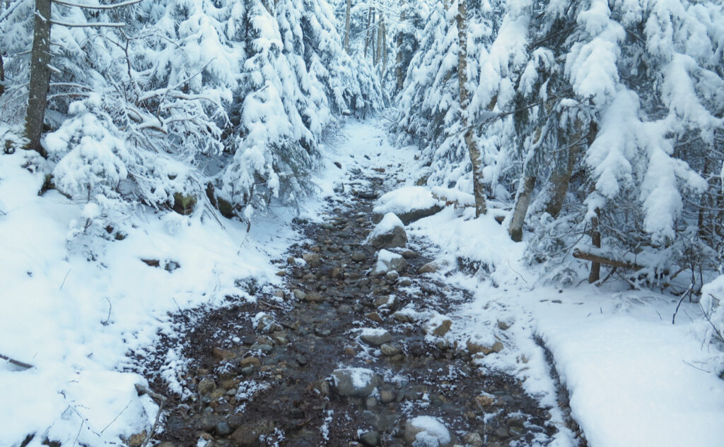
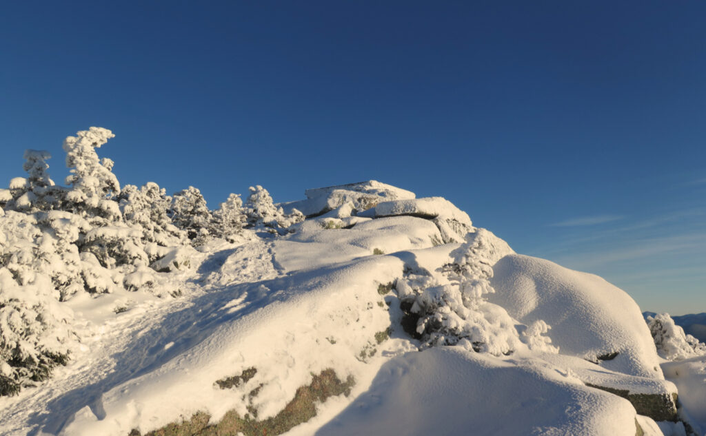
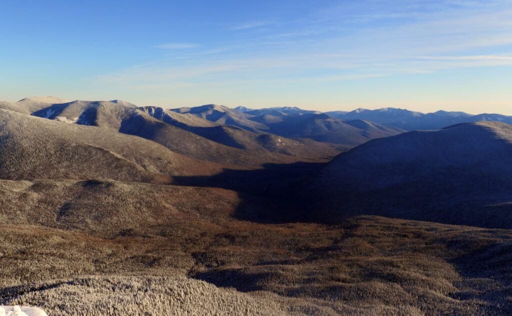
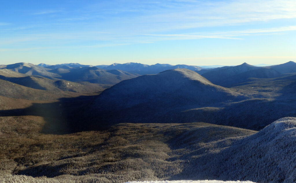
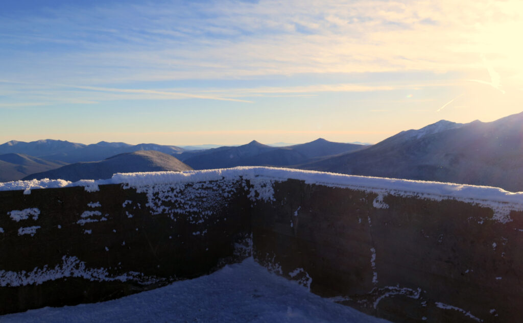
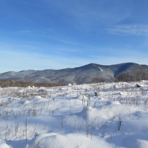
Any hoo, there was an outing. There was some amount of mileage, including a stinking road walk just to get to the trailhead. But there were (relatively) mild grades throughout. A trail that was gloriously tamped down by legions of trampers. A slightly hairy water crossing that really wasn’t terrible. And I stood on top of the fortress that is Garfield, looking down, with utterly commanding views, into the western end of the Pemigewasset Wilderness. Wind in my hair, warm sun on my face, all that.
Oh, and about that late start…
It’s kinda silly that I can’t seem to get out of bed on the quick. I mean, I can, but usually it’s only because I have to get to work on time. One of the things that occupied my mind today was the timing of sunset. Not the least, but after I dealt with the water crossings, the thought of dealing with them again, but in the dark, loomed large in my mind. As things turned out, I think I hit the trail at the right moment. It might have been nice to have had a start that was *maybe* 15 minutes or so sooner. Things turned out fine, though.
Hitting the summit at three in the afternoon meant getting this wonderful golden light. The photos don’t do it justice — whatever algorithms are in the camera bungle the whole works on that one. Just trust me on this. Especially if you can find a shorter hike, embrace a later start. Once you cross over mid-afternoon, savor the light. Sitting on West Bond first thing in the morning is the only thing I can think of that comes close.
Hiking back, wasn’t it dark?
I mean, yes, but for most practical purposes, it wasn’t necessarily headlamp conditions. I wish I could recall which one, but it was on the return from something north of Lincoln Woods — Owl’s Head, or the Bonds… not sure which. But either way, it was well and truly nighttime when I was back on Lincoln Woods trail. And yet, there was a moon. Maybe just 25% or so, but with the snow, it was plenty of light to navigate.
People were out on their evening constitutionals, some on X-C skis, some taking the dogs out, just wearing micro spikes. It was a great vibe, everyone out enjoying themselves, with all the light anyone needed coming down from above. And it was proof that sometimes, your headlamp should stay packed away.
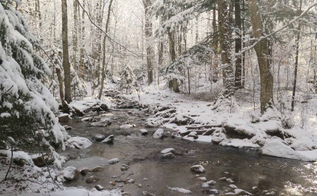
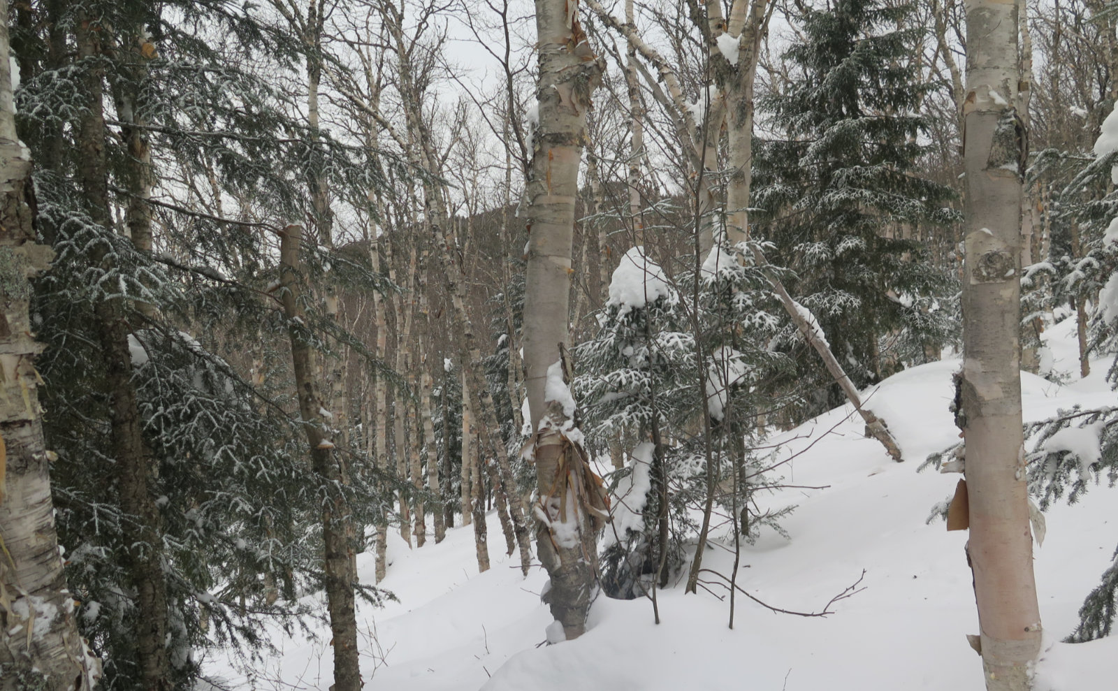
I got down the mountain, and across the water crossings. Spruce Brook was fairly tame. Thompson Brook was something of a bear on the way up, and now on the way down, it took more concentration. But I had the last dregs of twilight on my side, and made it across with dry feet, thanks to Gore-Tex and some advantageously situated rocks.
The darkness was encroaching, and nearer to the trailhead, I was pretty much using The Force to intuit my way back. But the trail was still apparent if you knew how and where to look. At last, I was back on Gale River Road, and there, the gap in the trees was much wider. Even by starlight, the road was almost blindingly obvious.
Stellar views, indeed!
What stars there were overhead, so near to sunset, were glorious. I easily spied Cassiopea, and also Cygnus, shining bright. The trees weren’t particularly advantageous to see much more. But on my way through Franconia Notch, I looked to the side, and over the ridge, I saw the shoulder of Orion. (Thankfully, no attack ships were on fire!) Further along, the moon rose… I was probably south of Plymouth. The wonders didn’t cease when I got back to the car.
And then, I was back at home. It was a good day out. For some irrational reason, it sticks in my mind that Garfield is a tough nut to crack. The more rational me chalks this aberrant opinion up to the approach from Franconia Ridge, where the combination of being physically exhausted, and stumbling over endless rocks and roots, before making a very steep climb, beats the hell out of me.
But coming in from the north, the trail is much more moderate. It’s long, for sure, but part of that is the switchbacks which make the grades much easier than if it were a typical fall-line trail. And I think that’s no small part of what made today such a nice day. I need to remember that it’s a good time, and even the road walk in is pretty laid back. In short, it’s a fine place to be.
As always, stay safe out there.
If you have similar or different experiences on this trail, please leave a note in the comments. Hearing from my readers is one of the things that makes it easy to write and maintain this blog.

Nuts and Bolts: Trailhead is on Route 3, just before the Gale River bridge. Take the Twin Mountain exit after Franconia Notch. Follow about 5-6 miles and you’re there. Park before the gate. As of this writing, there’s a thin layer of packed-down snow in the parking area, but if you feather the clutch, I doubt you’ll get stuck. Drive smartly.
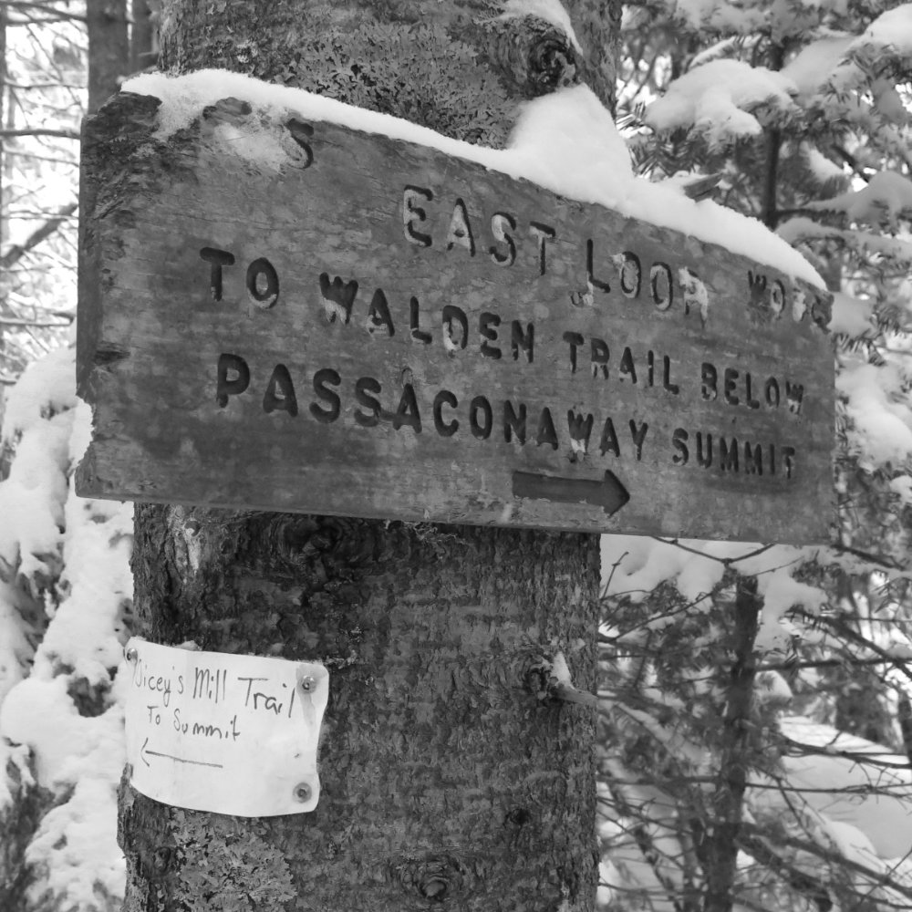
Trailhead will be after a mile and a quarter (or so) road walk down the fire road. Look for it on the right; there’s a wooden trailhead sign just after the metal hiker sign, and immediately before that, there’s a wide open parking area that’s nearly impossible to miss. Blazes are blue: the trail branches off the AT, so it’s actually blazed quite well. Up on the ridge, blazes will be white, in line with the standard AT blazes. Right now, the trail is quite obvious.
On the way down, be mindful: some people have headed further down the ridge in the direction of the shelter. As of this writing, each of the two options are about as tramped down as the other. Watch the signs, and make sure you’re on the correct route. It’s a very long walk back to the car if you mess this one up.
If you enjoy reading these posts, please subscribe — stay in the loop! Your email will only be used to alert you of new posts — typically 1-2 times per week. I will not use or share your email for any other purpose without your express permission. And feel free to share via social media using the buttons below.
Find me in the mountains, on this blog, or on Twitter: @Protean_Hiker
Additionally, for all the cool kids who sit in the back of the bus, find me on Mastodon.
Help support this blog! Visit www.photos.proteanwanderer.com to buy some of my signature images.