Mt Tecumseh (4,000 feet*). Waterville Valley, NH. 2022-12-19 (Monday.)
Via Mt Tecumseh Trail. 5 miles round-trip.
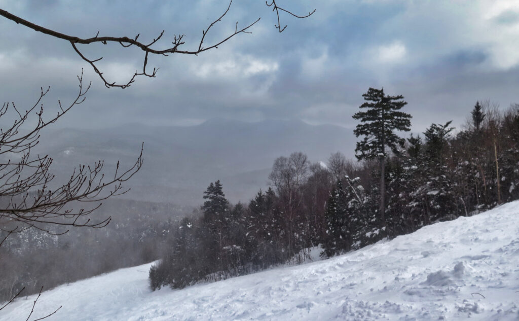
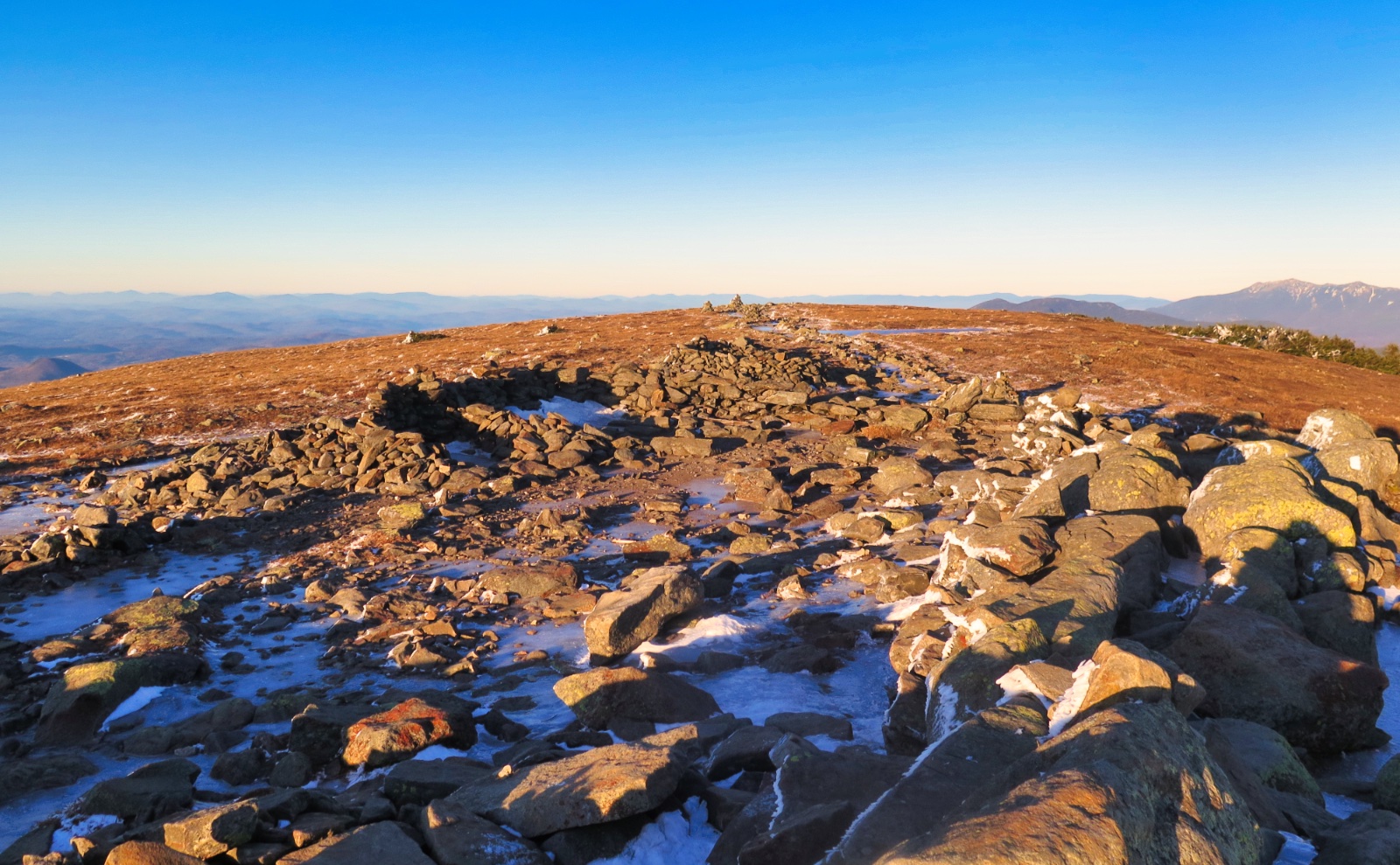
25 dF at the trailhead, 22 dF at the summit. Winds were “mostly” negligible in the trees, but occasionally felt, especially at the summit. Mostly cloudy at the trailhead, socked-in fog at the summit. Not the day for endless views.
Trailhead: 1130. Tecumseh summit: 1330. Car: 1500.
Unexpected. And yet, just what I needed.
There’s no shortage of discussion/debate (really, it’s your definition, not mine) about the value of lists in hiking. Short of it is that either you’re in favor, or not. For me, they make up a very useful framework; a way to keep myself honest, and a way to keep track of what I’ve done and not done. They’re a metric, and I’ve found I’m very motivated by metrics. Put me on a treadmill, and I try to go a little faster, a little longer. Knowing how fast I ran my last 5k makes me want to run the next one faster.
Anyone who’s read this blog for more than a week knows I’m both doing the grid and redlining. In the grand scheme, they’re mindless goals. No-one who’s achieved either or both has gone on to win the Nobel Prize. If I ever get a phone call from Sweden (or, better yet, Cambridge) in the wee hours of the morning, I’ll be sure to post here shortly thereafter, so all of you, my readers, can share in the joy. But don’t hold your breath.
This morning, I was still on the fence as far as what I was going to do. The spreadsheet of doom had several options, but neither my heart nor my head was into doing anything majestic. Still, I didn’t want to knock off Tecumseh, because somewhere within me, something was saying “save the easy one just in case.” But as I vacillated, the clock moved onward, and I ended up driving to Waterville Valley just the same.
As things turned out, that was a great happenstance.
I think the past few weeks have wrung me a bit dry. Moosilauke was one of the easiest hikes I’ve done recently. Before that, Jefferson, Adams, Middle Carter, Waumbek and Cabot (in a single day!), and then Carrigain. Every one of those outings was a day trip with some pretty significant pain. Nothing I’ve done in the last two months was “easy going.” And now, even though it isn’t officially winter, we’ve got snow enough to require snowshoes — “easy hikes” won’t really be a thing for the next three or four months, at least.
Tecumseh isn’t a hard outing. I can point to three or four others that fit a similar bill. Waumbek or Cabot, Pierce, and Hale would round out that list. If you didn’t insist on hiking the trio, Tom or Field aren’t hard, either. (Doing all three makes a longer day, but aside from the extra time and mileage, they’re fairly straightforward.) And not for nothing, this mountain has history, being my first 4,000 footer; and in conditions not unlike today.
It was with some measure of reluctance, but at last, I got out the door, heading north, accepting that I was going to knock off the shortest of the 4,000 footers. Later in the afternoon, I found out it was everything I needed. Sure, it would have been great for my lists to have knocked out two or more peaks. But I just needed something far less committing. Something short and sweet.
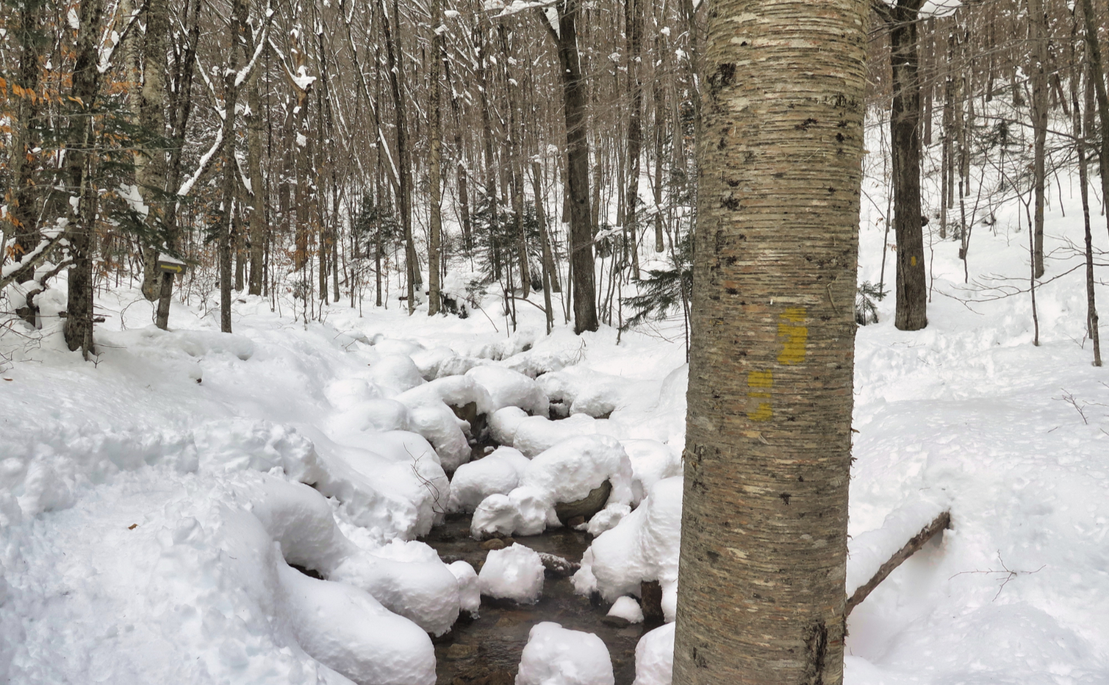
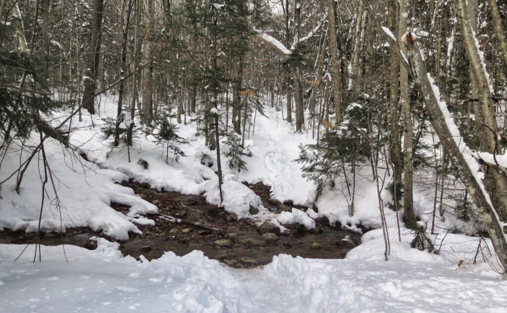
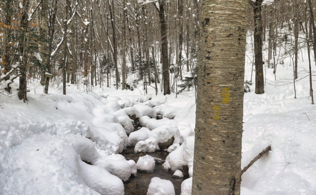
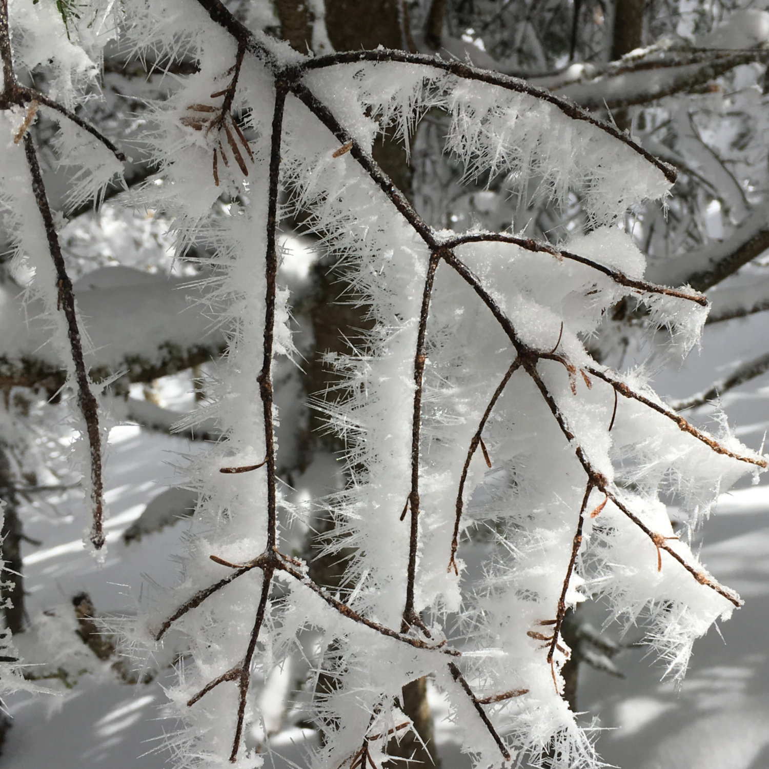
Fresh snow, not much of an obstacle today.
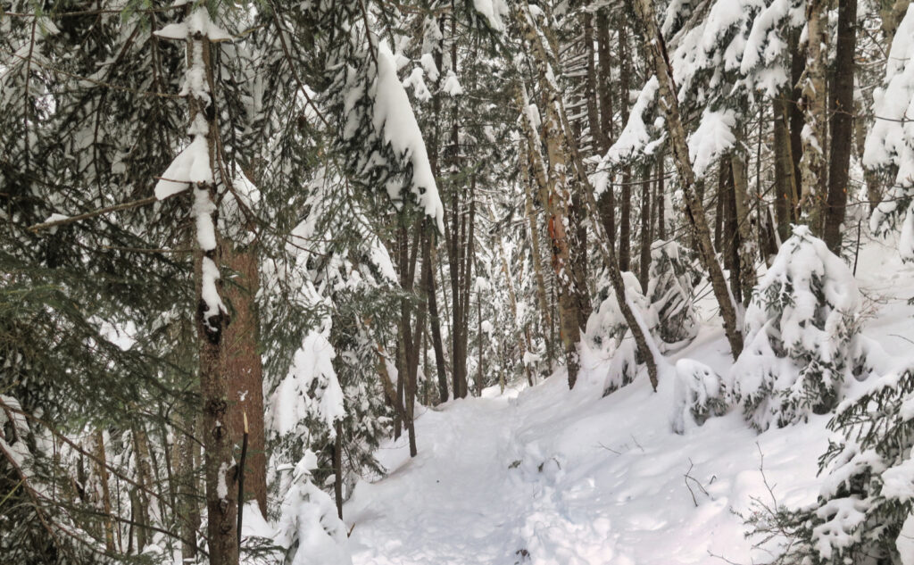
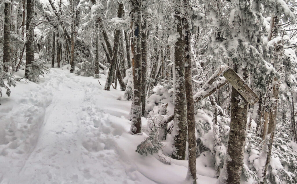
I’d read a few reports on New England Trail Conditions that all suggested Tecumseh was in stellar shape. No idea how a foot of snow a couple days ago got managed so well, but that’s what I saw, too. Yes, it’s a fall-line trail in many places, but all 2.5 miles of the trail were wonderfully tramped down. Everything was smooth, start to finish. This isn’t just an easy trail in July. It was an easy trail today, and I made quick work of it.
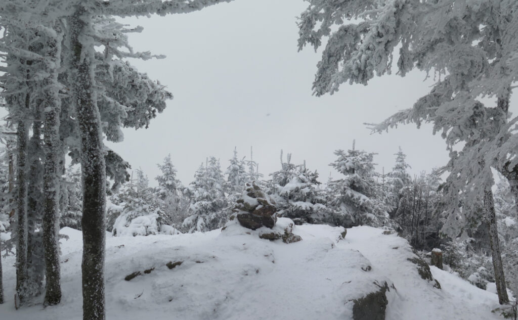
The weather left a lot to be desired. Instead of views that went straight out past the Tripyramids, I got the inside of the ping-pong ball. Even seeing the ski area or the valley below was asking a lot, even from the vista halfway up the trail. But then again, I hiked a bunch among trees that were freshly coated in snow. The air was cold and fresh. The wind bit a little, in a good way. It was good to be alive in the forest.
I got back to the trailhead in short order. No matter how you slice it, this isn’t a long hike. This was a good thing: afterward, I zoomed up 93 to The Mountain Wanderer Bookstore. Always a deadly destination, where despite several visits, I can’t seem to exit that establishment without an armload of books. Today was no exception. Steve inscribed my copy of “The Waterville Valley Guidebook”, which with its rich descriptions of the history of the valley (human, ecology, and geology) is about to become my new best friend. Thanks, Steve. Your pen is indeed mighty.
On one level, the day was a disappointment. I didn’t bag two or three peaks, I didn’t chip a lot off my list. No massive mileage, no new trails to add to my redlining list. But conversely, the day was a huge win. I had a quiet afternoon, on an easy trail, just recharging. Enjoying the mountain and the forest. Letting myself be wrapped in quietude, just occasional birdsong. In short, bliss.
As always, stay safe out there.
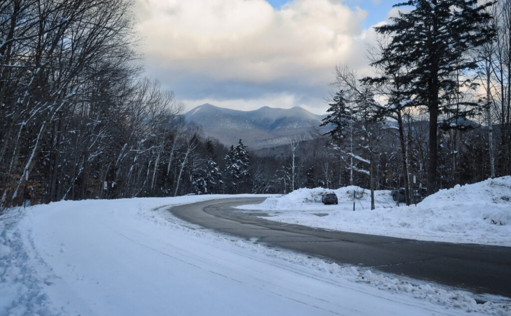
Nuts and Bolts: Take exit 28 from Route 93. Follow Route 49 to Waterville Valley ski area. In the ski area, make your way to parking area #1. (You’ll be about as close to the ski lodge as you can get without being in the pickup/drop off area.) The trailhead is on the north side of the parking lot. If you mess this up, the driveway is a loop; you can get another go at it. Take it slow; mind the people walking around everywhere. Don’t be “that guy.”
Look for a brown trailhead sign, on the small side. As of this writing, there’s a “hiker” sign visible from the road — they don’t overtly try to hide it. Blazes are yellow and fairly plentiful. That said, you don’t really need them on this trail. It’s a trade-route that gets no shortage of use. Route-finding is pretty trivial. At the screwy summit sign, take either side. It’s a loop, and either one will get you to the top in about the same amount of time. Don’t sweat it.
Views from the top are limited to whatever is to the east, but if you take the quick, half mile jaunt down the Sosman Trail, you have better options. That said, Tecumseh isn’t known for its views. Let it ride. It’s all good.
On the topic of snowshoes v micro spikes. The trail was in fine shape overall, thanks to a bevy of hikers who mashed everything down with their snowshoes, making a nearly sidewalk-smooth route from trailhead to summit. That said, there were occasional divots and minor postholes left by hikers not wearing snowshoes. Folks, it takes a couple dozen trampers on snowshoes to make the trail a nice, smooth surface that’s a pleasure to hike along. It only takes two or three hikers in spikes to turn that loveliness into a potholed mess.
Spikes are cheap. Depending on brand and style, they can be had for $75 on the high end, much less on the lower end. Snowshoes are a heftier investment — around $150 on the low end, and as much as $300 on the high end. They also take some getting used to, and that much weight is going to slow you down and tire you out.
That said, pothole-riddled trails will slow you down and tire you out. In the snow, there’s a significant qualitative difference between the traction you get with snowshoes (huge!) v spikes. Even on ice, snowshoes provide comparable traction compared to spikes. A nice pair of snowshoes will have heel elevators, which take the burn out of your calves on the uphills. And when you have to step off the trail for (ahem!) “reasons,” you’ll love having the flotation that snowshoes provide.
And hey, not for nothing, but Adirondack hikers already know about this. For everyone else, in the ADK wilderness areas, snowshoes are mandatory (by law!) in snow deeper than eight inches. (6 CRR-NY 190.13) Imagine that kind of thing happening in the Granite State! Folks, do the right thing. Keep the trails in fine shape in winter, as you’d do in summer.
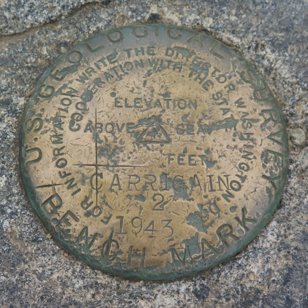
*Note on Tecumseh’s elevation: Some measure of debate surrounds the “real” height of the summit. Traditional USGS maps show the summit at 4,003 feet. A recent GPS-based survey revised that to 3,997 feet. More recent LiDAR-based surveying done by the Appalachian Mountain Club’s cartography department has shown the summit to be closer to 3,995 feet. Each successive survey has brought increasing levels of accuracy to the table, however, the official arbiter of the 4,000 footer list has always been the official USGS maps.
This, by the way, isn’t the first time the AMC has updated its list. As early as 1936, Tecumseh was thought to be 4,004 feet. In the 24th (1987) edition, the AMC “updated” its height to 4,003 feet. Similarly, in the 26th (1998) edition, Wildcat E was swapped for Wildcat D. It might take extra-human effort to move mountains, but the AMC repositions them on the 4,000 footer list at its will. That said, traditionally, the four thousand-footer committee has granted a few years leeway to trampers working on their lists to account for such movements of the goalposts. In other words, don’t lose sleep over this.
(All that aside, the changing of elevations is very obvious proof that you should update your paper map collection periodically. Not the least, but trails do get moved due to maintenance, storm-related damage, and whatnot. I swap mine out as the new White Mountain Guide editions hit the stores, but at the very least, you shouldn’t let two editions pass you by.)
For the moment, the 4,000 Footer Club has decided to leave the list as-is, at least until the USGS updates its maps; if you’re gunning for a patch, the official AMC list should remain your guide as to which peaks to hike. As of this writing, Tecumseh remains on the list. If you’re truly paranoid, I might nail down Guyot, and any other peak you’d consider borderline. I don’t think Sandwich Dome is ever going to grace the list, but hey, it’s a great hike just the same.
In light of the variations between the three surveys, I’ve listed the height as a generic value. Regardless, Tecumseh is still a nice outing, worthy of anyone’s time. Even if it’s a few feet short, it deserves its place in the 4,000 footer pantheon. If it falls off the list, I’ll still enjoy its trails; just as much as I enjoy Chocorua, Monadnock, Welch-Dickey, or any other “lesser” peak.
Aside from the “textbook” definition of the list, a true tramper of the Whites won’t mind if the goalposts move, having accumulated enough trail miles on enough of the various peaks to make changes to the lists meaningless. If you’ve hiked between South Twin and Zealand, for example, you’ve crossed over Guyot along the way — if that peak makes the list (as I think it should) you’ve already bagged it. And hey, is it the list that counts, or the trail?
If you enjoy reading these posts, please subscribe — stay in the loop! Your email will only be used to alert you of new posts — typically 1-2 times per week. I will not use or share your email for any other purpose without your express permission. And feel free to share via social media using the buttons below.
Find me in the mountains, on this blog, or on Twitter: @Protean_Hiker https://twitter.com/Protean_Hiker/
Additionally, for all the cool kids who sit in the back of the bus, find me on Mastodon: https://mastodonapp.boston/@Protean_Wanderer
Help support this blog! Visit www.photos.proteanwanderer.com to buy some of my signature images.

2 thoughts on “Trip Report: Tecumseh: perfectly imperfect. ”
Mike and I were on Tecumseh the same time you were, though going downhill. We were on Boneyard when some folks hiking up came out onto the side of the trail to look around before going back into the woods, made me think we should check out that hike sometime. Wednesday we skinned up the Tuckerman Ravine Trail but only to the Hermit Lake shelters, Avvy danger being “high” in the Ravine. Had a nice ski down the Sherburne. Thought of running into you atop Mt. W. a couple of years ago. Its been awhile.
I did step out into boneyard, but I was solo. Funny, tho. We could have scored another serendipitous mountain meeting. So close!
Good idea to turn back on Tucks. The mountain will still be there tomorrow, just as good as it was today.
PM?