
Mt Rowe (1,690 feet) Gunstock Mountain (2,250 feet). Gilford, NH. 2022-06-02 (Thursday.)
Via Rowe’s Revenge, Ridge Trail, Benjamin Weeks Trail, North Spur. Approx 8 miles round-trip.
Temps in the mid-60s throughout the day. RH about 75%: cool-ish, and slightly soupy, but not unbearably so. Winds were negligible, a refreshing breeze in exposed areas. Cloudy, with rare visits by a sun that was intent on breaking through, despite never having done so in a meaningful way.
Trailhead: 1400. Car: 1830. Ascending to Rowe’s summit was quick — a bit over half an hour, certainly well within 45 minutes. The rest of the time was spent tramping between the summits, and getting side tracked whenever I saw something I hadn’t seen in awhile. Which was often. Spring has sprung!
Visit my photography website, and help support this blog! http://photos.proteanwanderer.com
Belknap Range Hiker!
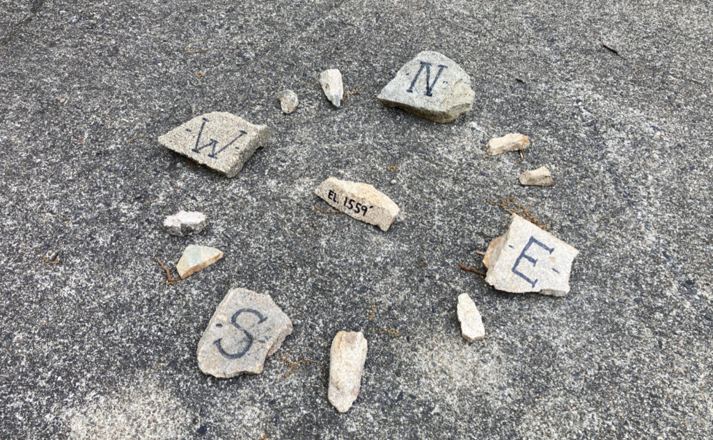
There was one bit of unfinished business today, even as I finished my last peak for the Belknap Range Hiker patch. I never figured out why Rowe’s Revenge was so named. I mean, it’s a fall line trail that doesn’t pull punches, but it’s quick and not that hard. But hey, it was a straight shot up, which was nice. Hooray for being to-the-point.
In other unfinished business, I’ve yet to mail in my stuff to the AMC for my winter 48. I’m thinking I might just end up doing so after the start of summer. Because that seems to be how I roll these days. Never do today what can be put off until tomorrow, right?
Is there anything out there?
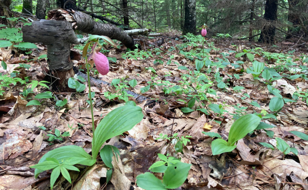
Silly patches and certificates aside, today was very nice indeed. Apparently I’m a cheap date, because my afternoon was made by seeing a pink lady slipper for the first time this season. It wasn’t my last, by a long shot. No kidding, the mountain is chock full of them at the moment, and I spent a lot of time chasing after the ideal photo. Is there such a thing? In one area, I counted half a dozen in an area about three meters a side. Wow!
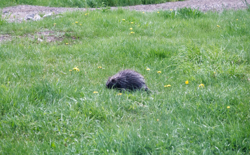
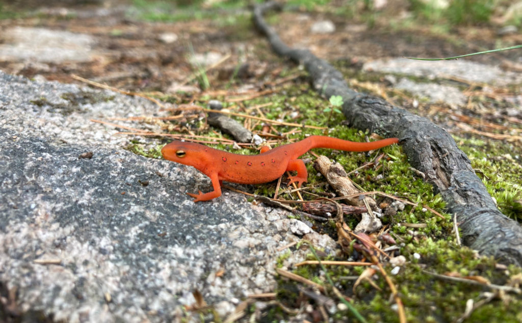
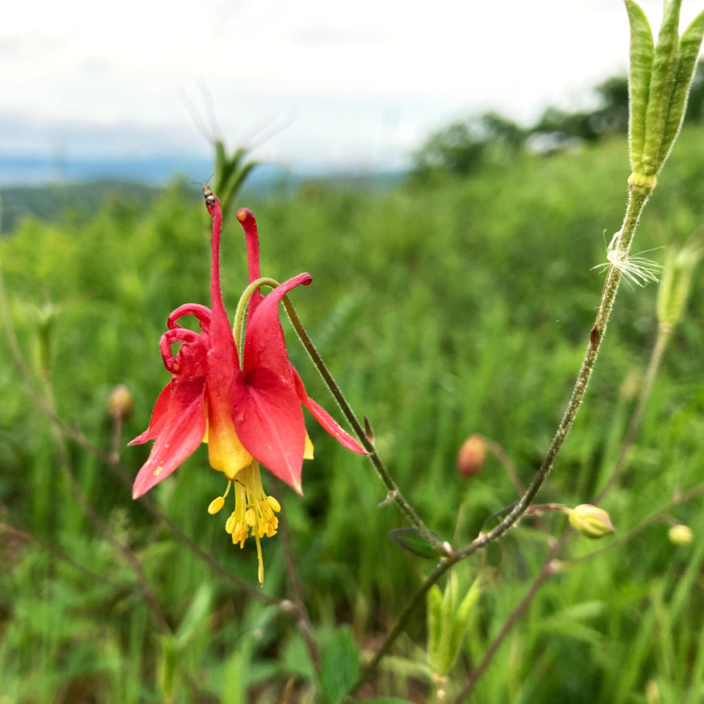
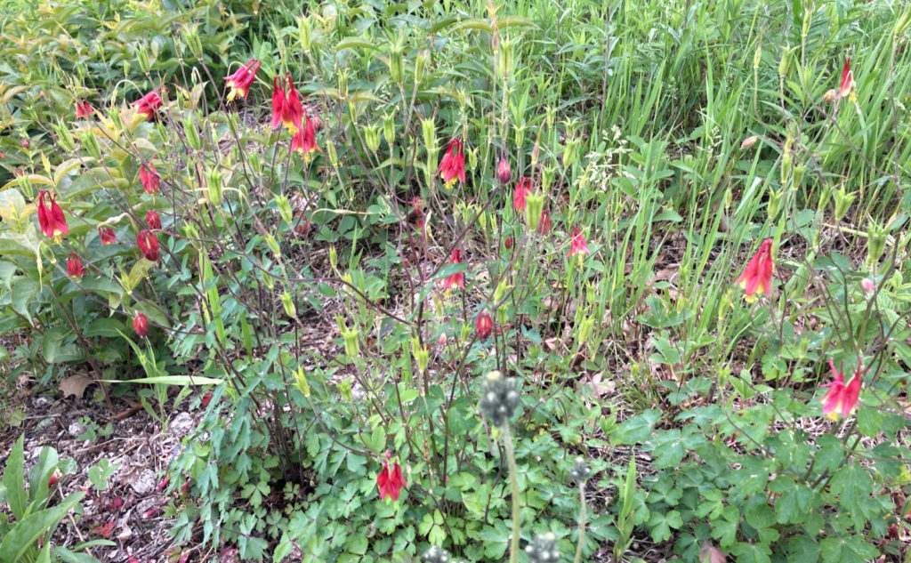
But that was just one example of seeing things in a day where I seemed to keep seeing things. Not sure I was paying more attention than normal, but there was the newt, a porcupine merrily noodling around in the grass, and some breathtaking columbines. It was an amazing day for finding things to look at, starting with some purple vetch by the car, and just going on and on from there. If this is an indication of the summer, I can’t wait.
There were times this past winter when I felt like I was booking mileage. Today was far from that, and I think it was all the flowers and stuff that did the trick. I don’t know why, but it feels like ski areas tend to have lots of wildflowers on their slopes. I noticed a lot on Saddleback. Sedges on Mansfield (the backside is Stowe). I think it’s just the exposure to the sun.
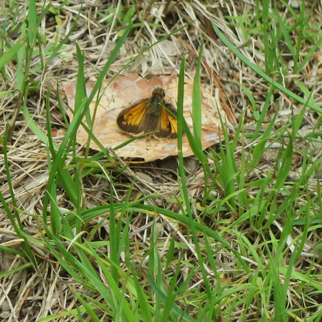
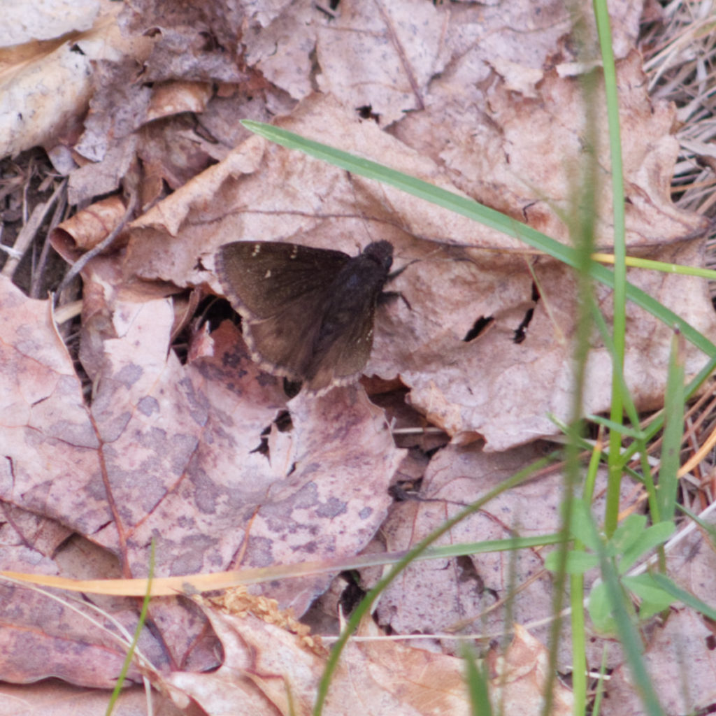
I might have spotted a Karner Blue butterfly as I started out. I’m not sure, but near the trailhead, there were a lot of dragonflies and butterflies. One did seem to flash some light blue for an instant, but I never got a good look — probably my only frustration of the day. That newt was very patient while I framed the shot, and showed its good side. The porcupine seemed similarly oblivious as long as I was quiet — I probably got within 15 feet. At one point, it raised its quills, but soon relaxed after I stepped back a couple steps. It was pretty chill, just like the day.
Fleet Feet Flew
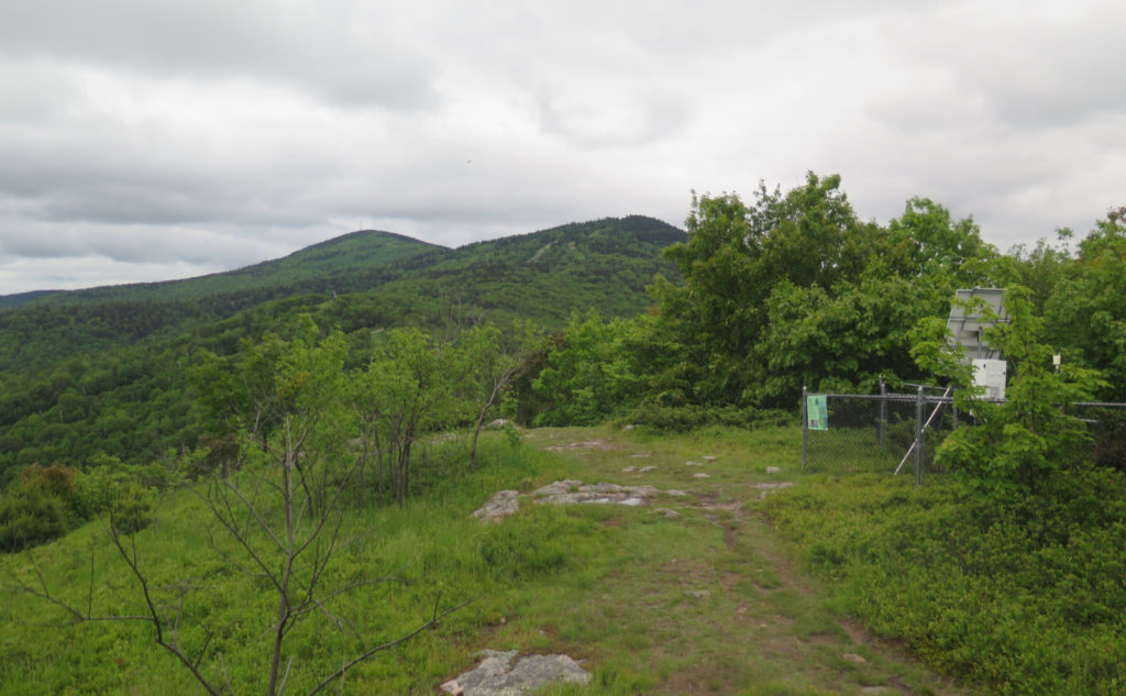
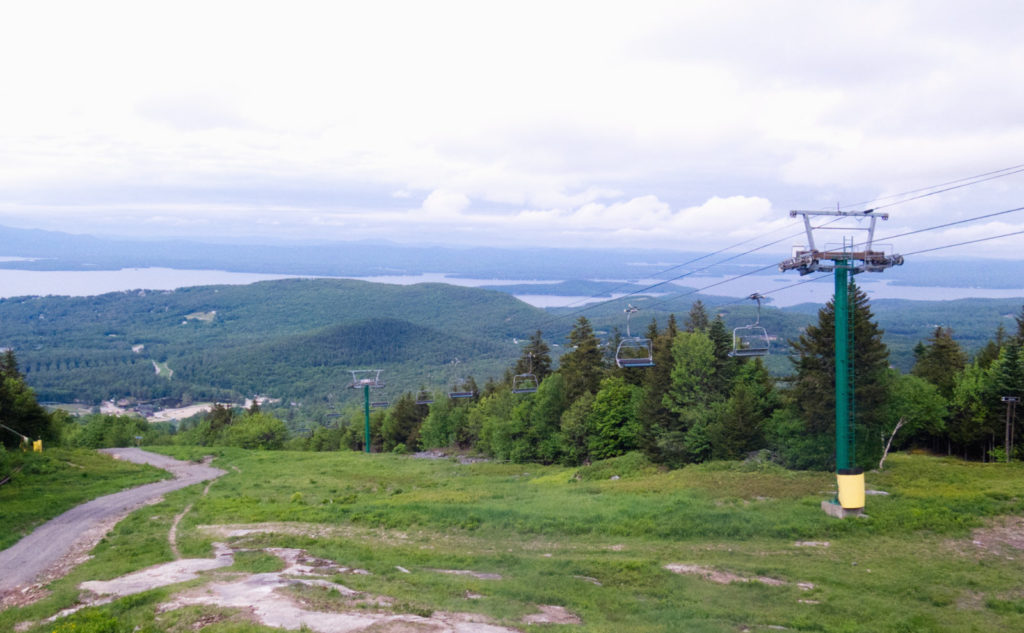
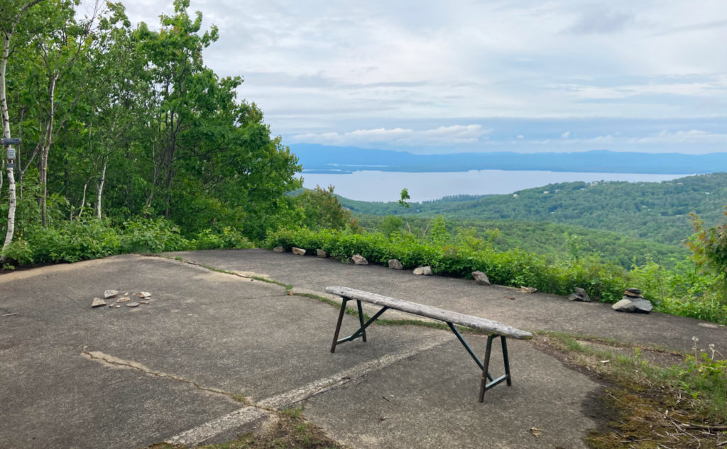
Overall, the trails were pretty moderate. There wasn’t a lot of sweating, nor much panting. This was one of the rare days when it feels like the trail comes out to welcome you. The views were attenuated by clouds (my Peak Finder app said Washington, Carrigain, and Moosilauke were all within view, as were the Tripyramids, but the only thing I could reliably spot was Winnipesauke. From various vantage points, I got great views of that at least.
Today finished out my Belknap Range patch. I’m probably going to redline, but that’s going to take a few more trips, and for sanity, I’ll block those out over the next couple years. These past few trips, I kept getting the sense that they’re a nice break from the big stuff, and a place where I can rejuvenate and recharge. There was an understated magic. Maybe part of it was the nearness; the lack of a long drive to get there.
I found myself again missing the big stuff, and tonight I was looking hard at the Pilot Range, where I found almost deafening solitude by Unknown Pond. But the Belknaps struck me, in a manner similar to the Wapack Range, as a people’s place. Just that spot where you bring the dogs out for an afternoon romp. No pressure. No revenge. Bliss.
As always, stay safe out there.
Nuts and Bolts: Probably the best, and easiest, way is to take 93 north into Concord. At Exit 15 (which heads toward Loudon) follow until Exit 3, and head north on 106. At Route 3/Daniel Webster Highway, hop on and go north for a few minutes into Laconia. From there, take 11a into Guilford where it crosses with Route 3. Much of all this is at a decent speed. But please slow down and be mindful when you pass through the obvious areas. You can go a long way on courtesy.
Just after Guilford Village, look for a huge sign for Gunstock — it’ll look like it’s for the ski area itself, in full color with the logo and all. Half a mile from that sign is indeed the ski area, and you’ll know this because it says “1/2 Mile.” Rather than carrying on to the ski area, turn right here. This is “Area Road” and you want to follow this past a bunch of ski chalet-inspired homes until its far end. There’s a locked gate blocking further travel, but nearby is parking. At this point, do the obvious.
For those who want to GPS the whole thing, plug “Guilford Elementary School” into your gadget. Once you’re near the school, turn off the directions and just keep going forward on 11a until you get to the sign mentioned above. It really is that easy.
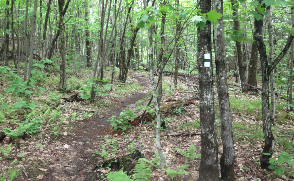
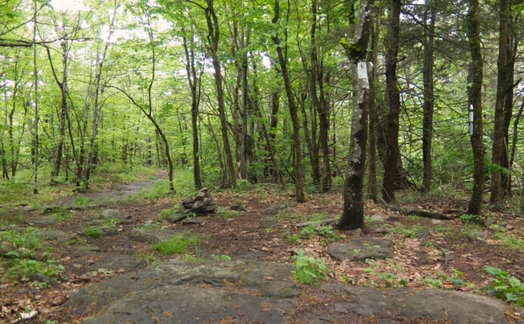
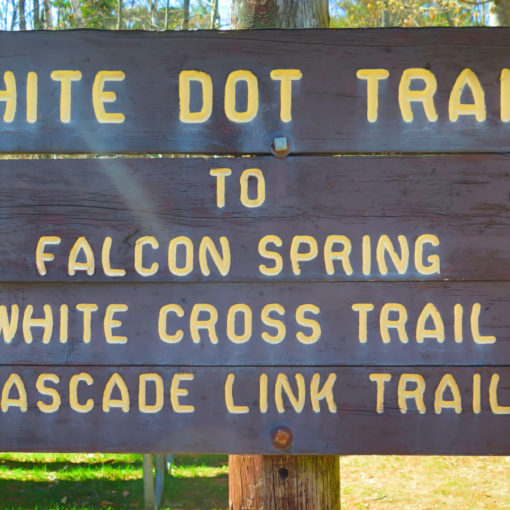
Trailhead will be about 100 yards past the gate, on the opposite side of the road. The trailhead sign is pretty tiny — it’s maybe 2 inches tall, and around eight inches wide. Oddly, it’s not hard to spot. Blazes are mainly white once you’re on the ridge. In general, you don’t need them much; the trail is pretty easy to find. The only concern is at the summit of Rowe, where a trail splits off and makes a more direct shot to the top. Those blazes are white with a green stripe through the middle, but really, just go uphill and you’re good.
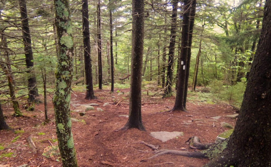
The North Spur trail really dries up after the junction with the Mt Rowe trail. It exists, but the forest is reclaiming it at the moment, and it can be a bit hard to find and follow. I don’t recommend this for any but the more experienced trampers. Use at your own risk. The other trails are in fine shape at the moment. Congratulations and thanks to the maintainers for their hard work.
Also… for those planning on the Mt Rowe Trail. The trailhead is located in the parking lot of the elementary school. For me, that made it a non-starter today, as I got there while class was still in session. Even forgetting recent events, just being a hiker looking decrepit from a “normal person” point of view, that probably wouldn’t have gone over well. Plan accordingly. Gunstock itself has a couple ways up, and the way across is quite pleasant, so there are options.
If you enjoy reading these posts, please subscribe — stay in the loop! Your email will only be used to alert you of new posts — typically 1-2 times per week. I will not use or share your email for any other purpose without your express permission. And feel free to share via social media using the buttons below.
Find me in the mountains, on this blog, or on Twitter: @Protean_Hiker