Mt Pierce. Crawford Notch, NH. 2019-11-23. (Thursday)
Via Crawford Connector, Crawford Path, Webster Cliff Trail. Approx. 6.4 miles. 2,400 feet elevation gain.
35 dF +/- at the trailhead, 35 dF at the summit, with 10-15 MPH winds.
Unbridled sun. Clement, although a bit bitter at the summit.
Left trailhead: 1150; Mt Pierce Summit: 1410; back at car: 1620. (Approx. 4 1/2 hours.)
Short and Sweet, with Stunning Sights!
First, on today’s hike, I met a huge number of very nice people on the trail. There were three separate AMC-guided hiking groups, along with many other smaller self-led outings. A lot of people from the Manchester, NH area, many from the Boston area, and I thought I detected a Quebecois accent here and there. If we met on the trail, or you’re visiting my blog for the first time, welcome! I hope you find some useful information that helps you plan your next outing. Now, on with the rest of the post…
The Higher Summits Forecast called for wind gusts at or near the century mark, and sustained winds not quite hurricane force for the morning, but still up there. And the afternoon wasn’t going to get very much better. I was expecting the winds to still remain wicked fast, and I really didn’t want to deal with that. So I checked the list for something I needed that could keep me in the trees for a good long while. Pierce naturally rose to the top. The view is attenuated, but it’s still a good time. And so off I went.
Pierce is on the short list of easy 4,000 footers, in part because of its short trail — even comparing the round trip of Pierce to the one way of many others, it’s quick. On the drive home, I was comparing it to my recent hike up Monadnock’s White Dot Trail, and honestly, I think White Dot is harder, even though it’s over a mile shorter and about 600 feet lower, in terms of raw elevation gain. There wasn’t any scrambling, no slippery rock slabs, way less exposure, and Crawford Path felt a much easier grade for almost its entire length up Pierce. And yet, even though it’s easier, it has the view off the north end. Wow, the view today!
I started out at the Mt Clinton road parking area, which was new for me. Previous trips all started at the Highland Center, but I saw the lot out of the corner of my eye, and just followed my nose. Heading up the trail, the air felt a bit on the cold side, but I was able to quickly warm up, and before long, I needed to open up layers and ventilate. It’s an easy grade, but I was still breaking a sweat. Katoola K-10s on my feet, and a pristine, hard-packed snow trail made for easy traction throughout. Water crossings, plentiful as they were in the lower half, were always trivial.
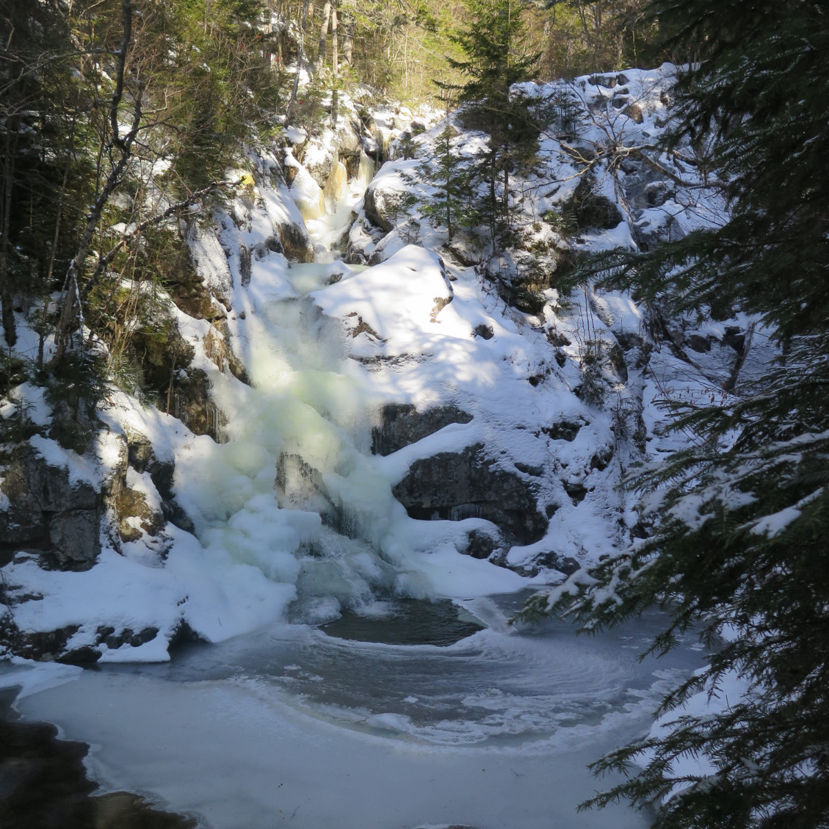
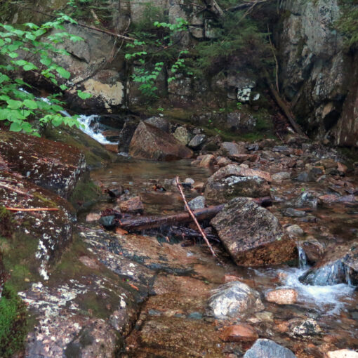
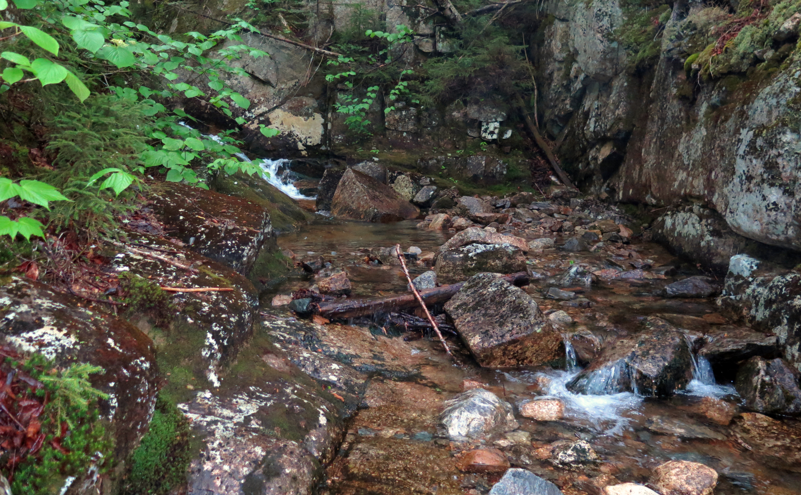
Reaching Gibbs Falls, I took a moment to zip down the side trail, and took in the view. It’s all iced-up again, not at all like when I saw it this past summer. Heading back up, I passed several groups on their way down, mostly in the lower half of the mountain. There was a lot of enthusiasm, and I heard over and over about the view. I couldn’t wait.
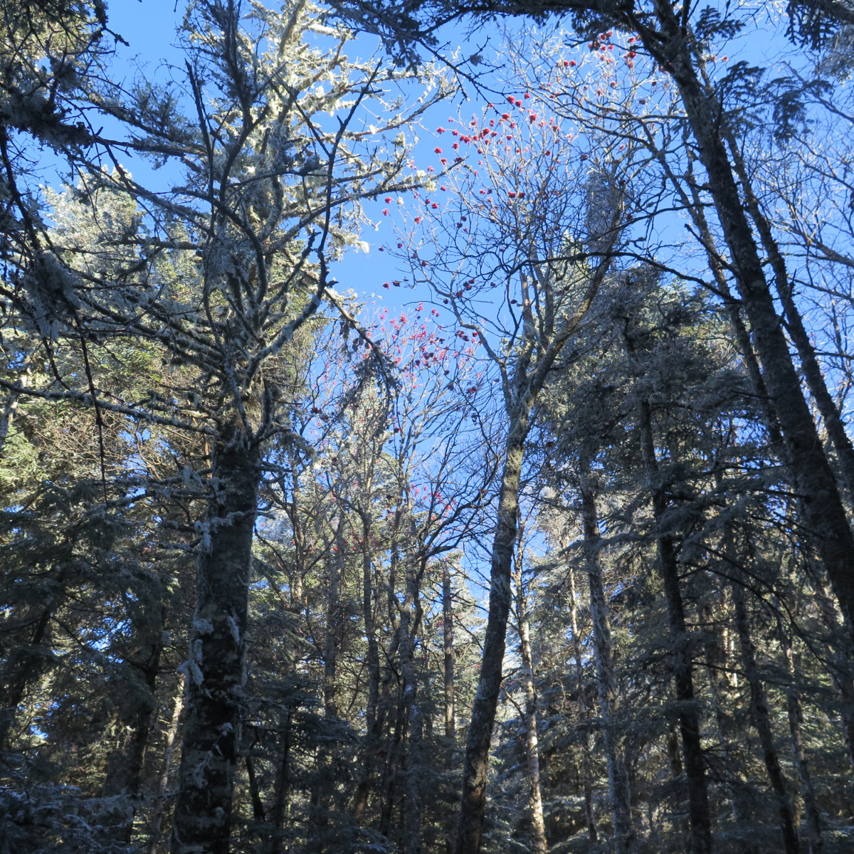
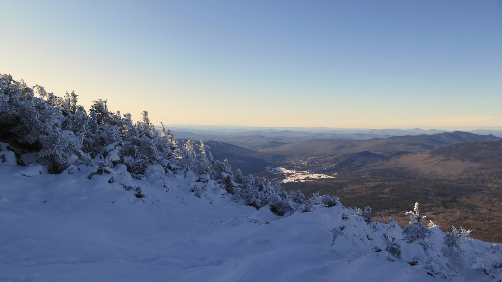
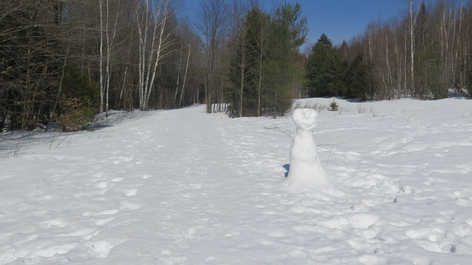
It was, overall, a winter wonderland. I saw plenty of mountain ash (AKA dogwood, by some) berries down in the wetter parts, and their red stood out brightly against the snow and the trees. Frost on the trees higher up lent an enchanting air to the trail nearer the summit. And up on top, it made an interesting landscape, with the snowy blanket reducing the rocks to soft bulges.
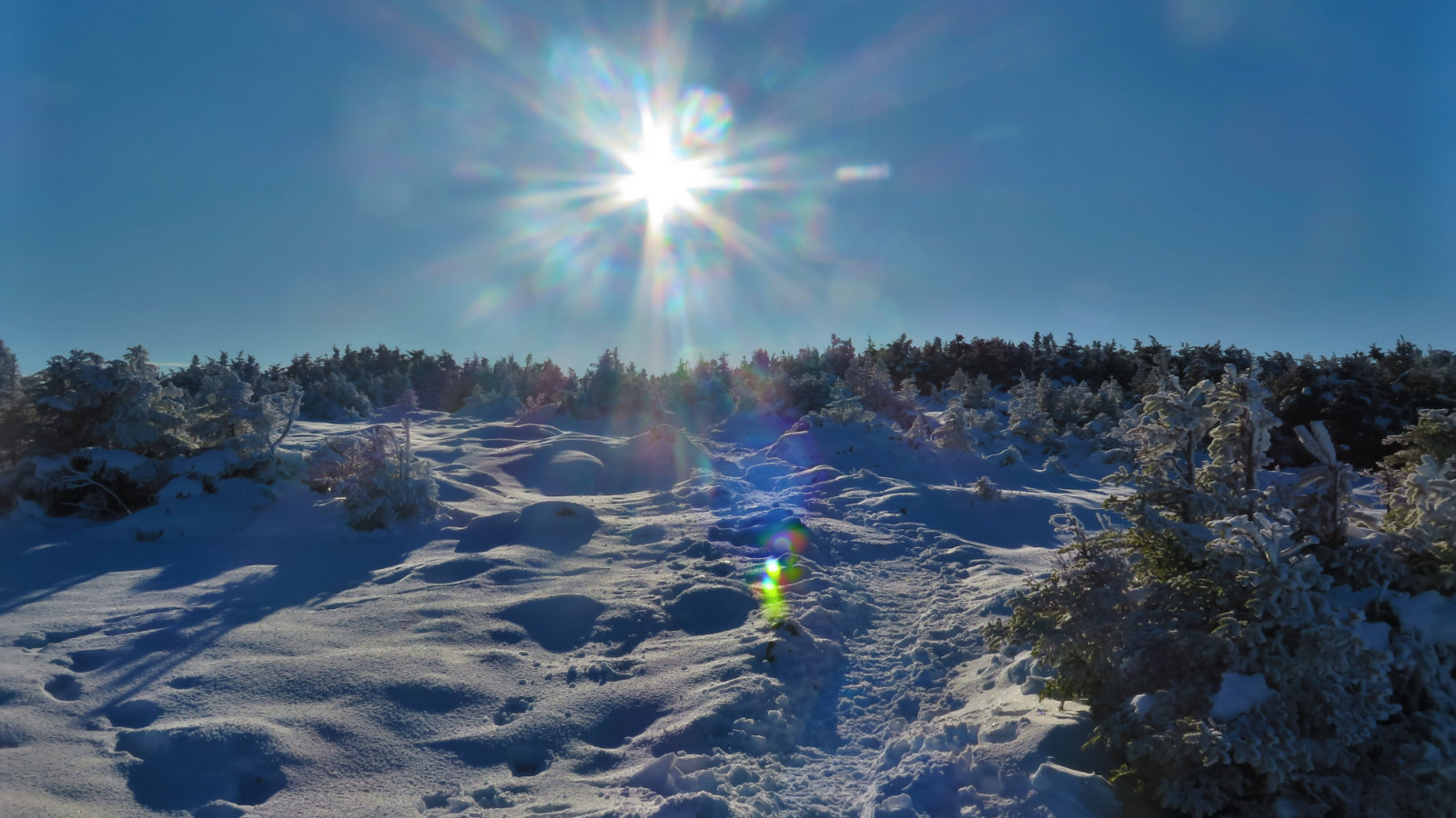
As I ascended, trees began to get noticeably shorter, and then more and more blue sky started to poke through the canopy above. That feeling of approaching the summit began to take hold. And then, I was kinda out of the trees, making that hard right turn to the top. There was a wide open area with few trees, and a short piece of iron pipe sticking up from the ground. There was too much snow over it, but this three-or-so inch tall pipe was all of about two inches away from the actual summit medallion. And with all the snow everywhere, that and a cairn was about it.
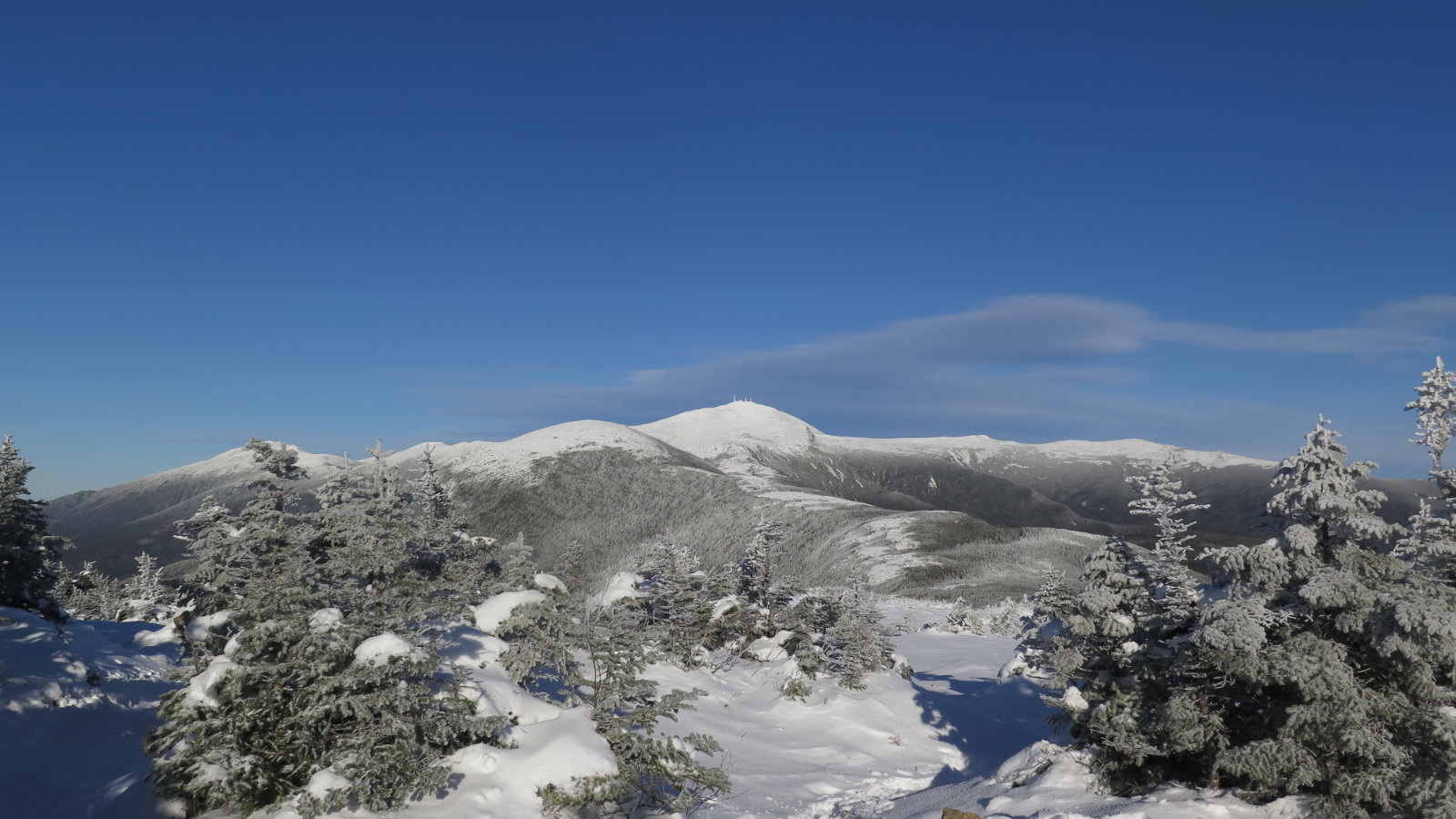
With the wind, it was hard spending any amount of time on the summit, savoring the view. Mansfield was visible in the way-off distance, and of course, Eisenhower, Washington, and the northern Presidential peaks were right there. I gave a quick look around to see if anything else stuck out, but apart from Starr-King and Waumbek, and Cabot, that was about all I could tolerate before really wanting to get back into the shelter of the trees. It wasn’t a very fast wind, but it sure was bitter. That being said, there was that brief, but very real reward of seeing even those few peaks against an unbelievably clear sky. Totally worth the price of admission.
Today’s was a much shorter hike than normal. I’d have tacked on Eisenhower for sure, but that will have to wait. (And I still need an autumn ascent of Washington — stay tuned!) On the other hand, I was reminded today that the southern half of the range can stand on its own two feet very well, even if it’s generally shorter in stature than its occasionally more celebrated other half. Sometimes, short and sweet is what you need.
Nuts and Bolts: From the junction of Route 302 and the Cog Railway road (the Mount Washington Hotel is in the same area) the Highland Center is about 3-4 miles down 302 on the right. Just prior to arriving there (you might be just able to catch a glimpse of the buildings) Mt Clinton road lies on the east side of 302. It’s a short drive and you’re in the parking area for the trailhead on the left.
If you enjoy reading these posts, please subscribe — stay in the loop! Your email will only be used to alert you of new posts — typically 1-2 times per week. I will not use or share your email for any other purpose without your express permission.
6 thoughts on “Trip Report: Mt Pierce”
Great post, as always! I enjoyed the comparison to Monadnock– trails up (down) there are no joke, especially with ice in the winter, and there’s no place to hide once you’re on the summit cone. One comment/question about the Crawford Path flora … you referred to the ubiquitous red berries as dogwood, but I’ve always been told they’re mountain ash. Care to opine?
Thanks! And good observation about Monadnock’s summit having no hiding places whatsoever. It can get brutal up there when it’s cold and windy for rather longer than is comfortable.
On the tree ID, that’s a good question, and I don’t have a good answer. For the time being… I’ve found references to both being the common name. Unfortunately, I don’t have a good tree ID book yet, so stay tuned for a possible update.
Every internet reference I could find puts the American mountain ash as a shrubby tree that doesn’t get up meaningfully past 30 or so feet. Obviously, in my photo, that tree blows past that. Right now, I’ve edited the post because in hindsight, I like ash more than dogwood. But stay tuned.
Thanks for sharing your card on the trail. Love viewing your photos and reading your blog. We were gifted quite the beautiful day to take in such beauty. I look forward to following your journey.
Glad you enjoyed it and I look forward to more of your feedback!
I met you on Pierce the other day, super excited to follow along on your journey! Best of luck on all of your travels
Great to have you aboard! I hope you get some good inspiration from my posts. Best of luck to you, too!