I Hiked Ike!
Mt Eisenhower, Bretton Woods, NH. Cinco de Mayo, 2018-05-05. (Saturday)
Via Edmands Path, Mt Eisenhower Loop. Approx 6 miles.
50 dF +/- at the trailhead, 45 dF at summit, with 20-25 MPH winds gusting to 35.
Partly sunny becoming mostly sunny by afternoon.
Trailhead: 0950; Summit; 1340; back at car: 1550. (6 hours.)
It was, in fact, a great day to be outside. The Higher Summits Forecast called for clement weather, and the 100 MPH winds from the overnight becoming more temperate as the day progressed. Nevertheless, they still called for 30-40 MPH. I’d gotten a late start, so lowered my expectations for the day. Initially hoping to bag Monroe as well, I gave up on that pretty early on. All I could hear on the way up was the wind in the trees, and the clouds were screaming across the sky; it was evident from the beginning what it was going to be like up there, and I wasn’t looking for a repeat of Bondcliff, where I got pancaked by a gust I’m still estimating to be in the 50s.
The trail down low was fine, if a bit muddy. But I bare booted the first third of the mountain with no issues. Reaching the first water crossing (Abenaki Brook), I scouted around until I found a bridge. The stones as they were presented no viable option for leaping across, so although the smaller (and lower) tree trunk looked a bit thin, I gave it a go. It turned out fine, and the thicker trunk was close enough that it served as a handrail. Success!
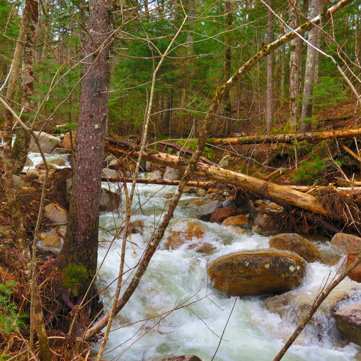
Those tree trunks make a great bridge!
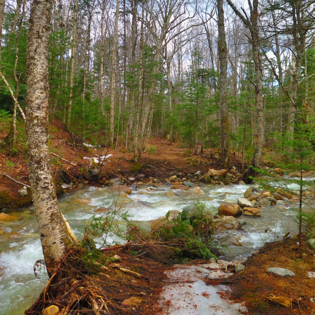
Now on the other side of the brook, I pressed ahead. There were occasional wet spots, and a few bits of outright mud. A little dodging here and there, and when that failed, sucking it up and getting muddy.
The second third of the trail was icy crust that spanned the width of the trail. On with the K-10s, and up I continued. There were parts when the ice gave way here and there, and I’d find myself up to my thigh in a hole. But for the most part, the trail was good enough that the going was unremarkable.
I wouldn’t remain that lucky for the last third. The ice turned to snow, and the monorail was even narrower than on recent mountains. It became folly to think I could find reliable footing, and when I became fed up with the surprise post holes, I transitioned to the snowshoes. I’m wondering if I’ve gone hiking in the Whites in the past few months without them. Something tells me I’ll have them with me well into June. What was that Mark Twain said?
At the point where the trail traverses the cone of the mountain, it got tedious. The trail seriously narrowed, the crusty snow was decidedly bumpy and pock-marked with post holes and spruce traps. To make matters worse, it was “bilevel” in the sense that my left foot, had I walked normally, would have been at least a foot below the right. Oh, and the tree branches were persistently trying to push me off the mountain. It was demoralizing. And uphill. In the snow.
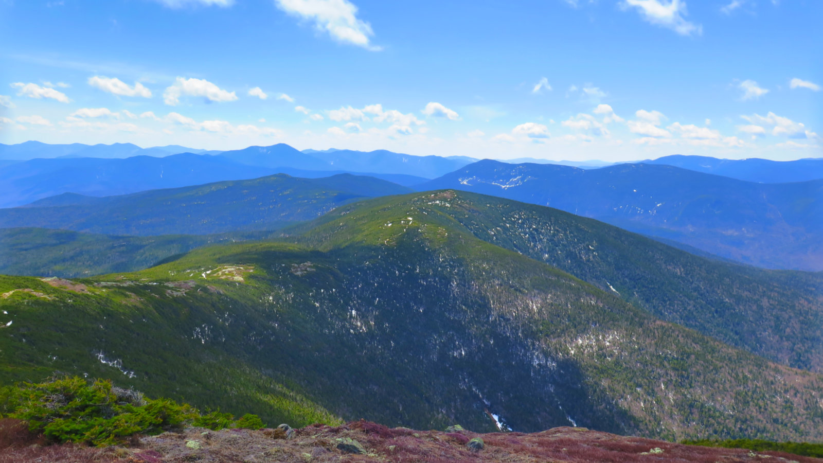
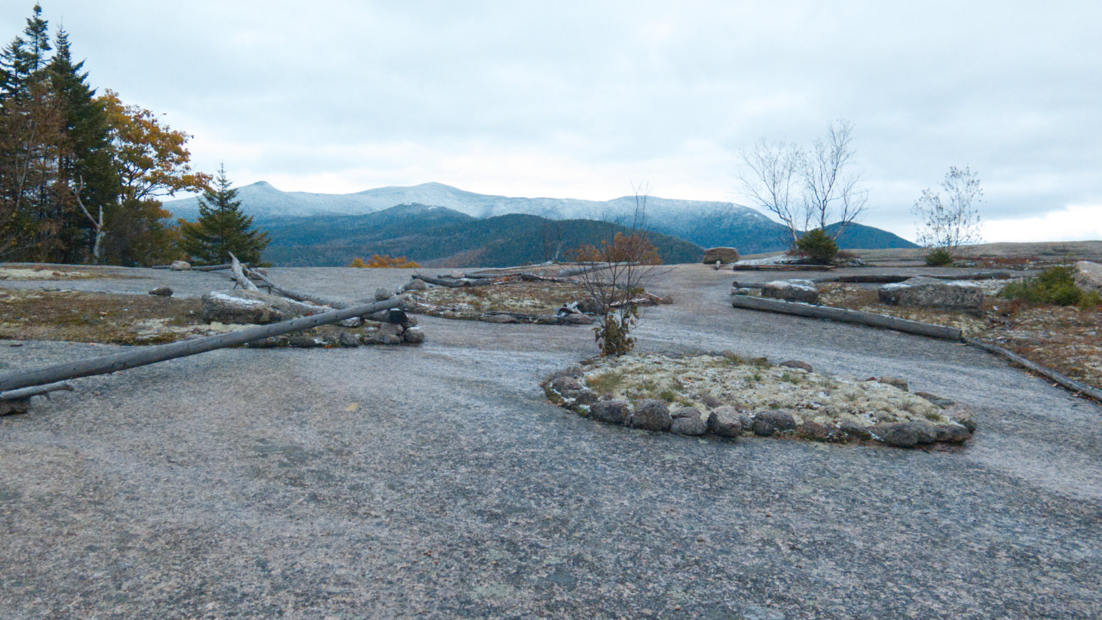
But at the end of that traverse, bare rock, and lots of it. I made a mistake in reading the signs below the summit, and went the long way around, on the AT bit, but that was rectified eventually. For my mistakes in navigation, I did get a stellar view of Pierce, which was lovely. It would have been nicer having this visibility on Tuesday, but whatever. I’ll take it.
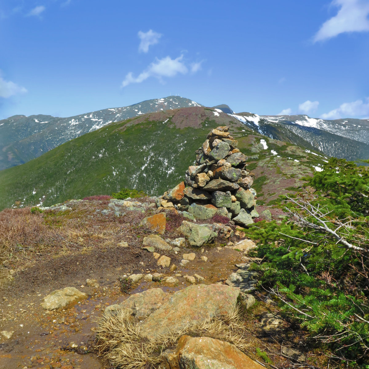
- Looking over to Monroe
The trail even a few dozen feet below the summit was windy. The summit itself was an outright wind tunnel, and I found the gusts shoving me around a bit less than I’d wanted. It made me glad that I’d made my peace with skipping Monroe when I was nearer my car than the summit. I’m fairly sure the hour or so spent crossing the col wouldn’t have been as enjoyable as I’d have liked. Taking pictures when you’re being tossed about is not fun.
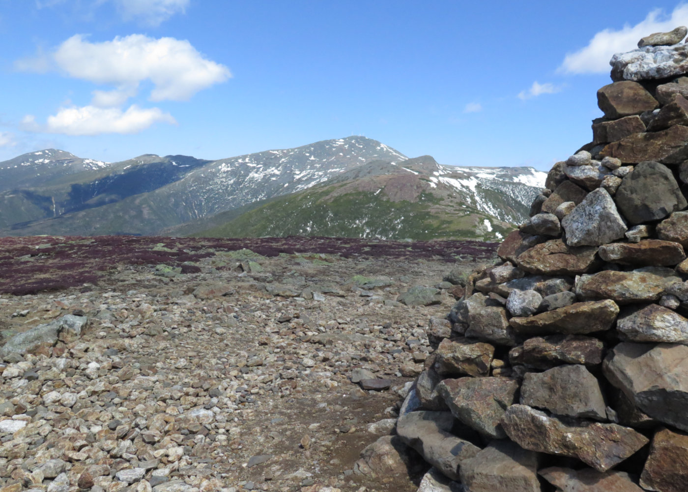
I did get some great views of Washington, and I can imagine the guys in the observatory were cheering the fact that they had a view. Really, without the wind, this would have been the most perfect day in the world.
And so, it was time to head down. I made quick time, and indeed, the traverse hurt less on the downhill than the uphill. That’s not saying it was great, but it was less demoralizing. I’m really curious what that trail segment is like in the middle of summer. Given that Eisenhower has some fantastic views, no laboriously long approach to enjoy them (I’m looking at you, Bondcliff!) and it’s a relatively short and easy hike, I can see no reason why I’d not re-examine this question in a couple months.
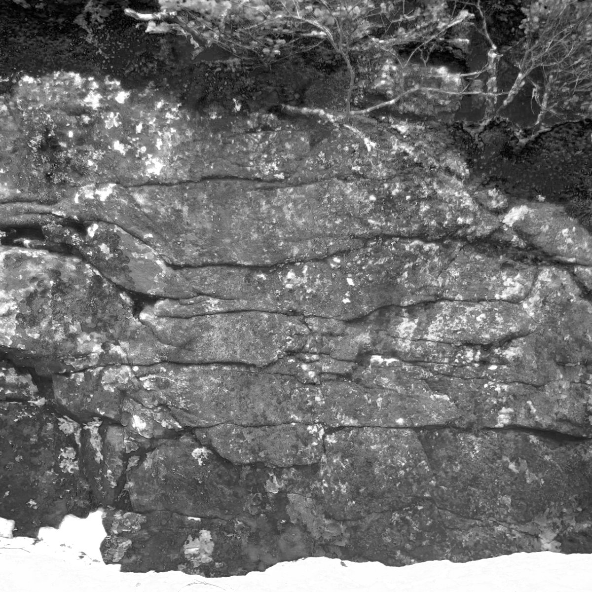
Ever since I studied ceramics in graduate school, I’ve kept an eye out for geology. One of the amazing things about this area is that you can see how these mountains were created if you just look around a little. And so it was with no small amount of interest that I gazed upon this interesting bit of rock. When I look at things like this, I’m struck by nothing so much as the sense of enormous amounts of time and physical forces. Wow!
The trail down was fairly straightforward. If anything, it was easier than most. Perhaps it’s because of a lack of a long, drawn-out approach, but there it is. It was a good day to be outside. My big goal was thwarted by the wind, but at the same time, “I Hiked Ike” has a neat ring to it, and I don’t know how I’d have written as clever a tag line as that had I included Monroe. (“Ike-Monroe in 18” just seems wrong.) There it is.
If you enjoy reading these posts, consider subscribing. Your email will only be used to alert you of new posts — typically 1-2 times per week. I will not use or share your email for any other purpose without your express permission.

2 thoughts on “Trip Report: Mt Eisenhower”