Mt Hedgehog (2,532 ft; 1,400 ft total elevation gain). Albany, NH. 2020-04-04 (Saturday.)
Via UNH Trail. Approx 5 miles round-trip.
Happy Hedgehog Hiking!
42 dF at the trailhead, 57 dF at the summit. 50 dF back at the car. RH ranged from about 50% to 70%. Winds were just about non-existent. Dew point was in the mid-30s to 40s. Overcast to begin, a gigantic hole in the clouds at the summit, returning to overcast on the way back.
Trailhead: 0900. Summit: 1145. Car: 1330.
I was tempted to write a headline that would appeal to techies. After all, today is 04-04, and the page number for the UNH trail in the AMC book is 404. But “happiness not found” made no sense whatsoever for a lede. So I aimed at the alliterative instead.
I’ve been feeling pretty beat-up by work lately. Just about anything that could have happened to me on-trail, short of being eaten by a bear, felt like it would have been an improvement. As things turned out, I got way more than I hoped, even if I didn’t hike all the trails I’d planned.
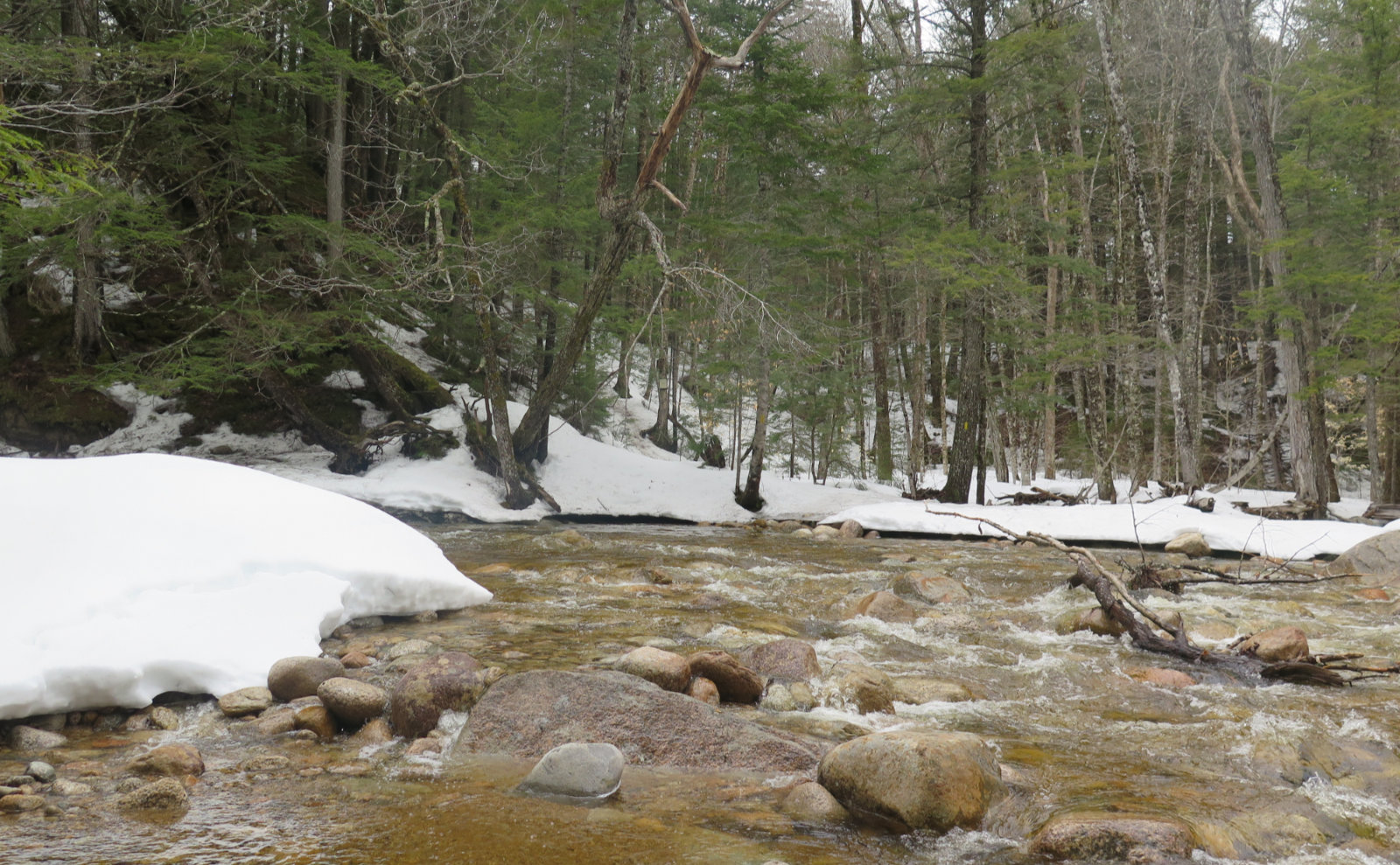
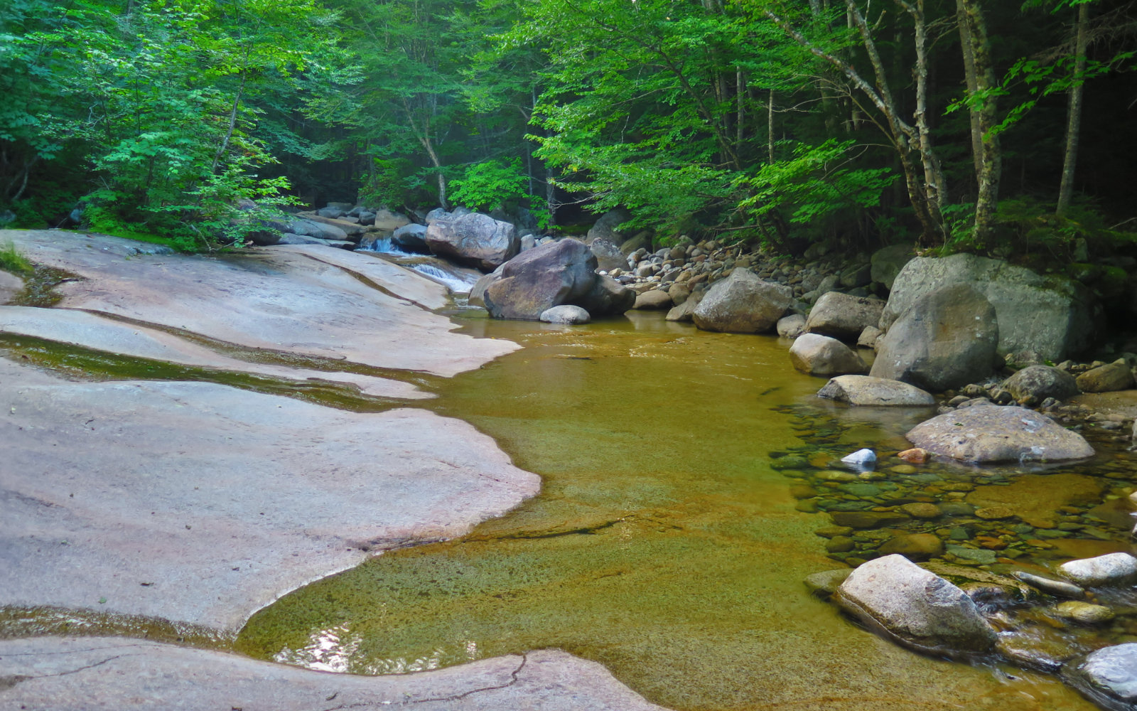
And so, to address that, I’d initially planned on hiking Potash after doing Hedgehog. But as it turned out, the crossing of Downe’s Brook was a bit more spirited than I’d have preferred. Photo is at the end of this post. It was a fine example of scrubbing part of the plan when trail conditions dictated as much.
I got a very early start, which felt unusual compared to my more recent trips. Adding to that, I didn’t stop along the way, just cruising right on up 93 to Lincoln. And so, heading down the main drag, I realized that I was way ahead of my planned schedule, and had a little time to burn. Might as well scratch some things off the mental to-do list. I’d been eyeballing the locomotive in front of Loon Mountain resort for quite awhile. Since I’m halfway through Bill Gove’s book JE Henry’s Logging Railroads and now have some historical perspective, it seemed apropos to stop and have a look. To be true, this isn’t a train from when JE Henry ran the show — he loved his Baldwin 0-4-0 locomotives, and his trains were lettered differently. But it’s a saddle-tank 0-4-0, which was what Henry ran on his railroads, and reminiscent of his beloved Baldwins.
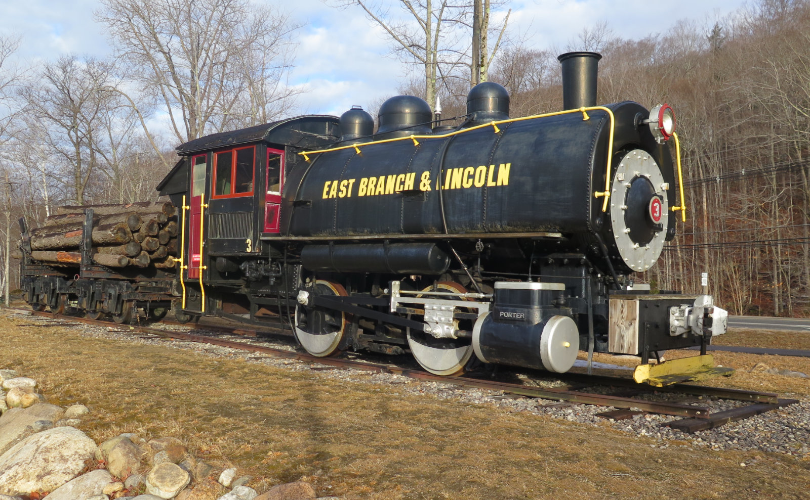
Also interesting: I’d read the AMC’s Logging Railroads of the White Mountains, which gave a more conservation-oriented view of the logging scene back then. I’m finding Gove’s tone to be far more sympathetic to the loggers. When I saw the signboard by the locomotive, it quoted Henry’s son as saying something to the tune of doing what they would with their lawfully owned land, by gum. And it didn’t really make me more sympathetic to Henry’s outlook, but at the same time, I understood better that those were different times. And truth be told, he paid good money for those trees, and wanted a return on his investment. For all we know about ecology today, especially back then, that wasn’t a completely unreasonable point of view. Thankfully, wiser heads prevailed.
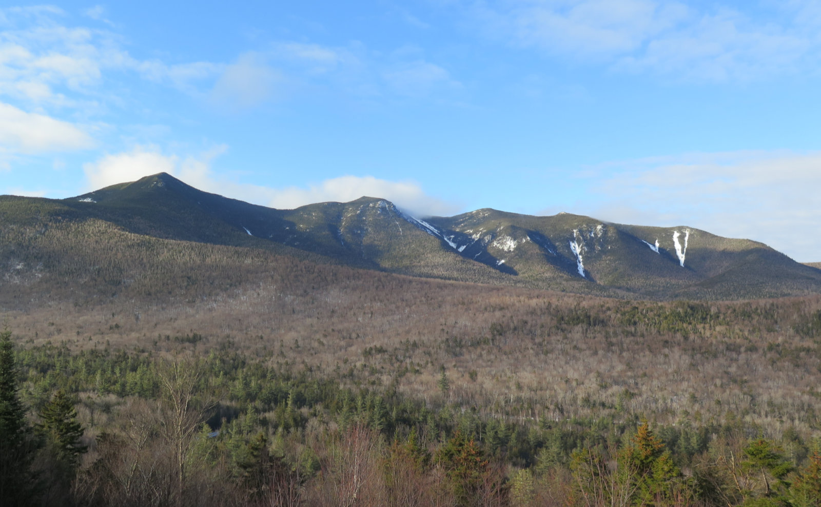
Anyhoo, continuing on, I came across a glorious vista, not far from Kancamagus pass, that laid out the Osceola range in magnificent tableau. The morning sun kissed each of the shoulders with honeyed goodness. The photo pretty much took itself, but of course, it pales compared to the photo I took with my mind’s eye. I live for this kind of thing.
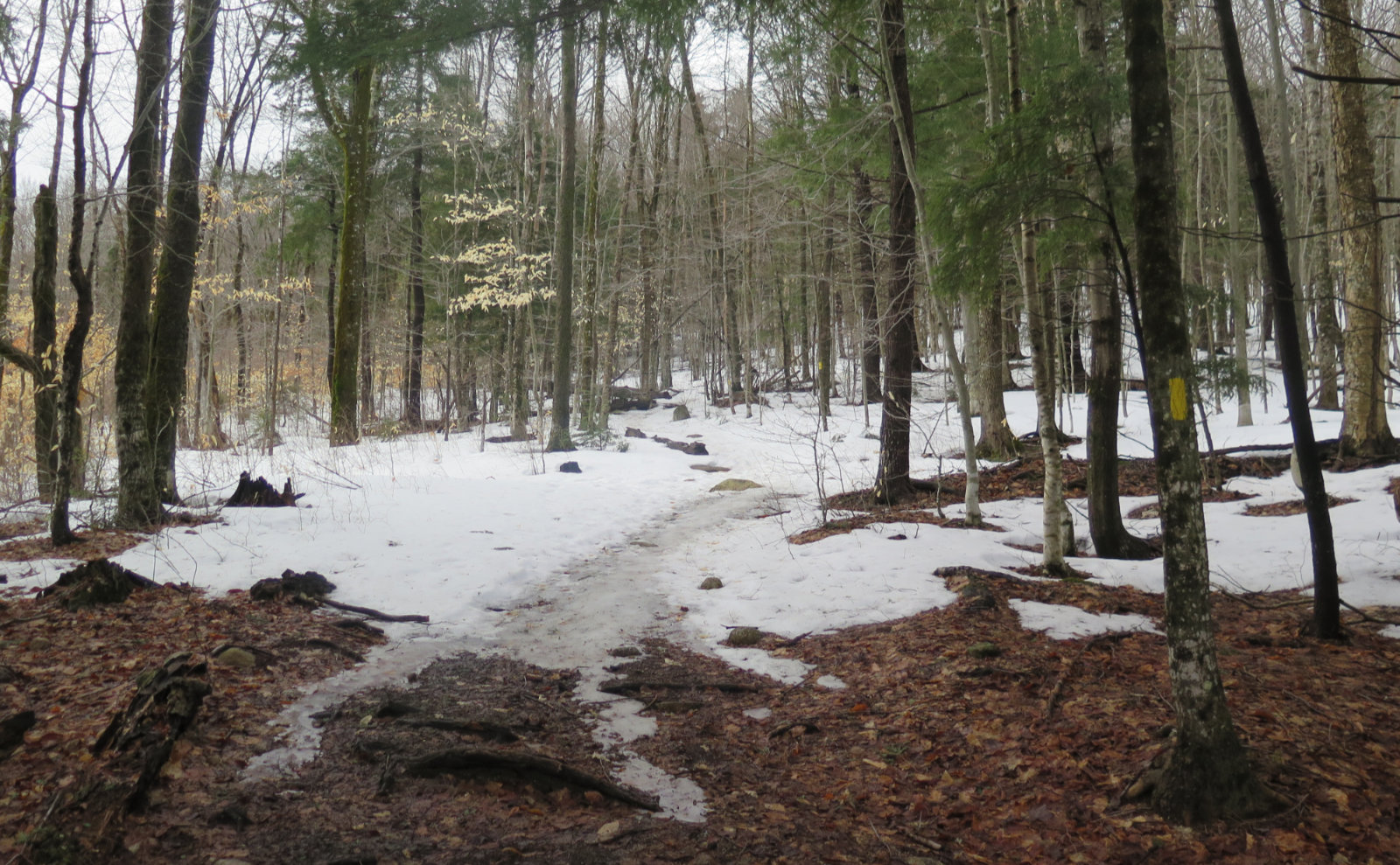
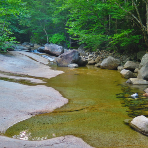
Not long after, I arrived at the trailhead, got my stuff together, and hit the trail. There’s a huge pile of snow at the moment to clamber over, and then a short, snow-covered dirt road before the actual start of the UNH trail. Last night at work was reasonably uneventful, but work has been stressful overall lately. I was glad for the easy start. Almost flat. Nice, firm snow that my Kahtoola K-10 spikes dug into solidly. And wide. Logging was all around here, too, and the spacing of the trees that line the trail are testament to the old passageways used by the logging trucks and trains.
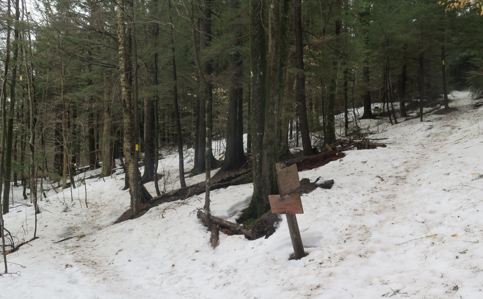
Shortly after that, I arrived at the trail junction. I’ve seen a lot written on the web about whether to go clockwise or widdershins. Taking the right side of the fork gets you to the summit in under a mile, but it’s steep for most of the way. Given how the sun and clouds played themselves out, I’m glad I took the left fork. But either way, it’s a loop. You’re going to expend about the same effort.
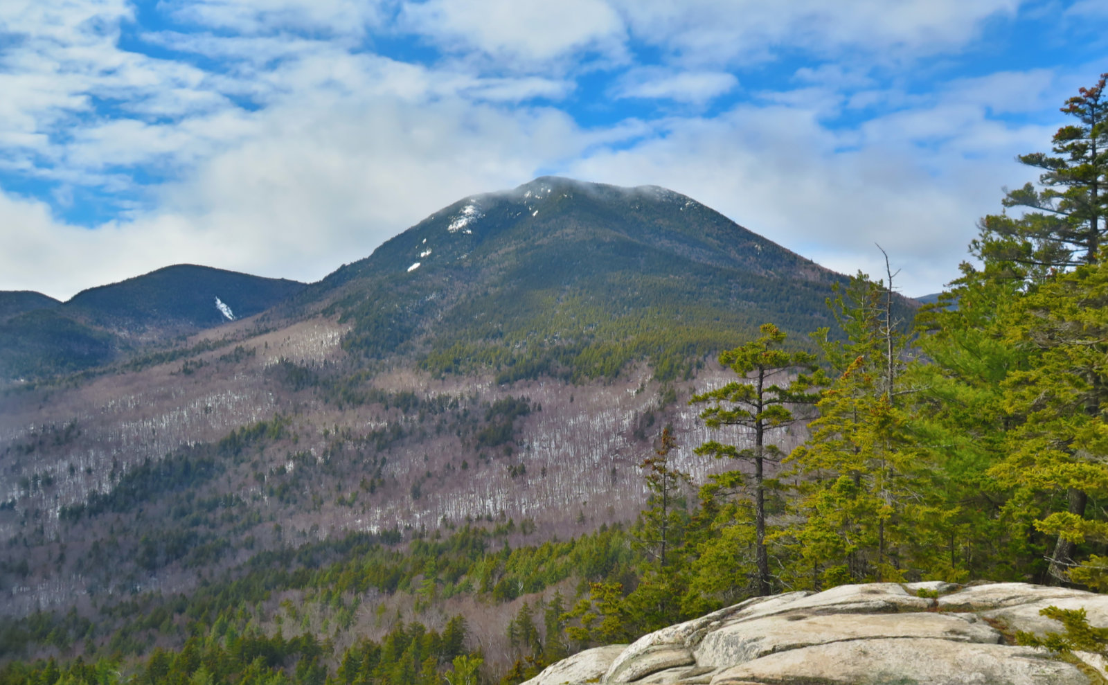
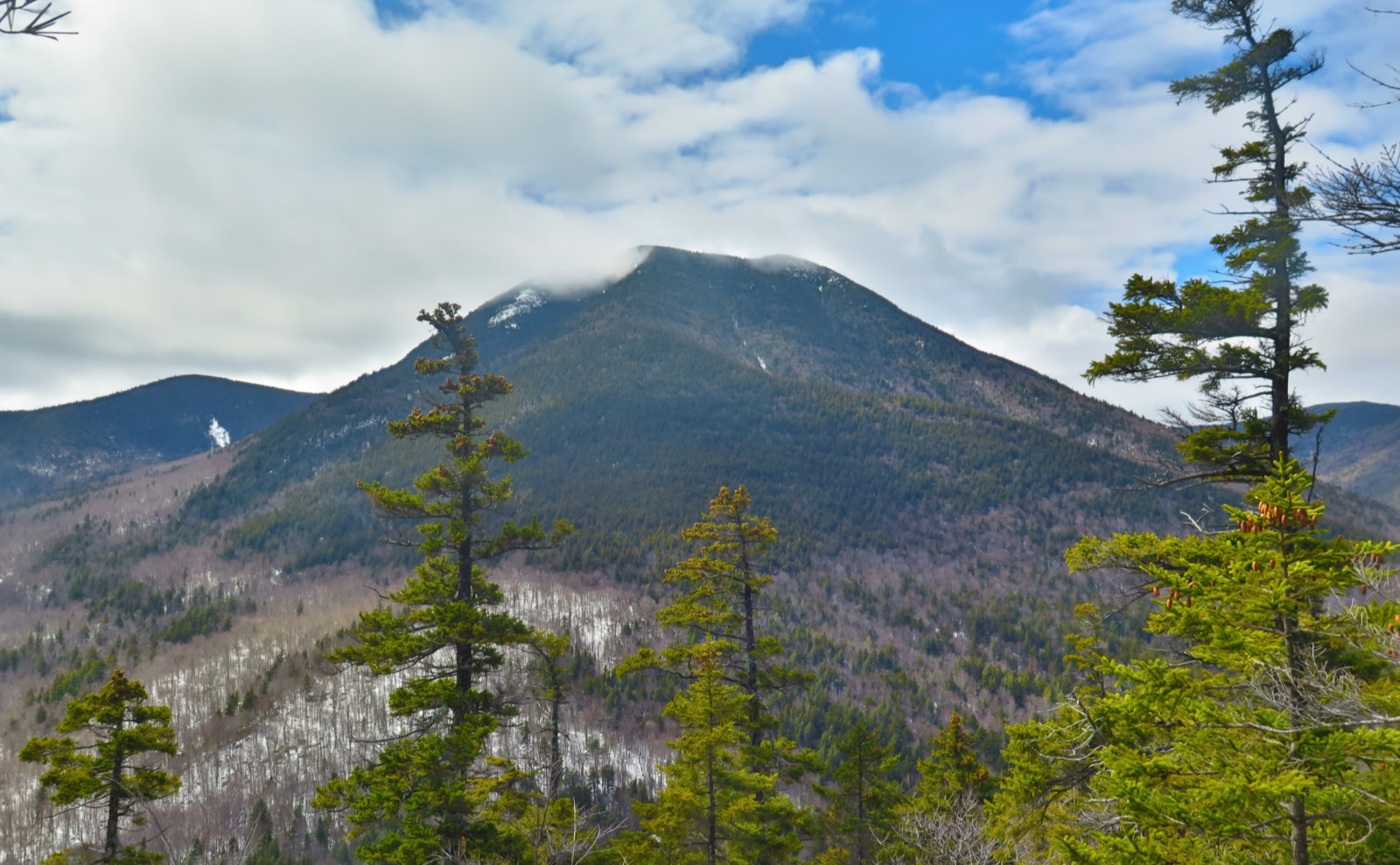
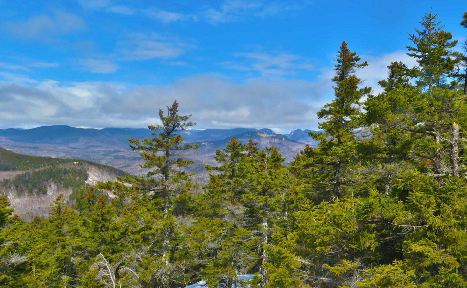
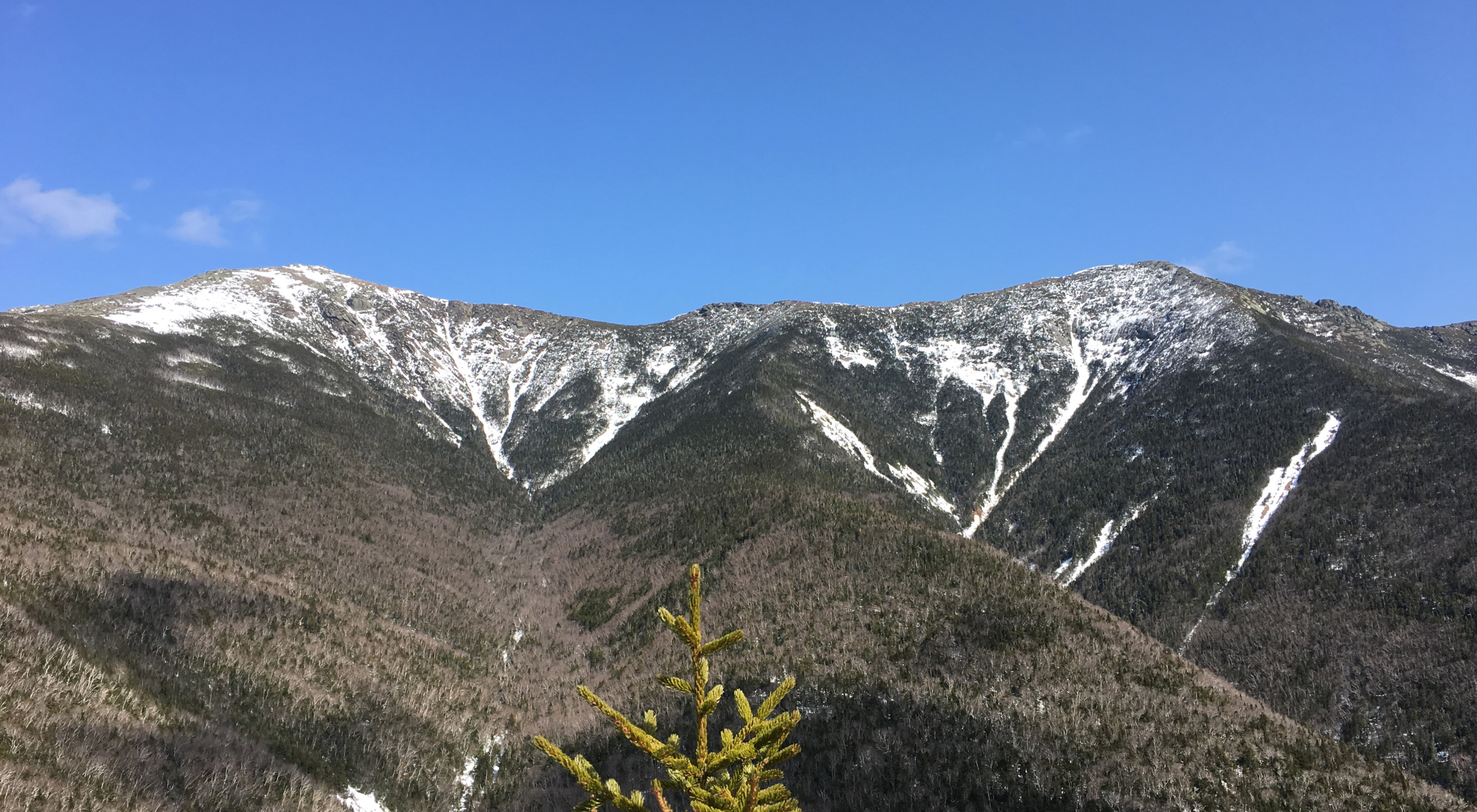
So about those clouds… leaving my car, it was overcast, without question. But as I got to the ledges, it became clear that gaps were opening up. I had to wait about 15 minutes, but finally, Passaconaway took off its hat. The photo never can do it justice, but I was downright humbled by the sheer hulking mass of that mountain. It’s barely a 4,000 footer (by under 50 feet!) so maybe it’s just the nearness. But wow, it just felt massive. And the steepness of its slopes felt magnified. Hiking to its summit has always felt disproportionately harder than most others. Today, everything about that made sense.
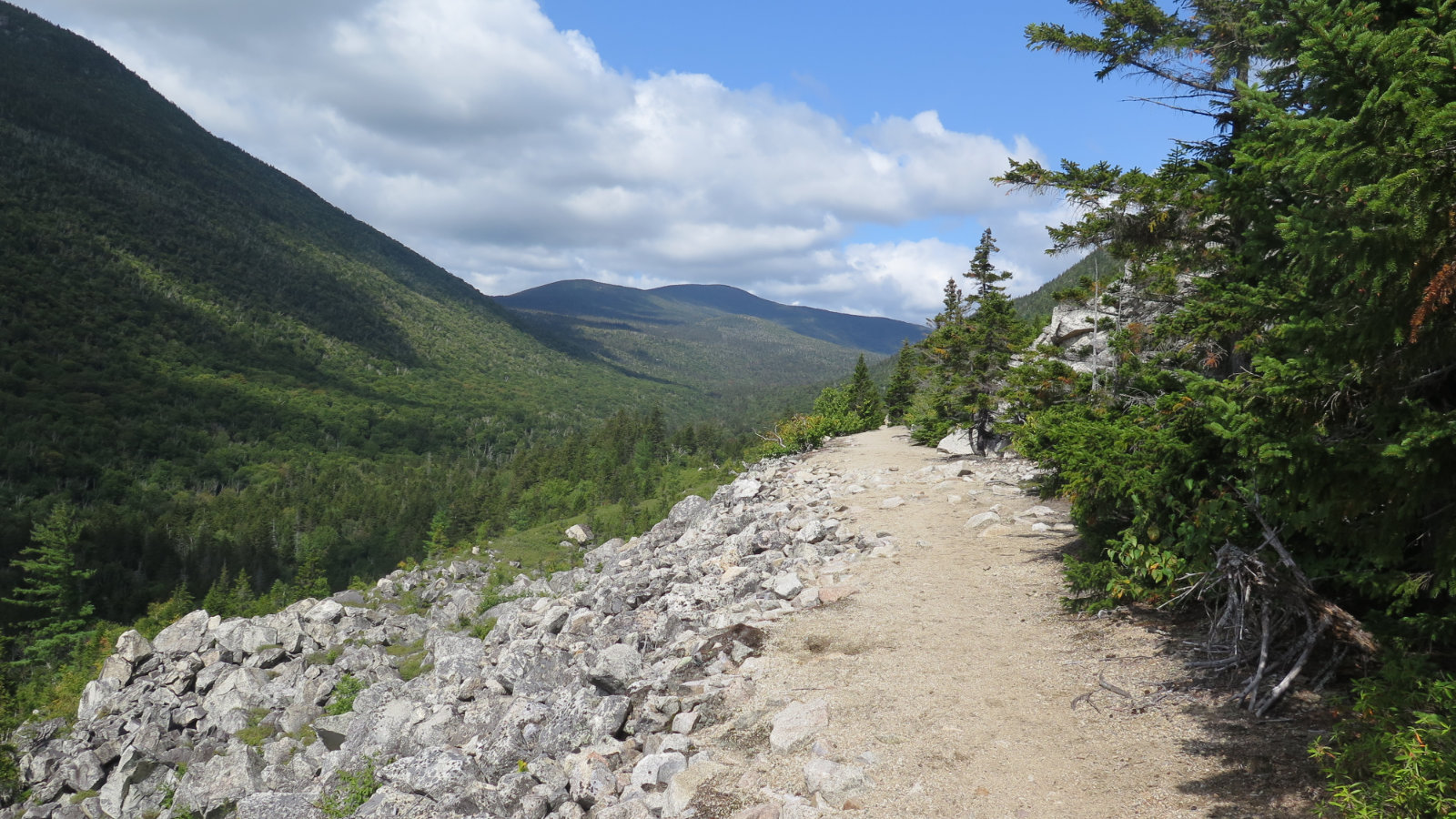
Continuing on, the trail narrowed down a lot, and crossed an exposed ledge. Yikes! I’m still recovering from the fractured ankle, and while in many ways I feel great, at the same time, just walking this dozen or so yards threw all of that into sharp relief. It was all psychological, and even still, easily managed, but the trail still felt about six inches wide when it was at least five times that.
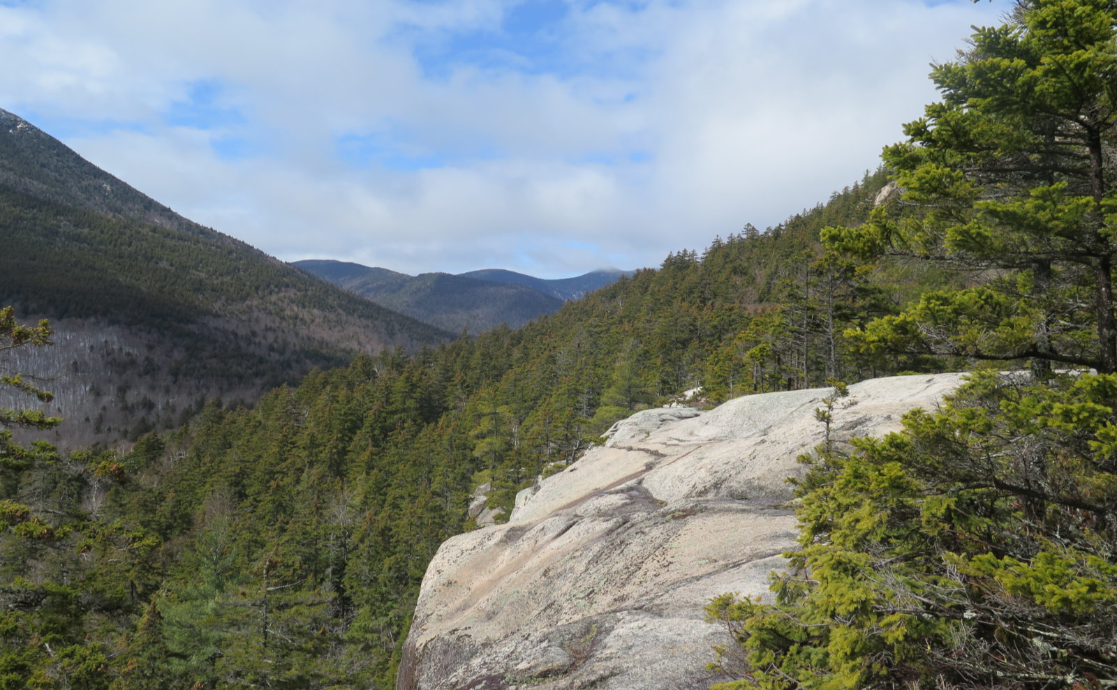
And then, coming around the bend, I saw the cliffs below Hedgehog’s summit. Recalling the many other places where I’ve seen this (most recently, a variation on the theme on Square Ledge last week) my first thought was “oh, I’ve seen this before.” Of course, I quickly reminded myself that every mountain is different, and Hedgehog hadn’t yet dealt out any pain. Nor, as I would find out, would it. That view was all bark and no bite. Well, not much bite, anyway.
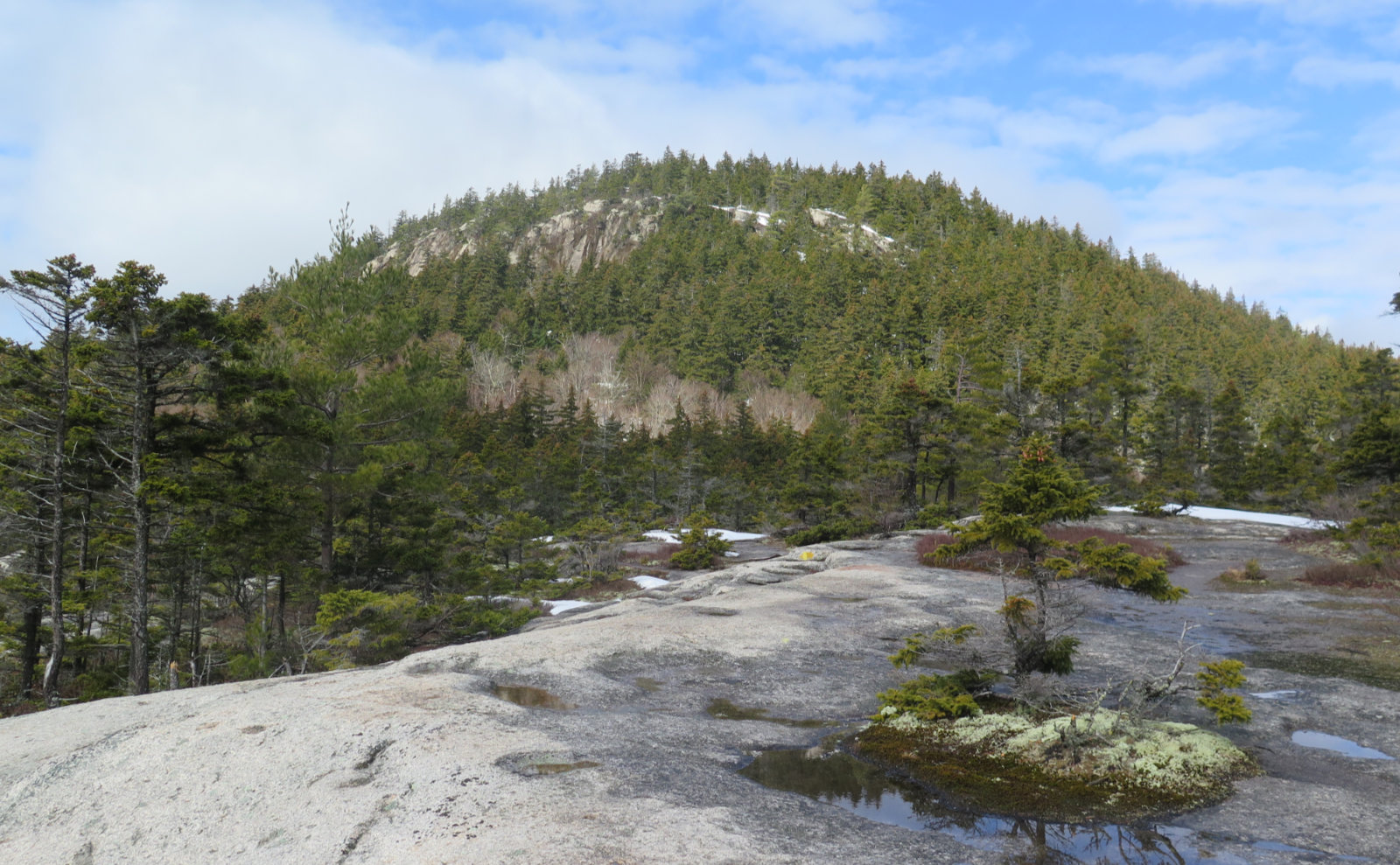
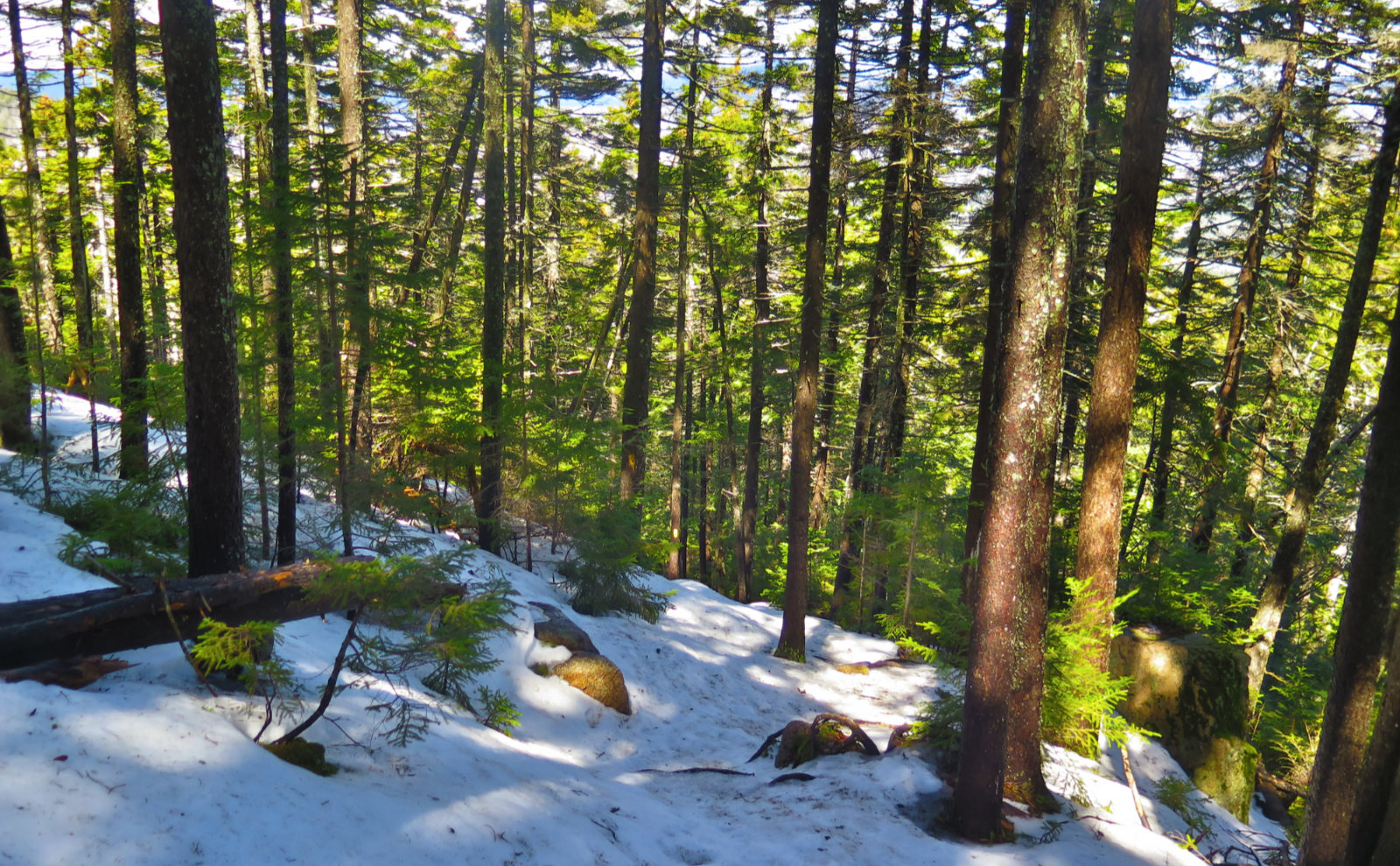
The trail actually wraps around the other side, and comes up inside the forest. There’s a few points where footing isn’t 100%, but I’m pretty sure that it’s at least in the high 80s. I didn’t have a hard time getting to the top.
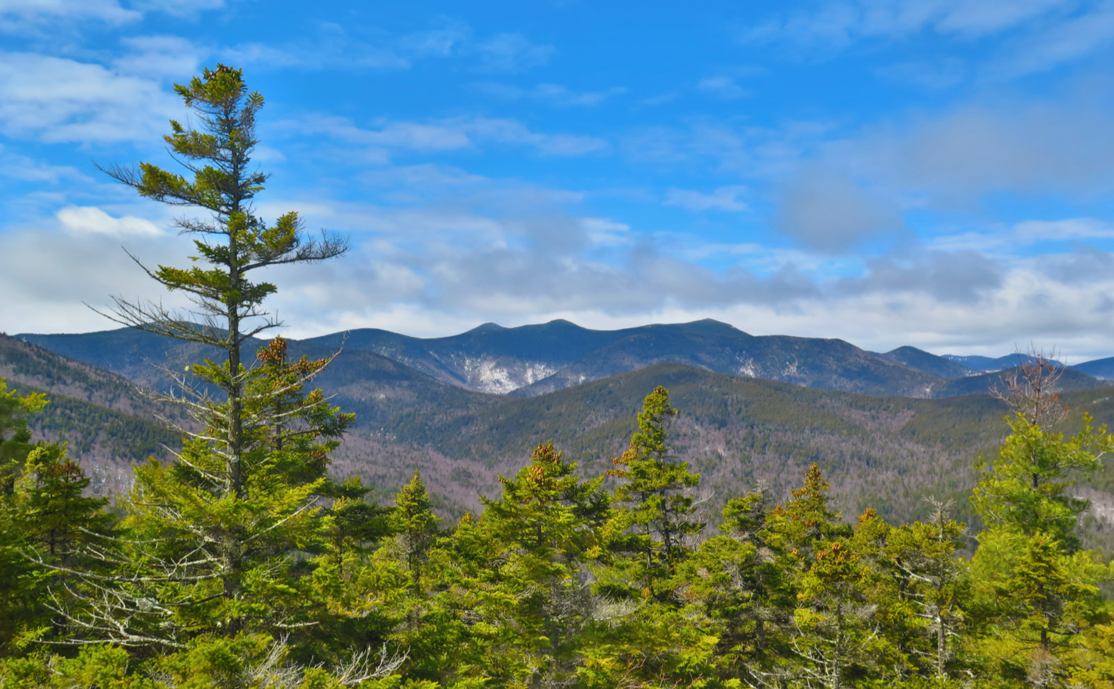
And of course, because today was the day that kept throwing me a bone, even my modest effort was given a huge reward. I’d been seeing views of Chocorua here and there, with varying levels of clouds obscuring the summit. But now, I could see the whole thing in all its glory. Proof that sometimes the best view is from some other mountain.
And speaking of that, coming around yet another bend, another view of Passaconaway. Surprisingly, this one was improved by the clouds. Off the summit to the left, there was a persistent cloud that seemed to be stuck in a massive divot. And it got me thinking about how sometimes topography can make meteorological phenomena hang around, accentuating the immediate lay of the land. Mt Washington’s persistent lenticular clouds come to mind. (Especially those that I saw on Mt Moriah a couple winters ago.)
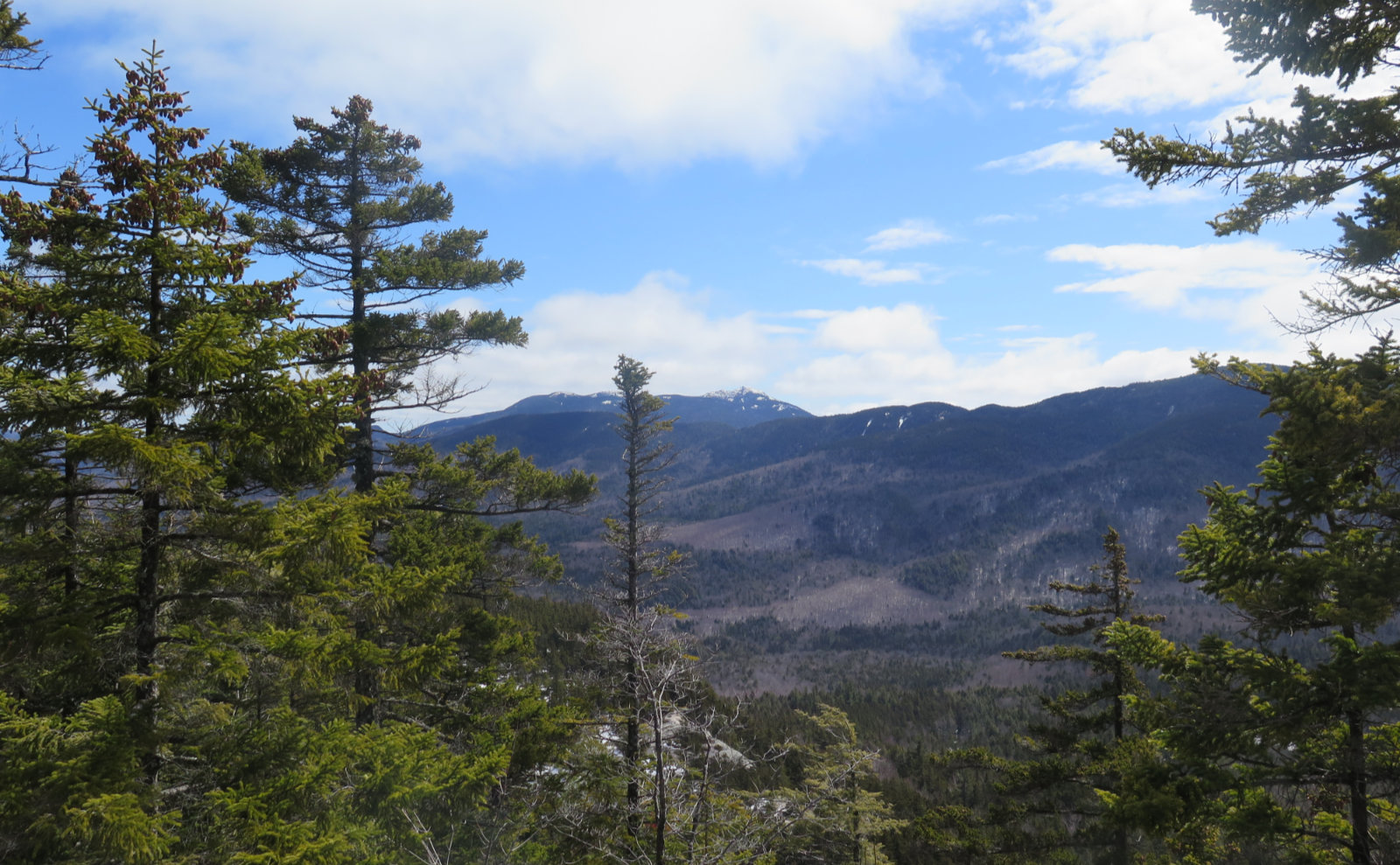
A little more walking, and another vista. This one featured an amazing view of the Tripyramids. It got me thinking about how once, the north slide got the better of me. And then I came back, and made peace with it. And now, it attracts my eye every time I can see it. I’ll be back, my friend.
And then, that was about it for the clean views. I was well and truly back in the woods. Heading downhill, I was reminded of my hike down the Old Bridle Path on Lafayette. And how knocking down other hikers like skittles could be the funniest thing in the universe. Thankfully, there wasn’t a reprise today. But wow, the trail was steep, so I burned a lot of cognitive effort minding every step. Nicely, there was some lovely dappled sun through the trees.
Oh yeah, about those views… just below the summit, Allen’s Ledge. And a fine view of Bear Mountain. Bear Notch Road passes in front, and through the notch. Not sure what the bald patch is in the near-distance, except there was a sign down in the lower elevations that described some USFS-sanctioned logging activity. Not sure if this relates to that, or if I’m just looking at a bog or something. Need to research that.
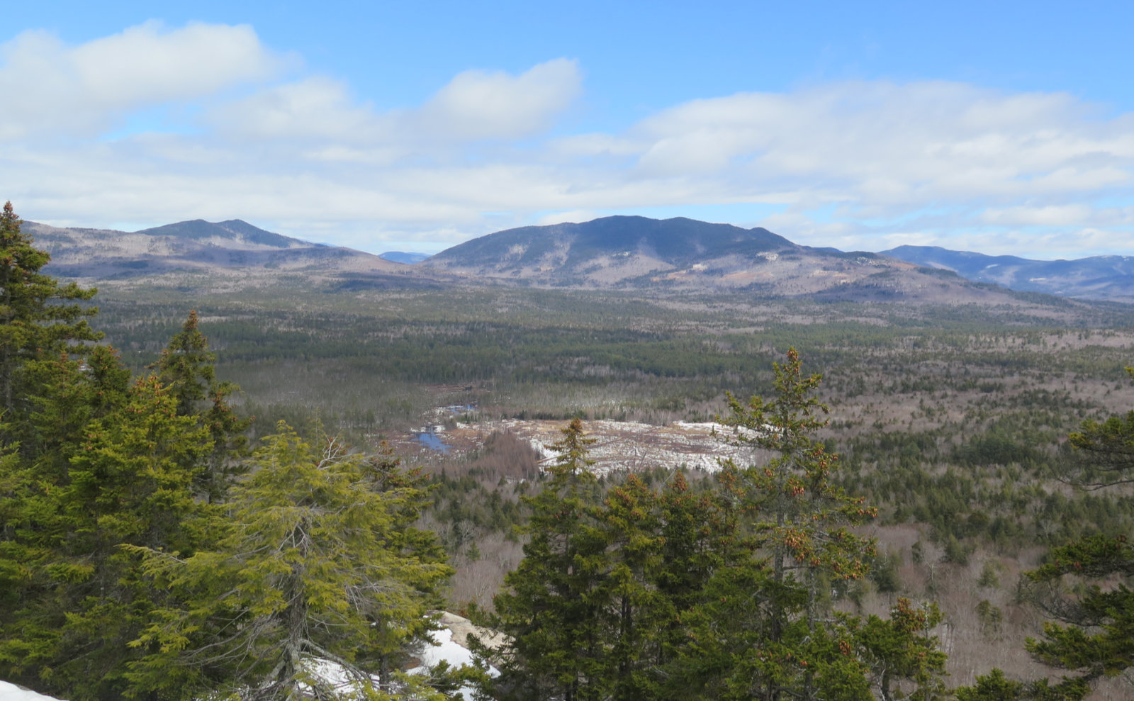
And just off to the side, a view of Green’s Cliff, and behind it, Carrigain’s Notch.
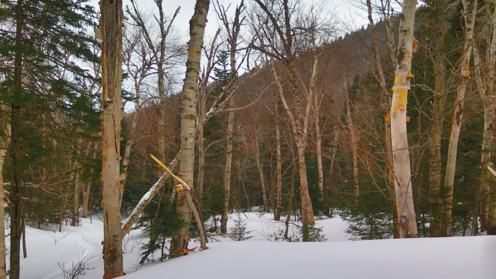
So my plans originally had me summiting Potash Mountain as well. But on the way to the trailhead, I passed a lovely couple who had attempted to do the same. They reported that Downe’s Brook was rather flush with snowmelt, and that to them, it was just too much to want to try crossing. Deciding that it was a half mile or so to check it out for myself, I did just that. And sure enough, after noodling around and looking here and there, I decided that it warrants coming back another day. Jumping from rock to rock was not an option, and the channels in between were too deep. And not like it was raging whitewater, but the flow was very much on the swift side. Plus, while the conditions might have been something I could deal with on the way up, I’d have to cross that brook again on the way back. With how warm the day was, and all the melting I’d already seen, there were exactly zero guarantees the brook wouldn’t be even more swollen in just a couple hours. And so, the decision was easy. Why make problems for myself? I have an excuse to return. (As if I need one.)
So there it is. I didn’t get everything I wanted, but maybe I did, actually. Completely unexpected was the miles-wide hole in the clouds, just as I reached the ledges and outlooks. Had I taken the other side of the loop first, I’d not have enjoyed those views. So that was nice. Weather was arguably the most clement spring weather imaginable. This one is a win on many levels. And much needed. Awesome.
As always, stay safe out there.
COVID-19 Thoughts: I arrived at the parking area before 0900, and was the only car in the lot. By the time I returned, the lot was full — about half with out-of-town tags. Especially if you or someone in your party is in a risk group, bear in mind that social distancing might not be as easy on some other trails, particularly on the ledges. (And please, don’t use this as an excuse to trample vegetation — there are several fragile plant communities near the summit, so do all you can to stay on trail, and encourage others to do the right thing, too.) Plan accordingly. I heard from at least 2-3 parties that this was a regular haunt, so a mid-week trip might yield an outing with fewer other groups on the trail. Have an alternate destination handy, just in case.
Also, and this probably goes without saying. Discretion is the better part of valor. If you’re not feeling like yourself, now’s not the time to pop a couple aspirin and power through. The mountains as we know them have been around for 12,000 years. They’ll wait for you to get healthy.
Nuts and Bolts: Super-easy to get there. From 93 north, hop off at Exit 32, and take the Kancamagus Highway east through town. (Make sure you have enough fuel before leaving town, because there are no service stations for the 30-ish miles between Lincoln and Conway.) You’re going well beyond the Hairpin turn at the Hancock loop trailhead. When you pass Sabbaday Falls trailhead, keep your eyes peeled, because in a couple minutes, you’ll be at the UNH/Downe’s Brook trailhead, which is on your right. The sign is a bit different from the typical USFS signs, but it’s pretty big, so if you missed it, you weren’t looking. Turn down the driveway and park.
Trailhead is accessed via the dirt road that begins just to the left of the trailhead signboard. Blazes are yellow, and reasonably abundant. If you think you haven’t seen one in too long, check behind you. Also, for the shoulder season hikers, many blazes on the ledges are painted directly on the rock itself. In times of variable snow cover, bear this in mind while navigating. Note that in the earliest section of the trail, there’s a X-C trail overlaid. Watch the signs, and if in doubt, consult your map. (You did bring a map, right?!)
At the moment, the snow is actively melting. There’s a drainage that you’ll walk up or down at some point, so expect that. I experienced a soft layer of snow on top of hard-pack, and it gave a little under every footstep. Given that, I’d incorporate a little extra time in your planning.
If you enjoy reading these posts, please subscribe — stay in the loop! Your email will only be used to alert you of new posts — typically 1-2 times per week. I will not use or share your email for any other purpose without your express permission. And feel free to share via social media using the buttons below.
Find me in the mountains, on this blog, or on Twitter: @Protean_Hiker
4 thoughts on “Trip Report: Hiking Hedgehog via the UNH Trail”
Please include me on future posts. Thank you
Welcome!
Unfortunately, WordPress doesn’t allow me to subscribe people — you have to do so, and there’s a verification email that gets sent. (Click on the link in the email that you’ll receive.) You can find a subscribe option on the left hand side of every post and page, near the top, just under the RSS/Twitter/Vimeo buttons.
Glad to have you aboard!