I need to learn to turn around…
Mt Jackson, Bean’s Purchase, Coos County, NH. 2019-02-02 (Wednesday)
Via Webster-Jackson, Webster-Cliff, Mitzpah Cutoff, and Crawford Path.
40 dF. Cloudy, becoming mostly sunny. Light wind, approx 5-10 MPH, gusting to 15. 95-97 avg % RH, avg 40 dF avg dew point. avg 26 mm Hg.
Trailhead: 1100; Summit: 1300; Mitzpah Hut: 1500; back at car: 1630. Approx 7 miles.
In toto, it was a good day. Some hardcore Type II fun. And the weather!
The other day on Waumbek, I kinda felt like the weather prognosticators blew the forecast. I had hoped for more sun, but it wasn’t to be, and indeed, the view closed down by the second half of my outing. This time around, I’d been watching the Higher Summits Forecast like a hawk, hoping for some calm weather. I loved the “unseasonably warm” and in reality, the wind wasn’t that bad. They called for winds in the 50s, gusting to 70, with clouds and maybe some drizzle. Thank heavens they blew this forecast, too. I’ll take it!
The last time I was on Jackson was foremost in my mind. That day, I was soaked to the bone by a wet cloud, and although I was in good spirits, I was still in the sphere of influence of Mt Washington, which weighed heavily on my mind. It didn’t matter: everything worked out fine. But I was also recalling the fairly easy hike from Jackson over to Pierce. A lot of the snow up top had melted, and I enjoyed relatively easy travel across the col.
Today, I started out with a lot of clouds. As things turned out, there was more sun than cloud by afternoon, and the temps held at around 40 plus a little bit. It felt like spring. Punxatawney Phil didn’t see his shadow the other day, so maybe that had something to do with it.
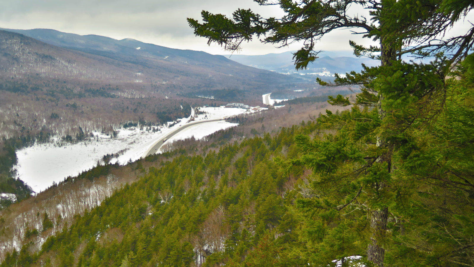
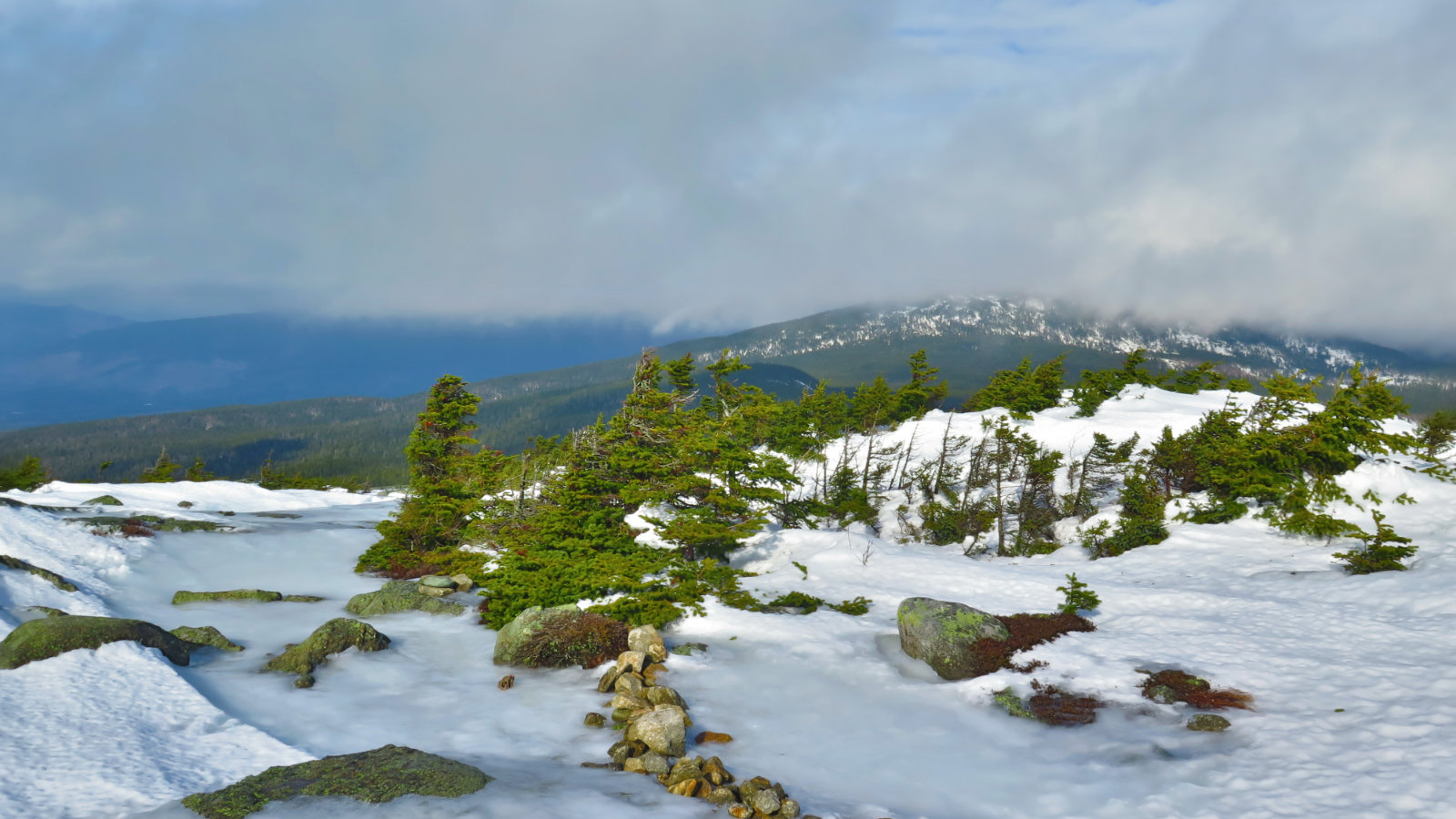
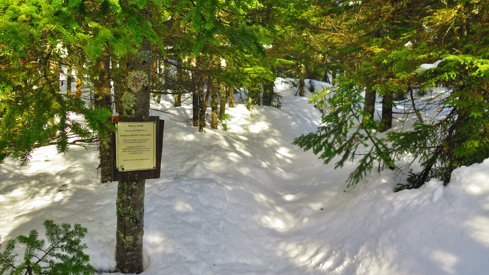
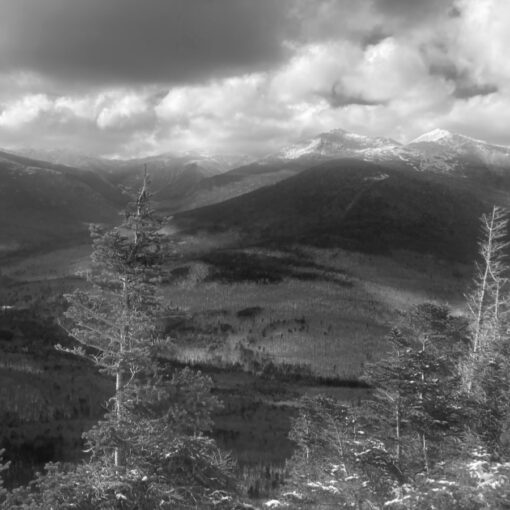
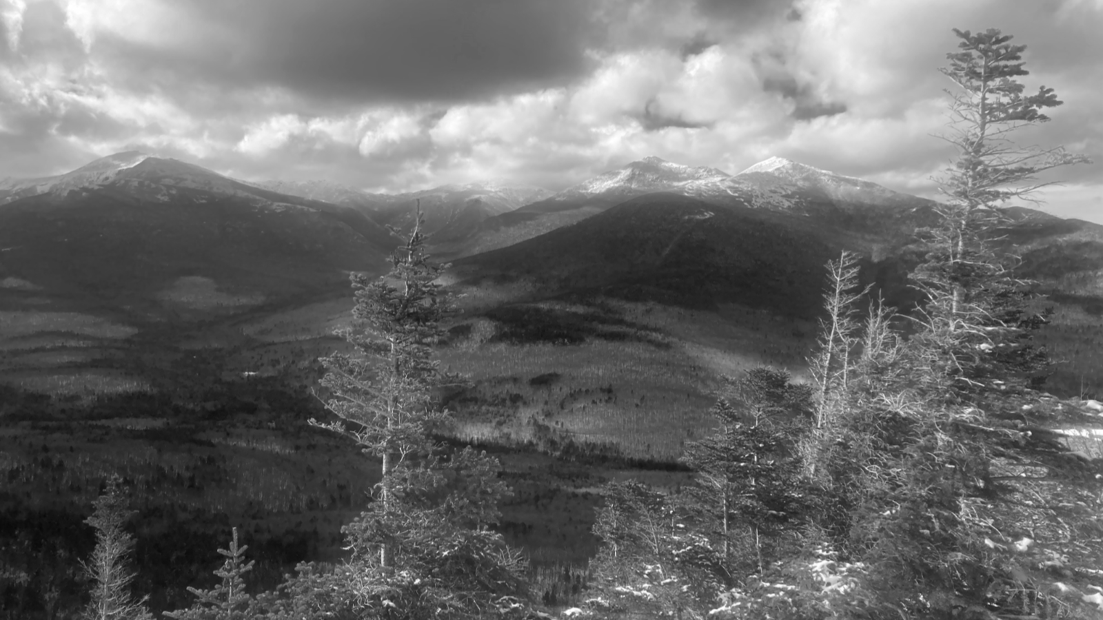
The way up to Jackson was about as straight forward as you could want. The trail was beautifully packed out, and I made good time. I made a quick detour over to Bugle Cliff, on the hope that I’d be able to see something… and I wasn’t entirely disappointed. Yep, there were clouds, but there was also a nascent view, stretching from the Highland Center, all the way out to the Mt Washington Hotel. Score!
Halfway up the mountain, I started realizing the weather was turning. Holes were appearing in the clouds, and in many places, the sun was making it to the forest floor despite the trees. Everywhere, I saw water droplets on branches, catching the light. While it wasn’t as magical as hoar frost on branches, it still looked enchanting.
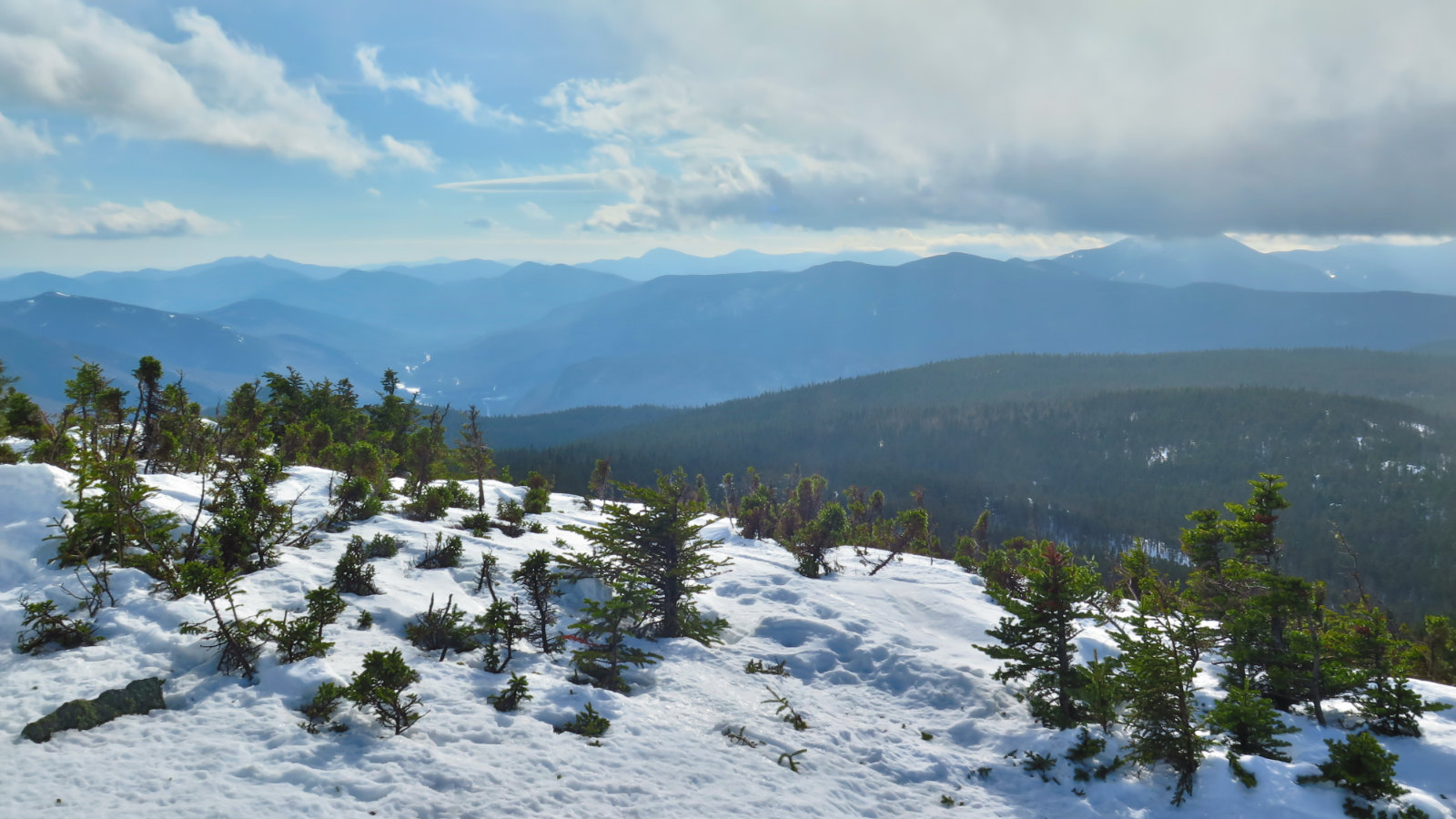
By the summit, the sun was really taking over, and while I did measure a gust of 15 MPH, the wind really was heard more than felt. So bonus point for that, too!
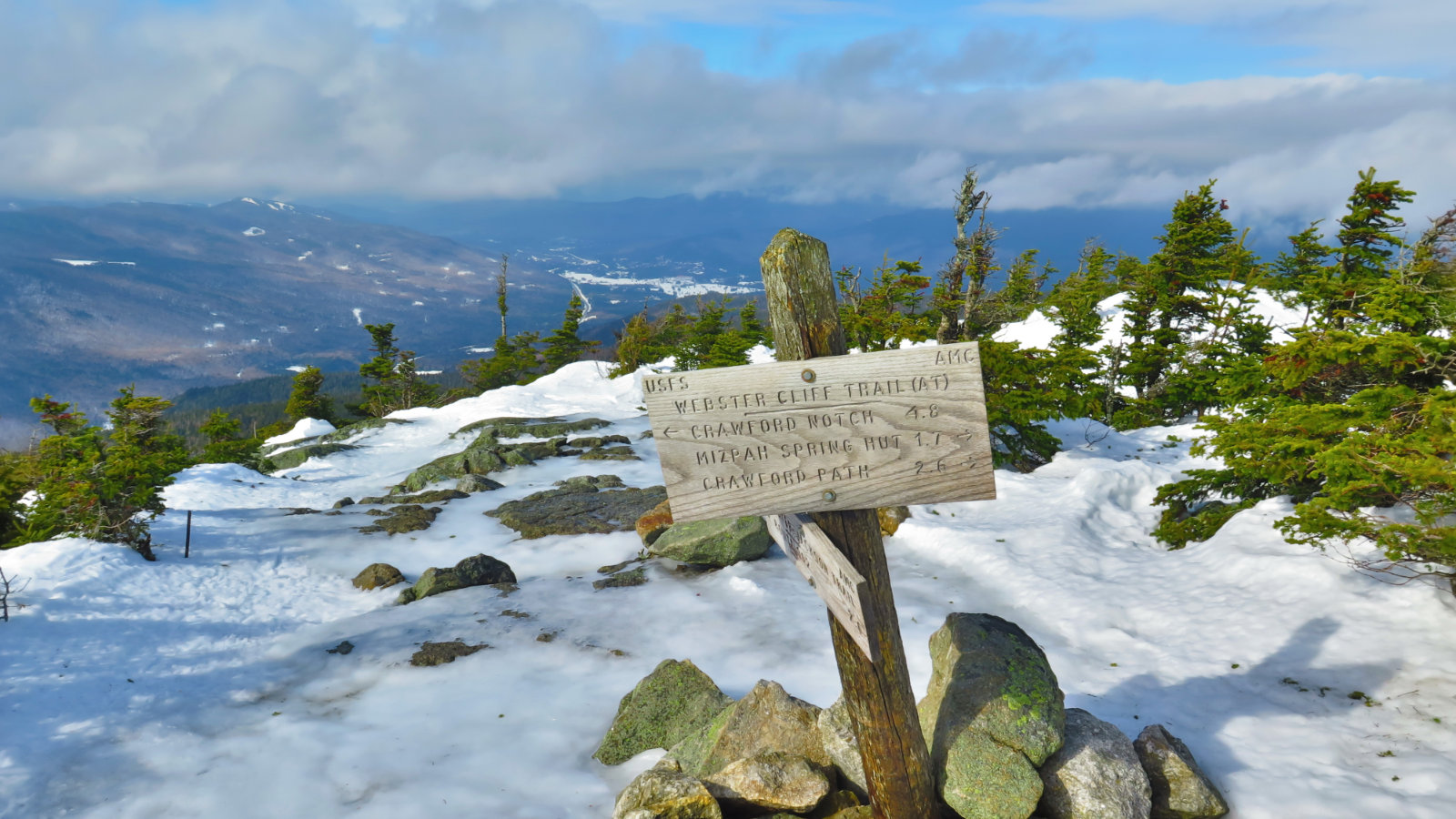
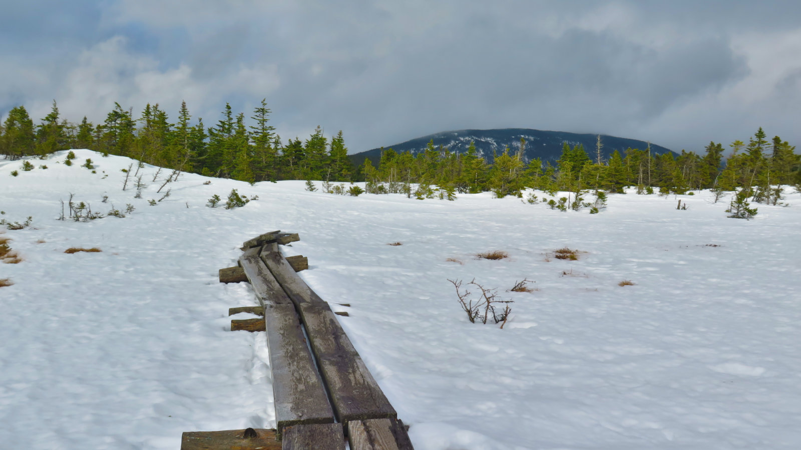
It was at that point that my judgement faltered. That thing about recalling relatively easy travel across the col? Yeah… today, not so much. I noodled around on the summit looking for the way across, and finally consulted my GPS for guidance. The absence of a clear path forward should have been my warning, but no!
At this point I want to mention the “sunk cost fallacy.” It’s a model of behavior constructed by economists, to define the human tendency to throw good money (or time, or other such) after bad situations — it’s seen often in gambling, but also shows up in other facets of life, too. The opposite idea is to cut your losses early.
By the time I started thinking it might be an idea to turn around, the fact that I’d been hiking for about half a mile made me dismiss the idea. “I’ve come this far…” is a fine example of the sunk cost. People, if you can’t find the trail, and following by GPS for a few minutes isn’t helping, then turn toward economics. “I’ve come this far” is your ego rationalizing not giving up. Any behavioral economist will tell you to cut your losses promptly and not do what I did. (On the plus side, it was warm and sunny, and I was comfortable with a fairly nearby trailhead, and the amount of daylight left.)
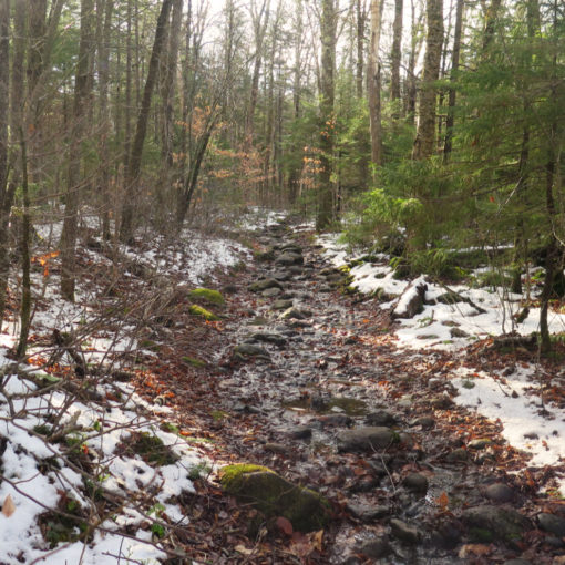
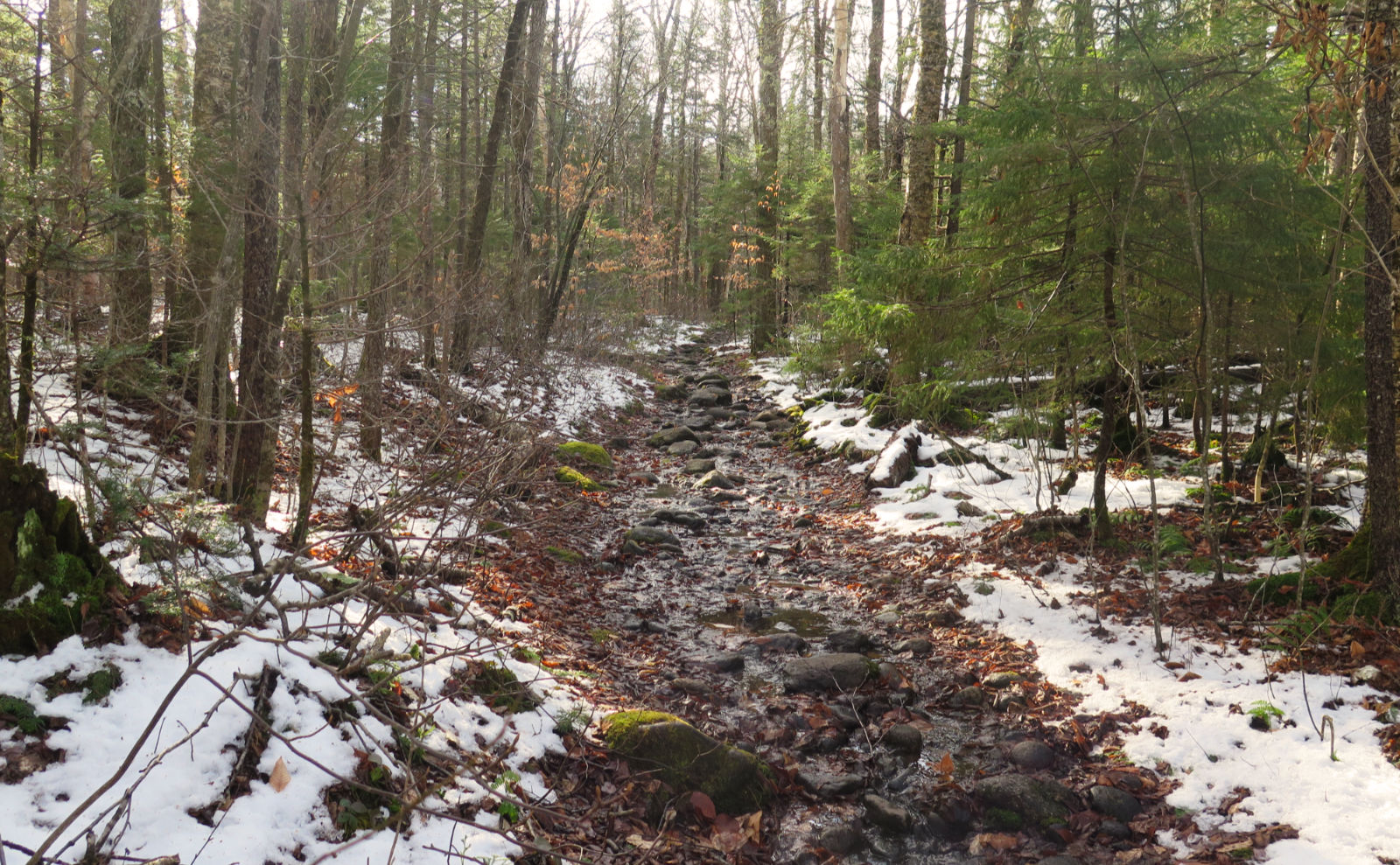
About 10-15 minutes into post-holing through snow that goes up to your knees at a minimum and frequently up to your waist (and a few times to your chest) a rational person would say “this stinks” and go find something better to do. I kept going to Mitzpah. I did elect to cut my day short after I saw I’d have enough time to get to the hut and then to the car without running out of daylight. But even still, I was slogging through insane amounts of drifting snow for two hours, and this despite wearing snowshoes. Don’t do this. It’s a great workout, but there are other ways to get that burn.
Eventually, I crossed the midpoint of the col, and the snow started to thin out a little. I began to make better time. And finally, I saw the hut, and its views of Mt Davis and Mt Isolation. Regrettably, it’s not a perfectly clear view, so the pictures didn’t come out well. But that’s OK. I have a lot of other things to remember about this outing. The views aren’t half bad. And I think it’s less about the summit, and more about enjoying being outside.
Jackson ended up being a lot of fun. It’s got some fantastic views, all over the place. And the trail, while steep in many bits, never felt that harsh. I made it to the top in a couple hours, and while that’s not everyone’s pace, at the same time, I think anyone could do it within three. The trail up Jackson was in fine shape, as was the Crawford Path. So that worked well. It was just the Webster Cliff trail across the col that got me bogged down.
I wouldn’t recommend trying to make the traverse to Pierce. The snow is just too deep. It was a lot of Type II fun, but that still was a very arduous afternoon. Oh well. Even with all that didn’t go right, I’ll be back. It’s a fun mountain, with stellar views.
Nuts and Bolts:
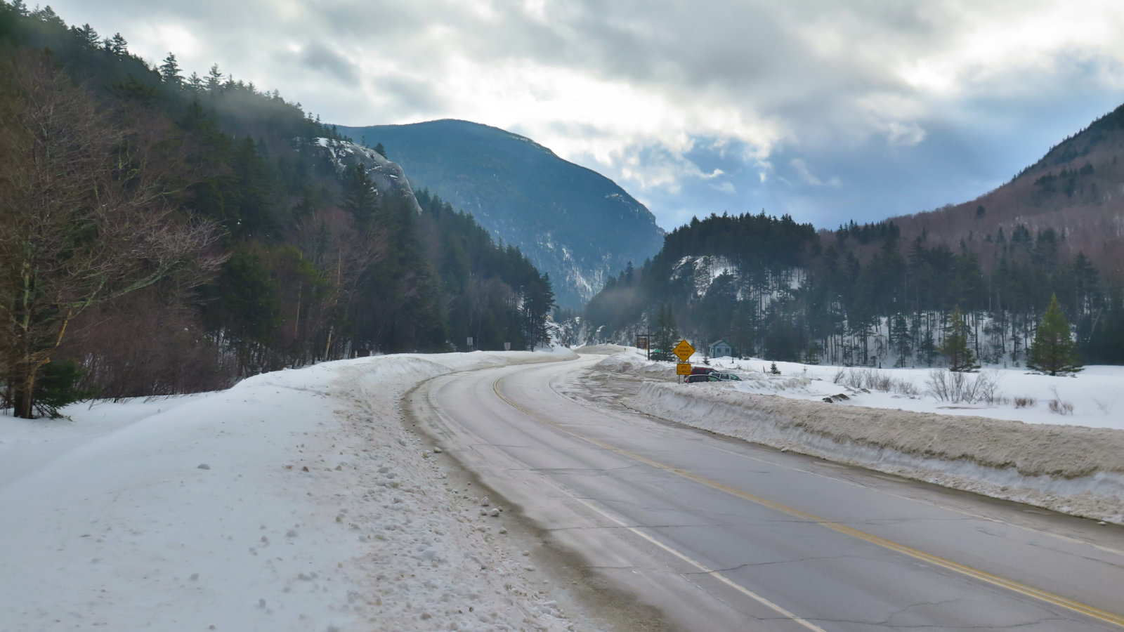
Drive out to the Highland Center, and park in the lot. Walk south along 302, and within about 1/4 mile, you’ll see the sign for the trailhead on the left. Any water crossing will be easily hopped over, which is nice.
Parking update:
Having spoken with the folks at the Highland Center, they assured me that the AMC got their allotment of parking stickers from the Forest Service — both single and double car.
If you enjoy reading these posts, consider subscribing, so you can stay informed. There’s no cost to do so. Your email will only be used to alert you of new posts — typically 1-2 times per week. I will not use or share your email for any other purpose without your express permission.
6 thoughts on “Trip Report: Mt Jackson”
Did you have snowshoes heading over to Mizpah/Pierce? Doing so without snowshoes, and post holing the whole time, is just not smart.
Thanks — I should probably edit my post and clarify. I was indeed wearing snowshoes, and post holing even in spite of that.
Thanks for leaving that tip on NETC about getting last year’s parking stickers. Exactly the unexpected thing that would happen. And thanks for breaking out that leg of the trail. Just be careful you don’t pull your knees apart trying to yank them out of the snow. So you must have passed that Nauman tentsite, if I’m not mistaken? I did Crawford Path to Pierce on Sunday and below treeline wind was not an issue at all. I was curious if Nauman tentsite was sheltered from the wind like that.
Steve, thanks for your comment, and if you haven’t already, consider subscribing.
I did indeed make it up to Mitzpah Hut, which obviously was boarded up. The tent site was “nominal” in the sense that there was firm footing, no major post holing. In the open areas, not a lot of drifts. Getting to Crawford Path from there was modest post holing, but nothing like I experienced crossing the col. Generally, the most I sank down was a little over the tops of my boots, but it was much quicker and easier travel. I think if half a dozen people came behind me (and, say, having blazes that were above the snow) the way across the col would be pretty slick. But then again, isn’t that the case everywhere?
On the “stickers report”, no problem. Knowledge is power.