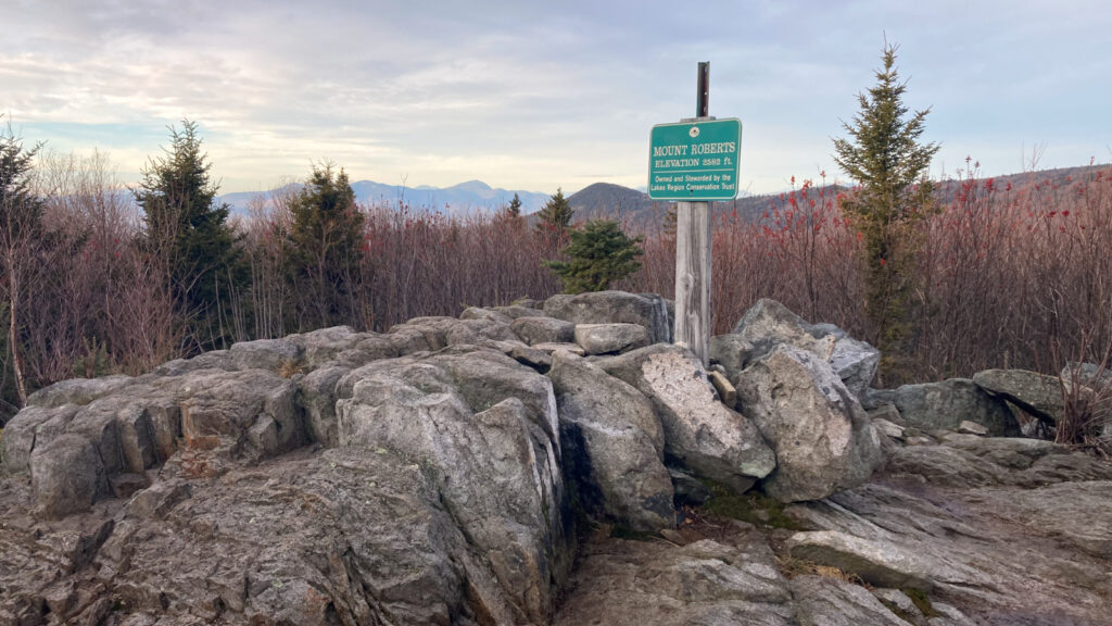
Roberts Mountain (2582 ft). Moultonborough, NH. 2023-12-26 (Tuesday.)
Via Mt Roberts. 5 miles round-trip.
Three hours (or so) round trip.
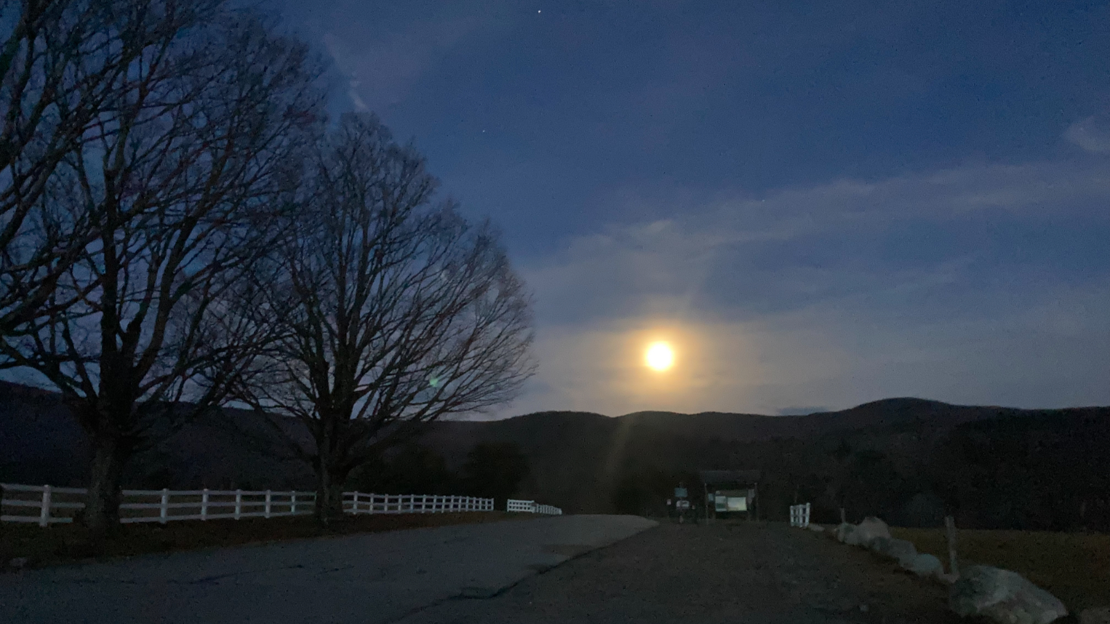
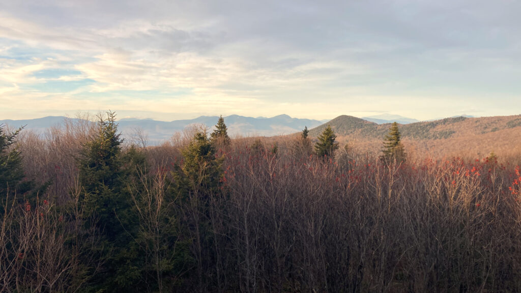
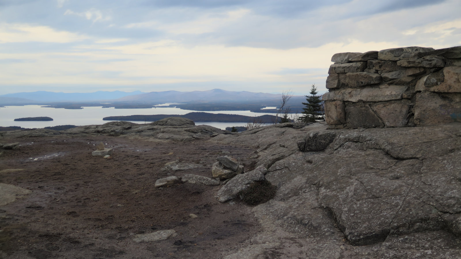
45 dF throughout — maybe down into the low 40s-high 30s. Shirtsleeve weather if you keep moving. RH ranged from about 85% to 90%. Winds were negligible. Visibility was decent for nearby things. You could see out to Washington and Chocorua, but there was a haze, for sure. Oh, and a full moon tonight.
Nothing for something. But that something… wow.
This isn’t hard mileage. But it’s worthwhile mileage. Not the least but if you’re looking for a “get off the couch” hike, this shouldn’t be off your list.
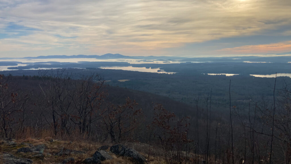
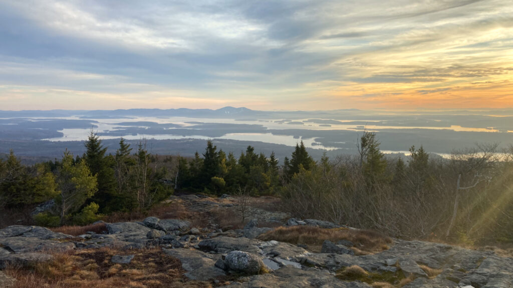
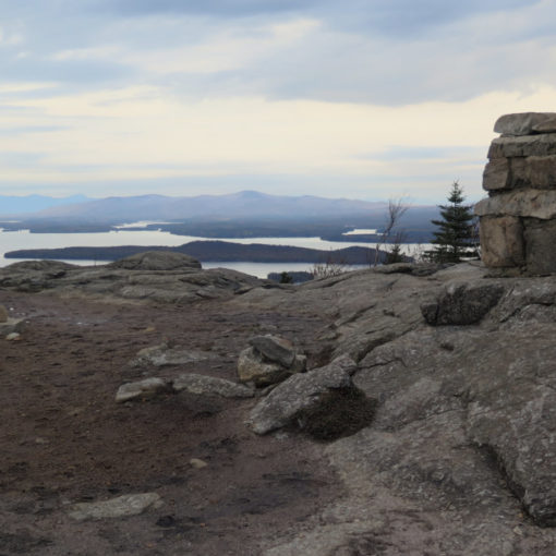
I don’t know what to say about this one. It’s short mileage, but not for nothing, it’s really good miles. In one fell swoop, you get amazing views of Washington (assuming conditions are clement on the rock pile) and the southern Whites. And then turning to the south, the Lakes. The weird thing about any mountain south of the Whites is this: go on a clear day, and be prepared for views.
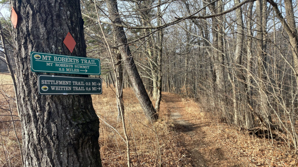
Most of today, I spent with a local of Alton. We had a long and varied conversation about hiking, blow-ins, being prepared, and both sunsets and glorious moons. Oh, and views from the summit. Don’t forget, you can see a lot from this mountain. But also, the trails can be a tad persnickety. Watch where you’re going. Blazes are plenty, but look before you leap in a few places.
To the south, the sun made photos “a bit challenging.” Let’s face it, even the most modern light meters and phone algorithms aren’t going to be able to capture the majesty of a sunset. Leave that for the likes of Byron, Shakespeare, Frost, (maybe ee cummings) and that lot. Oh, and the camera of the eye. You want it? Get up there yourself and see, for yourself. Don’t be lazy. It’s short, but memorable mileage. A sweet spot between the lakes and the mountains.
Beyond that, it’s a good hike with easy grades. It’s not a tall mountain by any stretch. There are great views to be had. Bring a picnic lunch. In cooler months, a thick blanket for said lunches. And get ready for the views.
As always, stay safe out there.

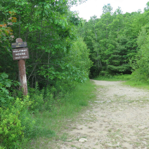
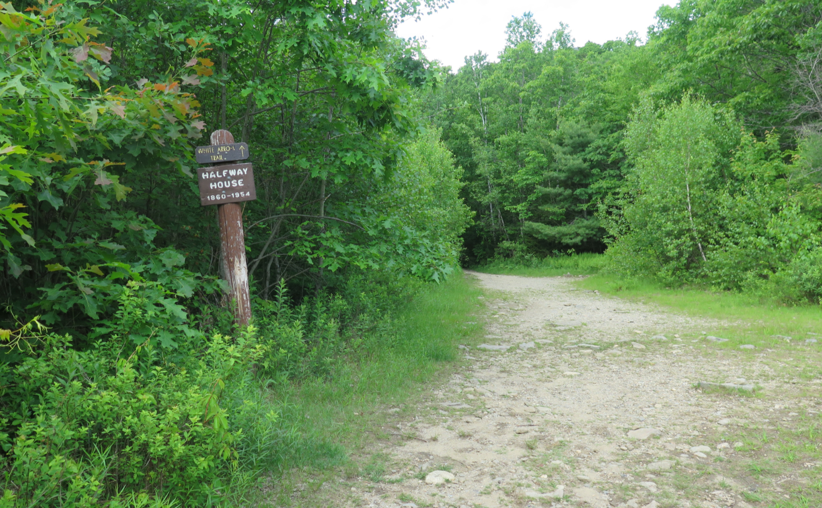
Nuts and Bolts: For the most part, I’d defer to your GPS. Basically, go to the end of Osspiee Park Road. Or… basically follow Rte 25 into Moultonboro, and turn right onto 109. Drive for about 2 1/2 miles, and when you see signs for a spring water plant (and perhaps Castle in the Clouds) then turn left. Park where it says “hiker parking.” Note that there are numerous hiker parking areas. Play it as it lies. Be an ambassador for the sport. Don’t be “that guy.” Trailhead is to the north. Just trust me. Follow your nose.
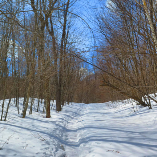
Blazes are orange/red diamonds on trees and orange paint on rocks. For the most part, you won’t go wrong. But stay sharp. There are a couple places higher up where you think the trail goes one way, and it actually goes the other. Take a moment at the viewpoint to take in that view. It’s a flat side trail of about 100 meters/yards. Won’t take a minute to get there, but it’s totally worth it. The views south are utterly majestic.
If you enjoy reading these posts, please subscribe — stay in the loop! Your email will only be used to alert you of new posts — typically 1-2 times per week. I will not use or share your email for any other purpose without your express permission. And feel free to share via social media using the buttons below.
Help support this blog! Visit www.photos.proteanwanderer.com to buy some of my signature images.

One thought on “Trip Report: Rumblin’ on Roberts!”