Wildcat Mountain D & A (4,062 and 4,422 feet, respectively). Jackson, NH. 2020-10-14 (Wednesday).
Via Wildcat Valley X-C Ski Trail, Wildcat Ridge Trail, 19 Mile Brook Trail, Wildcat River Trail, Bog Brook Trail.. Approximately 12 miles round-trip. (NB: The 12 mile number is from Gaia GPS, and I’m fairly certain that it draws mileage from a 2-D model, not taking elevation into account. This is especially significant where Wildcat A descends extremely rapidly into Carter Notch — as I recall, at a rate faster than 1,000 feet per mile. My fitness tracker, which does a reasonable job of counting actual “boots across the ground” miles, calls it closer to 14. At a normal hiking pace of 2 MPH, you’ll want an extra hour of daylight, or be prepared to break out your headlamp.)
Temps in the 40s and 50s throughout the day. Winds were an 8-10 MPH breeze through the trees in the higher elevations. Sun starting out the day, becoming partly cloudy in the afternoon.
Trailhead: 1200. Wildcat D summit: 1430. Wildcat A summit: 1600. Car: 1900.
This is going to be the write-up only; the photos will come in a separate post. On the surface, it would seem that I’m being lame. Trust me on this, folks. I had a truly amazing outing, and it’s taking a bit longer than usual to sort out the visuals. It’ll be worth it, I promise.
This is also going to be a long post. Not the least, but the ascent trail isn’t in the AMC book, so it’s worth drilling down on it a little. Right? Right!
I was wondering what to do next. One of the things that’s weighing on my mind, perhaps more than a little irrationally, is that I’d like a fourth 48 this year, and ideally, I’d like to close-out autumn. I’m at 30 right now. 18 left. Can I do it?
But that means managing time v hours of daylight, and the days are getting remarkably short right now. Those languid summer afternoons that lasted forever… ’til next year, my sweet!
OK, that got overly dramatic. Yikes!
Anyway, what’s left is stuff that I shouldn’t have to worry about. So I kicked myself, said “make a decision already!” and came up with Wildcat. The polar opposite “problem” was how to do it, and on that, redlining provided clarity. Presuming that Wildcat is done by Pinkham Notch, just because it’s the major thoroughfare is neglecting the other side of the mountain. And wow, I found out how nice that side really is. Come to the Dark Side. There are cookies.
I found myself leaving the house a bit late, as per my usual. This is something I need to break myself of, not the least because getting up to the Mt Washington area is a long drive. NH does north-south pretty well, with 93 and 89. It does east-west lousy, except if you’re going on 101 to Pawtuckaway. The Whites are about as far from there as… well, anything, so that road is pretty useless. Instead, it was surface roads, and their attendant traffic, going past the lake.
I love that area. It’s scenic. It’s got a great small-town vibe. You get to go past Chocorua, with its stellar view from the south. And if you get behind a dump truck, you get to go maddeningly slow for mile after mile. Ask me how I know. Good thing nature is a balm for frayed nerves, and that I was heading for the trailhead. And hey, it’s not like the leaves along the way weren’t colorful or anything. There were windstorms over the past few days, but they didn’t strip the trees completely bare. Not by a longshot.
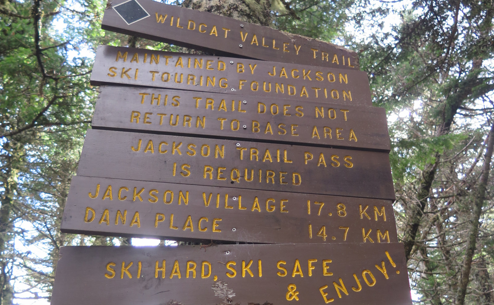
And so it came to pass that I walked by the trailhead kiosk at high noon. I was a bit concerned about the trail going up, because it’s not in the AMC book, nor is it signed or maintained by the AMC, or even the forest service. Instead, the trail is maintained by the Jackson Ski Touring Foundation. Somewhat like on the other side, you hike up Wildcat D by a ski trail. Unlike the other side, which has all kinds of signs, and a mile-wide ski trail, the X-C trail is a tad more… um… scenic.
Starting out, I hiked up basically a wide jeep road. The hill started almost as soon as I passed the kiosk, and for the most part, excepting a tiny bit of a sag high up, the trail goes up without a whole lot of switchback kerfluffle. Most of it isn’t a fast hill like the other side, or on Tecumseh. Think X-C skiing, not Olympic giant slalom. It’s actually a pretty nice balance between heading up quickly and not killing yourself doing so. Aside from that, this wasn’t the rockiest trail I’ve ever been on by far. I was very pleasantly taken by it, and the sunny weather did nothing to stop that. Yep, you can hear me complaining, right?
Not 15 minutes later, I came on the apple orchard. No-one’s surprised that a lot of New Hampshire, particularly in the Whites, changed hands more than once, and homesteads that existed way back when are no longer around, save for their artifacts. In this case, there’s the Johnson Farm, and much of the opening mile or so traverses it. There are cellar holes, and here, a grove of apple trees that remain from when the farm was active.
It’s all maintained by the town, and the local deer and bears have a tasty feast, no doubt. An annual mowing by the town keeps the “understory,” such that it is in an apple orchard, growing with goldenrod, milkweed, and the like. If all you do is come up and mill around in this area, you could walk a couple miles of winding X-C trails, see the various cellar holes, and if the day was clement, have a splendid picnic luncheon amongst the apple trees, with fantastic views of the mountains beyond as your vista. Not a bad outing.
I carried on, making good time up the ski trail. The forest was resplendent in reds and yellows, and against the deep blue sky, with a warm sun, it didn’t matter that the air wasn’t as warm as it was a few weeks ago. It felt great to be outside. Leaves swooshing underfoot, the odd crunch of rocks. Nice.
But you don’t get a free pass for the whole thing. Around a quarter, maybe a third of the way, a sign up ahead, with a black diamond. If you’ve ever skied, it’s one of those. But again, X-C, not Olympics, so while it got a little spirited, it wasn’t nutty. I entered a birch glade, and now, those reds and yellows were replaced by these stark white shafts stretching into the azure sky. The jeep trail faded, and now, I was on more of a conventional footpath. Except when I wasn’t.
This was probably the only part where I had to navigate. The glade, broad as it is, offers a lot of ways to get from one end to the other. And so the footpath isn’t so much a trail, as it is a suggestion that more people might have gone this way, even though a few went that way. There were some blue plastic diamond blazes nailed to trees, but separated by several dozen yards — just enough that you got to wondering, rather uncomfortably, if you were on the right track… and a few more paces uphill and… OK, I’m fine. For the most part, when in doubt, if you stick to a middle-ish track through the glade, you’re probably on the trail. And anyway, in a few yards, you’ll see another blue blaze and correct your course.
Right after that, the trail sorted itself out, and became something more normal for a hiker. There were still the blue blazes, but now the footpath was a seemingly unending carpet of moss. Nice and soft underfoot, which was welcome, except moss usually loves having wet feet. Indeed, you don’t see it much where it’s bone-dry, and that meant my feet were in danger of also becoming not-bone-dry. It was, oddly, a bit slow-going, because the wet isn’t always apparent. As much as I loved hiking with every footfall cushioned to the max, it got tiring long before I expected it would. One thing that wasn’t tiring was the sight of it all. No kidding, it has to be seen to be believed, but wow, how the softness of the landscape softened the mood perceptibly. Take the usual relaxation of a hike, and raise it to the power of a bunch. Easily.
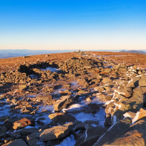
Not long after that, the trail became more rocky, and looking through the trees ahead, it felt a lot like I was closing in on the top. And yep, there it was. I noodled around to the left, so I could come out onto the ski area via the AT, with the view ahead of D peak. Crossing by the various lift stuff, I took in views across the way. Washington was wearing a hat, but Adams and Madison showed their pates against clouds just behind. The clouds had come in over the past hour or so, and they’d be with me, in various amounts, for the remainder of the day. At least they were somewhat high; I had a good view.
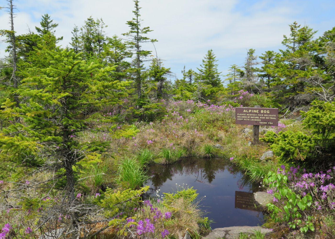
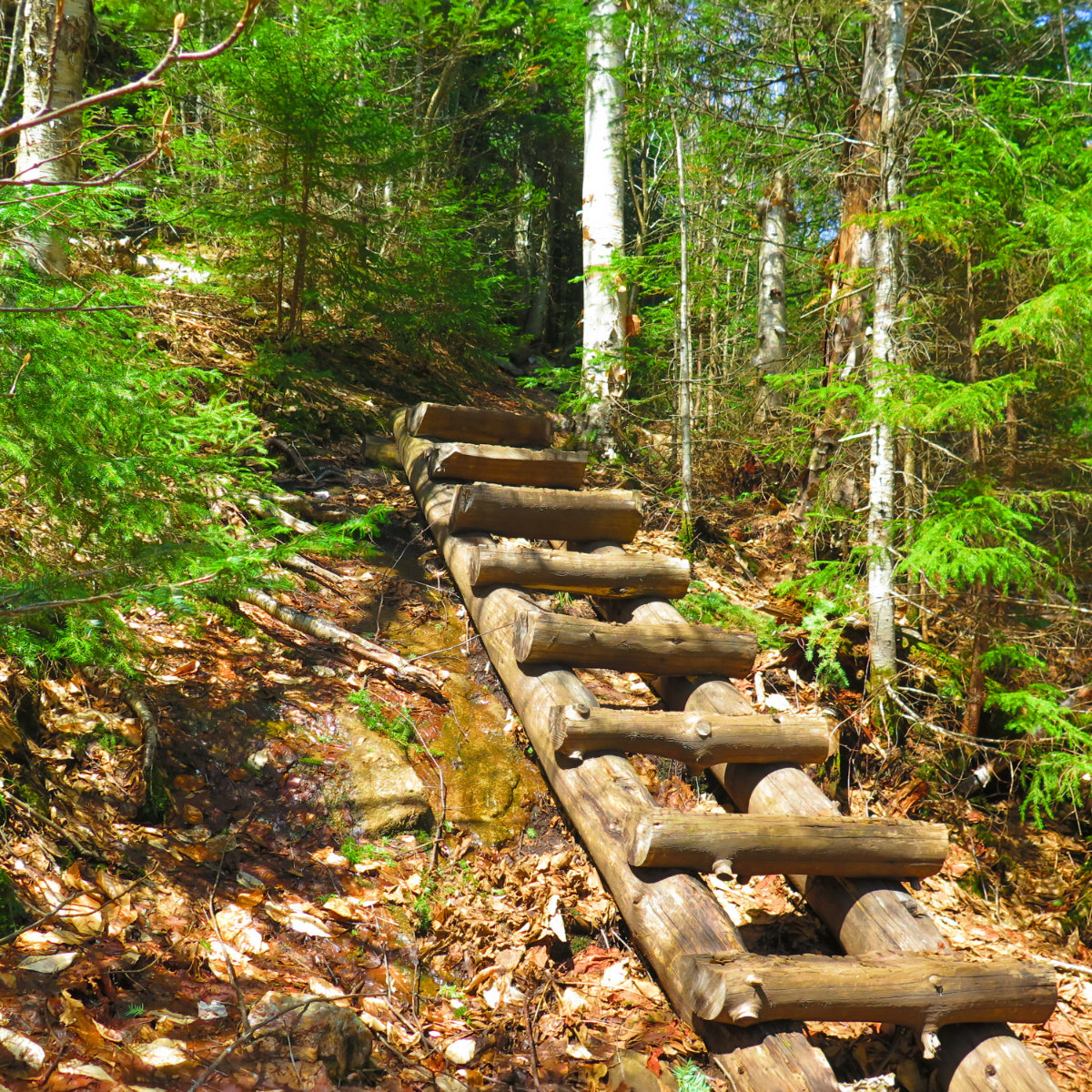
Crossing over the summit, and heading down, I had to be reminded that just because the trail over to A peak is paved with snow in winter, doesn’t mean it’s easy-peasy. A short bit earlier, I had a view through the trees of the col between D and C. Now I was there, and yep, it’s a rocky descent and a rocky ascent. Again, nothing nutty, but certainly not a simple run across some bog bridge — even though there is actually a lot of it up there.
And an aside… there’s a huge pleasure in writing this blog. It’s been a great way to remind myself of places I’ve been, things I’ve seen and done. Looking at the stats and reading the comments, it’s helping people, which is likewise pretty awesome. From the beginning, I’ve always wanted this to help people get out and enjoy the mountains. But at least as special is when I meet people on the trail, hand them my card, and hear “oh! I’ve been reading your blog for awhile now. Glad to finally meet you!” I met one such person today. In a nod to COVID, she refrained from giving me a hug, but the very fact that she mentioned wanting to do so was great. Thanks to our new “friend” coronavirus, life has been feeling mightily impersonal, so it’s a boost when people remind you that we’re all still the same people, even if we’re a little (intentionally) distant. “It’s not you, it’s that damn virus.” (And hey, C, drop me a note and let me know how your hike went!)
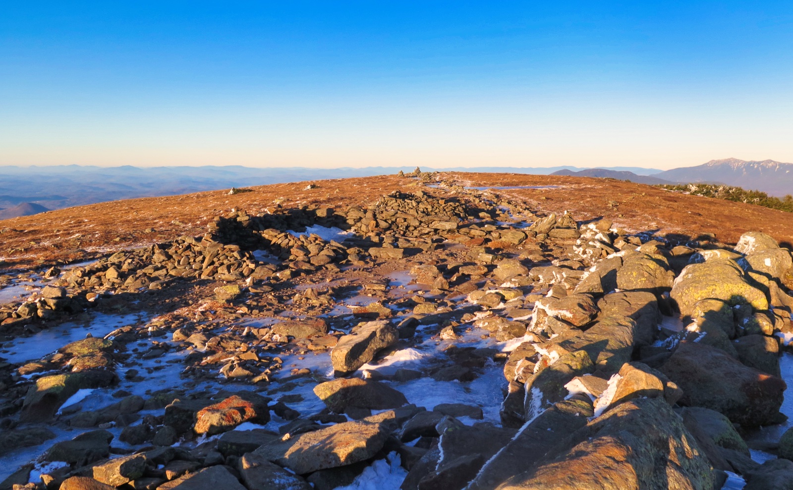
Coming up on A peak, there’s that vista off to the side, where you can gaze down into Carter Notch. And that view just never gets old. The cliffs on Carter Dome… the ramparts behind the hut complex, seeing Doublehead and Kearsarge North… wow. The clouds dutifully stayed at higher elevations, so I had a view that went on for miles. Technically it was a 2-state view, but there was some attenuation out in the further distances. Still, I’ll take it. It was pretty good, and the autumn vibe was in full effect.
Heading into the notch, it’s a swift descent. I’d forgotten, though, that much of it runs down stone steps, either intentionally positioned, or there by chance. Looking down from the summit, your mind races, but it’s unnecessary. That was a quick and painless segment, although on the up, even with sure footing, you’re still fighting gravity, so I was happy I was headed the way I was going.
Distressingly, the hut is not just closed. It’s really closed. If a hut has plywood over all its windows and doors, is it a hut, or a box? (A hox?) Either way, that’s the situation for all the buildings in the complex. In a storm, you’ve got the awnings over the dormitories, for what that’s worth, and that’s about all. I wasn’t pleased seeing it, no matter how much I understand the reasoning. It’s way too early in the season to close the huts, and that goes double for this one.
On the way out, I swung down the spur to the Ramparts. It’s a quick (maybe a dozen yards or two) diversion, but wow, worth it. When I finally get to doing the AT, this is on the list. It’s a strange vantage point, but effective. Close proximity to Carter Dome, with its cliffs, coupled with the boulder field, creates a stark landscape. Today, the sunlight was coming in under the clouds, so had that weird afternoon appearance. It was very striking, and while I tried various tricks, none of my cameras was able to keep up with the bizarre metering.
And then I was on the way down. Wildcat River Trail moves quickly, but you’re only dropping about 1,500 feet over 3.6 miles. I made good time mainly because the grade wasn’t overly steep, and the footpath was quite smooth. That said, it wouldn’t be Wildcat *River* Trail if there wasn’t a river involved. There were four not-so-trivial water crossings. I gave it the old college try, but alas, one of my shoes got submerged. Good thing those crossings were at the end of the trip.
On the one hand, from about the midpoint of the trip, I was rushing a little, to try and avoid coming off-trail in the dark. I missed that mark by about 45 minutes. But on the other hand, the day felt wonderful for a sense of timelessness. After finishing the 67, I felt a little out-of-sorts, and hiking up Liberty and Flume on a similar autumn day fixed that very definitively. It was one of those warm days, where even though all indications are that winter’s coming, Jack Frost is held in temporary abeyance. Curiously, that trip was two years and a day apart from today’s, and the weather wasn’t terribly different — only a little warmer. It’s these moments that stick with you, and when things are darker, become a salve that gets us through those moments.
It’s the stuff we all live for, right?
As always, stay safe out there.
Nuts and Bolts: Find the trailhead at the very end of Carter Notch Road. Bear in mind that the road is paved for most of its length, becoming a Class IV dirt road for almost the last mile. Go through the covered bridge in Jackson, and stay on Route 16A as it winds its way through town. At the fork in the road where 16B peels off to the right, stay left, and shortly thereafter, you’ll see the Wentworth Inn on the far corner of Carter Notch Road, on the right.
Trailhead will be right the way down the far end of the road, by a metal gate. Park by Bog Brook Trail — it should be obvious. There are two gates, one off to the side, one with the kiosk. The one off to the side has the parking. Blazes are… blue plastic diamonds on the Wildcat Valley X-C trail, white AT blazes on the ridge, and yellow blazes on the Wildcat River trail. For the most part, the trails are pretty obvious, but of course, bring the usual aids to navigation — map, compass, etc.
If you enjoy reading these posts, please subscribe — stay in the loop! Your email will only be used to alert you of new posts — typically 1-2 times per week. I will not use or share your email for any other purpose without your express permission. And feel free to share via social media using the buttons below.
Find me in the mountains, on this blog, or on Twitter: @Protean_Hiker https://twitter.com/Protean_Hiker/

2 thoughts on “Trip Report: Walking on the Wild side on the Wildcats.”
Great report as usual. I’ve been thru it several times and dug out the map. Never would have thought of this route but now I’m making plans to give it a whirl. Thanks for the idea! Emeral