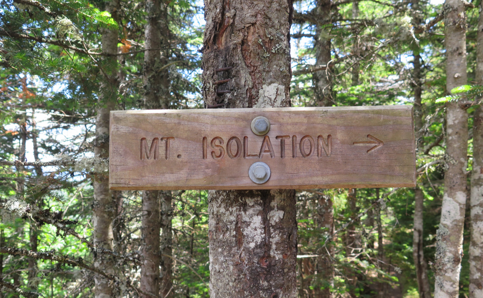
Mt Isolation (4,003 feet). Sargent’s Purchase, NH. 2020-06-25 (Thursday.)
Via Rocky Branch, Isolation trail, and Davis Path. 14.6 miles round-trip. Approx. 3,600 feet elevation gain.
70 dF at the trailhead, 65 dF at the summit. RH ranged from about 45% to 50%. Winds were negligible in the trees, about 3-5 knot gusts at the summit. Dew point was around 50% throughout. Sun and clouds throughout the day.
Trailhead: 0900. Summit: 1330. Car: 1845.
So much for solitude…
Pondering a new destination for this week, I looked at my to-do list and things were murky. Often, things just work out and the next peak is obvious. But right now, I’m close to being able to bang out another 48 by doing a Presidential traverse and a Pemi loop. I like both of those ideas, so didn’t want to mess up their perfection. But there were hangers-on, in the form of Zealand, Hale, and Isolation.
I let logic decide. Summer started a few days ago, and we’re still in that exciting phase where the days are still crazy long. Why not do something that would make the most of these long hours of daylight? Isolation rose to the top. There was something about Rocky Branch trail that was leaving me unsettled, so it would be a chance to make peace with that. At least I’d be able to decide if it’s as hard as I remember.
The two other times I’ve hiked this one, it felt like the mountain was living up to its name. With a nearly 15 mile round-trip, several water crossings, near-endless rock-hopping, and thick and soupy mud, it’s the kind of outing you’re doing to cross it off a list, right? Expecting solitude, I kept bumping into groups of people all day. Oh well. At least they were nice company. Indeed, throughout the day, I kept crossing paths with a father and his two kids, and we shared hours of lively conversation that helped the miles melt away. Nice.
There was some hiking…
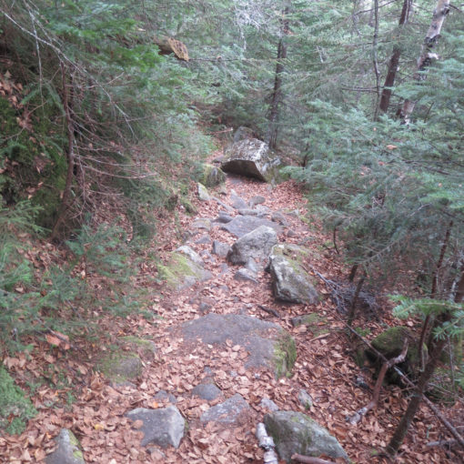
I got an early start to the day, and despite some frustration brought on by road work and slow-moving trucks on Route 25, I got to the trailhead still within my definition of “early morning.” Rocky Branch trail pulls no punches. Right out of the gate, I ascended. The trail wasn’t particularly smooth, but it wasn’t a rock hop yet. After an hour or so, the grade lessened a bit, and I passed through some really sweet deciduous forest with all kinds of grasses and stuff growing everywhere. Another half hour or so and I was past the wilderness boundary, heading for the Rocky Branch of the Saco river.
Just before I got to the river proper, I happened on a side trail on the left that led to an overlook. I had a commanding view looking down the river, taking in the southern half of the Montalban Range. Wow! It’s not signed, but when the sound of the Rocky Branch is loud and obviously close at hand, look for that path. It’s well worth the 60 seconds or so that it’ll take to get to that vista.
At the water’s edge, it took a minute of scanning around to find the best way to cross, but at the moment, the river is running low enough that this wasn’t a huge deal. I zig-zagged across the five water crossings, following an old railroad bed. (Likely the Rocky Branch Railroad, of the Conway Lumber Company.) As tough as it was getting to this point, it blew my mind a little to look at the wide spacing of the more mature trees, and realize they managed to get locomotives up there. This despite having seen similar craziness deep in the Pemigewassett. This area marked the finest footpath of the entire day. Of course, it wasn’t nearly as long as I’d have preferred.
Turning northwest, away from the river, I passed through a stand of blow-downs that I’d forgotten about. A few showed the shallowness of their root system, and I reflected on the relative paucity of topsoil. The neat thing was seeing so much in the understory that had been waiting in the wings all this time, and this now is their moment. There’s a lot of explosive growth going on. Hiking through, I was getting scraped on both sides by encroaching branches that threaten to entirely obscure the trail within a few short years if left unchecked. The cycle of life continues.
Finally, after what felt like an eternity of stepping on, over, and around all kinds of rocks, mud, roots, and who knows what else, I arrived at Davis Path. In comparison, it was paved with gold, and I made quick time across the mile to the summit of Isolation. Less than half an hour later, I stood before the sign that read “Isolation” with an arrow pointing up a very steep, very rocky spur. It’s only 100 feet of elevation, but at that point, I was getting tired.
But onward, upward is the way things are done. Breaking out of the trees, I stood on the summit. Huzzah! The views were as great as I’ve come to know them. There were a few more clouds than I’d have liked, but still, Washington was there, sans hat. Ike to the left. Oakes Gulf seemingly within reach. Carter Dome, the Baldfaces… it was a fine view, and I’m pretty sure I could even see Passaconaway, through the trees to the south.
It’s a tough hike, but not without a lot of fascinators…
It’s no surprise to any of my regular readers, but I tend to look around. In the time it took me to get to the wilderness boundary, I noted a scarcity of any kind of wildflower, which was disappointing. The forest felt very open, with minimal understory. But then I began noticing the blanks being filled in. And yet, something decidedly weird.
Bunchberries. Gobs and gobs. Indeed, it’s better to describe it as huge mats of the things. Seriously, once you’re in their zone, it’s impossible to throw a rock on that mountain without hitting a patch of them the size of a king sized bed. Occasionally I saw small communities of bluebead lilies, but as often as not, they were intermingled with clusters of bunchberries.
And the toads. Oh wow, the toads. It’s not like there were biblical quantities of them, but the trail is pretty wet, so they were out in force. Maybe oddly, the flies didn’t seem that bad today, so I wonder if the toads had anything to do with that.
This is going to seem a bit weird, but there seemed to be more than a few stealth camping sites practically everywhere. I saw a couple wooden trail signs indicating the way to sanctioned sites off the trail, but it always seemed that scarcely an hour went past before I saw a fire ring somewhere off to the side. Even on the summit. Odd.
I did try to find the end points of the Engine Hill bushwhack, but to no avail. I think I’ll have to try that in the winter at least once, get a better sense of where it lies, and then try applying it to the warmer months. (If anyone has some good 411 on that, ideally with GPS coordinates, please chime in.)
Anyway, it was a good day out. Exhausting, but I feel like I did something. In terms of making peace with that trail, the jury is still out, but I think I made progress. The views remain among the best in the Whites, though. When I compare it to, say, hiking up the fire warden’s trail, or bagging Reddington, I think both of those feel more like you’re in another world. But that doesn’t diminish the fact that it’s still a fine outing. Albeit one you really have to work for.
As always, stay safe out there.
Nuts and Bolts…
For most people, make your best way to Conway, and then continue north, up Route 16. About five miles out of Jackson (you’ll pass two covered bridges, one belonging to the golf course) be on the lookout. When you pass Wildcat Townhouse road, slow down. (NB: it’s a loop road, so there are two signs.) When you cross a bridge over the Ellis river, you should have your left blinker on. And when you see a National Forest sign on the right, the trailhead parking entrance is only a couple dozen or so yards ahead, on the left.
Trailhead will be at the far end of the parking area. The trail kiosk is a dozen or so yards down the trail itself. Blazes are yellow for Rocky Branch trail, and they thin out fast after the wilderness boundary. Beyond that, there are cairns at most water crossings, though those will be pretty obvious. Davis Path is signed at the junctions, and dead simple to follow. For the most part, the trail is pretty self evident, and you can just follow your nose. Bring normal, appropriate navigation aids, of course.
Be aware that most of the route hews very closely to either the Rocky Branch of the Saco river, or brooks and drainages of varying size. As such, while it’s probably not likely, any instance of heavy rain can drastically alter conditions on the trail. Compounding this is the fact that most of the route lies within a wilderness area, and austere conditions (including minimal trail maintenance) should be expected.
Similarly, this is a very wet route, and even with an epic bushwhack, at some point, you’ll have to cross the Rocky Branch. Normal caveats regarding slippery conditions, ice, etc apply. Remember, and keep it foremost in your head: there is never any shame in turning back if conditions exceed your experience or comfort level. It’s a very safe bet that the mountains will still be there when you return.


4 thoughts on “Trip Report: Starting Summer on Mt Isolation.”
Wow, you had a great day! I can’t believe VIOLETS! But then again, we saw some in Tuckerman Ravine in late July years ago. Looking forward to returning to NH hiking, but waiting a little longer for MA’s rates to go even lower so as not to make folks nervous. Happy that you were able to enjoy the always lovely Mt Isolation
regarding the engine hill bushwhack – the start has an arrow carved into a tree which is on your right fairly soon after you hit the height of land. the route was messed up when I did it and I was not savvy enough to fix it so not sure where I “should” have come out.
Your timing is amazing — plan is to hit Isolation tomorrow. (Stay tuned!) When you mention the arrow, is that heading up the mountain, or heading back to the trailhead?